Spooner, Wisconsin

Last updated
Spooner
City
Washburn county WI Spooner IMG 1650.JPG
Downtown Spooner
Nickname: 
Crossroads of the North
Washburn County Wisconsin Incorporated and Unincorporated areas Spooner Highlighted.svg
Location of Spooner in Washburn County, Wisconsin.
USA Wisconsin location map.svg
Red pog.svg
Spooner
Location within the state of Wisconsin
Coordinates: 45°49′33″N91°53′28″W / 45.82583°N 91.89111°W / 45.82583; -91.89111
CountryUnited States
State Wisconsin
County Washburn
Area
[1]
  Total4.27 sq mi (11.06 km2)
  Land4.03 sq mi (10.45 km2)
  Water0.24 sq mi (0.61 km2)
Population
 (2020) [2]
  Total2,573
  Estimate 
(2020) [3]
2,573
  Density637.8/sq mi (246.26/km2)
Time zone UTC−6 (Central (CST))
  Summer (DST) UTC−5 (CDT)
Area code(s) 715 & 534
FIPS code 55-75625
Website Official website

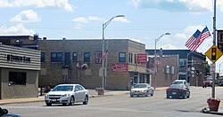
Spooner is a city in Washburn County, Wisconsin, United States. The population was 2,573 at the 2020 census. The city is located mostly within the southwest corner of the Town of Spooner, with a small portion extending into the Town of Beaver Brook on the south, the Town of Bashaw on the southwest, and the Town of Evergreen on the west. The city's nickname, Crossroads of the North, is a reference to the city's location at the junction of two U.S. highways, 53 and 63, and State Highways 70 and 253.

Contents

History

Originally a town in the year 1889, and thereafter officially incorporated a city in the year 1909, Spooner's history is closely interlaced with that of railroad history. In the year 1879, the North Wisconsin Railway was constructed due north of the present-day city of Spooner. Following that, the operations of that railroad were moved south where it then joined the Chicago and Northwestern at what was then coined as Chicago Junction. [4] [5]

The community, then initially only a station, was named by the general superintendent for the Chicago and Northwestern, Edwin W. Winter, for John Coit Spooner (1843 - 1919), who at the time was a distinguished railroad attorney from what is now the city of Hudson in St. Croix County, northwestern Wisconsin. Spooner would later serve in the Wisconsin State Assembly and represent Wisconsin in the United States Senate (1885-1891, 1897-1907). He was a well favoured politician of his time and even served as advisors to U.S. Presidents Benjamin Harrison, William McKinley, and Theodore Roosevelt. [6] [4] [5]

Eventually, the lines were absorbed by the Chicago & North Western Railroad. Passenger service ended in the early 1960s under the CNW ownership. In 1992, the Wisconsin Great Northern Railroad was incorporated, to serve as a freight hauler from Spooner to Trego, a nearby town, with a connection to the CNW. Although the freight idea didn't work out, they began operating successful passenger excursion trains in 1997 (following the example of the nearby Duluth & Northern Minnesota Railroad which began passenger excursions in Duluth only a few years before), and were an instant success. The passenger trains were very successful, and after the 1995 takeover of the CNW by the Union Pacific, UP in 1998 announced intentions to abandon the line from Hayward Junction where it connected to the Wisconsin Central 13 miles (21 km) to the north through Spooner all of the way down to Chippewa Falls. The company bought the portion of the line between Spooner and Hayward Jct in 1999, which greatly expanded passenger operations. To this day they run very popular robbery, western style, cowboy, and buffet style as well as more formal dinner trains. More recently, the Great Pumpkin train nearly sold out and now runs annually around the time of Halloween. [7] [8] [9] The old CNW Spooner Railroad Depot now serves as the town's Railroad Memories Museum.

The city was also once the hub of the Omaha Railroad Line. Its economy was once centered on the railroad and the two main lines that joined there.

Geography

Spooner is located at 45°49′33″N91°53′28″W / 45.82583°N 91.89111°W / 45.82583; -91.89111 (45.825941, 91.891116). [10]

According to the United States Census Bureau, the city has a total area of 3.52 square miles (9.12 km2), of which, 3.29 square miles (8.52 km2) is land and 0.23 square miles (0.60 km2) is water. [11]

Climate

Spooner has a Humid continental climate (Köppen climate classification Dfb), typical of northern Wisconsin with warm, humid summers and relatively long, cold winters.

Climate data for Spooner, Wisconsin (1991–2020 normals, extremes 1894–present)
MonthJanFebMarAprMayJunJulAugSepOctNovDecYear
Record high °F (°C)57
(14)
61
(16)
81
(27)
90
(32)
104
(40)
100
(38)
110
(43)
104
(40)
99
(37)
88
(31)
74
(23)
60
(16)
110
(43)
Average high °F (°C)20.7
(−6.3)
26.4
(−3.1)
39.5
(4.2)
53.7
(12.1)
66.7
(19.3)
76.1
(24.5)
80.1
(26.7)
78.3
(25.7)
69.6
(20.9)
55.6
(13.1)
39.0
(3.9)
25.7
(−3.5)
52.6
(11.4)
Daily mean °F (°C)10.8
(−11.8)
15.4
(−9.2)
28.6
(−1.9)
42.4
(5.8)
55.2
(12.9)
64.9
(18.3)
69.0
(20.6)
67.1
(19.5)
58.8
(14.9)
45.8
(7.7)
30.9
(−0.6)
17.5
(−8.1)
42.2
(5.7)
Average low °F (°C)0.9
(−17.3)
4.4
(−15.3)
17.7
(−7.9)
31.0
(−0.6)
43.6
(6.4)
53.7
(12.1)
58.0
(14.4)
56.0
(13.3)
48.0
(8.9)
35.9
(2.2)
22.8
(−5.1)
9.2
(−12.7)
31.8
(−0.1)
Record low °F (°C)−45
(−43)
−46
(−43)
−38
(−39)
−7
(−22)
13
(−11)
22
(−6)
35
(2)
29
(−2)
18
(−8)
2
(−17)
−26
(−32)
−44
(−42)
−46
(−43)
Average precipitation inches (mm)0.79
(20)
0.80
(20)
1.43
(36)
2.77
(70)
4.08
(104)
4.23
(107)
3.99
(101)
3.90
(99)
3.61
(92)
3.16
(80)
1.66
(42)
1.19
(30)
31.61
(803)
Average snowfall inches (cm)11.3
(29)
9.6
(24)
9.4
(24)
4.8
(12)
0.4
(1.0)
0.0
(0.0)
0.0
(0.0)
0.0
(0.0)
0.0
(0.0)
0.8
(2.0)
6.2
(16)
13.2
(34)
55.7
(141)
Average precipitation days (≥ 0.01 in)8.16.47.09.511.512.110.910.010.010.37.39.2112.3
Average snowy days (≥ 0.1 in)7.66.14.32.20.20.00.00.00.00.94.68.534.4
Source: NOAA [12] [13]

Demographics

Historical population
CensusPop.Note
1910 1,453
1920 2,29357.8%
1930 2,4265.8%
1940 2,6398.8%
1950 2,597−1.6%
1960 2,398−7.7%
1970 2,4441.9%
1980 2,365−3.2%
1990 2,4644.2%
2000 2,6537.7%
2010 2,6821.1%
2020 2,573−4.1%
U.S. Decennial Census [14]

2020 census

As of the census [15] of 2020, there were 2,573 people, 1,266 households, 669 families, and 1,289 housing units. The racial makeup of the city was 94.9% White, 0.3% African American, 1.4% Native American, 0.6% Asian, 0.65% from other races, and 5.0% from two or more races. Hispanic or Latino of any race were 2.7% of the population.

There were 1,266 households, of which 20.5% had children under the age of 18 living with them, 37.2% were married couples living together, 42.7% were living alone, and 47.4% had at least one person 60 years or older. The average household size was 1.97 and the average family size was 2.58.

The median age in the city was 47 years. 20.1% of residents were under the age of 18; 53.2% were between the ages of 18 and 65; and 26.7% were 65 years of age or older. The gender makeup of the city was 50.4% male and 49.6% female.

2010 census

As of the census [2] of 2010, there were 2,682 people, 1,180 households, and 666 families residing in the city. The population density was 815.2 inhabitants per square mile (314.8/km2). There were 1,302 housing units at an average density of 395.7 per square mile (152.8/km2). The racial makeup of the city was 95.1% White, 0.3% African American, 1.9% Native American, 0.7% Asian, 0.1% from other races, and 1.9% from two or more races. Hispanic or Latino of any race were 1.3% of the population.

There were 1,180 households, of which 28.9% had children under the age of 18 living with them, 37.2% were married couples living together, 13.5% had a female householder with no husband present, 5.8% had a male householder with no wife present, and 43.6% were non-families. 38.1% of all households were made up of individuals, and 18.3% had someone living alone who was 65 years of age or older. The average household size was 2.18 and the average family size was 2.84.

The median age in the city was 41.6 years. 23.9% of residents were under the age of 18; 7.8% were between the ages of 18 and 24; 21.5% were from 25 to 44; 25.3% were from 45 to 64; and 21.5% were 65 years of age or older. The gender makeup of the city was 45.6% male and 54.4% female.

2000 census

As of the census [16] of 2000, there were 2,653 people, 1,148 households, and 662 families residing in the city. The population density was 875.9 people per square mile (338.1/km2). There were 1,249 housing units at an average density of 412.4 per square mile (159.2/km2). The racial makeup of the city was 95.97% White, 0.41% Black or African American, 2.04% Native American, 0.04% Asian, 0.38% from other races, and 1.17% from two or more races. 1.21% of the population were Hispanic or Latino of any race.

There were 1,148 households, out of which 27.4% had children under the age of 18 living with them, 42.4% were married couples living together, 11.1% had a female householder with no husband present, and 42.3% were non-families. 37.8% of all households were made up of individuals, and 20.4% had someone living alone who was 65 years of age or older. The average household size was 2.22 and the average family size was 2.90.

In the city, the population was spread out, with 24.0% under the age of 18, 7.2% from 18 to 24, 24.3% from 25 to 44, 21.7% from 45 to 64, and 22.8% who were 65 years of age or older. The median age was 41 years. For every 100 females, there were 85.9 males. For every 100 females age 18 and over, there were 77.8 males.

The median income for a household in the city was $27,768, and the median income for a family was $39,677. The median income of its residents was $16,390. About 7.6% of families and 11.9% of the population were below the poverty line, including 12.7% of those under age 18 and 10.5% of those age 65 or over.

Attractions

An exhibit hall in the Wisconsin Canoe Heritage Museum. Two canoes built by J. H. Rushton, Canton, New York, are along the left wall, and the red canoe was built by B. N. Morris, Veazie, Maine. Canoe-museum.jpg
An exhibit hall in the Wisconsin Canoe Heritage Museum. Two canoes built by J. H. Rushton, Canton, New York, are along the left wall, and the red canoe was built by B. N. Morris, Veazie, Maine.
The Railroad Memories Museum is located in the former Chicago & North Western Railroad Depot. Railroad Memories Museum.jpg
The Railroad Memories Museum is located in the former Chicago & North Western Railroad Depot.

The Wisconsin Canoe Heritage Museum, [17] a museum dedicated to the preservation and interpretation of the cultural heritage of canoes and canoeing in North America, has displays of canoes and canoe-related ephemera.

The Railroad Memories Museum has a large collection of historic material and memorabilia. [18]

Since 1954, each summer in July, Spooner has hosted the Heart of the North Rodeo, which draws thousands of fans to the area. In addition to the rodeo each evening, there is a Saturday afternoon parade, live music every night, and the cowboy church service on Sunday morning, held outdoors at the rodeo arena.

The Jack Pine Savage Days is a local festival that features live bands, an annual fun run, a 3 on 3 basketball tournament, a horseshoe tournament, and a volleyball tournament. [19]

Jack O' Lantern Fest is an October festival that revolves around giving back to kids and families. Multiple inflatables, fundraising walk, pumpkin roll, pet costume contest, carnival games, baking contest, pumpkin carving contest and more. [20]

Notable people

Related Research Articles

<span class="mw-page-title-main">Altoona, Wisconsin</span> City in Wisconsin, United States

Altoona is a city in Eau Claire County, Wisconsin, United States. The population was 8,292 at the 2020 census with an estimated population in 2022 of 9,149. The city is a railroad terminal on the Union Pacific Railroad.

<span class="mw-page-title-main">Elroy, Wisconsin</span> City in Wisconsin, United States

Elroy is a city in Juneau County, Wisconsin, United States, along the Baraboo River and at the east end of the Elroy-Sparta Bike Trail. The population was 1,442 at the 2010 census.

<span class="mw-page-title-main">New Lisbon, Wisconsin</span> City in Wisconsin, United States

New Lisbon is a city in Juneau County, Wisconsin, United States. The population was 1,748 at the 2020 census.

<span class="mw-page-title-main">Cleveland (village), Wisconsin</span> Village in Wisconsin, United States

Cleveland is a village in Manitowoc County, Wisconsin, United States. The population was 1,485 at the 2010 census.

<span class="mw-page-title-main">Edgar, Wisconsin</span> Village in Wisconsin, United States

Edgar is a village in Marathon County, Wisconsin, United States. It is part of the Wausau, Wisconsin Metropolitan Statistical Area. The population was 1,479 at the 2010 census. Edgar has maintained Tree City USA standing since 1995.

<span class="mw-page-title-main">South Milwaukee, Wisconsin</span> City in Wisconsin, United States

South Milwaukee is a city in Milwaukee County, Wisconsin, United States. The population was 20,795 at the 2020 census.

<span class="mw-page-title-main">Cashton, Wisconsin</span> Village in Wisconsin, United States

Cashton is a village in Monroe County, Wisconsin, United States. The population was 1,158 at the 2020 census.

<span class="mw-page-title-main">Wyeville, Wisconsin</span> Village in Wisconsin, United States

Wyeville is a village in Monroe County, Wisconsin, United States. It is located on Wisconsin Highway 21. The population was 147 at the 2010 census.

<span class="mw-page-title-main">Glenbeulah, Wisconsin</span> Village in Wisconsin, United States

Glenbeulah is a village in Sheboygan County, Wisconsin, United States. The population was 463 at the 2010 census. It is included in the Sheboygan, Wisconsin Metropolitan Statistical Area. Glenbeulah is situated on the Mullet River.

<span class="mw-page-title-main">New Richmond, Wisconsin</span> City in Wisconsin, United States

New Richmond is a city in St. Croix County, Wisconsin, United States. Its population was 10,079 as of the 2020 census.

<span class="mw-page-title-main">Independence, Wisconsin</span> City in Wisconsin, United States

Independence is a city in Trempealeau County, Wisconsin, United States. The population was 1,498 at the 2020 census. It is located at the confluence of Elk Creek and the Trempealeau River.

<span class="mw-page-title-main">Whitehall, Wisconsin</span> City in Wisconsin, United States

Whitehall is a city in Trempealeau County, Wisconsin, United States, along the Trempealeau River. The population was 1,645 at the 2020 census. It is the county seat of Trempealeau County.

<span class="mw-page-title-main">Butler, Waukesha County, Wisconsin</span> Village in Wisconsin, United States

Butler is a village in Waukesha County, Wisconsin, United States. The population was 1,787 at the 2020 census.

<span class="mw-page-title-main">Genoa City, Wisconsin</span> Village in Wisconsin, United States

Genoa City is a village located in Kenosha and Walworth counties in the U.S. state of Wisconsin, 43 mi (69 km) south-southwest of Milwaukee, located on the Illinois–Wisconsin border. The population was 2,982 at the 2020 census. It was named after Genoa, New York, which was named after Genoa in Italy.

<span class="mw-page-title-main">Adams, Wisconsin</span> City in Wisconsin, United States

Adams is a city in Adams County in the U.S. state of Wisconsin. The population was 1,967 at the 2010 census. The city is located within the Town of Adams.

<span class="mw-page-title-main">Cumberland, Wisconsin</span> City in Wisconsin, United States

Cumberland is a city in Barron County in the U.S. state of Wisconsin. The population was 2,170 at the 2010 census. The city is located partially within the Town of Cumberland. It was incorporated in 1885.

<span class="mw-page-title-main">Lodi, Wisconsin</span> City in Wisconsin, United States

Lodi is a city in Columbia County, Wisconsin, United States. The population was 3,189 at the 2020 census. Lodi is part of the Madison Metropolitan Statistical Area.

<span class="mw-page-title-main">Dane, Wisconsin</span> Village in Wisconsin, United States

Dane is a village in Dane County, Wisconsin, United States. The population was 1,117 at the 2020 census. Located in the Town of Dane, the village is part of the Madison Metropolitan Statistical Area.

<span class="mw-page-title-main">Sparta, Wisconsin</span> Place in Wisconsin, United States

Sparta is a city in and the county seat of Monroe County, Wisconsin, United States, along the La Crosse River. The population was 10,025 at the 2020 census.

<span class="mw-page-title-main">Clinton (village), Rock County, Wisconsin</span> Village in Wisconsin, United States

Clinton is a village in Rock County, Wisconsin, United States. The population was 2,221 in the 2020 census. The village is located within the town of Clinton. The Norwegian-American Jefferson Prairie Settlement was located near the village.

References

  1. "2019 U.S. Gazetteer Files". United States Census Bureau. Retrieved August 7, 2020.
  2. 1 2 "U.S. Census website". United States Census Bureau . Retrieved 2012-11-18.
  3. "County Population Totals: 2010-2020" . Retrieved June 20, 2021.
  4. 1 2 Callary, Edward (2016). Place Names of Wisconsin. Madison, Wisconsin: University of Wisconsin Press. ISBN   9780299309640.
  5. 1 2 Stennett, W.H. (1908). History of the Origin of the Place Names Connected with the Chicago & North Western and Chicago, St. Paul, Minneapolis & Omaha Railways. Chicago, Illinois. p. 192.
  6. Chicago and North Western Railway Company (1908). A History of the Origin of the Place Names Connected with the Chicago & North Western and Chicago, St. Paul, Minneapolis & Omaha Railways. p. 192.
  7. "The Story of the Wisconsin Great Northern Railroad". Archived from the original on November 28, 2010. Retrieved November 9, 2010.
  8. "History of the Line". Archived from the original on November 28, 2010. Retrieved November 9, 2010.
  9. "Wisconsin Great Northern Railroad | Train Rides in Trego, WI". Wisconsin Great Northern Railroad.
  10. "US Gazetteer files: 2010, 2000, and 1990". United States Census Bureau. 2011-02-12. Retrieved 2011-04-23.
  11. "US Gazetteer files 2010". United States Census Bureau. Archived from the original on January 25, 2012. Retrieved 2012-11-18.
  12. "NowData - NOAA Online Weather Data". National Oceanic and Atmospheric Administration. Retrieved June 13, 2021.
  13. "Station: Spooner AG RES STN, WI". U.S. Climate Normals 2020: U.S. Monthly Climate Normals (1991-2020). National Oceanic and Atmospheric Administration. Retrieved June 13, 2021.
  14. "Census of Population and Housing". Census.gov. Retrieved June 8, 2022.
  15. U.S Census Bureau. "Explore Census Data". data.census.gov. Retrieved 2022-06-08.
  16. "U.S. Census website". United States Census Bureau . Retrieved 2008-01-31.
  17. "Wisconsin Canoe Heritage Museum - Welcome!". Wisconsin Canoe Heritage Museum.
  18. "Railroad Memories Museum". www.washburncounty.org. Retrieved 2023-07-10.
  19. "Home". jackpinesavagedays.
  20. Jack O' Lantern Fest website
  21. 'Wisconsin Blue Book 1909,' Biographical Sketch of Frank Hammill, pg. 1108
  22. "Veteran Announcer Is Emcee Of 'Wake Up And Smile'". The Jackson Sun. Tennessee, Jackson. January 13, 1946. p. 24. Retrieved April 20, 2023 via Newspapers.com.
  23. 'Wisconsin Blue Book 1970,' Biographical Sketch of Holger Rasmusen, pg. 29
  24. Civil rights leader Felmers Chaney Was 'Champion of the Community'. Milwaukee Sentinel. Milwaukee, Wisconsin. December 05, 2012.