Ridgeville, Wisconsin

Last updated

Town of Ridgeville
Town of Ridgeville, Wisconsin.jpg
Town Hall
WIMap-doton-Ridgeville.png
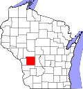
Location of the Town of Ridgeville
Town of Ridgeville, Wisconsin.webp
Coordinates: 43°50′26″N90°35′16″W / 43.84056°N 90.58778°W / 43.84056; -90.58778
Country Flag of the United States.svg  United States
State Flag of Wisconsin.svg  Wisconsin
County Monroe
Area
  Total34.2 sq mi (88.7 km2)
  Land34.2 sq mi (88.6 km2)
  Water0.0 sq mi (0.1 km2)
Elevation
[1]
1,083 ft (330 m)
Population
 (2000)
  Total491
  Density14.4/sq mi (5.5/km2)
Time zone UTC-6 (Central (CST))
  Summer (DST) UTC-5 (CDT)
Area code 608
FIPS code 55-67850 [2]
GNIS feature ID1584033 [1]

The Town of Ridgeville is located in Monroe County, Wisconsin, United States. The population was 491 at the 2000 census.

Contents

Geography

According to the United States Census Bureau, the town has a total area of 34.2 square miles (88.7 km2), of which, 34.2 square miles (88.6 km2) of it is land and 0.04 square miles (0.1 km2) of it (0.12%) is water.

Demographics

As of the census [2] of 2000, there were 491 people, 159 households, and 131 families residing in the town. The population density was 14.4 people per square mile (5.5/km2). There were 183 housing units at an average density of 5.4 per square mile (2.1/km2). The racial makeup of the town was 97.35% White, 0.41% Native American, 0.20% Asian, 2.04% from other races. Hispanic or Latino of any race were 4.07% of the population.

There were 159 households, out of which 41.5% had children under the age of 18 living with them, 67.9% were married couples living together, 8.2% had a female householder with no husband present, and 17.6% were non-families. 15.1% of all households were made up of individuals, and 4.4% had someone living alone who was 65 years of age or older. The average household size was 3.09 and the average family size was 3.39.

In the town, the population was spread out, with 30.8% under the age of 18, 8.6% from 18 to 24, 27.9% from 25 to 44, 21.8% from 45 to 64, and 11.0% who were 65 years of age or older. The median age was 35 years. For every 100 females, there were 115.4 males. For every 100 females age 18 and over, there were 111.2 males.

The median income for a household in the town was $35,000, and the median income for a family was $38,125. Males had a median income of $25,288 versus $21,111 for females. The per capita income for the town was $15,499. About 20.1% of families and 20.6% of the population were below the poverty line, including 32.2% of those under age 18 and 3.7% of those age 65 or over.

Related Research Articles

<span class="mw-page-title-main">Webb, Alabama</span> Town in Alabama, United States

Webb is a town in Houston County, Alabama, United States. It is named for plantation owner B. F. Webb, who settled in the area around 1890. The town was incorporated in 1903. It is part of the Dothan, Alabama Metropolitan Statistical Area. As of the 2010 census, the population was 1,430, up from 1,298 in 2000.

<span class="mw-page-title-main">Seelyville, Indiana</span> Town in Indiana, United States

Seelyville is a town in Lost Creek Township, Vigo County, in the U.S. state of Indiana. The population was 1,029 at the 2010 census. It is part of the Terre Haute Metropolitan Statistical Area.

<span class="mw-page-title-main">Chapman, Maine</span> Town in the state of Maine, United States

Chapman is a town in Aroostook County, Maine, United States. The population was 491 at the 2020 census.

<span class="mw-page-title-main">Wallagrass, Maine</span> Town in the state of Maine, United States

Wallagrass is a town in Aroostook County, Maine, United States. The population was 519 at the 2020 census.

<span class="mw-page-title-main">Westfield, Maine</span> Town in the state of Maine, United States

Westfield is a town in Aroostook County, Maine, United States. The population was 455 at the 2020 census.

<span class="mw-page-title-main">Fayette, Maine</span> Town in the state of Maine, United States

Fayette is a town in Kennebec County, Maine, United States. The population was 1,160 as of the 2020 census. A popular recreation spot in central Maine, Fayette is part of the Winthrop Lakes Region.

Exeter is a town in Penobscot County, Maine, United States. The population was 963 at the 2020 census.

Passadumkeag is a town on the east bank of the Penobscot River at the confluence with the Passadumkeag River in Penobscot County, Maine, United States. The population was 356 at the 2020 census. Passadumkeag is a word of the Penobscot people meaning "quick water".

<span class="mw-page-title-main">Friendsville, Maryland</span> Town in Maryland, United States

Friendsville is a town in Garrett County, Maryland, United States. The population was 491 at the 2010 census.

<span class="mw-page-title-main">Hubbard Lake, Alcona County, Michigan</span> Census-designated place & unincorporated community in Michigan, United States

Hubbard Lake is an unincorporated community and census-designated place (CDP) in Alcona County in the U.S. state of Michigan. The population was 857 at the 2020 census. Hubbard Lake occupies portions of Alcona, Caledonia, and Hawes township.

<span class="mw-page-title-main">Etowah, Oklahoma</span> Town in Oklahoma, United States

Etowah is a town in Cleveland County, Oklahoma, United States. The population was 159 at the 2020 census, a 72.8% increase from 2010.

<span class="mw-page-title-main">Tryon, Oklahoma</span> Town in Oklahoma, United States

Tryon is a town in Lincoln County, Oklahoma, United States. The population was 491 at the 2010 census. The community is named after early land owner Fred S. Tryon.

<span class="mw-page-title-main">Henrieville, Utah</span> Town in the state of Utah, United States

Henrieville is a town in Garfield County, Utah, United States, along Utah Scenic Byway 12. As of the 2010 census, the town population was 230, up from 159 at the 2000 census.

<span class="mw-page-title-main">Pembroke, Virginia</span> Town in Virginia, United States

Pembroke is a town in Giles County, Virginia, United States. The population was 1,128 at the 2010 census. It is part of the Blacksburg–Christiansburg Metropolitan Statistical Area.

<span class="mw-page-title-main">Bancroft, West Virginia</span> Town in West Virginia, United States

Bancroft is a town in Putnam County, West Virginia, United States, along the Kanawha River. The population was 389 at the 2020 census. It is part of the Huntington–Ashland metropolitan area.

<span class="mw-page-title-main">Bayview, Wisconsin</span> Town in Wisconsin, United States

Bayview is a town in Bayfield County, Wisconsin, United States. The population was 487 at the 2010 census. The unincorporated community of Sioux is located in the town.

<span class="mw-page-title-main">Springvale, Columbia County, Wisconsin</span> Town in Wisconsin, United States

Springvale is a town in Columbia County, Wisconsin, United States. The population was 550 at the 2000 census.

<span class="mw-page-title-main">Brighton, Marathon County, Wisconsin</span> Town in Wisconsin, United States

Brighton is a town in Marathon County, Wisconsin, United States. It is part of the Wausau, Wisconsin Metropolitan Statistical Area. The population was 620 at the 2020 census.

<span class="mw-page-title-main">Bergen, Vernon County, Wisconsin</span> Town in Wisconsin, United States

Bergen is a town in Vernon County, Wisconsin, United States. The population was 1,365 at the 2020 census. The unincorporated community of Pleasant Valley is located in the town.

<span class="mw-page-title-main">Washington, Vilas County, Wisconsin</span> Town in Wisconsin, United States

Washington is a town in Vilas County, Wisconsin, United States. The population was 1,577 at the 2000 census.

References

  1. 1 2 "US Board on Geographic Names". United States Geological Survey. October 25, 2007. Retrieved January 31, 2008.
  2. 1 2 "U.S. Census website". United States Census Bureau . Retrieved January 31, 2008.