Wellington, Wisconsin

Last updated

Wellington, Wisconsin
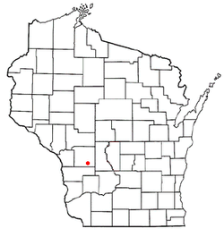
WIMap-doton-Wellington.png
Location of Wellington, Wisconsin
Coordinates: 43°45′59″N90°29′20″W / 43.76639°N 90.48889°W / 43.76639; -90.48889
Country Flag of the United States.svg  United States
State Flag of Wisconsin.svg  Wisconsin
County Monroe
Area
  Total35.4 sq mi (91.7 km2)
  Land35.4 sq mi (91.7 km2)
  Water0.0 sq mi (0.0 km2)
Elevation
[1]
1,371 ft (418 m)
Population
 (2000)
  Total544
  Density15.4/sq mi (5.9/km2)
Time zone UTC-6 (Central (CST))
  Summer (DST) UTC-5 (CDT)
Area code 608
FIPS code 55-85125 [2]
GNIS feature ID1584394 [1]

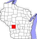
Wellington is a town in Monroe County, Wisconsin, United States. The population was 544 at the 2000 census.

Contents

Geography

According to the United States Census Bureau, the town has a total area of 35.4 square miles (91.7 km2), all of it land.

Demographics

At the 2000 census there were 544 people, 185 households, and 152 families in the town. The population density was 15.4 people per square mile (5.9/km2). There were 221 housing units at an average density of 6.2 per square mile (2.4/km2). The racial makeup of the town was 98.71% White, 0.18% Native American, 0.55% from other races, and 0.55% from two or more races. Hispanic or Latino of any race were 1.65%. [2]

Of the 185 households 40.0% had children under the age of 18 living with them, 73.5% were married couples living together, 5.4% had a female householder with no husband present, and 17.3% were non-families. 15.1% of households were one person and 5.4% were one person aged 65 or older. The average household size was 2.94 and the average family size was 3.29.

The age distribution was 32.7% under the age of 18, 6.4% from 18 to 24, 26.7% from 25 to 44, 23.0% from 45 to 64, and 11.2% 65 or older. The median age was 34 years. For every 100 females, there were 100.7 males. For every 100 females age 18 and over, there were 117.9 males.

The median household income was $36,146 and the median family income was $37,500. Males had a median income of $26,250 versus $17,500 for females. The per capita income for the town was $14,962. About 11.5% of families and 16.5% of the population were below the poverty line, including 23.7% of those under age 18 and 5.5% of those age 65 or over.

Related Research Articles

<span class="mw-page-title-main">Webb, Alabama</span> Town in Alabama, United States

Webb is a town in Houston County, Alabama, United States. It is named for plantation owner B. F. Webb, who settled in the area around 1890. The town was incorporated in 1903. It is part of the Dothan, Alabama Metropolitan Statistical Area. As of the 2010 census, the population was 1,430, up from 1,298 in 2000.

<span class="mw-page-title-main">Etna Green, Indiana</span> Town in Indiana, United States

Etna Green is a town in Etna Township, Kosciusko County, in the U.S. state of Indiana. The population was 586 at the 2010 census.

<span class="mw-page-title-main">Parker City, Indiana</span> Town in Indiana, United States

Parker City is a town in Monroe Township, Randolph County, in the U.S. state of Indiana. The population was 1,419 at the 2010 census.

Stottville is a hamlet and census-designated place (CDP) in Columbia County, New York, United States. The population was 1,375 at the 2010 census.

<span class="mw-page-title-main">South Lockport, New York</span> CDP in New York, United States

South Lockport is a hamlet located in the Town of Lockport in Niagara County, New York, United States. The population was 8,234 at the 2010 census. It is part of the Buffalo–Niagara Falls Metropolitan Statistical Area.

<span class="mw-page-title-main">Oakwood, Cuyahoga County, Ohio</span> Village in Ohio, United States

Oakwood is a village in Cuyahoga County, Ohio, United States. The population was 3,572 at the 2020 census. It is an inner ring suburb of Cleveland.

<span class="mw-page-title-main">Penn Township, York County, Pennsylvania</span> Township in Pennsylvania, United States

Penn Township is a township in York County, Pennsylvania, United States. The population was 17,494 at the 2020 census.

<span class="mw-page-title-main">Barrackville, West Virginia</span> Town in West Virginia, United States

Barrackville is a town in Marion County, West Virginia, United States. The population was 1,211 at the 2020 census.

<span class="mw-page-title-main">Northfork, West Virginia</span> Town in West Virginia, United States

Northfork is a town in McDowell County, West Virginia, United States, located on U.S. Route 52 between Welch and Bluefield.

<span class="mw-page-title-main">Bancroft, West Virginia</span> Town in West Virginia, United States

Bancroft is a town in Putnam County, West Virginia, United States, along the Kanawha River. The population was 389 at the 2020 census. It is part of the Huntington–Ashland metropolitan area.

<span class="mw-page-title-main">Courtland, Wisconsin</span> Town in Wisconsin, United States

Courtland is a town in Columbia County, Wisconsin in the United States. The population was 463 at the 2000 census.

<span class="mw-page-title-main">Rubicon, Wisconsin</span> Town in Wisconsin, United States

Rubicon is a town in Dodge County, Wisconsin, United States. The population was 2,005 at the 2000 census. The unincorporated communities of Rubicon and Saylesville are located in the town. The unincorporated community of Woodland is also located partially in the town.

<span class="mw-page-title-main">Glen Haven, Wisconsin</span> Town in Wisconsin, United States

Glen Haven is a town in Grant County, Wisconsin, United States. According to the 2000 census, the town population was 490. The census-designated place of Glen Haven is located in the town.

<span class="mw-page-title-main">Knapp, Jackson County, Wisconsin</span> Town in Wisconsin, United States

Knapp is a town in Jackson County, Wisconsin, in the United States. As of the 2000 census, the town population was 275. The unincorporated community of Lapham Junction is located in the town.

<span class="mw-page-title-main">Washington, Vilas County, Wisconsin</span> Town in Wisconsin, United States

Washington is a town in Vilas County, Wisconsin, United States. The population was 1,577 at the 2000 census.

<span class="mw-page-title-main">Frog Creek, Wisconsin</span> Town in Wisconsin, United States

Frog Creek is a town in Washburn County, Wisconsin, United States. The population was 160 at the 2000 census. The unincorporated community of Chittamo is located in the town.

<span class="mw-page-title-main">Stone Lake, Wisconsin</span> Town in Wisconsin, United States

Stone Lake is a town in Washburn County, Wisconsin, United States. The population was 544 at the 2000 census. The census-designated place of Stone Lake is located partially in the town.

<span class="mw-page-title-main">Mazomanie (town), Wisconsin</span>

Mazomanie is a town in Dane County, Wisconsin. The population was 1,185 at the time of the 2000 census. The Village of Mazomanie is located within the town.

Cassville is a town in Grant County, Wisconsin, United States. The population was 487 at the 2000 census. The Village of Cassville is located within the town.

<span class="mw-page-title-main">Sharon, Portage County, Wisconsin</span> Town in Wisconsin, United States

Sharon is a town in Portage County, Wisconsin, United States. The population was 2,123 at the 2020 census. The unincorporated communities of Ellis, Little Waupon, North Star, and Polonia are located within the town.

References

  1. 1 2 "US Board on Geographic Names". United States Geological Survey. October 25, 2007. Retrieved January 31, 2008.
  2. 1 2 "U.S. Census website". United States Census Bureau . Retrieved January 31, 2008.