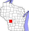
Glendale, Monroe County, Wisconsin

Last updated

Glendale, Wisconsin
WIMap-doton-Glendale b.png
Location of Glendale, Monroe County, Wisconsin
Coordinates: 43°46′19″N90°22′37″W / 43.77194°N 90.37694°W / 43.77194; -90.37694
Country Flag of the United States.svg  United States
State Flag of Wisconsin.svg  Wisconsin
County Monroe
Area
  Total35.6 sq mi (92.3 km2)
  Land35.6 sq mi (92.3 km2)
  Water0.0 sq mi (0.0 km2)
Elevation
[1]
1,194 ft (364 m)
Population
 (2000)
  Total579
  Density16.2/sq mi (6.3/km2)
Time zone UTC-6 (Central (CST))
  Summer (DST) UTC-5 (CDT)
Area code 608
FIPS code 55-29450 [2]
GNIS feature ID1583282 [1]

Glendale is a town in Monroe County, Wisconsin, United States. The population was 579 at the 2000 census. The unincorporated community of Glendale is located in the town.

Contents

Geography

According to the United States Census Bureau, the town has a total area of 35.7 square miles (92.3 km2), of which, 35.6 square miles (92.3 km2) of it is land and 0.03% is water.

Demographics

As of the census [2] of 2000, there were 579 people, 216 households, and 168 families residing in the town. The population density was 16.2 people per square mile (6.3/km2). There were 250 housing units at an average density of 7.0 per square mile (2.7/km2). The racial makeup of the town was 99.31% White, 0.35% Native American, and 0.35% from two or more races. Hispanic or Latino of any race were 0.17% of the population.

There were 216 households, out of which 33.3% had children under the age of 18 living with them, 71.3% were married couples living together, 2.8% had a female householder with no husband present, and 21.8% were non-families. 18.1% of all households were made up of individuals, and 8.8% had someone living alone who was 65 years of age or older. The average household size was 2.68 and the average family size was 3.05.

In the town, the population was spread out, with 25.9% under the age of 18, 6.2% from 18 to 24, 24.9% from 25 to 44, 26.8% from 45 to 64, and 16.2% who were 65 years of age or older. The median age was 42 years. For every 100 females, there were 113.7 males. For every 100 females age 18 and over, there were 109.3 males.

The median income for a household in the town was $37,083, and the median income for a family was $43,333. Males had a median income of $30,156 versus $20,568 for females. The per capita income for the town was $16,158. About 4.1% of families and 4.6% of the population were below the poverty line, including 6.3% of those under age 18 and none of those age 65 or over.

Related Research Articles

<span class="mw-page-title-main">Kinsey, Alabama</span> Town in the United States

Kinsey is a town in Houston County, Alabama, United States. It was initially located and incorporated in Henry County in February 1893. In 1903, it was redrawn into newly created Houston County and was later reincorporated in August 1957. It is part of the Dothan, Alabama Metropolitan Statistical Area. At the 2010 census the population was 2,198, up from 1,796 in 2000.

<span class="mw-page-title-main">Sherrill, Iowa</span> City in Iowa, United States

Sherrill is a city in Dubuque County, Iowa, United States. The population was 189 at the time of the 2020 census, up from 186 in 2000.

<span class="mw-page-title-main">New Era, Michigan</span> Village in Michigan, United States

New Era is a village in Shelby Township, Oceana County in the U.S. state of Michigan. The population was 451 at the 2010 census.

<span class="mw-page-title-main">Mabscott, West Virginia</span> Town in West Virginia, United States

Mabscott is a town in Raleigh County, West Virginia, United States. The population was 1,333 at the 2020 census. The town's name is a contraction of the name Mabel Scott, wife of local coal operator Cyrus H. Scott.

<span class="mw-page-title-main">North Hills, West Virginia</span> Town in West Virginia, United States

North Hills is a town in Wood County, West Virginia, United States. It is a suburb of Parkersburg. The population was 837 at the 2020 census. North Hills was incorporated on February 15, 1979.

<span class="mw-page-title-main">Morrison, Wisconsin</span> Town in Wisconsin, United States

Morrison is a town in Brown County in the U.S. state of Wisconsin. The population was 1,599 at the 2010 census.

Sherwood is a town in Clark County in the U.S. state of Wisconsin. The population was 252 at the 2000 census. The unincorporated community of Nevins is located in the town.

<span class="mw-page-title-main">Brandon, Wisconsin</span> Village in Wisconsin, United States

Brandon is a village in Fond du Lac County, Wisconsin, United States. The population was 879 at the 2010 census.

<span class="mw-page-title-main">Glendale, Wisconsin</span> City in Milwaukee County, Wisconsin

Glendale is a city in Milwaukee County, Wisconsin, United States. It is a suburb of the neighboring Milwaukee. The population was 13,357 at the 2020 census.

<span class="mw-page-title-main">Webster, Vernon County, Wisconsin</span>

Webster is a town in Vernon County, Wisconsin, United States. The population was 676 at the 2000 census. The unincorporated community of Avalanche is located in the town. The unincorporated community of Bloomingdale is also located partially within the town.

Eastman is a town in Crawford County, Wisconsin, United States. The population was 790 at the 2000 census. The village of Eastman and the unincorporated community of Charme are located within the town.

<span class="mw-page-title-main">Wonewoc (town), Wisconsin</span> Town in Wisconsin, United States

Wonewoc is a town in Juneau County, Wisconsin, United States. The population was 783 at the 2000 census. The Village of Wonewoc and the village of Union Center are located within the town.

<span class="mw-page-title-main">Bangor (town), Wisconsin</span>

Bangor is a town in La Crosse County, Wisconsin, United States. It is part of the La Crosse, Wisconsin Metropolitan Statistical Area. The population was 570 at the 2010 census. The Village of Bangor is located partially within the town.

<span class="mw-page-title-main">Oakdale (town), Wisconsin</span> Town in Wisconsin, United States

Oakdale is a town in Monroe County, Wisconsin, United States. The population was 679 at the 2000 census. The Village of Oakdale is located within the town.

<span class="mw-page-title-main">Wilton, Wisconsin</span> Village in Wisconsin, United States

Wilton is a village in Monroe County, Wisconsin, United States. The population was 504 at the 2010 census. The village is located partially within the Town of Wilton and partially within the Town of Wellington.

Wilton is a town in Monroe County, Wisconsin, United States. The population was 925 at the 2000 census. The Village of Wilton is located partially within the town.

<span class="mw-page-title-main">La Valle (town), Wisconsin</span>

The Town of La Valle is located in Sauk County, Wisconsin, United States. La Valle is a name derived from French meaning "the valley". The population was 1,203 at the 2000 census. The Village of La Valle is located within the town.

The Town of Spring Green is located in Sauk County, Wisconsin, United States. The January 1, 2021 final population estimate for the town is 1,728. Approximately 1,374 of the estimated population for the Town of Spring Green in Sauk County are of voting age.

<span class="mw-page-title-main">Genoa (town), Wisconsin</span> Human settlement in Vernon County, Wisconsin, United States of America

Genoa is a town in Vernon County, Wisconsin, United States. The population was 705 at the 2000 census. The Village of Genoa is located within the town. The unincorporated community of Romance is located in the town of Genoa.

<span class="mw-page-title-main">Locust Grove, Georgia</span> City in the United States

Locust Grove is a city in Henry County, Georgia, United States. The population was 5,402 at the 2010 census, up from 2,322 in 2000. Some unincorporated communities such as Luella and many rural areas surround Locust Grove, and those communities have Locust Grove postal addresses.

References

  1. 1 2 "US Board on Geographic Names". United States Geological Survey. October 25, 2007. Retrieved January 31, 2008.
  2. 1 2 "U.S. Census website". United States Census Bureau . Retrieved January 31, 2008.

43°46′56″N90°20′44″W / 43.78222°N 90.34556°W / 43.78222; -90.34556