Oakdale, Wisconsin

Last updated

Oakdale, Wisconsin
Oakdale WI.jpg
Monroe County Wisconsin Incorporated and Unincorporated areas Oakdale Highlighted.svg
Location of Oakdale in Monroe County, Wisconsin.
Coordinates: 43°56′45″N90°22′10″W / 43.94583°N 90.36944°W / 43.94583; -90.36944
Country Flag of the United States.svg  United States
State Flag of Wisconsin.svg  Wisconsin
County Monroe
Area
[1]
  Total0.74 sq mi (1.92 km2)
  Land0.74 sq mi (1.92 km2)
  Water0.00 sq mi (0.00 km2)
Elevation
[2]
948 ft (289 m)
Population
 (2020) [3]
  Total302
  Density395.41/sq mi (152.74/km2)
Time zone UTC-6 (Central (CST))
  Summer (DST) UTC-5 (CDT)
Area code 608
FIPS code 55-58875 [4]
GNIS feature ID1583836 [2]

Oakdale is a village in Monroe County, Wisconsin, United States. The population was 302 at the 2020 census. The village is located within the Town of Oakdale.

Contents

Geography

Oakdale is located at 43°57′32″N90°22′43″W / 43.95889°N 90.37861°W / 43.95889; -90.37861 (43.958986, -90.378844). [5]

According to the United States Census Bureau, the village has a total area of 0.86 square miles (2.23 km2), all of it land. [6]

Demographics

Historical population
CensusPop.Note
1990 162
2000 29783.3%
2010 2970.0%
2020 3021.7%
U.S. Decennial Census [7]
Oakdale Elementary School Oakdale WI Elementary School.jpg
Oakdale Elementary School

2010 census

As of the census [3] of 2010, there were 297 people, 129 households, and 75 families living in the village. The population density was 345.3 inhabitants per square mile (133.3/km2). There were 137 housing units at an average density of 159.3 per square mile (61.5/km2). The racial makeup of the village was 98.3% White, 0.7% African American, 0.7% Native American, and 0.3% Asian.

There were 129 households, of which 30.2% had children under the age of 18 living with them, 42.6% were married couples living together, 9.3% had a female householder with no husband present, 6.2% had a male householder with no wife present, and 41.9% were non-families. 32.6% of all households were made up of individuals, and 11.6% had someone living alone who was 65 years of age or older. The average household size was 2.30 and the average family size was 2.96.

The median age in the village was 39.8 years. 25.3% of residents were under the age of 18; 5% were between the ages of 18 and 24; 26.7% were from 25 to 44; 27.6% were from 45 to 64; and 15.5% were 65 years of age or older. The gender makeup of the village was 50.8% male and 49.2% female.

2000 census

Water tower Oakdale Wisconsin Water tower.jpg
Water tower

As of the census [4] of 2000, there were 297 people, 112 households, and 73 families living in the village. The population density was 352.9 people per square mile (136.5/km2). There were 127 housing units at an average density of 150.9 per square mile (58.4/km2). The racial makeup of the village was 98.65% White, 0.34% Native American, and 1.01% from two or more races. 0.34% of the population were Hispanic or Latino of any race.

There were 112 households, out of which 31.3% had children under the age of 18 living with them, 47.3% were married couples living together, 9.8% had a female householder with no husband present, and 34.8% were non-families. 23.2% of all households were made up of individuals, and 8.9% had someone living alone who was 65 years of age or older. The average household size was 2.65 and the average family size was 3.07.

In the village, the population was spread out, with 27.3% under the age of 18, 6.7% from 18 to 24, 35.7% from 25 to 44, 18.9% from 45 to 64, and 11.4% who were 65 years of age or older. The median age was 35 years. For every 100 females, there were 106.3 males. For every 100 females age 18 and over, there were 109.7 males.

The median income for a household in the village was $35,500, and the median income for a family was $36,667. Males had a median income of $30,833 versus $20,250 for females. The per capita income for the village was $14,440. About 4.7% of families and 9.6% of the population were below the poverty line, including 12.1% of those under the age of eighteen and none of those 65 or over.

Related Research Articles

Selmont-West Selmont is a census-designated place (CDP) in Dallas County, Alabama, United States. At the 2020 census, the population was 2,158.

<span class="mw-page-title-main">Parks, Arizona</span> CDP in Coconino County, Arizona

Parks is a census-designated place (CDP) in Coconino County, Arizona, United States. The population was 1,188 at the 2010 census.

<span class="mw-page-title-main">East Oakdale, California</span> Census-designated place in California, United States

East Oakdale is an unincorporated census-designated place (CDP) on the Stanislaus River, located east of the city of Oakdale in Stanislaus County, California.

<span class="mw-page-title-main">Oakdale, Illinois</span> Village in Illinois, United States

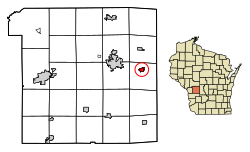
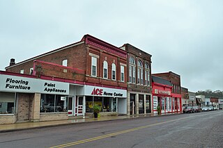
Oakdale is a village in Washington County, Illinois, United States. The population was 221 at the 2010 census.

<span class="mw-page-title-main">Elizabeth, Louisiana</span> Village in Louisiana, United States

Elizabeth is a village in Allen Parish, Louisiana, United States with population of 417 in the 2020 census. It was a town and had population of 532 at the 2010 census.

<span class="mw-page-title-main">Oakdale, Louisiana</span> City in Louisiana, United States

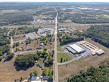
Oakdale is a city in Allen Parish in south Louisiana, United States. The population was 7,780 at the 2010 census.

<span class="mw-page-title-main">Oakdale, Minnesota</span> City in Minnesota, United States

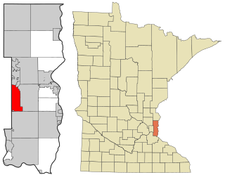
Oakdale is a city in Washington County, Minnesota, United States. It is a suburb of Saint Paul and is on the eastern side of the Twin Cities Metropolitan area. The population was 28,303 at the 2020 census. Oakdale is the 36th largest city in Minnesota by population.

<span class="mw-page-title-main">Oakdale, Nebraska</span> Village in Antelope County, Nebraska, United States

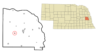
Oakdale is a village in Antelope County, Nebraska, United States. The population was 322 at the 2010 census.

<span class="mw-page-title-main">Rossie, New York</span> Town in New York, United States

Rossie is a town in St. Lawrence County, New York, United States. The population was 877 at the 2010 census. The town is named after the sister of an early land owner.

<span class="mw-page-title-main">Boggs Township, Clearfield County, Pennsylvania</span> Township in Pennsylvania, United States

Boggs Township is a township in Clearfield County, Pennsylvania, United States. The population was 1,668 at the 2020 census.

<span class="mw-page-title-main">Cottage Grove, Tennessee</span> Town in Tennessee, United States

Cottage Grove is a town in Henry County, Tennessee, United States. The population was 88 at the 2010 census. Cottage Grove is currently the smallest town in Tennessee.

<span class="mw-page-title-main">Friesland, Wisconsin</span> Village in Wisconsin, United States

Friesland is a village in Columbia County, Wisconsin, United States. The population was 320 at the 2020 census. It is part of the Madison Metropolitan Statistical Area.

<span class="mw-page-title-main">Kekoskee, Wisconsin</span> Village in Wisconsin, United States

Kekoskee is a village in Dodge County, Wisconsin, United States. The population was 161 at the 2010 census.

<span class="mw-page-title-main">Yuba, Wisconsin</span> Village in Wisconsin, United States

Yuba is a village in Richland County, Wisconsin, United States. The population was 74 at the 2010 census. Yuba is 11 miles southwest of Hillsboro and 17 miles north of Richland Center. County Hwy C runs through the village.

<span class="mw-page-title-main">Readstown, Wisconsin</span> Village in Wisconsin, United States

Readstown is a village in Vernon County, Wisconsin, United States. The population was 415 at the 2010 census.

<span class="mw-page-title-main">Eastman, Wisconsin</span> Village in Wisconsin, United States

Eastman is a village in Crawford County, Wisconsin, United States. The population was 428 at the 2010 census. The village is located within the Town of Eastman.

<span class="mw-page-title-main">Clyman, Wisconsin</span> Village in Wisconsin, United States

Clyman is a village in Dodge County, Wisconsin, United States. The population was 422 at the 2010 census. The village is located within the Town of Clyman.

<span class="mw-page-title-main">Lowell, Wisconsin</span> Village in Wisconsin, United States

Lowell is a village in Dodge County, Wisconsin, United States, along the Beaver Dam River. The population was 340 at the 2010 census. The village is located within the Town of Lowell.

Oakdale is a town in Monroe County, Wisconsin, United States. The population was 679 at the 2000 census. The Village of Oakdale is located within the town.

<span class="mw-page-title-main">Wilton, Wisconsin</span> Village in Wisconsin, United States

Wilton is a village in Monroe County, Wisconsin, United States. The population was 504 at the 2010 census. The village is located partially within the Town of Wilton and partially within the Town of Wellington.

References

  1. "2019 U.S. Gazetteer Files". United States Census Bureau. Retrieved August 7, 2020.
  2. 1 2 "US Board on Geographic Names". United States Geological Survey. October 25, 2007. Retrieved January 31, 2008.
  3. 1 2 "U.S. Census website". United States Census Bureau . Retrieved November 18, 2012.
  4. 1 2 "U.S. Census website". United States Census Bureau . Retrieved January 31, 2008.
  5. "US Gazetteer files: 2010, 2000, and 1990". United States Census Bureau. February 12, 2011. Retrieved April 23, 2011.
  6. "US Gazetteer files 2010". United States Census Bureau. Archived from the original on January 12, 2012. Retrieved November 18, 2012.
  7. "Census of Population and Housing". Census.gov. Retrieved June 4, 2015.