Grant, Monroe County, Wisconsin

Last updated

Grant, Wisconsin
WIMap-doton-Grant c.png
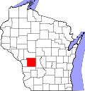
Location of Grant, Monroe County, Wisconsin
Coordinates: 44°6′33″N90°35′1″W / 44.10917°N 90.58361°W / 44.10917; -90.58361
Country Flag of the United States.svg  United States
State Flag of Wisconsin.svg  Wisconsin
County Monroe
Area
  Total35.9 sq mi (93.0 km2)
  Land35.7 sq mi (92.6 km2)
  Water0.2 sq mi (0.4 km2)
Elevation
[1]
1,001 ft (305 m)
Population
 (2000)
  Total483
  Density13.5/sq mi (5.2/km2)
Time zone UTC-6 (Central (CST))
  Summer (DST) UTC-5 (CDT)
Area code 608
FIPS code 55-30325 [2]
GNIS feature ID1583300 [1]

Grant is a town in Monroe County, Wisconsin, United States. The population was 483 at the 2000 census.

Contents

Geography

According to the United States Census Bureau, the town has a total area of 35.9 square miles (93.0 km2), of which, 35.7 square miles (92.6 km2) of it is land and 0.2 square miles (0.4 km2) of it (0.45%) is water.

Demographics

As of the census [2] of 2000, there were 483 people, 173 households, and 130 families residing in the town. The population density was 13.5 people per square mile (5.2/km2). There were 211 housing units at an average density of 5.9 per square mile (2.3/km2). The racial makeup of the town was 99.79% White and 0.21% Asian.

There were 173 households, out of which 33.5% had children under the age of 18 living with them, 64.2% were married couples living together, 6.9% had a female householder with no husband present, and 24.3% were non-families. 21.4% of all households were made up of individuals, and 6.9% had someone living alone who was 65 years of age or older. The average household size was 2.72 and the average family size was 3.12.

In the town, the population was spread out, with 26.1% under the age of 18, 6.8% from 18 to 24, 27.1% from 25 to 44, 29.2% from 45 to 64, and 10.8% who were 65 years of age or older. The median age was 40 years. For every 100 females, there were 101.3 males. For every 100 females age 18 and over, there were 105.2 males.

The median income for a household in the town was $43,456, and the median income for a family was $46,042. Males had a median income of $27,500 versus $24,583 for females. The per capita income for the town was $16,751. About 3.0% of families and 3.7% of the population were below the poverty line, including 5.4% of those under age 18 and none of those age 65 or over.

Related Research Articles

<span class="mw-page-title-main">Ashley, Indiana</span> Town in Indiana, United States

Ashley is a town in Indiana located on the border of Smithfield Township, DeKalb County and Steuben Township, Steuben County. The population was 983 at the 2010 census.

<span class="mw-page-title-main">Spurgeon, Indiana</span> Town in Indiana, United States

Spurgeon is a town in Monroe Township, Pike County, in the U.S. state of Indiana. The population was 207 at the 2010 census. It is part of the Jasper Micropolitan Statistical Area.

<span class="mw-page-title-main">Washburn, Maine</span> Town in the state of Maine, United States

Washburn is a town in Aroostook County, Maine, United States. It was incorporated on February 25, 1861, and named after Israel Washburn, the governor of Maine at the time. The population was 1,527 at the 2020 census. Benjamin C. Wilder House, which was built in 1852, is located on Main Street in Washburn and predates the town's incorporation by nine years.

<span class="mw-page-title-main">Upton, Maine</span> Town in the state of Maine, United States

Upton is a town in Oxford County, Maine, United States. The population was 69 at the 2020 census.

<span class="mw-page-title-main">Akron, Michigan</span> Village in Michigan, United States

Akron is a village in Tuscola County of the U.S. state of Michigan. The population was 349 at the 2020 census.

<span class="mw-page-title-main">Twin Lakes, Freeborn County, Minnesota</span> City in Minnesota, United States

Twin Lakes is a city in Freeborn County, Minnesota, United States, near Albert Lea. The population was 134 at the 2020 census.

<span class="mw-page-title-main">Annada, Missouri</span> Village in Missouri, United States

Annada is a village in Pike County, Missouri, United States. The population was 29 at the 2010 census.

<span class="mw-page-title-main">Prairie Rose, North Dakota</span> City in North Dakota, United States

Prairie Rose is a city in Cass County, North Dakota, United States. The population was 56 at the 2020 census. The city is an enclave suburb of Fargo. Prairie Rose was founded in 1975 and it was incorporated in 1978. There are 21 homes in the city.

<span class="mw-page-title-main">Hunter, Oklahoma</span> Town in Oklahoma, United States

Hunter is a town in Garfield County, Oklahoma, United States. The population was 165 at the 2010 census, a 4.6 percent decline from the figure of 173 in 2000.

<span class="mw-page-title-main">South Pymatuning Township, Pennsylvania</span> Township in Pennsylvania, United States

South Pymatuning Township is a township in Mercer County, Pennsylvania, United States. The population was 2,650 at the 2020 census, a decrease from 2,695 in 2010.

<span class="mw-page-title-main">Santee, South Carolina</span> Town in South Carolina, United States

Santee is a town in Orangeburg County along the Santee River Valley in central South Carolina, United States. It has become a resort town of note located centrally north-south along the Atlantic Seaboard of South Carolina. The region has been rural, with a primarily agricultural economy typical of Orangeburg County, but is now known primarily for its several golf courses in proximity to Lake Marion, Santee State Park and other Lake Marion attractions. Interstate 95 connects its attractions easily with tourists traveling by automobile. I-95 crosses a narrow arm of the lake into the town lands, along a causeway. Lake Marion is a man-made hydroelectric reservoir, which at 110,000 acres is one of the fifty largest lakes in the country.

<span class="mw-page-title-main">Fairview, West Virginia</span> Town in West Virginia, United States

Fairview is a town in Marion County, West Virginia, United States. The population was 374 at the 2020 census.

<span class="mw-page-title-main">Northfork, West Virginia</span> Town in West Virginia, United States

Northfork is a town in McDowell County, West Virginia, United States, located on U.S. Route 52 between Welch and Bluefield.

<span class="mw-page-title-main">Rhodell, West Virginia</span> Unincorporated community in West Virginia, United States

Rhodell is an unincorporated community in Raleigh County, West Virginia, United States. The population was 173 at the 2010 census.

<span class="mw-page-title-main">Rockland, Brown County, Wisconsin</span> Town in Wisconsin, United States

Rockland is a town in Brown County in the U.S. state of Wisconsin. The population was 1,734 at the 2010 census.

<span class="mw-page-title-main">Meenon, Wisconsin</span> Town in Wisconsin, United States

Meenon is a town in Burnett County in the U.S. state of Wisconsin. The population was 1,163 at the 2010 census. It is the home of the Burnett County Government Center.

<span class="mw-page-title-main">Sheridan, Wisconsin</span> Town in Wisconsin, United States

Sheridan is a town in Dunn County, Wisconsin, United States. The population was 483 at the 2000 census.

<span class="mw-page-title-main">Knox, Wisconsin</span> Town in Wisconsin, United States

Knox is a town in Price County, Wisconsin, United States. The population was 399 at the 2000 census. The unincorporated community of Brantwood is located with the town. The unincorporated community of Clifford is also located partially in the town. The ghost town of Knox Mills is also located in the town.

<span class="mw-page-title-main">Kinnickinnic, Wisconsin</span> Town in Wisconsin, United States

Kinnickinnic is a town in St. Croix County, Wisconsin, United States. The population was 1,400 at the 2000 census.

<span class="mw-page-title-main">Randolph, Wisconsin</span> Village in Wisconsin, United States

Randolph is a village in Columbia and Dodge Counties in the U.S. state of Wisconsin. The population was 1,811 at the 2010 census. Of this, 1,339 were in Dodge County, and 472 were in Columbia County. The village is located at the southeast corner of the Town of Randolph in Columbia County, although only a tiny portion of the village lies within the town. Most of the village lies within the Town of Westford in Dodge County. Small portions also lie within the Town of Fox Lake to the north and the Town of Courtland in Columbia County.

References

  1. 1 2 "US Board on Geographic Names". United States Geological Survey. October 25, 2007. Retrieved January 31, 2008.
  2. 1 2 "U.S. Census website". United States Census Bureau . Retrieved January 31, 2008.