Cataract, Wisconsin

Last updated

Cataract, Wisconsin
Wisconsin Highway 27 through Cataract, Wisconsin 02.jpg
USA Wisconsin location map.svg
Red pog.svg
Cataract, Wisconsin
Coordinates: 44°05′16″N90°50′32″W / 44.08778°N 90.84222°W / 44.08778; -90.84222
Country United States
State Wisconsin
County Monroe
Area
  Total0.594 sq mi (1.54 km2)
  Land0.594 sq mi (1.54 km2)
  Water0 sq mi (0 km2)
Elevation
850 ft (260 m)
Population
 (2010) [1]
  Total186
  Density310/sq mi (120/km2)
Time zone UTC-6 (Central (CST))
  Summer (DST) UTC-5 (CDT)
Area code 608
GNIS feature ID1562802 [2]

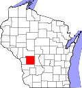
Cataract is a census-designated place (CDP) in the Town of Little Falls in Monroe County, Wisconsin, United States. As of the 2010 census, its population was 186. [1]

Contents

Geography

Cataract has an area of 0.594 square miles (1.54 km2), all of it land.

Attractions

The Paul and Matilda Wegner Grotto, located southwest of the village, is an outdoor collection of concrete folk-art sculptures encrusted with shards of glass, ceramics, seashells, and other materials. These have a variety of themes, including religious and patriotic subjects and more personal mementos of the lives of Paul and Matilda Wegner. The grotto was built between 1929 and 1942 by the Wegners on their farm, and is now owned by Monroe County and maintained by an endowment established for that purpose. [3]

Southeast of Cataract is The Little Falls Railroad & Doll Museum, with a garden railway, model railroad layout, and doll collection. [4]

The Walczak-Wontor Quarry Pit Workshop is located in the vicinity of Cataract; it is listed on the National Register of Historic Places.

Notable people

Images

See also

Related Research Articles

<span class="mw-page-title-main">Rusk County, Wisconsin</span> County in Wisconsin, United States

Rusk County is a county in the U.S. state of Wisconsin. As of the 2020 census, the population was 14,188. Its county seat is Ladysmith. The Chippewa and Flambeau rivers and their tributaries flow through the county. The land ranges from corn/soybean farms and dairy farms to lakes rimmed with vacation homes to hiking trails through the Blue Hills.

<span class="mw-page-title-main">Monroe County, Wisconsin</span> County in Wisconsin, United States

Monroe County is a county in the U.S. state of Wisconsin. As of the 2020 census, the population was 46,274. Its county seat is Sparta.

<span class="mw-page-title-main">Monroe County, Pennsylvania</span> County in Pennsylvania, United States

Monroe County is a county in the Commonwealth of Pennsylvania. As of the 2020 census, the population was 168,327. Its county seat is Stroudsburg. The county is part of the Northeast Pennsylvania region of the state. The county was formed from sections of Northampton and Pike counties on April 1, 1836. It was named in honor of James Monroe, the fifth president of the United States. The county borders Northampton County and the Lehigh Valley to its south, Pike and Wayne counties to its north, Carbon and Luzerne counties to its west, and the Delaware River and Warren County, New Jersey to its east. It is part of the New York metropolitan area, but also receives media from the Scranton/Wilkes-Barre and Philadelphia radio and television markets.

<span class="mw-page-title-main">Apex, North Carolina</span> Town in North Carolina, United States

Apex is a town in Wake County, North Carolina, United States. At its southern border, Apex encompasses the community of Friendship. In 1994, the downtown area was designated a historic district, and the Apex train depot, built in 1867, is designated a Wake County landmark. The depot location marks the highest point on the old Chatham Railroad, hence the town's name. The town motto is "The Peak of Good Living".

<span class="mw-page-title-main">Chippewa Falls, Wisconsin</span> City in Wisconsin, United States

Chippewa Falls is a city located on the Chippewa River in Chippewa County, Wisconsin, United States. The population was 14,731 in the 2020 census. Incorporated as a city in 1869, it is the county seat of Chippewa County.

<span class="mw-page-title-main">Little Falls, Wisconsin</span> Town in Wisconsin, United States

Little Falls is a town in Monroe County, Wisconsin, United States. The population was 1,334 at the 2000 census. The unincorporated communities of Cataract and Four Corners are located in the town.

<span class="mw-page-title-main">Wyeville, Wisconsin</span> Village in Wisconsin, United States

Wyeville is a village in Monroe County, Wisconsin, United States. It is located on Wisconsin Highway 21. The population was 147 at the 2010 census.

<span class="mw-page-title-main">Waldo, Wisconsin</span> Village in Wisconsin, United States

Waldo is a village along the Onion River in Sheboygan County, Wisconsin, United States. The population was 503 at the 2010 census. It has a post office with ZIP code 53093. It is included in the Sheboygan, Wisconsin Metropolitan Statistical Area.

<span class="mw-page-title-main">Norwich, Connecticut</span> City in Connecticut, United States

Norwich is a city in New London County, Connecticut, United States. The Yantic, Shetucket, and Quinebaug Rivers flow into the city and form its harbor, from which the Thames River flows south to Long Island Sound. The city is part of the Southeastern Connecticut Planning Region. The population was 40,125 at the 2020 United States Census.

Avon is a town in Livingston County, New York, United States. It is south of Rochester. The town population was 7,146 at the 2010 census. The town was named after Avon, Connecticut, a town in Hartford County. The village of Avon is in the northwest part of the town.

<span class="mw-page-title-main">Sheboygan Falls, Wisconsin</span> City in United States, Town of Rochester

Sheboygan Falls is a city in Sheboygan County, Wisconsin, United States, along the Sheboygan River. The population was 8,210 at the 2020 census. It is part of the Sheboygan metropolitan area.

<span class="mw-page-title-main">Hudson, Wisconsin</span> City in Wisconsin, United States

Hudson is a city in and the county seat of St. Croix County, Wisconsin, United States. As of the 2020 census, its population was 14,755. It is part of the Minneapolis–St. Paul metropolitan area.

<span class="mw-page-title-main">Spooner, Wisconsin</span> City in Wisconsin, United States

Spooner is a city in Washburn County, Wisconsin, United States. The population was 2,573 at the 2020 census. The city is located mostly within the southwest corner of the Town of Spooner, with a small portion extending into the Town of Beaver Brook on the south, the Town of Bashaw on the southwest, and the Town of Evergreen on the west. The city's nickname, "Crossroads of the North", is a reference to the city's location at the junction of two U.S. highways, 53 and 63, and State Highways 70 and 253.

<span class="mw-page-title-main">Jump River (CDP), Wisconsin</span> Census-designated place in Wisconsin, United States

Jump River is an census-designated place in the towns of Jump River and McKinley in Taylor County, Wisconsin, United States. It is located on the north bank of the Jump River, from which the hamlet takes its name. As of the 2010 census, its population was 52.

<span class="mw-page-title-main">Dickeyville Grotto</span> Series of grottos and shrines in Dickeyville, Grant County, Wisconsin, United States

The Dickeyville Grotto is a series of grottos and shrines in Dickeyville, Grant County, Wisconsin, United States. It is located at the intersection of U.S. Highway 151 and U.S. Highway 61. Most of the site's concrete structures are covered in shells, stones, tiles, wood, glass, gems and geodes donated by area parishioners. The site is visited by 40,000 to 60,000 visitors per year.

<span class="mw-page-title-main">Tunnel City, Wisconsin</span> Census-designated place in Wisconsin, United States

Tunnel City is an unincorporated census-designated place in the town of Greenfield, Monroe County, Wisconsin, United States, named after the train tunnel through a hill just to the west of town.

<span class="mw-page-title-main">Amberg (CDP), Wisconsin</span> Census-designated place in Wisconsin, United States

Amberg is an unincorporated census-designated place in Marinette County, Wisconsin, United States, in the town of Amberg. It is located on U.S. Highway 141. As of the 2010 census, its population was 180. The Amberg Historical Society operates the Amberg Historical Museum Complex which consists of the historic town hall that is on the National Register of Historic Places, the community's train depot, a 1900-era house, and the Amberg Museum.

<span class="mw-page-title-main">Hermansville, Michigan</span> Census-designated place in Michigan, United States

Hermansville is an unincorporated community and census-designated place (CDP) in Meyer Township of Menominee County in the U.S. state of Michigan. As of the 2020 census, it had a population of 509. The community formed around the defunct Wisconsin Land & Lumber Company as a company town. The company's former headquarters is open as the IXL Historical Museum. US Highway 2 (US 2) passes through the north edge of the community.

<span class="mw-page-title-main">Humbird, Wisconsin</span> Census-designated place in Wisconsin, United States

Humbird is an unincorporated census-designated place in the Town of Mentor in Clark County, Wisconsin, United States. It is located on U.S. Route 12 north-northwest of Merrillan. As of the 2010 census, its population was 266. Humbird has a post office with ZIP code 54746.

References

  1. 1 2 "U.S. Census website". U.S. Census Bureau . Retrieved March 29, 2011.
  2. U.S. Geological Survey Geographic Names Information System: Cataract, Wisconsin
  3. The Paul & Matilda Wegner Grotto
  4. The Little Falls Railroad & Doll Museum

Commons-logo.svg Media related to Cataract, Wisconsin at Wikimedia Commons