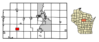
Cobb is a village in Iowa County, Wisconsin, United States. The population was 458 at the 2010 census. It is part of the Madison Metropolitan Statistical Area.

Cleveland is a village in Manitowoc County, Wisconsin, United States. The population was 1,579 at the 2020 census.
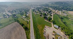
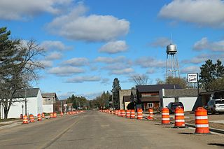
Stratford is a village in Marathon County, Wisconsin, United States. It is part of the Wausau, Wisconsin Metropolitan Statistical Area. The population was 1,578 at the 2010 census.

Footville is a village in Rock County, Wisconsin, United States. The population was 772 at the 2020 census.

Woodville is a village in St. Croix County, Wisconsin, United States. The population was 1,344 at the 2010 census.

Embarrass is a village in Waupaca County, Wisconsin, United States. The population was 404 at the 2010 census.
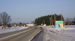
Wild Rose is a village in Waushara County, Wisconsin, United States. The population was 725 at the 2010 census.

Livingston is a village in Grant and Iowa Counties in the U.S. state of Wisconsin. The population was 664 at the 2010 census. Of this, 657 were in Grant County, and only 7 were in Iowa County.

Montfort is a village in Grant and Iowa Counties in the U.S. state of Wisconsin. The population was 718 at the 2010 census. Of this, 622 were in Grant County, and 96 were in Iowa County.

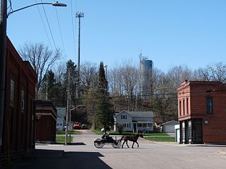
Birnamwood is a village in Marathon and Shawano counties in the U.S. state of Wisconsin. It is part of the Wausau, Wisconsin Metropolitan Statistical Area. The population was 818 at the 2010 census. Of this, 802 were in Shawano County, and 16 were in Marathon County. The village is located mostly within the town of Birnamwood in Shawano County; only a small portion extends into the town of Norrie in adjacent Marathon County.
Dane is a village in Dane County, Wisconsin, United States. The population was 1,117 at the 2020 census. Located in the Town of Dane, the village is part of the Madison Metropolitan Statistical Area.
Fairchild is a village in Eau Claire County, Wisconsin, United States. The population was 550 at the 2010 census. The village is located within the Town of Fairchild.

Eden is a village in Fond du Lac County, Wisconsin, United States. The population was 875 at the 2010 census. The village is located within the Town of Eden.
Oakfield is a village in Fond du Lac County, Wisconsin, United States. The population was 1,052 at the 2020 census. The village is located within the Town of Oakfield.

Hazel Green is a village in Grant and Lafayette counties in the U.S. state of Wisconsin. The population was 1,256 at the 2010 census. Of this, 1,243 were in Grant County, and only 13 were in Lafayette County. The village is located mostly within the Town of Hazel Green in Grant County; only a small portion extends into the Town of Benton in Lafayette County.

Woodman is a village in Grant County in the U.S. state of Wisconsin. The population was 132 at the 2010 census. The village is located within the Town of Woodman.
Elderon is a village in Marathon County, Wisconsin, United States. It is part of the Wausau, Wisconsin Metropolitan Statistical Area. The population was 179 at the 2010 census.
Merrimac is a village in Sauk County, Wisconsin, United States, northwest of Madison. The population was 420 at the 2010 census. The village is located within the Town of Merrimac.
Radisson is a village in Sawyer County, Wisconsin, United States, along the Couderay River. The population was 241 at the 2010 census. The village is located within the Town of Radisson and was named in honor of the early French explorer, Pierre-Esprit Radisson (c.1636–1710).

Aniwa is a village in Shawano County, Wisconsin, United States. The population was 260 at the 2010 census. The village is located within the Town of Aniwa. U.S. Route 45 runs north–south through the village.