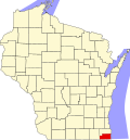
Somers, Wisconsin

Last updated
Somers, Wisconsin
Kenosha County Wisconsin Incorporated and Unincorporated areas Somers Highlighted.svg
Location of Somers in Kenosha County, Wisconsin
Coordinates: 42°37′17″N87°52′17″W / 42.62139°N 87.87139°W / 42.62139; -87.87139
Country United States
State Wisconsin
County Kenosha
Area
[1]
  Total25.30 sq mi (65.53 km2)
  Land25.28 sq mi (65.48 km2)
  Water0.02 sq mi (0.04 km2)
Elevation
[2]
679 ft (207 m)
Population
 (2020)
  Total8,402
  Density331.09/sq mi (127.83/km2)
Time zone UTC-6 (Central (CST))
  Summer (DST) UTC-5 (CDT)
ZIP Code
53171 [3]
Area code 262
FIPS code 55-74650 [4]
GNIS feature ID1584173 [2]
Website somers.org

Somers is a village [5] in Kenosha County, Wisconsin, United States. The population was 8,402 at the 2020 census. Somers has a post office with ZIP code 53171. [3] The former unincorporated communities of Berryville, Central Park, and Kellogg's Corners are located in the village.

Contents

The village of Somers was incorporated on April 24, 2015, following a local election that favored incorporation. [6] While the village originally only included the eastern half of the town's former boundaries, it now includes almost all of the original town; the remainder is still a town and is slated to become part of Kenosha by 2035. [7] [8]

History

The community was originally named Pike on April 15, 1843, by an act of the Wisconsin territorial legislature, [9] and became Somers in 1851. [10]

Geography

According to the United States Census Bureau, the village has a total area of 25.274 square miles (65.46 km2), of which 25.257 square miles (65.42 km2) are land and 0.017 square miles (0.044 km2) are water. [11]

Demographics

Historical population
CensusPop.
2020 8,402
U.S. Decennial Census [12]

Neighborhoods

Berryville

Berryville is a residential and business community located in the eastern part of the village, at the intersection of Kenosha County Highway A (7th Street) and Highway 32 (Sheridan Road). The community was named for the proliferation of strawberry farms in the area. [13] The Berryville School was a community fixture into the 1980s, when it was demolished for new housing. Adjacent to the school to the south was the Mid-City Outdoor Theatre (1948-1984), one of Wisconsin's first drive-in theatres. [14]

Central Park

Central Park is a residential and business community within the southeastern corner of the village. It is centered on the intersection of Sheridan Road (Highway 32) and Twelfth Street (Kenosha County Highway E). [15] The area once was the location of the namesake Central Park, a sprawling private recreational park, baseball field, and picnic grounds that was served by a stop of the Milwaukee Electric Railway & Light Company (TMER&L) interurban line which had installed layover sidings for its rail cars waiting to reload and return picnickers to their homes. Central Park often hosted many annual company picnics including those of the Nash Motors Company of Kenosha. The Central Park picnic grounds were later sold and renamed "Minkowski's Grove", which since has been subdivided and no longer exists for public usage. [16]

Kellogg's Corners

Kellogg's Corners (often called Kellogg) is a residential and agricultural community in the northwestern corner of the village. [16] It lies at the junction of Interstate 94/U.S. Route 41 and Kenosha County Highway KR at the border with Racine County. [17] Kellogg's Corners was first settled in 1837 by three Kellogg brothers - Seth, Chauncey, and Thaddeus.

By far, the most notable Kellogg's Corners landmark was the Greek Revival mid-19th century Kellogg's Corners School, an early historic one-room school of frame construction that eventually became privately owned and was demolished by its owner in 1990. The school's rustic foundation remains to mark its location.[ citation needed ]

Education

Notable people

Related Research Articles

<span class="mw-page-title-main">Walworth County, Wisconsin</span> County in Wisconsin, United States

Walworth County is a county located in the U.S. state of Wisconsin. As of the 2020 census, the population was 106,478. Its county seat is Elkhorn. The county was created in 1836 from Wisconsin Territory and organized in 1839. It is named for Reuben H. Walworth. Walworth County comprises the Whitewater-Elkhorn, WI Micropolitan Statistical Area and is included in the Milwaukee-Racine-Waukesha, WI Combined Statistical Area. Lake Geneva, the University of Wisconsin-Whitewater, and Alpine Valley Resort, and Music Theatre are located in Walworth County.

<span class="mw-page-title-main">Racine County, Wisconsin</span> County in Wisconsin, United States

Racine County is a county in southeastern Wisconsin. As of the 2020 census, its population was 197,727, making it Wisconsin's fifth-most populous county. Its county seat is Racine. The county was founded in 1836, then a part of the Wisconsin Territory. Racine County comprises the Racine metropolitan statistical area. This area is part of the Milwaukee-Racine-Waukesha combined statistical area. According to the U.S. Census Bureau, the county has an area of 792 square miles (2,050 km2), of which 333 square miles (860 km2) is land and 460 square miles (1,200 km2) (58%) is water. The county's unemployment rate was 5.6% in June 2021.

<span class="mw-page-title-main">Milwaukee County, Wisconsin</span> County in Wisconsin, United States

Milwaukee County is located in the U.S. state of Wisconsin. At the 2020 census, the population was 939,489, down from 947,735 in 2010. It is both the most populous and most densely populated county in Wisconsin, and the 45th most populous county nationwide; Milwaukee, its eponymous county seat, is also the most populous city in the state. The county was created in 1834 as part of Michigan Territory and organized the following year.

<span class="mw-page-title-main">Kenosha County, Wisconsin</span> County in Wisconsin, United States

Kenosha County is located in the southeastern corner of the U.S. state of Wisconsin. The population was 169,151 as of the 2020 census, making it the eighth most populous county in Wisconsin. The county shares the same name as the city of Kenosha, the fourth largest city in Wisconsin. Kenosha County is part of the Chicago metropolitan area, the fourth most-populous metropolitan area in North America after the metro areas of Mexico City, New York, and Los Angeles. Kenosha County is situated on the southwestern shore of Lake Michigan.

<span class="mw-page-title-main">Fond du Lac County, Wisconsin</span> County in Wisconsin, United States

Fond du Lac County is a county in the U.S. state of Wisconsin. As of the 2020 census, the population was 104,154. Its county seat is Fond du Lac. The county was created in the Wisconsin Territory in 1836 and later organized in 1844. Fond du Lac is French for "bottom of the lake", given so because of the county's location at the southern shore of Lake Winnebago. Fond du Lac County comprises the Fond du Lac, Wisconsin Metropolitan Statistical Area. The Holyland region is in northeastern Fond du Lac County.

<span class="mw-page-title-main">Dane County, Wisconsin</span> County in Wisconsin, United States

Dane County is a county in the U.S. state of Wisconsin. As of the 2020 census, the population was 561,504, making it the second-most populous county in Wisconsin. The county seat is Madison, which is also the state capital.

<span class="mw-page-title-main">Berryville, Arkansas</span> City in Arkansas, United States

Berryville is a city in Carroll County, Arkansas, United States. The population was 5,682 at the 2020 census. making it the largest city in Carroll County. Along with Eureka Springs, it is one of the two county seats of Carroll County.

<span class="mw-page-title-main">Vestal, New York</span> Town in Broome County, New York, US

Vestal is a town within Broome County in the Southern Tier of New York, United States, and lies between the Susquehanna River and the Pennsylvania border. As of the 2020 census, the population was 29,110.

<span class="mw-page-title-main">Berryville, Texas</span> Town in Texas, United States

Berryville is a town in Henderson County, Texas, United States. The population was 824 at the 2020 census, down from 975 at the 2010 census.

<span class="mw-page-title-main">Kenosha, Wisconsin</span> City in Wisconsin, United States

Kenosha is a city in the U.S. state of Wisconsin and the seat of Kenosha County. Per the 2020 census, the population was 99,986 which made it the fourth-largest city in Wisconsin. Situated on the southwestern shore of Lake Michigan, Kenosha is part of the greater Chicago metropolitan area (Chicagoland) as defined by the U.S. Census Bureau. It also has longstanding connections to the Racine and Milwaukee areas to the north. Interstate 94 connects Kenosha to the Chicago and Milwaukee metro areas, and Kenosha itself is situated about halfway between each city.

<span class="mw-page-title-main">Pleasant Prairie, Wisconsin</span> Village in Wisconsin, United States

Pleasant Prairie is a village in the U.S. state of Wisconsin. Located in Kenosha County along the southwestern shoreline of Lake Michigan, Pleasant Prairie was home to 21,250 people at the 2020 census. The village is positioned directly south of the city of Kenosha and directly north of the Illinois border. Although located just 37 miles south of Milwaukee, it is part of the United States Census Bureau's Chicago combined statistical area (CSA) and metropolitan statistical area despite being 57 miles north of that city. Among its notable features are the RecPlex and Chiwaukee Prairie.

<span class="mw-page-title-main">Wheatland, Kenosha County, Wisconsin</span> Town in Wisconsin, United States

Wheatland is a town in Kenosha County, Wisconsin, United States. The population was 3,391 at the 2020 census. The census-designated place of Powers Lake is located partially in the town. The unincorporated communities of Lily Lake, New Munster, and Slades Corners are also located in the town.

<span class="mw-page-title-main">Kronenwetter, Wisconsin</span> Village in Wisconsin, United States

Kronenwetter is a village in Marathon County, Wisconsin, United States. It is the largest village by land area in the state of Wisconsin, as well as in the entire United States, and the third-largest community by population in Marathon County. It is part of the Wausau, Wisconsin Metropolitan Statistical Area. As of the 2010 census, the population of Kronenwetter was 7,210, an increase from the 2000 census which had the community at 5,369.

<span class="mw-page-title-main">Elkhart Lake, Wisconsin</span> Village in Wisconsin, United States

Elkhart Lake is a village in Sheboygan County, Wisconsin, United States, located within the northwestern part of the county within the Town of Rhine. The population was 967 at the 2010 census. It is included in the Sheboygan, Wisconsin Metropolitan Statistical Area. Elkhart Lake may be best known for hosting road races on public county roads during the 1950s, later moving to a dedicated race track called Road America, which is located a few miles south of the village.

<span class="mw-page-title-main">Kiel, Wisconsin</span> City in Wisconsin, United States

Kiel is a city in Calumet and Manitowoc counties in the U.S. state of Wisconsin. The population was 3,738 at the 2010 census. Of this, 3,429 residents lived in Manitowoc County, and 309 residents lived in Calumet County. The city is located primarily within Manitowoc County, though a portion extends west into adjacent Calumet County and is known as "Hinzeville".

<span class="mw-page-title-main">Belgium, Wisconsin</span> Village in Ozaukee County, Wisconsin

Belgium is a village in Ozaukee County, Wisconsin, United States. Located along Interstate 43, the village is one of the northernmost communities in the Milwaukee metropolitan area. The population was 2,245 at the 2010 census.

<span class="mw-page-title-main">Cedarburg (town), Wisconsin</span> Town in Ozaukee County, Wisconsin

Cedarburg is a town in Ozaukee County, Wisconsin, United States, and is in the Milwaukee metropolitan area. The town was created in 1849 and at the time of the 2020 census had a population of 6,162.

<span class="mw-page-title-main">Brooklyn (village), Wisconsin</span> Place in Wisconsin, United States

Brooklyn is a village in Dane and Green counties in Wisconsin, United States. The population was 1,524 at the 2020 census, with 1,026 residents in Dane County and 498 in Green County.

<span class="mw-page-title-main">Bristol (village), Wisconsin</span> Village in Wisconsin, United States

Bristol is a village in Kenosha County, Wisconsin, United States. It was incorporated in 2009 from portions of the Town of Bristol. The population was 5,192 at the 2020 census, more than double the 2010 census population of 2,584. The former unincorporated communities of Bissell, Cypress, Pikeville, and Woodworth are located in the village.

<span class="mw-page-title-main">Somers (town), Wisconsin</span> Town in Wisconsin, United States

Somers is a town in Kenosha County, Wisconsin, United States. Prior to 2015, the town encompassed all of the village of Somers along with its current area. When the village was incorporated in 2015, the western part of the original town remained as part of the town; however, it was later incorporated into the village as well. The present town largely consists of land along or within the boundaries of Kenosha, and it is slated to become part of Kenosha by 2035.

References

  1. "2019 U.S. Gazetteer Files". United States Census Bureau. Retrieved August 7, 2020.
  2. 1 2 "US Board on Geographic Names". United States Geological Survey. 2007-10-25. Retrieved 2008-01-31.
  3. 1 2 United States Postal Service. "USPS - Look Up a ZIP Code" . Retrieved June 25, 2017.
  4. "U.S. Census website". United States Census Bureau . Retrieved 2008-01-31.
  5. Brines, Jon (24 May 2015). "Somers Village Board gets off to rocky start" . Retrieved 15 June 2017.
  6. "Incorporation". Village and Town of Somers. Retrieved June 25, 2017.
  7. Proposed Village Incorporation (PDF) (Map). Town of Somers. February 23, 2015. Retrieved June 25, 2017.
  8. Somers Town & Village Boundaries (PDF) (Map). Village and Town of Somers. Retrieved June 25, 2017.
  9. Territory acts. Act 43 [ dead link ]
  10. Territory acts. Act 213 [ dead link ]
  11. "2016 U.S. Gazetteer Files: County Subdivisions - Wisconsin". U.S. Census Bureau . Retrieved June 25, 2017.
  12. "Census of Population and Housing". Census.gov. Retrieved June 4, 2016.
  13. Chicago and North Western Railway Company (1908). A History of the Origin of the Place Names Connected with the Chicago & North Western and Chicago, St. Paul, Minneapolis & Omaha Railways. p. 44.
  14. "Kenosha Co. WI Placenames" . Retrieved Jan 23, 2023.
  15. "Town of Somers, Kenosha County, Wisconsin" . Retrieved Jan 23, 2023.
  16. 1 2 Kenosha County Place Names
  17. "Town of Somers-Kenosha County, Wisconsin" . Retrieved Jan 23, 2023.
  18. "'We prepare them for the next life". Kenosha News. 1979-08-10. p. 9. Retrieved 2022-01-27.
  19. 'Wisconsin Blue Book 1911,' Biographical Sketch of William H. Flett, pg. 648
  20. 'Drue Leyton; Actress, Member of the French Resistance,' Los Angeles Times, February 11, 1997
  21. 'Wisconsin Blue Book 1923,' Biographical Sketch of Conrad Shearer, pg. 625

Coordinates: 42°38′25″N87°54′37″W / 42.64028°N 87.91028°W / 42.64028; -87.91028