List of state trunkline highways in Michigan

Last updated

State Trunkline Highway System

M-12 1919.svg

M-7 1926.svg

M-76 1948.svg

M-28.svg

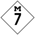
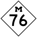
Highway markers from different years for former M-12 (1919), former M-7 (1926), former M-76 (1948), and current M-28
System information
Maintained by MDOT
Length5,976.147 mi [1]  (9,617.676 km)
Plus 14.775 mi [1] (23.778 km) of special routes and 24.079 mi [1] (38.751 km) of unsigned connectors
FormedMay 13, 1913, [2] signed by July 1, 1919 [3]
Highway names
State M-nn
Special Routes:
  • Alternate M-nn (Alt. M-nn or M-nnA)
  • Business M-nn (Bus. M-nn)
  • Bypass M-nn (Byp. M-nn)
  • Connector M-nn (Conn. M-nn)
  • Truck M-nn (Truck M-nn)
System links

The state trunkline highways in the US state of Michigan are the segments of the State Trunkline Highway System maintained by the Michigan Department of Transportation and numbered with the "M-" prefix officially.

Contents

Mainline highways

NumberLength (mi) [1] Length (km)Southern or western terminusNorthern or eastern terminusFormedRemovedNotes
M-1.svg M-1 21.48834.582Adams Avenue in Detroit BL I-75/Bus. US 24 in Pontiac 01970-01-011970 [4] currentWoodward Avenue
No image.svgM-2Never assignedMay have been assigned to service drives along I-96 in Livonia, but not marked on official state maps as such
M-3 1926.svg M-3 7.80712.564 US 25 in Detroit US 16 in Detroit01937-01-011937 [5] 01939-01-011939 [6] Became M-39 (now Schaefer Highway)
M-3.svg M-3 26.68542.945Randolph & Broadway streets in Detroit I-94 and M-29 in Chesterfield Township 01973-01-011973 [7] currentGratiot Avenue
M-4 1926.svg M-4 St. Ignace DeTour Village 01936-01-011936 [8] 01939-01-011939 [9] Became M-39, now M-134
M-4.svg M-4 4.6877.543 Southfield West Bloomfield Township 01979-01-011979 [10] 01986-01-011986 [11] Northwestern Highway; now part of M-10
M-5 1926.svg M-5 Cedarville Sault Ste. Marie 01933-01-011933 [12] 01939-01-011939 [13] Became M-129
M-5.svg M-5 27.89044.885Pontiac Trail in Commerce Township Cass Avenue in Detroit [14] 01977-01-011977 [15] current Grand River Avenue
M-6 1926.svg M-6 Phoenix Eagle River 01926-01-011926 [16] 01938-01-011938 [17] Became M-111 (now part of M-26)
M-6.svg M-6 I-96 in Novi I-94 in Roseville 01970-04-14197001979-01-011979 [18] Signed along the service drives for the eastern section of I-696 [19]
M-6.svg M-6 19.69631.698 I-196 near Hudsonville I-96 near Cascade 02001-01-012001 [20] currentPaul B. Henry Freeway, South Beltline Freeway
M-7 1926.svg M-7 34.05954.813 Three Rivers Coldwater 01927-01-011927 [21] 01940-01-011940 [22] Replaced by M-86
M-8.svg M-8 5.4918.837 I-96 in Detroit Conant Avenue near Hamtramck 01993-01-011993 [23] currentDavison Freeway; built in the 1940s as the first urban, depressed freeway in the world
M-9 1926.svg M-9 Phoenix Eagle Harbor 01927-01-01192701929-01-011929Replaced by M-64 (became M-129, later became part of M-26; now a local road)
M-9 1926.svg M-9 Ohio state line Lansing 01929-01-011929 [24] 01940-01-011940 [25] Replaced by M-99
M-10 1919.svg M-10 Ohio state line south of Erie Mackinaw City 01919-01-011919 [26] 01926-01-011926 [27] Replaced by US 24, US 112, US 10, and US 23
M-10 1926.svg M-10 US 10 in Flint US 10 in Flint01928-01-011928 [24] 01942-01-011942 [28] Replaced by Bus. US 10
M-10.svg M-10 22.88136.823 M-3 & BS I-375 in Detroit Orchard Lake Road in West Bloomfield 01986-01-011986currentJohn C. Lodge Freeway, Northwestern Highway
M-11 1919.svg M-11 Indiana state line in Grand Beach Mackinaw City 01919-01-011919 [26] 01926-01-011926 [27] Replaced by US 12 and US 31
M-11 1948.svg M-11 Napoleon Saline 01926-01-011926 [16] 01954-01-011954 [29] Manchester to Saline became part of an extension of M-92 (now M-52); rest given to local control
M-11.svg M-11 20.84033.539 I-96 in Marne I-96 in Cascade 01961-01-011961 [30] current
M-12 1919.svg M-12 406.63654.41 Ironwood Sault Ste. Marie 01919-01-011919 [31] 01926-01-011926 [16] Replaced by US 2, [27] M-69 and what is now M-95
M-13 1919.svg M-13 Fife Lake Petoskey 01919-01-011919 [26] 01926-01-011926 [16] Replaced by M-131 (now US 131)
M-13 1926.svg M-13 Brockway Fort Gratiot 01927-01-011927 [21] 01931-01-011931 [32] Replaced by M-136
M-13.svg M-13 73.339118.028 I-69 in Lennon US 23 in Standish 01932-01-01c.1932 [33] current
M-14 1926.svg M-14 Ohio State line near Waldron Jackson 01919-01-011919 [26] 01931-01-011931 [34] Replaced by US 127
M-14 1926.svg M-14 Battle Creek Edmore 01931-01-011931 [35] 01942-01-011942 [36] Replaced by a reroute of M-66
M-14.svg M-14 22.25035.808 I-94 near Ann Arbor I-96/I-275 in Livonia 01956-01-011956 [37] current
M-15 1919.svg M-15 Wisconsin State line near Menominee Copper Harbor 01919-01-011919 [31] 01926-01-011926 [21] Replaced by US 41
M-15.svg M-15 73.664118.551 US 24 in Clarkston M-25 in Bay City 01926-01-011926 [21] current
M-16 1919.svg M-16 Muskegon Detroit 01919-01-011919 [26] 01926-01-011926 [16] Replaced by US 16
M-17.svg M-17 6.39010.284 US 23 and BL I-94 in Ann Arbor US 12 in Ypsilanti 01919-01-011919 [26] current
M-18.svg M-18 77.530124.772 US 10 near North Bradley M-72 & F-97 near Luzerne 01919-01-011919 [26] current
M-19.svg M-19 85.626137.802 I-94 near New Haven M-142 near Bad Axe 01919-01-011919 [26] current
M-20 1919.svg M-20 Ludington Bay City 01919-01-011919 [26] 01926-01-011926 [16] Replaced by US 10
M-20.svg M-20 132.435213.133 US 31 in New Era US 10 in Midland 01926-01-011926 [16] current
M-21.svg M-21 99.322159.843 M-37/M-44 in Grand Rapids I-475 in Flint 01919-01-011919 [26] current
M-22.svg M-22 116.651187.732 US 31 near Manistee US 31/M-37/M-72 in Traverse City 01919-01-011919 [26] currentLeelanau Scenic Heritage Route
M-23 1919.svg M-23 01919-01-011919 [26] 01926-01-011926 [27] Replaced by US 112, now US 12
M-24 1919.svg M-24 Muskegon Saginaw 01919-01-011919 [26] 01926-01-011926 [27] Replaced by M-20 and US 10 (one part now M-47)
M-24.svg M-24 75.691121.813 I-75 & BL I-75 in Auburn Hills M-25 in Unionville 01926-01-011926 [21] currentExtension of US 24
M-25 1919.svg M-25 Skandia Sault Ste. Marie 01919-01-011919 [31] 01926-01-011926 [21] Replaced by an extension of M-28
M-25.svg M-25 147.638237.600 BL I-69/BL I-94 in Port Huron I-75/US 23 & US 10 in Bay City 01933-01-011933 [38] currentExtension of US 25 (now decommissioned)
M-26.svg M-26 96.355155.068 US 45 in Rockland US 41 in Copper Harbor 01919-01-011919 [31] current
M-27 1919.svg M-27 01919-01-011919 [26] 01926-01-011926 [16] Replaced by M-29 (one part now M-25), M-51 (now M-136, Wildcat Road, M-90, and Old M-51), and M-83 (this section now M-142)
M-27.svg M-27 16.76326.977 I-75 near Indian River US 23 and C-66 in Cheboygan 01961-01-011961 [39] currentFormerly part of US 27
M-28.svg M-28 290.373467.310 US 2 in Wakefield M-129 in Dafter Township 01919-01-011919 [31] currentLongest state trunkline excluding Interstate or US Highways
M-29 1919.svg M-29 Indiana state line south of Coldwater Lansing 01919-01-011919 [26] 01926-01-011926 [27] Replaced by US 27
M-29.svg M-29 41.63467.003 I-94 & M-3 in Chesterfield Township BL I-94 in Marysville 01926-01-011926 [16] current
M-30.svg M-30 65.465105.356 US 10 in Sanford BL I-75/M-55 in West Branch 01919-01-011919 [26] current
M-31 1919.svg M-31 166.910268.616 M-21 in Port Huron M-20 in Bay City 01919-01-011919 [26] 01926-01-011926 [16] Replaced by M-29 (this section now M-25) and M-83 (this section now M-142)
M-32.svg M-32 100.003160.939 M-66 in East Jordan US 23 in Alpena 01919-01-011919 [26] current
M-33.svg M-33 121.858196.111 I-75 in Alger M-27 near Cheboygan 01919-01-011919 [26] current
M-34.svg M-34 28.93846.571 M-99 near Osseo Bus. US 223 in Adrian 01919-01-011919 [26] current
M-35.svg M-35 128.388206.620 US 41 in Menominee US 41/M-28 in Negaunee Township 01919-01-011919 [31] current
M-36 1926.svg M-36 M-21 in Attica M-53 in Burnside 01919-01-011919 [26] 01930-01-011930 [35]
M-36.svg M-36 43.29869.681 US 127 in Mason US 23 in Whitmore Lake 01930-01-011930 [35] current
M-37.svg M-37 221.892357.101 I-94 & BL I-94 in Battle Creek Cul-de-sac at Old Mission Point 01919-01-011919 [26] current
M-38 1948.svg M-38 US 23 in Bridgeport M-53 in Marlette 01919-01-011919 [26] 01961-01-011961 [40]
M-38.svg M-38 42.22567.955 US 45 & M-64 in Ontonagon US 41 in Baraga 01968-01-011968 [41] currentFormerly part of M-35
M-39 1926.svg M-39 Woodbury Lansing 01919-01-011919 [26] 01937-01-011937 [42] Became an extension of M-43
M-39 1948.svg M-39 7.80712.564 US 25 in Detroit US 16 in Detroit01939-01-011939 [43] 01959-01-011959 [44]
M-39.svg M-39 17.00627.369Lafayette Boulevard in Lincoln Park M-10 in Southfield 01959-01-011959 [44] currentSouthfield Freeway, Southfield Highway; roadway continues as Southfield Road at northern end
M-40.svg M-40 74.266119.520 Union Holland 01919-01-011919 [26] current
M-41 1919.svg M-41 38.161.3 M-24 in Holton M-11 in Hart 01919-01-011919 [26] 01926-01-011926 [16] Replaced in part by M-20, now M-120
M-42.svg M-42 10.33916.639 Bus. US 131 in Manton M-66 near Lake City 01919-01-011919 [26] current
M-43.svg M-43 136.723220.034 BL I-196 in South Haven I-96 in Webberville 01919-01-011919 [26] current
M-44.svg M-44 37.46360.291 M-11 and M-37 in Kentwood M-66 near Ionia 01919-01-011919 [26] current
M-45 1926.svg M-45 Wisconsin border south of Kingsford Humboldt Township 01919-01-011919 [31] 01934-01-011934 [45] Renumbered to M-95 because of designation of US 45 in Michigan
M-45.svg M-45 24.43439.323 US 31 in Agnew I-196 in Grand Rapids 01964-01-011964 [46] currentLake Michigan Drive
M-46.svg M-46 199.190320.565Muskegon Avenue in Muskegon M-25 in Port Sanilac 01919-01-011919 [26] currentTrans-peninsular highway
M-47.svg M-47 14.32823.059 M-46 near Shields US 10 near Midland 01919-01-011919 [26] current
M-48.svg M-48 43.72370.365 I-75 in Rudyard M-134 in DeTour Village 01919-01-011919 [26] current
M-49 1926.svg M-49 US 127 in Mason US 23 in Whitmore Lake 01919-01-011919 [26] 01930-01-011930 [35] Replaced by M-36
M-49.svg M-49 25.48041.006 SR 49 near Columbia, OH M-99 in Litchfield 01930-01-011930 [35] current
M-50.svg M-50 138.072222.205 I-96 near Lowell US 24 in Monroe 01919-01-011919 [26] current
M-51 1919.svg M-51 Holland Grand Rapids 01919-01-011919 [26] 01926-01-011926 [16] Replaced by an extension of M-21 (this section now M-121)
M-51 1948.svg M-51 M-46 in Carsonville M-142 in Harbor Beach 01926-01-011926 [16] 01965-01-011965 [47]
M-51.svg M-51 40.40565.026 SR 933 at Indiana state line near South Bend, IN I-94 near Paw Paw 01971-01-011971 [48] current
M-52.svg M-52 127.300204.869 SR 109 at Ohio state line M-46 near Saginaw 01919-01-011919 [26] current
M-53.svg M-53 120.980194.698 M-3 in Detroit M-25 in Port Austin 01919-01-011919 [26] current
M-54 1919.svg M-54 Grand Rapids Baldwin 01919-01-011919 [26] 01926-01-011926 [21] Transferred to an extension of M-37
M-54 1926.svg M-54 1.2702.044 WIS 77 at Ironwood US 2 in Ironwood01934-01-011934 [49] 01942-01-011942 [50] transferred to Business US 2
M-54.svg M-54 30.27648.724 I-75 in Grand Blanc I-75/US 23 in Birch Run 01962-01-011962 [51] current
M-55.svg M-55 150.944242.921 US 31 in Manistee US 23 in Tawas City 01919-01-011919 [26] currentTrans-peninsular highway
M-56 1948.svg M-56 16.42626.435 US 24 in Monroe US 24/US 25 near Flat Rock 01919-01-011919 [26] 01957-01-011957 [52]
M-56.svg M-56 12.72620.481 M-13 & M-21 near Lennon I-69/M-21 in Flint 01971-01-011971 [53] 01984-01-011984 [54] Replaced by M-21
M-57 1919.svg M-57 16.42626.435 Boyne Falls Clarion 01919-01-011919 [26] 01926-01-011926 [16] Replaced by M-75
M-57 1919.svg M-57 1.1321.822 WIS 57 in Breitung Township US 2 in Quinnesec 01927-01-011927 [21] 01928-01-011928 [55] Transferred to an extension of US 141
M-57.svg M-57 105.377169.588 US 131 near Rockford M-15 near Otisville 01930-01-011930 [35] current
M-58 1919.svg M-58 Indiana state line south of Niles St. Joseph 01919-01-011919 [26] 01926-01-011926 [27] Replaced by US 31
M-58 1948.svg M-58 US 10 in Pontiac US 10 in Pontiac 01930-01-011930 [56] 01961-01-011961 [57] Replaced by reroute of US 10 (now US 24 and Business US 24)
M-58.svg M-58 5.1088.221 M-47 near Shields I-675 in Saginaw 01971-01-011971 [58] current
M-59.svg M-59 60.51497.388 I-96 near Howell I-94 near Mount Clemens 01919-01-011919 [26] current
M-60.svg M-60 104.224167.732 US 12 near Niles I-94 & BL I-94 near Jackson 01919-01-011919 [26] current
M-61.svg M-61 62.276100.224 M-115 near Marion US 23 in Standish 01919-01-011919 [26] current
M-62.svg M-62 28.32945.591 SR 23 near Granger, IN M-140 near Eau Claire 01924-01-01c.1924 [59] current
M-63 1948.svg M-63 US 131 in Le Roy M-37 west of Luther 01919-01-011919 [26] 01961-01-011961 [60]
M-63.svg M-63 16.14125.976 M-139 near Scottdale I-196/US 31 near Lake Michigan Beach 01986-01-011986 [61] currentFormerly part of US 33
M-64 1926.svg M-64 Ohio State Line Lansing 01919-01-011919 [26] 01929-01-011929 [24] Replaced by M-9 (now M-99)
M-64 1926.svg M-64 Phoenix Eagle Harbor 01929-01-011929 [24] 01930-01-011930 [35] Replaced by M-129 (later became part of M-26; now a local road)
M-64.svg M-64 63.765102.620CTH-B near Presque Isle, WI US 45 & M-38 in Ontonagon 01930-01-011930 [35] current
M-65 1919.svg M-65 Ohio State Line Flint 01919-01-011919 [26] 01926-01-011926 [27] Replaced by US 23
M-65.svg M-65 103.176166.046 US 23 near Omer US 23 near Rogers City 01930-01-011930 [35] current
M-66.svg M-66 266.399428.728 SR 9 near Sturgis US 31 in Charlevoix 01919-01-011919 [26] current
M-67.svg M-67 12.04419.383 US 41 in Trenary M-94 in Chatham 01919-01-011919 [31] current
M-68 1926.svg M-68 14.23522.909 M-26 in Rockland Ontonagon 01919-01-011919 [31] 01927-01-011927 [21] Replaced by M-35 (this section now part of US 45)
M-68.svg M-68 53.39085.923 US 31 in Alanson Bus. US 23 in Rogers City 01936-01-011936 [62] current
M-69 1919.svg M-69 55.28088.965 WIS 69 at Wisconsin state line M-28 in Covington 01919-01-011919 [31] 01926-01-011926 [27] Replaced by US 2 and US 102 (now part of US 141)
M-69.svg M-69 65.260105.026 US 2/US 141 in Crystal Falls US 2/US 41 near Bark River 01926-01-011926 [27] current
M-70 1948.svg M-70 22.135.6 M-76 near Sterling M-55 near Prescott 01919-01-011919 [26] 01960-01-011960 [63]
M-71.svg M-71 10.53016.946 M-21 in Owosso I-69 in Durand 01919-01-011919 [26] current
M-72.svg M-72 156.552251.946 M-22 in Empire US 23 in Harrisville 01919-01-011919 [26] currentTrans-peninsular highway
M-73.svg M-73 8.17113.150 STH-55 near Iron River US 2 near Iron River01919-01-011919 [31] current
M-74 1926.svg M-74 18.429.6 M-66 near Pioneer M-55 near Merritt 01919-01-011919 [26] 01939-01-011939 [64]
M-75 1919.svg M-75 2.7934.495 Wisconsin state line in Breitung Township M-12 in Iron Mountain 01919-01-01191901926-01-011926Replaced by an extension of M-45 (now M-95)
M-75.svg M-75 11.76818.939 US 131 in Boyne Falls US 131 in Walloon Lake 01927-01-011927 [21] current
M-76 1948.svg M-76 61.18798.471 US 23 in Standish US 27 near Grayling 01919-01-011919 [26] 01973-01-011973 [65] Replaced by I-75
M-77.svg M-77 42.60268.561 US 2 in Blaney Park H-58 in Grand Marais 01919-01-011919 [31] current
M-78.svg M-78 10.74417.291 M-66 near Battle Creek I-69 near Olivet 01919-01-011919 [26] current
M-79.svg M-79 24.89040.057 M-37 near Hastings BL I-69/M-50 in Charlotte 01919-01-011919 [26] current
M-80 1919.svg M-80 Adrian Somerset 01919-01-011919 [26] 01926-01-011926 [27] Replaced by US 127 (now US 223)
M-80 1926.svg M-80 M-18 in Beaverton M-30 in Billings 01927-01-011927 [16] 01939-01-011939 [66]
M-80.svg M-80 7.91712.741 I-75 & H-63 near Kinross M-129 near Kincheloe 01994-01-011994 [67] current
M-81.svg M-81 45.63673.444 M-13 in Saginaw M-53 near Cass City 01919-01-011919 [26] current
M-82 1919.svg M-82 M-25 near Newberry Eight Mile Corner01919-01-011919 [31] 01926-01-011926 [16] Replaced by M-48
M-82.svg M-82 31.49250.681 M-120 near Fremont US 131 near Howard City 01926-01-011926 [16] current
M-83 1919.svg M-83 Mohawk Gay 01919-01-011919 [31] 01926-01-011926 [16]
M-83 1926.svg M-83 Harbor Beach 01926-01-011926 [24] 01939-01-011939 [68] Renumbered M-142
M-83.svg M-83 14.67223.612 I-75/US 23 in Birch Run M-15 near Richville 01929-01-011929 [24] current
M-84 1919.svg M-84 Garnet McLeods Corner southeast of Newberry 01919-01-011919 [31] 01926-01-011926 [16] Replaced by M-48
M-84 1926.svg M-84 M-81 near Reese M-29 in Unionville 01926-01-011926 [16] 01930-01-011930 [69] Replaced by M-83
M-84.svg M-84 14.71023.673 M-58 in Saginaw M-25 in Bay City 01960-01-011960 [70] current
M-85 1926.svg M-85 M-66 (now M-91) Stanton 01919-01-011919 [26] 01930-01-011930 [35] Replaced by M-57
M-85 1926.svg M-85 Mayville Caro 01930-01-011930 [35] 01941-01-011941 [71] Replaced by M-24
M-85.svg M-85 21.88235.216 I-75 near Rockwood Griswold Street in Detroit 01956-01-011956 [72] currentFort Street
M-86 1919.svg M-86 Six Lakes Remus01921-01-011921 [73] 01924-01-011924 [59] Replaced by M-66
M-86 1926.svg M-86 Orleans Woods Corners 01924-01-011924 [59] 01929-01-011929 [24] Replaced by M-44
M-86.svg M-86 34.05954.813 Bus. US 131/M-60 in Three Rivers US 12 near Coldwater 01940-01-011940 [22] currentReplaced M-7
M-87 1948.svg M-87 11.56418.610 Bus. US 23 in Fenton US 10 in Holly 01919-01-011919 [26] 01960-01-011960 [74]
M-88.svg M-88 26.21542.189 US 31 in Eastport US 131 & C-38 in Mancelona 01919-01-011919 [26] current
M-89.svg M-89 61.15398.416 I-196/US 31 near Ganges BL I-94 in Battle Creek 01919-01-011919 [26] current
M-90 1926.svg M-90 16.55326.639 M-45 near Sagola Foster City 01919-01-011919 [31] 01927-01-011927 [21] Replaced by M-69
M-90.svg M-90 44.17871.098 M-24 near North Branch M-25 in Lexington 01927-01-011927 [21] current
M-91 1919.svg M-91 M-15 in Memominee Cedar River 01919-01-011919 [31] 01927-01-011927 [21] Replaced by M-35
M-91 1926.svg M-91 US 23 in Rogers City CR 646 near Huron Beach 01927-01-011927 [21] 01940-01-011940 [75] Replaced by US 23
M-91.svg M-91 24.46439.371 M-44 near Belding M-46 in Lakeview 01942-01-011942 [76] current
M-92 1948.svg M-92 36.63958.965 SR 109 near Clinton US 12 in Stockbridge 01919-01-011919 [26] 01962-01-011962 [77] Replaced by M-52
M-93.svg M-93 11.81019.006 Camp Grayling Hartwick Pines State Park 01919-01-011919 [26] current
M-94.svg M-94 86.983139.986 M-553 near K.I. Sawyer US 2 in Manistique 01927-01-01c.1927 [21] current
M-95 1926.svg M-95 5.1478.283 M-68 in Onaway Onaway State Park 01919-01-011919 [26] 01934-01-011934 [78] Replaced by M-211
M-95.svg M-95 55.16288.775CTH-N at Aurora, WI US 41/M-28 in Humboldt Township 01934-01-011934 [45] currentLeif Erickson Highway; replaced M-45
M-96.svg M-96 33.37953.718 BS I-94 in Kalamazoo BL I-94 in Marshall 01926-01-011926 [16] current
M-97.svg M-97 17.16927.631 M-3 in Detroit M-59 near Mount Clemens 01929-01-011929 [79] current
M-98 1948.svg M-98 16.226.1 US 2 near Germfask M-28 near McMillan 01919-01-011919 [31] 01960-01-011960 [80] Now H-33 and H-44
M-99 1926.svg M-99 US 31 in Muskegon Hart 01919-01-011919 [26] 01929-01-011929 [24]
M-99 1926.svg M-99 US 2 in Gulliver Port Inland 01931-01-011931 [32] 01939-01-011939 [81]
M-99.svg M-99 86.058138.497 SR 15 near Pioneer, OH I-496 & Capitol Loop in Lansing 01940-01-011940 [25] currentReplaced M-9
M-100 rectangle.svg M-100 12.46020.052 I-69 near Potterville I-96 near Grand Ledge 01927-01-011927 [21] current
M-101 1926.svgM-1011.221.96 Millersburg US 23 near Millersburg
M-102 rectangle.svg M-102 20.80433.481 M-5 on the LivoniaFarmington Hills city line I-94 in Harper Woods 01928-01-01c.1928 [55] current8 Mile Road
M-103 1948.svg M-103 SR 13 near Bristol, IN US 12 in White Pigeon 01932-01-011932 [82] 01960-01-01c.1960 [83] Replaced by US 131
M-103 rectangle.svg M-103 3.0554.917 SR 15 near Bristol, IN US 12 in Mottville 01960-01-01c.1960 [83] currentReplaced part of US 131
M-104 1926.svg M-104 M-47 at Pittsburg DeWitt 01927-01-011927 [21] 01939-01-011939 [84]
M-104 rectangle.svg M-104 7.67712.355 US 31 in Ferrysburg I-96 near Nunica 01940-01-011940 [85] currentReplaced part of US 16
M-105 1926.svg M-105 3.5485.710 M-53 near Bad Axe M-83 near Elkton 01928-01-011928 [55] 01939-01-011939 [86]
M-106 rectangle.svg M-106 27.04143.518 BL I-94/Bus. US 127/M-50 in Jackson M-36 near Gregory 01928-01-011928 [55] current
M-107.svg M-107 9.57615.411 Lake of the Clouds M-64 in Silver City 01935-01-011935 [87] 02008-01-012008 [88]
M-108 1948.svg M-108 Three-legged highway in Mackinaw City 01928-01-011928 [55] 01957-01-011957 [89] Connected the State Highway Ferry Docks with the Fort Michilimackinac State Historic Park and US 31
M-108.svg M-108 1.0691.720 I-75 near Mackinaw City Michigan Welcome Center in Mackinaw City01960-01-011960 [90] 02010-01-012010 [91]
M-109 rectangle.svg M-109 6.83110.993 M-22 near Empire M-22 in Glen Arbor 01929-01-01c.1929 [24] currentLeelanau Scenic Heritage Route; runs through the Sleeping Bear Dunes National Lakeshore
M-110.svg M-110 1.7152.760 US 31 in Parkdale Orchard Beach State Park 01927-01-011927 [92] 02003-01-012003 [93]
M-111 1926.svg M-111 Bay City Bay City State Park 01928-01-01192801938-01-011938
M-111 1926.svg M-111 Phoenix Eagle River 01939-01-01193901940-01-011940
M-112 1926.svg M-112 8.7014.00 Ypsilanti Dearborn 01942-01-011942 [94] 01956-01-011956 [95] Replaced by I-94
M-113 rectangle.svg M-113 16.57326.672 M-37 near Hannah US 131 in Walton Junction 01927-01-011927 [21] current
M-114 1926.svg M-114 13.45421.652 Paris Township Comstock Park 01929-01-01c.1929 [56] 01945-01-011945 [96] Former bypass routing around Grand Rapids; trunkline had three legs at the time of its decommissioning with an east–west branch in Comstock Park
M-115 rectangle.svg M-115 96.432155.192 Bus. US 10/Bus. US 127 in Clare M-22 in Frankfort 01929-01-011929 [24] current
M-116 rectangle.svg M-116 7.01811.294 US 10 in Ludington Ludington State Park 01928-01-011928 [55] current
M-117 rectangle.svg M-117 14.47923.302 US 2 in Engadine M-28 near Newberry 01941-01-011941 [97] current
M-118.svg M-118 10.24716.491 M-40/M-89 in Allegan US 131 near Martin 01929-01-011929 [24] 01988-01-011988 [98] Replaced by M-222
M-119 1948.svg M-119 M-40 in Paw Paw US 12 near Mottville 01930-01-011930 [56] 01971-01-011971 [48] Replaced by M-40
M-119 rectangle.svg M-119 27.54844.334 US 31 near Bay View C-66/C-77 in Cross Village 01979-01-011979 [99] currentFormerly the northern end of M-131
M-120 1926.svg M-120 US 16 in Lansing Lansing01930-01-011930 [100] 01939-01-011939 [101] Replaced by M-174
M-120 1948.svg M-120 SR 120 on the Michigan–Indiana state line SR 120 on the Michigan–Ohio state line01939-01-011939 [102] 01961-01-011961 [103]
M-120 rectangle.svg M-120 27.90144.902 Bus. US 31 in Muskegon M-20 in Hesperia 01969-01-011969 [104] currentOnce was part of M-20
M-121 1926.svg M-121 01933-01-011933 [105] 01935-01-011935 [106]
M-121.svg M-121 5.7009.173 I-69 near Bishop Airport in Flint M-54 in Burton 01935-01-011935 [107] 02003-01-012003 [108] Bristol Road; provided access to Bishop International Airport and a truck bypass route from I-69 to General Motors plants near I-75
M-121 rectangle.svg M-121 12.76320.540Main Street in Zeeland I-196 in Grandville 02007-01-012007 [109] currentOnce was part of M-21; Chicago Drive
M-122 1948.svg M-122 1.0681.719 US 2 in St. Ignace State Ferry Dock in St. Ignace01929-01-011929 [56] 01957-01-011957 [110] Former route from US 2 to state ferry docks for service from St. Ignace to Mackinaw City; ferry service ended after the Mackinac Bridge was opened in 1957.
M-123 rectangle.svg M-123 96.071154.611 I-75 near St. Ignace M-28 near Newberry 01936-01-011936 [111] currentTahquamenon Scenic Heritage Route
M-124 rectangle.svg M-124 7.73112.442 M-50 in Brooklyn US 12 in Springville 01929-01-011929 [24] current
M-125 1926.svg M-125 Thompson US 2 01931-01-011931 [112] [113] 01936-01-011936 [114]
M-125 1948.svg M-125 7 Mile Road in Bay County US 23 01938-01-011938 [115] 01956-01-01c.1956 [116]
M-125 rectangle.svg M-125 19.48031.350Detroit Avenue near Toledo, OH US 24 near Monroe 01974-01-011974 [117] currentFormer routing of US 25
M-126 1926.svg M-126 11.9419.22 Muskegon Heights Nunica 01934-01-011934 [118] 01940-01-011940 [119] Replaced by US 16
M-129 1926.svg M-129 Marenisco Lake Gogebic State Park 01926-01-01192601930-01-011930Replaced by M-64
M-129 1926.svg M-129 Phoenix Copper Harbor 01930-01-01193001935-01-011935Replaced by M-26 (portions now a local road)
M-129 rectangle.svg M-129 33.22353.467 M-134 in Cedarville BS I-75 in Sault Ste. Marie 01939-01-011939 [13] currentFollows the Michigan Meridian
M-130 1948.svg M-130 9.1114.66 US 23/M-50 in Raisinville Township US 24 in Monroe 01930-01-011930 [24] 01955-01-011955 [120]
M-131.svg M-131 27.54844.334 US 31 in Bayview C-66/C-77 in Cross Village 01926-01-011926 [16] 01979-01-011979 [99] Replaced by M-119
M-132 1948.svg M-132 7.76612.498Main Street in Dexter US 12 in Ann Arbor 01928-10-011928 [121] 01959-12-011959 [122]
M-134 1926.svg M-134 M-66 near McBain Prosper Road in Falmouth 01929-01-011929 [24] 01938-01-011938 [17]
M-134 rectangle.svg M-134 50.23380.842 I-75 near St. Ignace Drummond 01939-01-011939 [9] currentIncludes the Drummond Island Ferry across the DeTour Passage
M-135 1948.svg M-135 18.229.3 US 2 near Gould City M-28 near McMillan 01928-01-01c.1928 [24] 01960-01-011960 [80] Now H-33
M-136 rectangle.svg M-136 17.03327.412 M-19 in Brockway M-25 in Port Huron 01931-01-011931 [32] [112] current
M-137.svg M-137 2.8844.641 Interlochen State Park US 31 in Interlochen 01930-01-011930 [69] 02020-06-012020 [123] Returned to local control; formerly connected to Interlochen Center for the Arts and Interlochen State Park
M-138 rectangle.svg M-138 20.14132.414 M-15 near Munger M-24 near Akron 01931-01-011931 [32] [112] current
M-139 rectangle.svg M-139 26.48742.627 US 12 near Niles BL I-94 in Benton Harbor 01931-01-011931 [32] [112] current
M-140 rectangle.svg M-140 37.20559.876 M-139 near Niles I-196/US 31 & BL I-196 near South Haven 01931-01-01c.1931 [112] [124] current
M-142 1926.svg M-142 M-55 and M-66 near Lake City Lake City Experiment Station at Call Road near Lake City01929-01-011929 [32] [112] 01939-01-011939 [125] now Jennings Road
M-142 rectangle.svg M-142 39.18663.064 M-25 in Bay Port M-25 in Harbor Beach 01939-01-011939 [68] current
M-143 1948.svg M-143 US 27 near Cheboygan Cheboygan State Park01931-01-011931 [113] 01960-01-011960 [126] Lincoln Avenue
M-143 rectangle.svg M-143 0.9361.506 LansingEast Lansing city line M-43 in East Lansing 01962-01-011962 [127] currentUnsigned from 1989 until 2013
M-144 1926.svgM-1440.3880.624 Michigan State Police Headquarters in East Lansing M-39 in East Lansing01937-01-011937 [128] 01939-01-011939 [129]
M-144 1948.svg M-144 15.07824.266 Roscommon Luzerne 01940-01-011940 [130] 01973-01-011973 [131]
M-145 1948.svgM-145 Vandercook Lake Jackson Designation used on paper for a proposed western bypass of Jackson; only one portion was designated on paper along Springport Road
M-146 1948.svg M-146 5.138.26 US 25 in Port Huron Blue Water Bridge in Port Huron01933-01-011933 [132] 01966-01-011966 [133]
M-147.svg M-147 0.5050.813 M-106 near Jackson State Prison of Southern Michigan 01936-01-011936 [134] 01991-01-011991 [135]
M-149 rectangle.svg M-149 10.60517.067 US 2 near Thompson Palms Book State Park 01930-01-01c.1930 [136] current
M-150 rectangle.svg M-150 4.7677.672 M-59 in Rochester Hills Tienken Road in Rochester 01930-01-01c.1930 [136] currentRochester Road
M-151 1926.svg M-151 17.37627.964 Niles Union 01931-01-011931 [137] 01935-01-011935 [138]
M-151.svg M-151 3.7155.979 US 223 in Whiteford Township US 23 in Whiteford Township01935-01-011935 [139] 01977-01-011977 [140] Replaced by US 223
M-152 rectangle.svg M-152 7.70112.394 Sister Lakes M-51 near Dowagiac 01933-01-011933 [141] current
M-153 rectangle.svg M-153 25.12740.438 M-14 near Dixboro I-94/US 12 in Detroit 01930-01-011930 [142] currentFord Road
M-154 rectangle.svg M-154 6.1259.857Green Road in Sans Souci Ferry dock in Sans Souci01931-01-011931 [32] currentLocated on Harsens Island
M-155.svg M-155 3.4205.504Howell State Hospital BL I-96 in Howell 01931-01-011931 [112] [113] currentNo longer signed since 1987, still under state control
M-156 rectangle.svg M-156 10.66517.164 SR 108 at the Ohio state line near Morenci M-34 in Clayton 01931-01-01c.1931 [112] [124] current
M-157 rectangle.svg M-157 1.1931.920 M-55 near Prudenville M-18 near Prudenville01932-01-011932 [143] current
M-158 1926.svg M-158 3.2855.287 M-99 in Hillsdale County M-99 in Hillsdale County01934-01-011934 [144] 01934-01-011934 [145] Replaced by M-99
M-160 1926.svgM-160 Mount Clemens Selfridge Field 01941-01-01194101942-01-011942
M-162 1926.svg M-162 M-28 near Au Train M-94 near Au Train01935-01-01193501939-01-011939Returned to local control, now H-03
M-164 1926.svgM-1642.0063.228 Snover M-19 near Snover01936-01-01c.1936 [146] 01939-01-01c.1939 [147]
M-165 1926.svgM-1650.3930.632 M-21 near Ovid Ovid01936-01-01c.1936 [148] 01939-01-01c.1939 [125]
M-166 1926.svgM-16612.75420.526 US 16 in Portland M-21 in Muir 01936-01-01c.1936 [149] 01939-01-011939 [150]
M-167 1926.svgM-1670.6100.982 M-21 near Saranac Saranac01936-01-01c.1936 [149] 01939-01-01c.1939
M-168.svg M-168 0.9531.534Former ferry dock in Elberta M-22 in Elberta01931-01-011931 [112] [113] 02012-01-012012 [151]
M-169 1926.svgM-169 Fostoria M-36 east of Fostoria01930-01-01193001936-01-011936
M-169 1948.svgM-169 Houghton Lake 01935-01-01193501949-01-011949
M-169 1948.svgM-169 Houghton Lake 01949-01-01194901950-01-011950
M-170 1926.svgM-170 McMillan 01939-01-011939
M-171 1926.svg M-171 Spruce Alpena 01932-01-01193201934-01-011934
M-171 1948.svg M-171 31.80351.182 US 23 in Oscoda US 23 in Caledonia Township 01936-01-011936 [152] 01960-01-011960 [153] Now F-41
M-172 1926.svgM-172 Middleville 01939-01-011939
M-173 1926.svgM-173 Orleans 01928-01-01192801938-01-011938
M-173 1948.svgM-173 Menominee 01939-01-01193901972-01-011972Spur to the Ann Arbor Railroad ferry docks
M-174 1926.svgM-174 Buchanan 01939-01-011939
M-174 1948.svgM-174 Lansing 01939-01-01193901970-01-011970
M-175 1926.svgM-175 Galien 01939-01-011939
M-176 1926.svgM-176 Durand 01939-01-011939
M-177 1926.svgM-177 Alma St. Louis 01939-01-011939
M-178 1926.svg M-178 1.0361.667 Wetmore Munising 01936-01-011936 [154] 01941-01-011941 [155] Former connector between M-28 and M-98, now part of M-28
M-179 1948.svg M-179 US 131 near LeRoy M-63 near LeRoy01935-01-011935 [156] 01958-01-011958 [157]
M-179 rectangle.svg M-179 16.96327.299 US 131 near Bradley M-37/M-43 near Hastings 01998-01-011998 [158] currentChief Noonday Trail Recreational Heritage Route
M-180 1926.svgM-180 Menominee 01933-01-01193301935-01-011935Spur to the Ann Arbor Railroad ferry docks
M-181 1948.svgM-181 Dryden Metamora 01959-01-011959
M-183 1948.svg M-183 US 16 US 23 01932-01-01193201963-01-011963
M-183 rectangle.svg M-183 16.37726.356 Fayette State Park US 2 in Garden Corners 01985-01-011985 [159] current
M-184 1926.svgM-184 Richland Kellogg Bird Sanctuary 01939-01-011939
M-185 (MISPC).svg M-185 8.00412.881Loop around Mackinac Island 01933-01-011933 [160] currentThe only car-free state highway in the US
M-186 1926.svg M-186 4.4787.207 M-35 near Perkins US 2/US 41 in Rapid River 01932-10-271932 [161] 01939-07-271939 [162] Now CR 186
M-186 rectangle.svg M-186 2.4934.012 M-113 near Kingsley US 131 in Fife Lake 01940-01-011940 [163] current
M-188 rectangle.svg M-188 4.5597.337 M-50/M-99 in Eaton Rapids VFW National Home for Children01932-01-011932 [164] current
M-189 rectangle.svg M-189 7.78612.530 STH-139 at the Wisconsin state line US 2 in Iron River 01932-01-011932 [165] current
M-191 1926.svgM-191 Fenwick 01939-01-011939
M-193 1926.svgM-193 Morrice 01936-01-011936
M-194 1926.svgM-194 New Lothrop 01939-01-011939
M-195 1926.svgM-195 Henderson 01937-01-011937
M-196 1926.svgM-196 Hersey 01939-01-011939
M-198 1926.svgM-198 Lakeview 01939-01-011939
M-199 1926.svg M-199 Daggett 01933-01-011933 [166] 01939-01-011939 [167]
M-199 rectangle.svg M-199 4.0306.486 I-94 near Albion BL I-94 in Albion01998-01-011998 [158] current
M-200 1926.svgM-200 Stephenson 01933-01-011933 [166] 01939-01-011939 [167]
M-201 rectangle.svg M-201 1.4672.361 M-22 in Northport CR 640 near Northport01949-01-011949 [168] current
M-203 rectangle.svg M-203 17.94428.878 US 41 in Hancock US 41/M-26 in Calumet 01933-01-011933 [169] currentConnects with McLain State Park
M-204 rectangle.svg M-204 7.22011.619 M-22 near Leland M-22 in Suttons Bay 01933-01-011933 [170] currentPart of the Leelanau Scenic Heritage Route
M-205.svg M-205 1.7092.750 SR 19 at the Indiana state line US 12 near Adamsville 01935-01-011935 [171] 02002-01-012002 [172] Formerly US 112S
M-206 1926.svg M-206 Eagle Harbor Eagle Harbor Lighthouse 01935-01-011935 [173] 01940-01-011940Replaced by M-26
M-208 1926.svg M-208 13.321.4 Au Sable River Grayling 01936-01-011936 [174] 01939-01-011939 [175] Replaced by M-72
M-209.svg M-209 0.5430.874 M-109 at Glen Haven Coast Guard Life Saving Station at Glen Haven01920-01-01c.1920 [176] 01996-01-011996 [177] Formerly the shortest trunkline in Michigan
M-210 1926.svgM-2101.9283.103 M-21 near Pewamo M-21 near Pewamo01933-01-011933 [178] 01939-01-011939 [179] Former route of M-21
M-211 rectangle.svg M-211 5.1478.283 M-68 in Onaway Onaway State Park 01934-01-011934 [78] current
M-212 rectangle.svg M-212 0.7321.178 Aloha State Park M-33 near Aloha 01937-01-011937 [180] currentShortest signed trunkline in Michigan
M-213 1948.svg M-213 Muskegon Brunswick 01960-01-011960Now part of B-35
M-213 1948.svg M-213 Muskegon State Park Muskegon 01960-01-011960 [181] 01970-01-011970 [182]
M-214 1926.svg M-214 M-79 in Nashville M-66 in Nashville01934-01-011934 [183] 01953-01-011953 [184]
M-215 1948.svgM-2150.8961.442 US 12 in Lawrence Lawrence village limits01936-01-01193601956-01-011956 [185] Previously ran northward to terminate at M-43 in Bangor [185]
M-216 rectangle.svg M-216 9.37915.094 M-40 in Marcellus US 131 near Moorepark 01935-01-011935 [186] current
M-217 rectangle.svg M-217 1.6532.660 CR 17 at the Indiana state line US 12 near Union 02002-01-012002 [172] currentMichiana Parkway
M-218 1948.svg M-218 18.10829.142 I-96 in Wixom Bus. US 10 in Pontiac 01936-01-01c.1936 [187] 01963-01-011963 [188]
M-219 1948.svgM-219 Manistique 01935-01-01193501966-01-011966Spur to the Ann Arbor Railroad ferry docks
M-221 rectangle.svg M-221 2.5454.096 M-28 near Brimley Lakeshore Drive in Brimley01945-01-011945 [189] current
M-222 rectangle.svg M-222 10.24716.491 M-40/M-89 in Allegan US 131 near Martin 01988-01-011988 [98] currentReplaced M-118
M-227 rectangle.svg M-227 6.83410.998 I-69 near Marshall BL I-94 in Marshall01998-01-011998 [158] currentOnce was part of US 27
M-231 rectangle.svg M-231 7.00211.269 M-45 near Robinson I-96 and M-104 near Nunica 02015-10-302015 [190] currentScaled-down bypass route for US 31 [191]
M-239 rectangle.svg M-239 1.1361.828 SR 39 at Indiana state line I-94 near New Buffalo 01963-01-011963 [192] current
M-247 rectangle.svg M-247 3.0364.886 M-13 in Bay City Bay City State Park 01961-01-011961 [193] current
No image.svg M-275 Novi Clarkston 01975-01-011975 [194] 01985-01-011985Proposed northern extension of I-275 that was cancelled before being built [194] [195]
M-294 rectangle.svg M-294 1.5352.470 I-94 near Battle Creek M-96 near Battle Creek01998-01-011998 [158] current
M-311 rectangle.svg M-311 13.60021.887 M-60 in Burlington I-94 & M-96 near Battle Creek 01998-01-011998 [158] current
No image.svg M-331 3.3635.412 KalamazooPortage city line BL I-94/Bus. US 131/M-43 in Kalamazoo01998-01-011998 [158] 02019-01-072019 [196] Never signed, returned to local control; once was part of US 131
M-343 rectangle.svg M-343 7.92812.759Riverview Drive in Kalamazoo M-43/M-89 in Richland 02019-01-012019 [14] [197] currentPreviously part of M-43
M-553 rectangle.svg M-553 19.61831.572 M-35 near Gwinn US 41/M-28 in Marquette 01998-01-011998 [158] currentFormerly CR 553
No image.svg M-554 0.8521.371 M-553 in Marquette Division Street in Marquette01998-01-011998 [158] 02005-01-012005 [198] Never signed, returned to local control
No image.svgM-7005.5458.924East Grand Boulevard & East Jefferson Avenue in Detroit M-712 (Riverbank Drive) & M-708 (Inselruhe Avenue) in Belle Isle State Park 02014-02-102014 [199] currentUnsigned; includes the MacArthur Bridge connecting the park to the mainland and follows Sunset Drive, The Strand, Lakeside Drive, and Riverbank Drive
No image.svgM-7011.9373.117 M-704 (Casino Way) near the Belle Isle Casino M-700 (Lakeside Drive) in Belle Isle State Park 02014-02-102014 [199] currentUnsigned; follows Central Avenue
No image.svgM-7020.2860.460 M-700 (The Strand) in Belle Isle State Park M-700 (Sunset Drive)02014-02-102014 [199] currentUnsigned; follows Fountain Way and includes Fountain Circle around the James Scott Memorial Fountain
No image.svgM-7030.1260.203 M-702 (Fountain Circle) in Belle Isle State Park M-704 (Casino Way)02014-02-102014 [199] currentUnsigned; follows third leg of Fountain Way
No image.svgM-7040.4220.679 M-700 (The Strand) in Belle Isle State Park M-700 (Sunset Drive)02014-02-102014 [199] currentUnsigned; follows Casino Way
No image.svgM-7051.2932.081 M-701 (Central Avenue) in Belle Isle State Park M-700 (The Strand)02014-02-102014 [199] currentUnsigned; follows Muse Road, Loiter Way, and Vista Avenue
No image.svgM-7060.1300.209 M-700 (The Strand) in Belle Isle State Park M-705 (Loiter Way)02014-02-102014 [199] currentUnsigned; follows southern segment of Picnic Way
No image.svgM-7070.3540.570 M-705 (Loiter Way) in Belle Isle State Park M-712 (Riverbank Drive)02014-02-102014 [199] currentUnsigned; follows northern segment of Picnic Way
No image.svgM-7080.4030.649 M-700 (The Strand) in Belle Isle State Park M-700 & M-712 (Riverbank Drive)02014-02-102014 [199] currentUnsigned; follows Inselruhe Avenue
No image.svgM-7090.8611.386 M-700 (Riverbank Drive) in Belle Isle State Park M-700 (Riverbank Drive)02014-02-102014 [199] currentUnsigned; follows Oakway Trail
No image.svgM-7100.6321.017 M-700 (The Strand) in Belle Isle State Park M-700 (Lakeside Street)02014-02-102014 [199] currentUnsigned; follows Woodside Drive
No image.svgM-7110.0540.087 M-701 (Central Avenue) in Belle Isle State Park M-700 (Riverbank Drive)02014-02-102014 [199] currentUnsigned; follows Vista Drive
No image.svgM-7120.5140.827 M-700 (Sunset Drive) in Belle Isle State Park M-700 (Riverbank Drive) & M-708 (Inselruhe Avenue)02014-02-102014 [199] currentUnsigned; follows Riverbank Drive
  •       Former

Special routes

NumberLength (mi) [1] Length (km)Southern or western terminusNorthern or eastern terminusFormedRemovedNotes
Connector plate.svg
M-13.svg Conn. M-13
2.4143.885 I-75/US 23 in Monitor Township M-13 in Monitor Township01967-01-011967 [200] currentFreeway near Bay City and Kawkawlin
Business plate 1948.svg
M-17 1948.svg Bus. M-17
6.27510.099 US 23/M-17 in Pittsfield Township US 112 & M-17 in Ypsilanti Township 01945-01-01c.1945 [201] 01956-01-011956 [202] Replaced by M-17
M-21A 1926.svg M-21A 9.03314.537 M-21 and US 10 in Flint M-15 and M-21 in Davison 01929-01-011929 [24] 01948-01-011948 [203]
By-pass plate 1948.svg
M-21 1948.svg Byp. M-21
12.00519.320 Byp. US 16 & M-21 in Grandville Byp. US 131 & M-21 in Grand Rapids Township 01945-01-011945 [204] 01953-01-011953 [205]
Business plate.svg
M-21.svg Bus. M-21
6.74910.861 I-196/M-21 in Grandville I-196/M-21 in Grand Rapids 01953-01-011953 [205] 01974-01-011974 [206] Replaced by BS I-196
Business plate 1948.svg
M-24 1948.svg Bus. M-24
6.75410.870 US 10/M-24 in Bloomfield Township M-24 in Pontiac Township 01940-01-011940 [207] 01963-01-011963 [208] Served Pontiac; replaced by BL I-75
Business plate 1948.svg
M-28 1948.svg Bus. M-28
9.01014.500 M-28 in Pentland Township M-28 in Pentland Township01936-01-011936 [209] 01953-01-011953 [210] Served Newberry; partially returned to local control, remainder is part of M-117
Business plate.svg
M-28.svg Bus. M-28
4.8737.842 US 41/M-28 in Ishpeming US 41/M-28 in Negaunee 01958-01-011958 [211] currentPart of US 41/M-28 bypassed in the 1930s
Business plate.svg
M-28.svg Bus. M-28
2.3433.771 US 41/M-28 in Marquette US 41/M-28 in Marquette01975-01-011975 [212] 01982-01-011982 [213] Short-lived secondary designation for Bus. US 41; returned to local control in 2005
Business plate.svg
M-32.svg Bus. M-32
0.7381.188Old M-32 and Hillman Road in Hillman Hillman Road in Hillman01927-01-01c.1927 [21] currentBusiness spur; also called Spur M-32
Business plate 1948.svg
M-43 1948.svg Bus. M-43
2.4233.899 M-43 in Oneida Township M-43 and M-100 in Grand Ledge 01959-01-011959 [214] 01968-01-011968 [215]
Connector plate.svg
M-44.svg Conn. M-44
4.1966.753 I-96/M-37 in Grand Rapids M-44 in Plainfield Township 01969-01-011969 [216] currentPreviously part of US 131 on Plainfield Avenue
Business plate 1948.svg
M-50 1948.svg Bus. M-50
11.08417.838 M-50 in Walker I-96/M-50 in Grand Rapids Township 01953-01-011953 [205] 01961-01-011961 [30] Replaced by M-50
Truck plate.svg
M-51.svgTruck M-51
1.2381.992 M-51/M-62 (Spruce Street) in Dowagiac M-51 (North Front Street) in DowagiacNot state maintained; [1] follows North Paul Street and West Prairie Ronde Street
Business plate 1948.svg
M-54 1948.svg Bus. M-54
14.76723.765 M-54 in Grand Blanc Township M-54 in Mount Morris Township 01962-01-011962 [217] 01974-01-011974 [218] Saginaw Street; returned to local Control
Business plate 1948.svg
M-55 1948.svg Bus. M-55
2.8984.664 US 27 & M-55 in Houghton Lake Heights M-55 in Houghton Lake Heights01950-01-01c.1950 [219] 01961-01-011961 [220]
Alternate plate 1926.svg
M-60 1926.svg Alt. M-60
1.6712.689 M-60 in Concord Township M-60 in Concord 01933-01-011933 [221] 01934-01-011934 [222]
Business plate.svg
M-60.svg Bus. M-60
2.5544.110 M-51 in Niles M-60 in Howard Township 01957-01-01c.1957 [223] currentBusiness spur
Business plate 1948.svg
M-76 1948.svg Bus. M-76
4.3186.949 M-76 in Horton Township M-55/M-76 in Ogemaw Township 01971-01-011971 [224] 01973-01-011973 [225] Replaced by BL I-75 in West Branch
Truck plate 1948.svg
M-78 1948.svg Truck M-78
1.5292.461 US 27/M-78 in Lansing US 27/M-78 in Lansing01936-01-01c.1936 [226] 01950-01-011950 [227]
Business plate 1948.svg
M-78 1948.svg Bus. M-78
9.78215.743 I-96 & US 27/M-78 in Windsor Township I-496/US 127 & M-78 in Lansing Township 01963-01-011963 [228] 01970-01-011970 [229] Served Lansing
Spur plate 1948.svg
M-130 1948.svg Spur M-130
1.1381.831Muehleisen Road in Raisinville Township M-130 in Raisinville Township01938-01-011938 [230] 01955-01-01c.1955 [231]
  •       Former

Connectors

Most of the following connectors are unsigned, [232] but they were inventoried publicly as part of the 6th edition of the Michigan Geographic Framework in 2006. [233] Up through the 7th edition, MDOT used a different numbering system, [234] which was changed in May 2008 with the publication of the 8th edition. [235] The years below note when each connector was established as an individual component of the highway system.

Number [236] Length (mi)Length (km)Southern or western terminusNorthern or eastern terminusFormedRemovedNotes
No image.svgConnector 30.7241.165 I-75 & I-375 in Detroit M-3 in Detroit01968-01-011968 [237] currentPart of the Fisher Freeway without a posted highway number; previously Connector 8 [234]
No image.svgConnector 50.8361.345 M-5 in Farmington Hills I-696 in Farmington Hills01964-01-011964 [238] currentConnector ramp between I-696 and M-5 in the I-96/I-275/I-696/M-5 interchange
No image.svg Connector 13 2.4143.885 I-75/US 23 in Monitor Township M-13 in Monitor Township01967-01-011967 [200] currentSigned as Conn. M-13; previously Connector 14 [234]
No image.svgConnector 242.3793.829 US 24 in Brownstown Township I-75 in Brownstown Township01973-01-011973 [239] currentPart of Dix–Toledo Highway; labeled "I-75 connector" on state maps; previously part of US 25 and later Connector 3 [234]
No image.svgConnector 250.2650.426 BL I-69/BL I-94 in Port Huron M-25 in Port Huron01973-01-011973 [240] currentLabeled "I-94 connector" on state maps; previously part of US 25 [240] and later Connector 13 [234]
No image.svgConnector 300.6291.012 I-94 in Roseville M-3 in Roseville01963-01-011963 [241] currentPreviously Connector 10 [234]
No image.svg Connector 34 0.3660.589 M-34 in Adrian US 223 in Adrian02003-01-012003 [242] currentIndustrial Drive
No image.svg Connector 44 4.1856.735 I-96/M-37 in Plainfield Township M-44 in Plainfield Township01969-01-011969 [216] currentSigned as Conn. M-44
No image.svgConnector 580.5570.896 M-58 in Saginaw I-675 in Saginaw01971-01-011971 [58] currentPart of Hill Street and Michigan Avenue
No image.svg Connector 69 0.9351.505Lapeer Road in Port Huron Township I-94/I-69 in Port Huron Township01966-01-011966 [243] currentLabeled as "Lapeer Connector" on maps; replaced M-146; [243] previously Connector 9 [234]
No image.svgConnector 752.9924.815 I-75 in Erie Township M-125 in Erie Township01956-01-011956 [244] currentReplaced part of US 24A; [244] previously Connector 2 [234]
No image.svgConnector 850.2190.352 M-85 in Detroit I-75 on the Detroit–Melvindale city line01956-01-011956 [245] currentSchaefer Highway
No image.svgConnector 962.3653.806 I-96 in Watertown Township I-69 in Watertown Township01984-01-011984 [246] currentConnector in the I-96/I-69 interchange
No image.svgConnector 1020.2010.323 M-10 in Detroit M-102 on the Detroit–Southfield city line01963-01-011963 [247] currentPart of Greenfield Road and Greenlodge Street; previously Connector 23 [234]
No image.svg Connector 104 0.3260.525 M-104 in Ferrysburg US 31 in Ferrysburg01961-01-011961 [248] currentPart of Pine Street and 3rd Street
No image.svgConnector 1250.5720.921 US 24 in Erie Township M-125 in Erie Township01965-01-011965 [249] currentLuna Pier Road, replaced part of M-151; [249] previously Connector 1 [234]
No image.svgConnector 2401.5892.557 I-75 in Taylor US 24 in Taylor01963-01-011963 [247] currentPreviously Connector 4 [234]
No image.svg Connector 496 2.3983.859 I-496 & M-99 in Lansing I-496 & BL I-96 in Lansing01989-01-011989 [250] currentSigned as the Capitol Loop; previously Connector 81 [234]
No image.svgConnector 8500.1270.204 M-85 in Detroit I-75 in Detroit01973-01-011973 [239] currentPart of Clark Street; replaced part of US 25; previously Connector 7 [234]

See also

Related Research Articles

<span class="mw-page-title-main">M-60 (Michigan highway)</span> State highway in Michigan, United States

M-60 is an east–west state trunkline highway in the US state of Michigan. It runs from the Niles area at a junction with US Highway 12 (US 12) to the Jackson area where it ends at Interstate 94 (I-94). The trunkline passes through a mix of farm fields and woodlands, crosses or runs along several rivers and connects several small towns of the southern area of the state. The westernmost segment runs along divided highway while the easternmost section is a full freeway bypass of Jackson.

<span class="mw-page-title-main">M-78 (Michigan highway)</span> State highway in Michigan, United States

M-78 is a state trunkline highway in the US state of Michigan. The western terminus is the intersection with M-66 north of Battle Creek in Pennfield Township. The roadway runs 10.744 miles (17.291 km) through rural farmland and the community of Bellevue as it approaches its eastern terminus at an interchange with Interstate 69 (I-69) near Olivet. The highway is used by between 3,100 and 5,300 vehicles on a daily basis.

<span class="mw-page-title-main">M-99 (Michigan highway)</span> State highway in Michigan, United States

M-99 is a north–south state trunkline highway in the Lower Peninsula of the US state of Michigan. It runs from the Ohio state border, where it connects to State Route 15 (SR 15), north to Lansing, where it terminates at a junction with Interstate 496 (I-496) and the Capitol Loop. The highway mainly serves local communities along the route as it passes through farm lands in the southern part of the state. One short segment, in Jonesville, is routed concurrently with US Highway 12 (US 12). The segment within Lansing follows Martin Luther King Jr. Boulevard.

<span class="mw-page-title-main">M-86 (Michigan highway)</span> State highway in St. Joseph and Branch counties in Michigan, United States

M-86 is an east–west state trunkline highway in the US state of Michigan in the southern portion of the Lower Peninsula. The highway starts at Business US Highway 131 and M-60 in Three Rivers and ends at US Highway 12 (US 12) near Coldwater. In between, it crosses farm country and runs along a section of the Prairie River. Following a highway originally numbered M-7, the roadway was renumbered M-86 in 1940. It has been a part of the state highway system at least since 1927. Two other roadways carried the M-86 designation in the 1920s. Two bridges along the road are eligible for inclusion on the National Register of Historic Places (NRHP).

<span class="mw-page-title-main">M-96 (Michigan highway)</span> State highway in Kalamazoo and Calhoun counties in Michigan, United States

M-96 is a state trunkline highway in the US state of Michigan that runs between Kalamazoo and Marshall. Its termini are both on business routes of Interstate 94 (I-94); the eastern one coincides with an intersection with I-69. Between Kalamazoo and Marshall it passes through Comstock, Galesburg, Augusta, and Battle Creek intersecting I-194/M-66 in Battle Creek and I-94 in Emmett Township.

<span class="mw-page-title-main">M-46 (Michigan highway)</span> State highway in Michigan, United States

M-46 is an east–west state trunkline highway in the US state of Michigan between Muskegon and Port Sanilac, terminating near Lake Michigan and Lake Huron on each end. Except for the north–south segment that corresponds with the US Highway 131 (US 131) freeway between Cedar Springs and Howard City, M-46 is practically a due east–west surface highway. The road runs through rural sections of the Lower Peninsula connecting several freeways including US 31, US 131, US 127 and Interstate 75 (I-75).

<span class="mw-page-title-main">M-13 (Michigan highway)</span> State highway in Michigan, United States

M-13 is a 73.339-mile (118.028 km) north–south state trunkline highway that runs through the Saginaw Bay region of the US state of Michigan. It runs from Interstate 69 (I-69) south of Lennon to US Highway 23 (US 23) near Standish. The southern section of the trunkline runs along a pair of county lines in a rural area dominated by farm fields. The highway directly connects the downtown areas of both Saginaw and Bay City. North of the latter city, the Lake Huron Circle Tour follows M-13 along the Saginaw Bay.

<span class="mw-page-title-main">H-13 (Michigan county highway)</span> County highway and forest highway in Michigan, United States

H-13 is a county-designated highway in the Upper Peninsula of the US state of Michigan that runs north–south for approximately 36.2 miles (58.3 km) between Nahma Junction in Delta County and the Munising area in Alger County. The highway is also signed as Federal Forest Highway 13 (FFH-13), a Federal Forest Highway between Nahma Junction and Wetmore. The roadway runs through rural national forest lands providing access to several campgrounds and parks. The area contains several lakes as well. The Forest Highway System dates back to the 1920s, and an earthen roadway was present along the route of FFH-13 by the 1930s. It was paved by the late 1940s and added to the county-designated highway system in the 1970s. A section of H-13 in Alger County originally continued north to Miners Castle, but the roadway designation was truncated in the first decade of the 21st century.

<span class="mw-page-title-main">M-59 (Michigan highway)</span> State highway in Michigan, United States

M-59 is an east–west state trunkline highway that crosses the northern part of Metropolitan Detroit in the US state of Michigan. It runs between Howell at Interstate 96 (I-96) and I-94 on the Chesterfield–Harrison township line near the Selfridge Air National Guard Base. While primarily a multi-lane surface highway, it is a full freeway from just east of downtown Pontiac near Opdyke Road to just east of the Mound Road/Merrill Road exit in Utica. The various surface highway segments are named either Highland Road, Huron Street or Hall Road, with the latter known as an area for shopping and dining. The rural sections west of Pontiac pass through Oakland County lake country, passing through two state recreational areas.

<span class="mw-page-title-main">M-53 (Michigan highway)</span> State highway in Michigan, United States

M-53 is a north–south state trunkline highway in the US state of Michigan that connects Detroit to The Thumb region. The highway starts in Detroit at a connection with M-3 and ends in Port Austin, Michigan at M-25. In between, the trunkline passes through the northern suburbs of Metro Detroit, connects to freeways like Interstate 69 (I-69) and provides access to rural farmland. In Macomb County, M-53 follows the Christopher Columbus Freeway and POW/MIA Memorial Freeway, while the remainder of the highway is known as Van Dyke Avenue in the metro area or Van Dyke Road elsewhere. The highway has also been named the Earle Memorial Highway for one of the pioneers of the Good Roads Movement and Michigan's highway system.

<span class="mw-page-title-main">M-120 (Michigan highway)</span> State highway in Michigan, United States

M-120 is a state trunkline highway in the US state of Michigan in the southwest Lower Peninsula. The highway runs northeast from Muskegon to Hesperia. In between, the road passes through suburban Muskegon, forests and farmland. Some 5,900–26,000 vehicles use the highway each day on average as it runs long a series of roads that follow county lines in the area.

<span class="mw-page-title-main">M-115 (Michigan highway)</span> State highway in Michigan, United States

M-115 is a state trunkline highway in the northwestern part of the Lower Peninsula of the US state of Michigan. The highway takes a generally southeast-to-northwest direction between Frankfort on Lake Michigan and Clare in the central part of the state. The northwestern end is at M-22 next to Betsie Lake; the southeastern end in downtown Clare is at an intersection with Business US Highway 127 and Bus. US 10. In between, the trunkline runs about 96+12 miles (155.3 km) through woodlands, including areas that are a part of either the Manistee National Forest or the Pere Marquette State Forest. The highway also passes agricultural areas, several lakes in the region and a state park near Cadillac.

<span class="mw-page-title-main">U.S. Route 27 in Michigan</span> Former U.S. Highway in Michigan

US Highway 27 (US 27) is a part of the US Highway System that now runs from Miami, Florida, to Fort Wayne, Indiana. In the US state of Michigan, it was a north–south state trunkline highway that entered the state south of Kinderhook and ended south of Grayling. Its route consisted of a freeway concurrency with Interstate 69 (I-69) from the state line north to the Lansing area before it followed its own freeway facility northward to St. Johns. From there north to Ithaca, US 27 was an expressway before continuing as a freeway to a terminus south of Grayling.

<span class="mw-page-title-main">M-134 (Michigan highway)</span> State highway in Mackinac and Chippewa counties in Michigan, United States

M-134 is an east–west state trunkline highway in the Upper Peninsula (UP) of the US state of Michigan. It connects Interstate 75 (I-75) north of St. Ignace with the communities of Hessel, Cedarville and De Tour Village along Lake Huron. East of De Tour, the highway crosses the De Tour Passage on a ferry to run south of the community of Drummond on Drummond Island. It is one of only three state trunklines in Michigan on islands; the others are M-154 on Harsens Island and M-185 on Mackinac Island. M-134 is also one of only two highways to utilize a ferry in Michigan; the other is US Highway 10 (US 10) which crosses Lake Michigan from Manitowoc, Wisconsin, to Ludington. Most of the mainland portion of M-134 is also part of the Lake Huron Circle Tour, and since 2015, it has been a Pure Michigan Byway under the name M-134 North Huron Byway.

<span class="mw-page-title-main">U.S. Route 12 in Michigan</span> US Highway in Michigan

US Highway 12 (US 12) is an east–west United States Numbered Highway that runs from Aberdeen, Washington, to Detroit, Michigan. In Michigan, it runs for 210 miles (340 km) between New Buffalo and Detroit as a state trunkline highway and Pure Michigan Byway. On its western end, the highway is mostly a two-lane road that runs through the southern tier of counties roughly parallel to the Indiana state line. It forms part of the Niles Bypass, a four-lane expressway south of Niles in the southwestern part of the state, and it runs concurrently with the Interstate 94 (I-94) freeway around the south side of Ypsilanti in southeastern Michigan. In between Coldwater and the Ann Arbor area, the highway angles northeasterly and passes Michigan International Speedway. East of Ypsilanti, US 12 follows a divided highway routing on Michigan Avenue into Detroit, where it terminates at an intersection with Cass Avenue.

<span class="mw-page-title-main">U.S. Route 31 in Michigan</span> U.S. Highway in Michigan

US Highway 31 (US 31) is a part of the United States Numbered Highway System that runs from Alabama to the Lower Peninsula of the US state of Michigan. In Michigan, it is a state trunkline highway that runs from the Indiana–Michigan state line at Bertrand Township north to its terminus at Interstate 75 (I-75) south of Mackinaw City. Along its 355.2-mile-long (571.6 km) route, US 31 follows the Michigan section of the St. Joseph Valley Parkway as well as other freeways and divided highways northward to Ludington. North of there, the trunkline is a rural undivided highway through the Northern Michigan tourist destinations of Traverse City and Petoskey before terminating south of Mackinaw City. Along its route, US 31 has been dedicated in memory of a few different organizations, and sections of it carry the Lake Michigan Circle Tour (LMCT) moniker. Four bridges used by the highway have been recognized for their historic character as well.

<span class="mw-page-title-main">Business routes of U.S. Route 31 in Michigan</span> Routes of a highway in Michigan

There have been seven business routes of US Highway 31 in the state of Michigan. All of the business routes are former sections of US Highway 31 (US 31). They connect the freeway mainline of US 31 to the various downtowns of cities bypassed by US 31. Two of the current business routes, for Hart and Ludington, are business spurs, connecting to US 31 on only one end, while the remainder for Muskegon, Whitehall–Montague and Pentwater, are business loops. The two former routes, for Niles and Holland were a business spur and loop, respectively.

<span class="mw-page-title-main">Business routes of U.S. Route 23 in Michigan</span> Routes of a highway in Michigan

There have been five different business routes of US Highway 23 in the state of Michigan. These business routes were designated along former sections of US Highway 23 (US 23) to provide signed access from the main highway to the downtowns of cities bypassed by new routings of US 23. Two are still extant, connecting through downtown Ann Arbor and Rogers City. Three others have been decommissioned. The former Business US 23 in Fenton was split in half during the 1970s and later completely turned back to local control in 2006. The former business loops through Saginaw and Bay City were renumbered as business loops of Interstate 75 in the 1960s.

References

Footnotes

  1. 1 2 3 4 5 6 Michigan Department of Transportation (2021). Next Generation PR Finder (Map). Michigan Department of Transportation. Retrieved October 11, 2021.
  2. Michigan Legislature (1915) [enacted May 13, 1913]. "Chapter 91: State Reward Trunk Line Highways". In Shields, Edmund C.; Black, Cyrenius P.; Broomfield, Archibald (eds.). The Compiled Laws of the State of Michigan. Vol. 1. Lansing, MI: Wynkoop, Hallenbeck, Crawford. pp. 1868–1872. OCLC   44724558 . Retrieved January 24, 2012.
  3. MSHD (1919), Upper Peninsula and Lower Peninsula sheets.
  4. Baulch, Vivian M. (June 13, 1999). "Woodward Avenue, Detroit's Grand Old 'Main Street'". The Detroit News . ISSN   1055-2715. OCLC   137348716. Archived from the original on January 4, 2009. Retrieved June 6, 2012.
  5. MSHD (1937a), Detroit & Vicinity inset; MSHD (1937b), Detroit & Vicinity inset.
  6. MSHD (1939a), Detroit & Vicinity inset; MSHD (1939b), Detroit & Vicinity inset.
  7. MDSH (1973), Detroit and Vicinity inset, §§ E8–A11; MDSHT (1974), Detroit and Vicinity inset, §§ E8–A11.
  8. MSHD (1936a), §§ D10–D11.
  9. 1 2 MSHD (1939a), §§ D10–D11; MSHD (1939b), §§ D10–D11.
  10. MDSHT (1979), Detroit and Vicinity inset, §§ C5–C6; MDOT (1980), Detroit and Vicinity inset, §§ C2–C3.
  11. MDOT (1986), Detroit and Vicinity inset, §§ C5–E8; MDOT (1987), Detroit and Vicinity inset, §§ C5–E8.
  12. MSHD (1933a), §§ C11–D11; MSHD (1933b), §§ C11–D11.
  13. 1 2 MSHD (1939a), §§ C11–D11; MSHD (1939b), §§ C11–D11.
  14. 1 2 Michigan Department of Transportation (2019). Truck Operator's Map (PDF) (Map). Scale not given. Lansing: Michigan Department of Transportation.
  15. MDSHT (1977), Detroit and Vicinity inset, §§ D5–E9; MDSHT (1978), Detroit and Vicinity inset, §§ D5–E9.
  16. 1 2 3 4 5 6 7 8 9 10 11 12 13 14 15 16 17 18 19 20 21 22 MSHD (1926).
  17. 1 2 MSHD (1938b), § A4.
  18. "I-94–I-75 Link To Open". Argus-Press . Owosso, MI. Associated Press. January 3, 1979. p. 16. OCLC   36134862 . Retrieved January 7, 2011.
  19. Auto Club of Michigan (September 1976). Detroit Northern Suburbs and Oakland County (Map) (Fall 1976–77 ed.). c. 1:44,352. Falls Church, VA: American Automobile Association. § P12. OCLC   49819797.
  20. "South Beltline Opens". Grand Rapids, MI: WZZM-TV. November 21, 2001. Archived from the original on February 10, 2013. Retrieved January 8, 2011.
  21. 1 2 3 4 5 6 7 8 9 10 11 12 13 14 15 16 17 18 19 MSHD (1927a); MSHD (1927b).
  22. 1 2 MSHD (1939b), §§ N9–N10; MSHD (1940a), §§ N9–N10.
  23. Barnett (2004), p. 66.
  24. 1 2 3 4 5 6 7 8 9 10 11 12 13 14 15 16 MSHD (1929); MSHD (1930a).
  25. 1 2 MSHD (1939b), §§ L11–N11; MSHD (1940a), §§ L11–N11.
  26. 1 2 3 4 5 6 7 8 9 10 11 12 13 14 15 16 17 18 19 20 21 22 23 24 25 26 27 28 29 30 31 32 33 34 35 36 37 38 39 40 41 42 43 44 45 46 47 48 49 50 51 52 53 54 55 56 57 58 59 60 61 62 63 64 65 66 MSHD (1919), Lower Peninsula sheet.
  27. 1 2 3 4 5 6 7 8 9 10 11 Bureau of Public Roads & American Association of State Highway Officials (November 11, 1926). United States System of Highways Adopted for Uniform Marking by the American Association of State Highway Officials (Map). 1:7,000,000. Washington, DC: United States Geological Survey. OCLC   32889555 . Retrieved November 7, 2013 via Wikimedia Commons.
  28. MSHD (1941a), § K12; MSHD (1941b), § K12.
  29. MSHD (1954a), § M12; MSHD (1954b), § M12.
  30. 1 2 MSHD (1961), Grand Rapids inset; MSHD (1962), Grand Rapids inset.
  31. 1 2 3 4 5 6 7 8 9 10 11 12 13 14 15 16 17 18 MSHD (1919), Upper Peninsula sheet.
  32. 1 2 3 4 5 6 7 MSHD (1931a), § D8; MSHD (1931b), § D8.
  33. MSHD (1932b).
  34. ODOH (1930); ODOH (1931), §§ E4–B14.
  35. 1 2 3 4 5 6 7 8 9 10 11 MSHD (1930b); MSHD (1930c).
  36. MSHD (1942), §§ J10–M10; MSHD (1943), §§ J10–M10.
  37. MSHD (1956a), §§ M12–M14; MSHD (1956b), §§ M12–14.
  38. MSHD (1933a), §§ I13–K14; MSHD (1933b), §§ I13–K14.
  39. MSHD (1961), §§ E11–G10; MSHD (1962), §§ E11–G10.
  40. MSHD (1961), §§ J12–J14; MSHD (1962), §§ J12–J14.
  41. MDSH (1968), § B3; MDSH (1969), § B3.
  42. MSHD (1937b), § L10; MSHD (1938a), § L10.
  43. MSHD (1939a), Detroit & Vicinity inset; MSHD (1939b), Detroit & Vicinity inset.
  44. 1 2 MSHD (1958), Detroit Metropolitan Area inset, §§ E6–F6; MSHD (1960), Detroit Metropolitan Area inset, §§ E6–F6.
  45. 1 2 MSHD (1934b), §§ C5–D5; MSHD (1934c), §§ C5–D5.
  46. MSHD (1964), §§ K8–K9; MSHD (1965), §§ K8–K9.
  47. MSHD (1965), §§ I14–J14; MDSH (1966), §§ I14–J14.
  48. 1 2 MDSH (1971), §§ M8–N8; MDSH (1972), §§ M8–N8.
  49. MSHD (1933b), § C1; MSHD (1934b), § C1.
  50. "US 2 Business Route Through Ironwood". The Bessemer Herald . August 14, 1942. Retrieved November 9, 2015 via Newspapers.com.
  51. MSHD (1962), §§ K12–L12; MSHD (1963), §§ K12–L12.
  52. MSHD (1957a), §§ M13–N13; MSHD (1957b), §§ M13–N13
  53. MDSH (1971), § K12; MDSH (1972), § K12.
  54. MDOT (1984), § K12; MDOT (1985), § K12.
  55. 1 2 3 4 5 6 MSHD (1928a); MSHD (1928b).
  56. 1 2 3 4 MSHD (1930a), Grand Rapids inset.
  57. MSHD (1961), Detroit Metropolitan Area inset; MSHD (1962), Detroit Metropolitan Area inset.
  58. 1 2 MDSH (1971), Saginaw inset; MDSH (1972), Saginaw inset.
  59. 1 2 3 MSHD (1924); MSHD (1925).
  60. MSHD (1961), § I9; MSHD (1962), § I9.
  61. MDOT (1986), § M7; MDOT (1987), § M7.
  62. MSHD (1936a), § F10.
  63. MSHD (1960), §§ H12–I12; MSHD (1961), §§ H12–I12.
  64. MSHD (1939a), § H10; MSHD (1939b), § H10.
  65. MDSH (1973), §§ H11–I12; MDSHT (1974), §§ H11–I12.
  66. MSHD (1939a), § I11; MSHD (1939b), § I11.
  67. MDOT (1993), § C11; MDOT (1995), § C11.
  68. 1 2 MSHD (1939a), §§ I13–I14; MSHD (1939b), §§ I13–I14.
  69. 1 2 MSHD (1930a); MSHD (1930b).
  70. MSHD (1960), § J12; MSHD (1961), § J12.
  71. MSHD (1941b), § J13; MSHD (1942), § J13.
  72. MSHD (1956a), §§ M13–M14; MSHD (1956b), §§ M13–M14.
  73. Rand McNally (1921). "Southern Peninsula of Michigan, Northern Indiana, Northwestern Ohio" (Map). Auto Trail Map. Scale not given. Chicago: Rand McNally.
  74. MSHD (1960), § L12; MSHD (1961), § L12.
  75. MSHD (1940b), §§ E11–E12; MSHD (1940c), §§ E11–E12.
  76. MSHD (1942), §§ J9–L10; MSHD (1943), §§ J9–L10.
  77. MSHD (1962), § N12; MSHD (1963), § N12.
  78. 1 2 MSHD (1934b), § E11; MSHD (1934c), § E11.
  79. Barnett (2004), p. 100.
  80. 1 2 MSHD (1960), §§ C8–D8; MSHD (1961), §§ C8–D8.
  81. MSHD (1939a), § D8; MSHD (1939b), p. ., § D8
  82. MSHD (1932b), § N9; MSHD (1933a), § N9.
  83. 1 2 MSHD (1958), §§ N8–N9; MSHD (1960), §§ N8–N9.
  84. MSHD (1939a), § L11; MSHD (1939b), § L11.
  85. MSHD (1940a), § K8; MSHD (1940b), § K8.
  86. MSHD (1939a), § I13; MSHD (1939b), § I13.
  87. Barnett (2004), p. 166.
  88. Lake, James (June 19, 2008). "MDOT Transfers M-107 Jurisdiction to Ontonagon County Road Commission" (Press release). Michigan Department of Transportation. Retrieved June 19, 2008.
  89. MSHD (1957b), § E10; MSHD (1958), § E10.
  90. MSHD (1960), § E10; MSHD (1961).
  91. Michigan Department of Transportation (December 9, 2010). "Contract Numbers 2011-0033 and 2011-0033". Michigan Department of Transportation. Archived from the original on January 5, 2013. Retrieved December 13, 2010.
  92. MSHD (1927a), Manistee inset; MSHD (1927b), Manistee inset.
  93. MDOT (2003a), § H8; MDOT (2004a), § H8.
  94. "Aging Willow Run Expressway Has Served Michigan Well". The Ann Arbor News . July 15, 1972. p. 12. OCLC   9497417.
  95. MSHD (1956a), § M12; MSHD (1956b), § M12.
  96. MSHD (1945a), §§ K8–L9; MSHD (1945b), §§ K8–L9.
  97. MSHD (1940c), §§ C9–D10; MSHD (1941a), §§ C9–D10.
  98. 1 2 MDOT (1988), §§ M8–M9; MDOT (1989), §§ M8–M9.
  99. 1 2 MDSHT (1979), § E10; MDOT (1980), § E10.
  100. MSHD (1930a), Lansing inset; MSHD (1930b), Lansing inset.
  101. MSHD (1938b), Lansing inset; MSHD (1939a), Lansing inset.
  102. MSHD (1939a), § N11; MSHD (1939b), § N11.
  103. MSHD (1960), §§ N10–N11; MSHD (1961), §§ N10–N11.
  104. MDSH (1969), §§ J8–K8; MDSH (1970), §§ J8–K8.
  105. MSHD (1933a), §§ C11–D10; MSHD (1933b), §§ C11–D10.
  106. MSHD (1935a), §§ C11–D10; MSHD (1935b), §§ C11–D10.
  107. MSHD (1935b), Flint inset; MSHD (1936a), Flint inset.
  108. MDOT (2003a), Flint inset; MDOT (2004a), Flint inset.
  109. Grand Region (2007). "Grand Region Five-Year Transportation Program 2008–2012" (PDF). Grand Rapids: Michigan Department of Transportation. Retrieved December 7, 2007.
  110. MSHD (1957a), § D10; MSHD (1957b), § D10.
  111. MSHD (1936a), § B10.
  112. 1 2 3 4 5 6 7 8 9 MSHD (1931c).
  113. 1 2 3 4 MSHD (1931b), § E11.
  114. MSHD (1936a), § D7; MSHD (1936b), § D7.
  115. MSHD (1938a), § J12; MSHD (1938b), § J12.
  116. MSHD (1956b), §§ J12; MSHD (1957a), § J12.
  117. MDSH (1973), § N13; MDSHT (1974), § N13.
  118. MSHD (1934c).
  119. MSHD (1940c), § K8.
  120. MSHD (1955a), § K13; MSHD (1955b), § K13.
  121. "B.H.–Dowagiac State Road Approval Sure". The Herald-Palladium . Benton Harbor, Michigan. October 19, 1928. p. 1. Retrieved February 9, 2023 via Newspapers.com.
  122. "Highway Advisory Board OKs X-Way Bond Issue". The State Journal . Lansing, Michigan. December 15, 1959. p. 17. Retrieved February 9, 2023 via Newspapers.com.
  123. Lake, James (August 6, 2020). "MDOT Transfers M-137 Jurisdiction to Grand Traverse County Road Commission" (Press release). Michigan Department of Transportation. Retrieved August 16, 2020.
  124. 1 2 MSHD (1932a).
  125. 1 2 MSHD (1938b), § K11; MSHD (1939a), § K11.
  126. MSHD (1960), § E11; MSHD (1961), § E11.
  127. MSHD (1962), § L11; MSHD (1963), § L11.
  128. MSHD (1936b), Lansing inset; MSHD (1937a), Lansing inset.
  129. MSHD (1939a), Lansing inset; MSHD (1939b), Lansing inset.
  130. MSHD (1940b), § G11; MSHD (1940c), § G11.
  131. MDSH (1973), § G11; MDSHT (1974), § G11.
  132. MSHD (1933a), Port Huron inset; MSHD (1933b).
  133. MDSH (1966), §§ K13–K14; MDSH (1967), §§ K13–K13.
  134. MSHD (1935b), § M11; MSHD (1936a), § M11.
  135. MDOT (1991), § M11; MDOT (1992), § M11.
  136. 1 2 MSHD (1930c); MSHD (1931a).
  137. MSHD (1931b), § N8; MSHD (1931c), § N8.
  138. MSHD (1935a), § N8; MSHD (1935b), § N8.
  139. MSHD (1935b), § N12; MSHD (1936a), § N12.
  140. Special Committee on U.S. Route Numbering (July 6, 1977). "Route Numbering Committee Agenda" (PDF) (Report). Washington, DC: American Association of State Highway and Transportation Officials. p. 2. Retrieved August 2, 2014 via Wikimedia Commons.
  141. MSHD (1933a), § M8; MSHD (1933b), § M8.
  142. Barnett (2004), p. 84.
  143. MSHD (1932a), § H10; MSHD (1933a), § H10.
  144. MSHD (1934a), § N11; MSHD (1934b), § N11.
  145. MSHD (1934b), § N11; MSHD (1934c), § N11.
  146. MSHD (1936a), § J13.
  147. MSHD (1938b), § J13; MSHD (1939a), § J13.
  148. MSHD (1936a), §§ K11.
  149. 1 2 MSHD (1936a), §§ K11, L9, L10.
  150. MSHD (1939a), § L10; MSHD (1939b), § L10.
  151. Michigan Department of Transportation (April 24, 2012). "Contract Number 2012-0366". Michigan Department of Transportation. Archived from the original on January 5, 2013. Retrieved May 7, 2012.
  152. MSHD (1936b), §§ G13–H13;
  153. MSHD (1961), §§ G13–H13; MSHD (1961), §§ G13–H13.
  154. MSHD (1936a), §§ B1–B11.
  155. MSHD (1941a), §§ B1–B11; MSHD (1941c), §§ B1–B11.
  156. MSHD (1935b), § I9; MSHD (1936a), § I9.
  157. MSHD (1958), § I9; MSHD (1960), § I9.
  158. 1 2 3 4 5 6 7 8 Truscott, John (September 24, 1998). "MDOT Accepts Responsibility for 120 Miles of Local Roads" (Press release). Michigan Department of Transportation. Archived from the original on March 15, 2007. Retrieved August 26, 2008.
  159. Berres, Mike (September 19, 1985). "Fayette Road to Get Face Lift". Daily Press . Escanaba, MI.
  160. Michigan Department of Transportation & V3 Consultants (February 13, 2001). "Mackinac County" (Map). Right-of-Way File Application. Scale not given. Lansing: Michigan Department of Transportation. Sheet 76.{{cite map}}: CS1 maint: numeric names: authors list (link)
  161. "Half of Federal Loan to Be Spent On U.P. Highways". The Daily Mining Journal . Marquette, Michigan. October 28, 1932. p. 5. Retrieved March 2, 2023 via Upper Peninsula Digital Network.
  162. "State Turns Over Highways: Notice Received by County of Road Transfers". The Escanaba Daily Press . July 27, 1939. p. 7. Retrieved June 11, 2019 via Newspapers.com.
  163. MSHD (1940b), § G9; MSHD (1940c), § G9.
  164. MSHD (1932b), § L11; MSHD (1933a), § L11.
  165. MSHD (1932a), § C3; MSHD (1933a), § Ce.
  166. 1 2 MSHD (1935a), § E5; MSHD (1935b), § E5.
  167. 1 2 MSHD (1939a), § E5; MSHD (1939b), § E5.
  168. MSHD (1949a), § F9.
  169. MSHD (1933b).
  170. Michigan Department of Transportation (July 2005). "Leelanau County" (Map). Right-of-Way File Application. Scale not given. Lansing: Michigan Department of Transportation. Sheets 43-1 through 45A.
  171. MSHD (1935b), § N8; MSHD (1936a), § N8.
  172. 1 2 "Michiana Parkway Will Benefit Region". South Bend Tribune . October 6, 2002. OCLC   8793233. Archived from the original on October 20, 2012. Retrieved April 29, 2009.
  173. MSHD (1935a).
  174. MSHD (1936a), §§ G10–G11, G13–H13.
  175. MSHD (1939a), §§ G10–G11; MSHD (1939b), §§ G10–G11.
  176. Baird, Thomas (January 31, 2006). "Early Modern Highways in Leelanau". Leelanau Post. Archived from the original on July 4, 2008. Retrieved February 15, 2008.
  177. State Administrative Board (February 20, 2007). "State Administrative Board Resolutions, 1940–Present". Lansing: State of Michigan. p. 49. OCLC   85834636 . Retrieved January 1, 2023 via Library of Michigan Digital Repository.
  178. MSHD (1933a), § K10; MSHD (1933b), § K10.
  179. MSHD (1939a), § K10; MSHD (1939b), § K10.
  180. Michigan Department of Transportation (June 27, 1966). "Cheboygan County" (PDF) (Map). Right-of-Way File Application. Scale not given. Lansing: Michigan Department of Transportation. Sheet 63. Retrieved June 8, 2008.
  181. MSHD (1960), §§ J7–J8; MSHD (1961), §§ J7–J8.
  182. MDSH (1970), §§ J7–J8; MDSH (1971), §§ J7–J8.
  183. MSHD (1934b), § L10; MSHD (1934c), § L10.
  184. MSHD (1953a), § L10; MSHD (1953b), § L10.
  185. 1 2 "Lawrence Street Change" (Map). The News-Palladium . Benton Harbor, MI. May 3, 1956. § 2, p. 1. OCLC   10117334 . Retrieved November 9, 2015 via Newspapers.com.
  186. MSHD (1935a), §§ N8–N9; MSHD (1935b), § §§ N8–N9.
  187. MSHD (1936a), §§ L13–M13.
  188. MSHD (1963), §§ L13–M13; MSHD (1964), §§ L13–M13.
  189. MSHD (1945a), § C11; MSHD (1945b), § C11.
  190. Lloyd, Eric D. (October 30, 2015). "Community Ready for M-231 Grand Opening". Walker, MI: WZZM-TV . Retrieved October 30, 2015.[ permanent dead link ]
  191. Reimink, Troy (September 19, 2012). "Long-Awaited Bridge Work Begins Yet This Year on M-231 Near Grand Haven". The Grand Rapids Press . Archived from the original on October 17, 2011. Retrieved July 19, 2012.
  192. MSHD (1963), § N7; MSHD (1964), § N7.
  193. MSHD (1961), § J12; MSHD (1962), § J12.
  194. 1 2 Michigan Department of State Highways (1975). Proposed M-275, Oakland County. Lansing: Michigan Department of State Highways.
  195. "North–South Corridor? As State Prioritizes Projects, Answer Needed on West Oakland Route". Spinal Column Newsweekly. West Bloomfield, MI. May 1, 1985.
  196. Barrett, Malachi (January 8, 2019). "Kalamazoo Accepts Control of State Trunklines Spanning City". MLive . Booth Newspapers. Retrieved April 23, 2019.
  197. Barrett, Malachi (January 8, 2019). "Kalamazoo Accepts Control of State Trunklines Spanning City". MLive . Booth Newspapers. Retrieved April 23, 2019.
  198. Garner, Dawn (November 9, 2005). "MDOT and City of Marquette Complete Jurisdictional Transfer" (Press release). Michigan Department of Transportation. Archived from the original on December 12, 2008. Retrieved July 31, 2008.
  199. 1 2 3 4 5 6 7 8 9 10 11 12 13 Michigan Department of Natural Resources (July 19, 2018). Belle Isle Park Strategic Management Plan (PDF). Michigan Department of Natural Resources. pp. 12, 21, 63. Retrieved October 4, 2022.
  200. 1 2 MDSH (1967), §§ I12–J12; MDSH (1968), §§ I12–J12.
  201. MSHD (1945a), § M12. MSHD (1945b), § M12;
  202. MSHD (1956a), § M12; MSHD (1956b), § M12.
  203. MSHD (1948b), §§ K12–K13; MSHD (1949a), §§ K12–K13.
  204. MSHD (1945a), Grand Rapids inset; MSHD (1945b), Grand Rapids inset.
  205. 1 2 3 MSHD (1953a), Grand Rapids inset; MSHD (1953b), Grand Rapids inset.
  206. MDSHT (1974), Grand Rapids inset; MDSHT (1975), Grand Rapids inset.
  207. MSHD (1940b), § L13; MSHD (1940c), § L13.
  208. MSHD (1963), § L13; MSHD (1964), § L13.
  209. MSHD (1935a), § C9; MSHD (1936a), § C9.
  210. MSHD (1953a), § C9; MSHD (1953b), § C9.
  211. MSHD (1958), § C5.
  212. MDSHT (1975), Marquette inset; MDSHT (1976), Marquette inset.
  213. MDOT (1982), Marquette inset; MDOT (1983), Marquette inset.
  214. "Open Bypass at Grand Ledge". The Grand Rapids Press . November 14, 1959. p. 13.
  215. MDSH (1968), § L10; MDSH (1969), § L10.
  216. 1 2 MDSH (1969), Grand Rapids inset; MDSH (1970), Grand Rapids inset.
  217. MSHD (1962), § K12; MSHD (1963), § K12.
  218. MDSHT (1974), § K12; MDSHT (1975), § K12.
  219. MSHD (1949b), § H10; MSHD (1950a), § H10.
  220. MSHD (1961), § H10; MSHD (1962), § H10.
  221. MSHD (1933a), § M11; MSHD (1933b), § M11.
  222. MSHD (1934b), § M11; MSHD (1934c), § M11.
  223. MSHD (1956b), Niles inset; MSHD (1957a), Niles inset.
  224. MDSH (1971), § H11; MDSH (1972), § H11.
  225. MDSH (1973), § H11; MDSHT (1974), § H11.
  226. MSHD (1936a), Lansing inset.
  227. MSHD (1950a), Lansing inset; MSHD (1950b), Lansing inset.
  228. MSHD (1963), § L10–L11; MSHD (1964), § L10–L11.
  229. MDSH (1970), Lansing inset; MDSH (1971), Lansing inset.
  230. MSHD (1938a), § K13; MSHD (1938b), § K13.
  231. MSHD (1955b), § K13; MSHD (1956a), § K13.
  232. MDOT (2015b) , full map.
  233. Michigan Department of Information Technology (August 1, 2006). "Appendix C: State Trunkline Connector Routes" (PDF). Michigan Geographic Framework (6th ed.). Michigan Department of Information Technology. Archived from the original (PDF) on March 10, 2007. Retrieved January 28, 2016.
  234. 1 2 3 4 5 6 7 8 9 10 11 12 13 Michigan Department of Information Technology (May 15, 2007). "Appendix C: State Trunkline Connector Routes". Michigan Geographic Framework (7th ed.). Michigan Department of Information Technology.
  235. Michigan Department of Information Technology (May 1, 2008). "Appendix C: State Trunkline Connector Routes" (PDF). Michigan Geographic Framework (8th ed.). Michigan Department of Information Technology. Archived from the original (PDF) on December 12, 2008. Retrieved October 15, 2008.
  236. Michigan Department of Information Technology (March 15, 2015). "Appendix C: State Trunkline Connector Routes". Michigan Geographic Framework (15th ed.). Michigan Department of Information Technology.
  237. MDSH (1968), Detroit and Vicinity inset, § E9; MDSH (1969), Detroit and Vicinity inset, § E9.
  238. Brown, Warren (February 4, 1990). "Home of the American Auto Finds Reuther Freeway a Mixed Blessing". The Washington Post . p. H2. ISSN   0740-5421. OCLC   9965758 . Retrieved May 25, 2023.
  239. 1 2 MDSH (1973), Detroit and Vicinity inset, § H6–A12; MDSHT (1974), Detroit and Vicinity inset, § H6–A12.
  240. 1 2 MDSH (1973), Port Huron inset; MDSHT (1974), Port Huron inset.
  241. MSHD (1963), § L14; MSHD (1964), § L14.
  242. MDOT (2003b), Adrian inset; MDOT (2004b), Adrian inset.
  243. 1 2 MDSH (1966), § K13–K14; MDSH (1967), § K13–K13.
  244. 1 2 MSHD (1956a), § N13; MSHD (1956b), § N13.
  245. MSHD (1956a), § M13–M14; MSHD (1956b), § M13–M14.
  246. MDOT (1984), Lansing inset; MDOT (1985), Lansing inset.
  247. 1 2 MSHD (1963), Detroit Metropolitan Area inset, § B2, E2; MSHD (1964), Detroit Metropolitan Area inset, § B2, E2.
  248. Michigan Department of Transportation & JCK and Associates (October 22, 2001). Right-of-Way Maps for Ottawa County (Map). Scale not given. Lansing: Michigan Department of Transportation. Sheet 40.
  249. 1 2 MSHD (1965), § N13; MDSH (1966), § N13.
  250. Michigan Department of Transportation (August 29, 2007). "Ingham County" (PDF) (Map). Right-of-Way File Application. Scale not given. Lansing: Michigan Department of Transportation. Sheet 180. OCLC   12843916 . Retrieved October 15, 2008.

Works cited

  • Barnett, LeRoy (2004). A Drive Down Memory Lane: The Named State and Federal Highways of Michigan. Allegan Forest, MI: Priscilla Press. ISBN   1-886167-24-9. OCLC   57425393.
  • Michigan State Highway Department (July 1, 1919). State of Michigan (Map). Scale not given. Lansing: Michigan State Highway Department. Upper Peninsula and Lower Peninsula sheets. OCLC   15607244.
  • (September 15, 1924). Official Highway Condition Map (Map). [c. 1:823,680]. Lansing: Michigan State Highway Department. Archived from the original on April 25, 2019. Retrieved December 18, 2016 via Archives of Michigan.
  • (September 1, 1925). Official Highway Condition Map (Map). [c. 1:823,680]. Lansing: Michigan State Highway Department. Archived from the original on May 10, 2017. Retrieved December 18, 2016 via Archives of Michigan.
  • (December 1, 1926). Official Highway Condition Map (Map). [c. 1:823,680]. Lansing: Michigan State Highway Department.
  • (November 1, 1927a). Official Highway Service Map (Map). [c. 1:810,000]. Lansing: Michigan State Highway Department. OCLC   12701195, 79754957.
  • (December 1, 1927b). Official Highway Service Map (Map). [c. 1:810,000]. Lansing: Michigan State Highway Department. OCLC   12701195, 79754957.
  • (May 1, 1928a). Official Highway Service Map (Map). [c. 1:810,000]. Lansing: Michigan State Highway Department. OCLC   12701195, 79754957.
  • (September 1, 1928b). Official Highway Service Map (Map). [c. 1:810,000]. Lansing: Michigan State Highway Department. Archived from the original on April 23, 2017. Retrieved December 16, 2016 via Archives of Michigan.
  • (May 1, 1929). Official Highway Service Map (Map). [c. 1:810,000]. Lansing: Michigan State Highway Department. OCLC   12701195, 79754957.
  • & H.M. Gousha (January 1, 1930a). Official Highway Service Map (Map). [c. 1:810,000]. Lansing: Michigan State Highway Department. OCLC   12701195, 79754957.
  • & H.M. Gousha (July 1, 1930b). Official Highway Service Map (Map). [c. 1:810,000]. Lansing: Michigan State Highway Department. OCLC   12701195, 79754957.
  • & H.M. Gousha (November 1, 1930c). Official Highway Service Map (Map). [c. 1:810,000]. Lansing: Michigan State Highway Department. OCLC   12701195, 79754957.
  • & Rand McNally (May 15, 1931a). Official Highway Service Map (Map). [c. 1:840,000]. Lansing: Michigan State Highway Department. OCLC   12701053.
  • & Rand McNally (July 1, 1931b). Official Highway Service Map (Map). [c. 1:840,000]. Lansing: Michigan State Highway Department. OCLC   12701053. Archived from the original on May 10, 2017. Retrieved December 18, 2016 via Archives of Michigan.
  • & Rand McNally (October 1, 1931c). Official Highway Service Map (Map). [c. 1:840,000]. Lansing: Michigan State Highway Department. OCLC   12701053.
  • & Rand McNally (April 1, 1932a). Official Michigan Highway Map (Map). [c. 1:840,000]. Lansing: Michigan State Highway Department. OCLC   12701053.
  • & Rand McNally (October 1, 1932b). Official Michigan Highway Map (Map). [c. 1:840,000]. Lansing: Michigan State Highway Department. OCLC   12701053.
  • & Rand McNally (May 1, 1933a). Official Michigan Highway Map (Map). [c. 1:840,000]. Lansing: Michigan State Highway Department. OCLC   12701053. Archived from the original on May 10, 2017. Retrieved December 18, 2016 via Archives of Michigan.
  • & Rand McNally (July 1, 1933b). Official Michigan Highway Map (Map). [c. 1:840,000]. Lansing: Michigan State Highway Department. OCLC   12701053.
  • & Rand McNally (September 1, 1933c). Official Michigan Highway Map (Map). [c. 1:840,000]. Lansing: Michigan State Highway Department. OCLC   12701053.
  • & Rand McNally (May 1, 1934a). Official Michigan Highway Map (Map). [c. 1:850,000]. Lansing: Michigan State Highway Department. OCLC   12701143 . Retrieved October 17, 2019 via Michigan History Center.
  • & Rand McNally (July 1, 1934b). Official Michigan Highway Map (Map). [c. 1:850,000]. Lansing: Michigan State Highway Department. OCLC   12701143.
  • & Rand McNally (September 1, 1934c). Official Michigan Highway Map (Map). [c. 1:850,000]. Lansing: Michigan State Highway Department. OCLC   12701143.
  • & Rand McNally (July 15, 1935a). Official Michigan Highway Map (Map). [c. 1:850,000]. Lansing: Michigan State Highway Department. OCLC   12701143.
  • & Rand McNally (September 15, 1935b). Official Michigan Highway Map (Map). [c. 1:850,000]. Lansing: Michigan State Highway Department. OCLC   12701143.
  • & Rand McNally (December 1, 1935c). Official Michigan Highway Map (Map). [c. 1:850,000]. Lansing: Michigan State Highway Department. OCLC   12701143.
  • & Rand McNally (June 1, 1936a). Official Michigan Highway Map (Map). [c. 1:850,000]. Lansing: Michigan State Highway Department. OCLC   12701143.
  • & Rand McNally (December 15, 1936b). Official Michigan Highway Map (Map) (Winter ed.). [c. 1:850,000]. Lansing: Michigan State Highway Department. OCLC   12701143, 317396365 . Retrieved October 17, 2019 via Michigan History Center.
  • & Rand McNally (May 15, 1937a). Official Michigan Highway Map (Map) (Summer ed.). [c. 1:850,000]. Lansing: Michigan State Highway Department. OCLC   12701143 . Retrieved October 17, 2019 via Michigan History Center.
  • & Rand McNally (December 1, 1937b). Official Michigan Highway Map (Map) (Winter ed.). [c. 1:850,000]. Lansing: Michigan State Highway Department. OCLC   12701143 . Retrieved October 17, 2019 via Michigan History Center.
  • & Rand McNally (May 1, 1938a). Official Michigan Highway Map (Map) (Spring ed.). [c. 1:850,000]. Lansing: Michigan State Highway Department. OCLC   12701143 . Retrieved October 17, 2019 via Michigan History Center.
  • & Rand McNally (December 1, 1938b). Official Michigan Highway Map (Map) (Winter ed.). [c. 1:850,000]. Lansing: Michigan State Highway Department. OCLC   12701143 . Retrieved October 17, 2019 via Michigan History Center.
  • & Rand McNally (April 15, 1939a). Official Michigan Highway Map (Map) (Summer ed.). [c. 1:850,000]. Lansing: Michigan State Highway Department. OCLC   12701143.
  • & Rand McNally (December 1, 1939b). Official Michigan Highway Map (Map) (Winter ed.). [c. 1:850,000]. Lansing: Michigan State Highway Department. OCLC   12701143 . Retrieved October 17, 2019 via Michigan History Center.
  • & Rand McNally (April 15, 1940a). Official Michigan Highway Map (Map) (Spring ed.). [c. 1:850,000]. Lansing: Michigan State Highway Department. OCLC   12701143.
  • & Rand McNally (July 15, 1940b). Official Michigan Highway Map (Map) (Summer ed.). [c. 1:850,000]. Lansing: Michigan State Highway Department. OCLC   12701143 . Retrieved October 17, 2019 via Michigan History Center.
  • & Rand McNally (December 1, 1940c). Official Michigan Highway Map (Map) (Winter ed.). [c. 1:850,000]. Lansing: Michigan State Highway Department. OCLC   12701143.
  • & Rand McNally (March 21, 1941a). Official Michigan Highway Map (Map) (Spring ed.). [c. 1:850,000]. Lansing: Michigan State Highway Department. OCLC   12701143.
  • & Rand McNally (July 1, 1941b). Official Michigan Highway Map (Map) (Summer ed.). [c. 1:850,000]. Lansing: Michigan State Highway Department. OCLC   12701143. Archived from the original on April 22, 2017. Retrieved January 2, 2017 via Archives of Michigan.
  • & Rand McNally (December 1, 1941c). Official Michigan Highway Map (Map) (Winter ed.). [c. 1:850,000]. Lansing: Michigan State Highway Department. OCLC   12701143.
  • & Rand McNally (June 1, 1942). Official Michigan Highway Map (Map) (Summer ed.). [c. 1:850,000]. Lansing: Michigan State Highway Department. OCLC   12701143.
  • & Rand McNally (June 1, 1943). Official Michigan Highway Map (Map) (Summer ed.). [c. 1:850,000]. Lansing: Michigan State Highway Department.
  • (June 1, 1945a). Official Highway Map of Michigan (Map). [c. 1:918,720]. Lansing: Michigan State Highway Department. OCLC   554645076 . Retrieved December 18, 2016 via Michigan History Center.
  • (October 1, 1945b). Official Highway Map of Michigan (Map). [c. 1:918,720]. Lansing: Michigan State Highway Department. OCLC   554645076.
  • (July 1, 1948b). Official Highway Map (Map). [c. 1:918,720]. Lansing: Michigan State Highway Department. OCLC   12701120 . Retrieved October 17, 2019 via Michigan History Center.
  • (April 1, 1949a). Michigan Official Highway Map (Map). [c. 1:918,720]. Lansing: Michigan State Highway Department. OCLC   12701120 . Retrieved October 17, 2019 via Michigan History Center.
  • (July 1, 1949b). Michigan Official Highway Map (Map). [c. 1:918,720]. Lansing: Michigan State Highway Department. OCLC   12701120.
  • (April 15, 1950a). Michigan Official Highway Map (Map). [c. 1:918,720]. Lansing: Michigan State Highway Department. OCLC   12701120.
  • (July 1, 1950b). Official Highway Map (Map). [c. 1:918,720]. Lansing: Michigan State Highway Department. OCLC   12701120 . Retrieved October 17, 2019 via Michigan History Center.
  • (April 15, 1953a). Official Highway Map (Map). [c. 1:918,720]. Lansing: Michigan State Highway Department. OCLC   12701120.
  • (October 1, 1953b). Official Highway Map (Map). [c. 1:918,720]. Lansing: Michigan State Highway Department. OCLC   12701120 . Retrieved October 17, 2019 via Michigan History Center.
  • (April 15, 1954a). Michigan Water Wonderland: Official Highway Map (Map). [c. 1:918,720]. Lansing: Michigan State Highway Department. OCLC   12701120 . Retrieved October 17, 2019 via Michigan History Center.
  • (October 1, 1954b). Official Highway Map (Map). [c. 1:918,720]. Lansing: Michigan State Highway Department. OCLC   12701120.
  • (April 15, 1955a). Official Highway Map (Map). [c. 1:918,720]. Lansing: Michigan State Highway Department. OCLC   12701120 . Retrieved October 17, 2019 via Michigan History Center.
  • (October 1, 1955b). Official Highway Map (Map). [c. 1:918,720]. Lansing: Michigan State Highway Department. OCLC   12701120.
  • (April 15, 1956a). Official Highway Map (Map). [c. 1:918,720]. Lansing: Michigan State Highway Department. OCLC   12701120.
  • (October 1, 1956b). Official Highway Map (Map). [c. 1:918,720]. Lansing: Michigan State Highway Department. OCLC   12701120 . Retrieved October 17, 2019 via Michigan History Center.
  • (April 1, 1957a). Official Highway Map (Map). [c. 1:918,720]. Lansing: Michigan State Highway Department. OCLC   12701120 . Retrieved October 17, 2019 via Michigan History Center.
  • (October 1, 1957b). Official Highway Map (Map). [c. 1:918,720]. Lansing: Michigan State Highway Department. OCLC   12701120, 367386492.
  • (1958). Official Highway Map (Map). [c. 1:918,720]. Lansing: Michigan State Highway Department. OCLC   12701120, 51856742 . Retrieved October 17, 2019 via Michigan History Center. (Includes all changes through July 1, 1958)
  • (1960). Official Highway Map (Map). [c. 1:918,720]. Lansing: Michigan State Highway Department. OCLC   12701120, 81552576 . Retrieved October 17, 2019 via Michigan History Center. (Includes all changes through July 1, 1960)
  • (1961). Official Highway Map (Map). [c. 1:918,720]. Lansing: Michigan State Highway Department. OCLC   12701120, 51857665 . Retrieved October 17, 2019 via Michigan History Center. (Includes all changes through July 1, 1961)
  • (1962). Official Highway Map (Map). [c. 1:918,720]. Lansing: Michigan State Highway Department. OCLC   12701120, 173191490 . Retrieved October 17, 2019 via Michigan History Center.
  • (1963). Official Highway Map (Map). [c. 1:918,720]. Lansing: Michigan State Highway Department. OCLC   12701120 . Retrieved October 17, 2019 via Michigan History Center.
  • (1964). Official Highway Map (Map). [c. 1:918,720]. Lansing: Michigan State Highway Department. OCLC   12701120, 81213707 . Retrieved October 17, 2019 via Michigan History Center.
  • (1965). Official Highway Map (Map). [c. 1:918,720]. Lansing: Michigan State Highway Department. OCLC   12701120 . Retrieved October 17, 2019 via Michigan History Center.
  • Michigan Department of State Highways (1966). Official Highway Map (Map). [c. 1:918,720]. Lansing: Michigan Department of State Highways. OCLC   12701120 . Retrieved October 17, 2019 via Michigan History Center.
  • (1967). Michigan Water-Winter Wonderland: Official Highway Map (Map). [c. 1:918,720]. Lansing: Michigan Department of State Highways. OCLC   12701120 . Retrieved October 17, 2019 via Michigan History Center.
  • (1968). Official Highway Map (Map). [c. 1:918,720]. Lansing: Michigan Department of State Highways. OCLC   12701120 . Retrieved October 17, 2019 via Michigan History Center.
  • & H.M. Gousha (1969). Michigan, Great Lake State: Official Highway Map (Map). c. 1:918,720. Lansing: Michigan Department of State Highways. OCLC   12701120 . Retrieved October 17, 2019 via Michigan History Center.
  • (1970). Michigan, Great Lake State: Official Highway Map (Map). c. 1:918,720. Lansing: Michigan Department of State Highways. OCLC   12701120.
  • (1971). Michigan, Great Lake State: Official Highway Map (Map). c. 1:918,720. Lansing: Michigan Department of State Highways. OCLC   12701120, 77960415.
  • (1972). Michigan, Great Lake State: Official Highway Map (Map). c. 1:918,720. Lansing: Michigan Department of State Highways. OCLC   12701120.
  • (1973). Michigan, Great Lake State: Official Highway Map (Map). c. 1:918,720. Lansing: Michigan Department of State Highways. OCLC   12701120, 81679137 . Retrieved October 17, 2019 via Michigan History Center.
  • Michigan Department of State Highways and Transportation (1974). Michigan, Great Lake State: Official Transportation Map (Map). c. 1:918,720. Lansing: Michigan Department of State Highways and Transportation. OCLC   12701177, 83138602 . Retrieved October 17, 2019 via Michigan History Center.
  • (1975). Michigan, Great Lake State: Official Transportation Map (Map). c. 1:918,720. Lansing: Michigan Department of State Highways and Transportation. OCLC   12701177, 320798754 . Retrieved October 17, 2019 via Michigan History Center.
  • (1976). Michigan, Great Lake State: Official Transportation Map (Map) (1976–1977 ed.). c. 1:918,720. Lansing: Michigan Department of State Highways and Transportation. OCLC   12701177 . Retrieved October 17, 2019 via Michigan History Center.
  • (1977). Michigan, Great Lake State: Official Transportation Map (Map) (1976–1977 ed.). c. 1:918,720. Lansing: Michigan Department of State Highways and Transportation. OCLC   12701177.
  • (1978). Michigan, Great Lake State: Official Transportation Map (Map) (1978–1979 ed.). c. 1:918,720. Lansing: Michigan Department of State Highways and Transportation. OCLC   12701177.
  • (1979). Michigan, Great Lake State: Official Transportation Map (Map) (1978–1979 ed.). c. 1:918,720. Lansing: Michigan Department of State Highways and Transportation. OCLC   12701177 . Retrieved October 17, 2019 via Michigan History Center.
  • Michigan Department of Transportation (1980). Michigan, Great Lake State: Official Transportation Map (Map) (1980–1981 ed.). c. 1:918,720. Lansing: Michigan Department of Transportation. OCLC   12701177, 606211521.
  • (1981). Michigan, Great Lake State: Official Transportation Map (Map) (1980–1981 ed.). c. 1:918,720. Lansing: Michigan Department of Transportation. OCLC   12701177, 606211521 . Retrieved October 17, 2019 via Michigan History Center.
  • (1982). Say Yes to Michigan!: Official Transportation Map (Map). c. 1:918,720. Lansing: Michigan Department of Transportation. OCLC   12701177, 320798736. Archived from the original on August 27, 2019. Retrieved August 26, 2019 via Archives of Michigan.
  • (1983). Say Yes to Michigan!: Official Transportation Map (Map). c. 1:918,720. Lansing: Michigan Department of Transportation. OCLC   12701177 . Retrieved October 17, 2019 via Michigan History Center.
  • (1984). Say Yes to Michigan!: Official Transportation Map (Map). c. 1:918,720. Lansing: Michigan Department of Transportation. OCLC   12701177 . Retrieved October 17, 2019 via Michigan History Center.
  • (1985). Yes Michigan: Official Transportation Map (Map). c. 1:918,720. Lansing: Michigan Department of Transportation. OCLC   12701177 . Retrieved October 17, 2019 via Michigan History Center.
  • (1986). Yes Michigan: Official Transportation Map (Map). c. 1:918,720. Lansing: Michigan Department of Transportation. OCLC   12701177 . Retrieved October 17, 2019 via Michigan History Center.
  • (1987). Yes Michigan: Official Transportation Map (Map). c. 1:918,720. Lansing: Michigan Department of Transportation. OCLC   12701177 . Retrieved October 17, 2019 via Michigan History Center.
  • (1988). Yes Michigan: Department of Transportation Map (Map). c. 1:918,720. Lansing: Michigan Department of Transportation. OCLC   42778335 . Retrieved October 17, 2019 via Michigan History Center.
  • (1989). Celebrate the Great Lakes, Yes Michigan: Michigan Department of Transportation Map (Map). c. 1:918,720. Lansing: Michigan Department of Transportation. OCLC   42778335 . Retrieved October 17, 2019 via Michigan History Center.
  • (1990). Celebrate the Great Lakes, Yes Michigan: Michigan Department of Transportation Map (Map). c. 1:918,720. Lansing: Michigan Department of Transportation. OCLC   42778335 . Retrieved October 17, 2019 via Michigan History Center.
  • (1991). Celebrate the Great Lakes, Yes Michigan: Michigan Department of Transportation Map (Map). c. 1:918,720. Lansing: Michigan Department of Transportation. OCLC   42778335 . Retrieved October 17, 2019 via Michigan History Center.
  • (1992). Celebrate the Great Lakes, Yes Michigan: Michigan Department of Transportation Map (Map). c. 1:918,720. Lansing: Michigan Department of Transportation. OCLC   42778335, 318947496 . Retrieved October 17, 2019 via Michigan History Center.
  • (1993). Michigan Department of Transportation Map (Map). c. 1:918,720. Lansing: Michigan Department of Transportation. OCLC   42778335, 52515351.
  • (1995). Michigan Department of Transportation Map (Map). c. 1:918,720. Lansing: Michigan Department of Transportation. OCLC   42778335, 32885070 . Retrieved October 17, 2019 via Michigan History Center.
  • (1996). Michigan Department of Transportation Map (Map). c. 1:918,720. Lansing: Michigan Department of Transportation. OCLC   42778335, 41545375.
  • (1997). Michigan Department of Transportation Map (Map). c. 1:918,720. Lansing: Michigan Department of Transportation. OCLC   42778335, 39132463 . Retrieved October 17, 2019 via Michigan History Center.
  • (1998). Michigan Department of Transportation Map (Map). c. 1:918,720. Lansing: Michigan Department of Transportation. OCLC   42778335.
  • (1999). Michigan Department of Transportation Map (Map). c. 1:918,720. Lansing: Michigan Department of Transportation. OCLC   42778335, 55974644 . Retrieved October 17, 2019 via Michigan History Center.
  • (2000). Department of Transportation Map (Map). c. 1:918,720. Lansing: Michigan Department of Transportation. OCLC   42778335, 62107754.
  • (2001). Michigan, Great Lakes Great Times: Official Department of Transportation Map (Map). c. 1:918,720. Lansing: Michigan Department of Transportation. OCLC   42778335 . Retrieved October 17, 2019 via Michigan History Center.
  • (2002). Michigan, Great Lakes Great Times: Official Department of Transportation Map (Map). c. 1:918,720. Lansing: Michigan Department of Transportation. OCLC   42778335.
  • (2003a). Michigan: Official Department of Transportation Map (Map) (2003–2004 ed.). c. 1:918,720. Lansing: Michigan Department of Transportation. OCLC   42778335 . Retrieved October 17, 2019 via Michigan History Center.
  • (2003b). Truck Operator's Map (Map). Scale not given. Lansing: Michigan Department of Transportation.
  • (2004a). Michigan: Official Department of Transportation Map (Map) (2003–2004 ed.). c. 1:975,000. Lansing: Michigan Department of Transportation. OCLC   42778335, 53197160.
  • (2004b). Truck Operator's Map (Map). Scale not given. Lansing: Michigan Department of Transportation.
  • (2005). Michigan, One Hundred Years of Michigan Transportation: Official Department of Transportation Map (Map). c. 1:975,000. Lansing: Michigan Department of Transportation. OCLC   42778335, 71041619.
  • (2006). Michigan, A State for All Seasons: Official Department of Transportation Map (Map). c. 1:975,000. Lansing: Michigan Department of Transportation. OCLC   42778335.
  • (2007). Michigan: Official Department of Transportation Map (Map). c. 1:975,000. Lansing: Michigan Department of Transportation. OCLC   42778335. Archived from the original on August 27, 2019. Retrieved August 26, 2019 via Archives of Michigan.
  • (2008). Michigan: Official Department of Transportation Map (Map). c. 1:975,000. Lansing: Michigan Department of Transportation. OCLC   42778335.
  • (2009). Michigan: Official Department of Transportation Map (Map). c. 1:975,000. Lansing: Michigan Department of Transportation. OCLC   42778335.
  • (2010). Uniquely Michigan: Official Department of Transportation Map (Map). c. 1:975,000. Lansing: Michigan Department of Transportation. OCLC   42778335, 639960603.
  • (2011). Pure Michigan: State Transportation Map (Map). c. 1:975,000. Lansing: Michigan Department of Transportation. OCLC   42778335, 786008212.
  • (2012). Pure Michigan: State Transportation Map (Map). c. 1:975,000. Lansing: Michigan Department of Transportation. OCLC   42778335, 794857350.
  • (2013). Pure Michigan: State Transportation Map (Map). c. 1:975,000. Lansing: Michigan Department of Transportation. OCLC   42778335, 861227559.
  • (2014). Pure Michigan: State Transportation Map (Map). c. 1:975,000. Lansing: Michigan Department of Transportation. OCLC   42778335, 900162490.
  • (2015a). Pure Michigan: State Transportation Map (Map). c. 1:975,000. Lansing: Michigan Department of Transportation. OCLC   42778335, 900162490.
  • (2015b). Truck Operator's Map (Map). Scale not given. Lansing: Michigan Department of Transportation.
  • Ohio Department of Highways (1930). Map of Ohio Showing State Highway System (PDF) (Map). 1:760,320. Columbus: Ohio Department of Highways. OCLC   5673562, 7237073 . Retrieved December 31, 2010.
  • (1931). Map of Ohio Showing State Highway System (PDF) (Map). 1:760,320. Columbus: Ohio Department of Highways. OCLC   5673562, 7231737 . Retrieved December 31, 2010.