Morenci, Michigan | |
---|---|
City of Morenci | |
Coordinates: 41°43′15″N84°12′59″W / 41.72083°N 84.21639°W | |
Country | United States |
State | Michigan |
County | Lenawee |
Settled | 1833 |
Government | |
• Type | Mayor–council |
• Mayor | Tracy Schell [1] |
Area | |
• Total | 2.12 sq mi (5.49 km2) |
• Land | 2.12 sq mi (5.49 km2) |
• Water | 0.00 sq mi (0.00 km2) |
Elevation | 764 ft (233 m) |
Population (2020) | |
• Total | 2,270 |
• Density | 1,070.75/sq mi (413.51/km2) |
Time zone | UTC-5 (Eastern (EST)) |
• Summer (DST) | UTC-4 (EDT) |
ZIP code(s) | 49256 |
Area code | 517 |
FIPS code | 26-55500 [3] |
GNIS feature ID | 0632677 [4] |
Website | www |
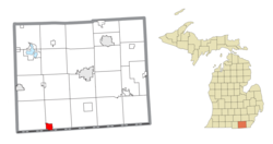
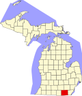
Morenci is a city in Lenawee County in the U.S. state of Michigan. Sharing a southern boundary with the state of Ohio, it is the southernmost city in the state of Michigan. The population was 2,270 at the 2020 census.
The settlement of Morenci began in 1833. [5] The Chicago and Canada Southern Railway opened a railway line through Morenci to Fayette, Ohio, in 1872. This line was abandoned in 1991. [6]
According to the United States Census Bureau, the city has a total area of 2.12 square miles (5.49 km2), all land. [7]
Census | Pop. | Note | %± |
---|---|---|---|
1860 | 459 | — | |
1880 | 1,209 | — | |
1890 | 1,248 | 3.2% | |
1900 | 1,334 | 6.9% | |
1910 | 1,515 | 13.6% | |
1920 | 1,697 | 12.0% | |
1930 | 1,773 | 4.5% | |
1940 | 1,845 | 4.1% | |
1950 | 1,983 | 7.5% | |
1960 | 2,053 | 3.5% | |
1970 | 2,132 | 3.8% | |
1980 | 2,110 | −1.0% | |
1990 | 2,342 | 11.0% | |
2000 | 2,398 | 2.4% | |
2010 | 2,220 | −7.4% | |
2020 | 2,270 | 2.3% | |
U.S. Decennial Census [8] |
At the 2010 census, [9] there were 2,220 people, 821 households and 582 families living in the city. The population density was 1,047.2 per square mile (404.3/km2). There were 951 housing units at an average density of 448.6 per square mile (173.2/km2). The racial makeup of the city was 96.2% White, 1.0% African American, 0.3% Native American, 0.3% Asian, 0.1% Pacific Islander, 0.7% from other races, and 1.4% from two or more races. Hispanic or Latino of any race were 4.5% of the population.
There were 821 households, of which 39.0% had children under the age of 18 living with them, 51.0% were married couples living together, 13.9% had a female householder with no husband present, 6.0% had a male householder with no wife present, and 29.1% were non-families. 25.7% of all households were made up of individuals, and 13% had someone living alone who was 65 years of age or older. The average household size was 2.68 and the average family size was 3.13.
The median age was 34.1 years. 28.7% of residents were under the age of 18; 8.8% were between the ages of 18 and 24; 26.9% were from 25 to 44; 22.2% were from 45 to 64; and 13.4% were 65 years of age or older. The gender makeup was 48.1% male and 51.9% female.
At the 2000 census, [3] there were 2,398 people, 877 households and 644 families living in the city. The population density was 1,134.1 inhabitants per square mile (437.9/km2). There were 942 housing units at an average density of 445.5 per square mile (172.0/km2). The racial makeup was 97.00% White, 0.13% African American, 0.33% Native American, 0.33% Asian, 0.63% from other races, and 1.58% from two or more races. Hispanic or Latino of any race were 3.50% of the population.
There were 877 households, of which 39.3% had children under the age of 18 living with them, 56.7% were married couples living together, 11.3% had a female householder with no husband present, and 26.5% were non-families. 22.5% of all households were made up of individuals, and 12.8% had someone living alone who was 65 years of age or older. The average household size was 2.68 and the average family size was 3.11.
28.9% of the population were under the age of 18, 9.2% from 18 to 24, 27.8% from 25 to 44, 19.7% from 45 to 64, and 14.4% who were 65 years of age or older. The median age was 34 years. For every 100 females, there were 93.9 males. For every 100 females age 18 and over, there were 83.7 males.
The median household income was $40,050 and the median family income was $46,324. Males had a median income of $33,459 and females $22,288. The per capita income was $16,557. About 7.4% of families and 9.7% of the population were below the poverty line, including 14.4% of those under age 18 and 6.8% of those age 65 or over.
The community is served by Morenci Area Schools. The Morenci Area High School Bulldogs are members of the Tri-County Conference.
This climatic region is typified by large seasonal temperature differences, with warm to hot (and often humid) summers and cold (sometimes severely cold) winters. According to the Köppen Climate Classification system, Morenci has a humid continental climate, abbreviated "Dfb" on climate maps. [11]
Clifton is a town in and is the county seat of Greenlee County, Arizona, United States, along the San Francisco River. The population of the town was 3,311 at the 2010 census, with a 2018 population estimate of 3,700. It was a place of the Arizona copper mine strike of 1983.
Morenci is a census-designated place (CDP) and company town in Greenlee County, Arizona, United States, and was founded by the Detroit Copper Mining Company of Arizona. The population was 2,000 at the 2000 census and 1,489 at the 2010 census. The biggest employer in Morenci and the owner of the town is Freeport-McMoRan, the owner of the Morenci Mine, the largest copper mining operation in North America, and one of the largest copper mines in the world. The town was a site of the Arizona Copper Mine Strike of 1983. The large open-pit mine is north of the town.
Beulah is a village in the U.S. state of Michigan. It is the county seat of Benzie County, and is located within Benzonia Township. The village had a population of 313 at the 2020 census. The village sits at the southeast end of Crystal Lake, and is immediately north of the village of Benzonia.
Pellston is a village in Emmet County in the U.S. state of Michigan. The population was 822 at the 2010 census. The village is the home of Pellston Regional Airport.
Beaverton is a city in Gladwin County in the U.S. state of Michigan. The population was 1,145 at the 2020 census. The city is bordered by Beaverton Township on the west, but the two are administered autonomously.
Gladwin is a city in Gladwin County in the U.S. state of Michigan. The population was 3,069 at the 2020 census. Gladwin is the county seat of Gladwin County. The city is at the southwest corner of Gladwin Township, but the two are administered autonomously.
Alma is the largest city in Gratiot County in the U.S. state of Michigan. The population was 9,488 at the 2020 census. It was incorporated as the Village of Alma in 1872 and became a city in 1905.
Sebewaing (SEE-bah-wing) is a village in Huron County in the U.S. state of Michigan. The population was 1,721 at the 2020 census. The village is within Sebewaing Township. This community is known as the Sugar Beet Capital, due to the Michigan Sugar slicing mill located within the village and the yearly Michigan Sugar Festival. The Sebewaing area, the Thumb, and the state of Michigan overall are major beet sugar producers, mostly for domestic consumption. Sebewaing is also the first gigabit village in the state of Michigan. In 2014–15, Sebewaing completed its fiber to the home network, offering up to gigabit/second speeds over their fiber optic network.
Ionia is the largest city in, and the county seat of, Ionia County, Michigan, United States. The population was 13,378 at the 2020 census. Every July it hosts what is said to be the world's largest free-admission fair, the Ionia Free Fair. The city is mostly within Ionia Township, with small portion extending into Easton Township and Berlin Township, but is politically autonomous of the townships. The city is named after Ionia, a historic region in Greece.
East Tawas is a city in Iosco County in the U.S. state of Michigan. The population was 2,663 at the 2020 census.
Iron River is a city in Iron County in the U.S. state of Michigan. As of the 2020 census, the city population was 3,007. The city is situated at the southeast corner of Iron River Township, but is administratively autonomous.
Stephenson is a city in Menominee County in the U.S. state of Michigan. The population was 816 at the 2020 census. The city is surrounded by Stephenson Township but is administered autonomously. It is part of the Marinette, WI–MI micropolitan statistical area.
McBain is a city in Missaukee County in the U.S. state of Michigan. The population was 637 at the 2020 census, making McBain the eighth-smallest city in the state of Michigan by population.
Lakeview is a village in Cato Township in Montcalm County of the U.S. state of Michigan. The population was 1,024 at the 2020 census.
Fruitport is a village in Muskegon County in the U.S. state of Michigan. The population was 1,103 at the 2020 census. The community is located within Fruitport Charter Township.
Newaygo is a rural city in Newaygo County in the U.S. state of Michigan. The population was 2,471 at the 2020 census.
Evart is a city in Osceola County in the U.S. state of Michigan. The population was 1,742 at the 2020 census. The city lies on the northern edge of Evart Township and is partially within neighboring Osceola Township, although the city is administered autonomously.
Ferrysburg is a city in Ottawa County in the U.S. state of Michigan. The population was 2,892 at the 2010 census.
Sandusky is the most populous city and county seat of Sanilac County, Michigan. The population was 2,679 at the 2010 census.
Kenmare is a city in Ward County, North Dakota, United States. The population was 961 at the 2020 census. Kenmare is part of the Minot Micropolitan Statistical Area.