Jasper, Michigan

Last updated

Jasper, Michigan
Jasper, MI along M-52.jpg
Looking north along S. Adrian Highway (M-52)
Jasper, MI location.png
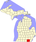
Location within Lenawee County
USA Michigan location map.svg
Red pog.svg
Jasper
Location within the state of Michigan
Usa edcp location map.svg
Red pog.svg
Jasper
Location within the United States
Coordinates: 41°47′36″N84°02′26″W / 41.79333°N 84.04056°W / 41.79333; -84.04056
CountryUnited States
State Michigan
County Lenawee
Townships Fairfield Ogden
Established1874
Area
[1]
  Total4.03 sq mi (10.44 km2)
  Land4.03 sq mi (10.44 km2)
  Water0.00 sq mi (0.00 km2)
Elevation
735 ft (224 m)
Population
 (2020)
  Total371
  Density92.06/sq mi (35.54/km2)
Time zone UTC-5 (Eastern (EST))
  Summer (DST) UTC-4 (EDT)
ZIP code(s)
49248
Area code 517
GNIS feature ID629217 [2]
U.S. Post Office in Jasper Jasper, MI post office.jpg
U.S. Post Office in Jasper

Jasper is an unincorporated community and census-designated place (CDP) in Lenawee County in the U.S. state of Michigan. The CDP had a population of 371 at the 2020 census. Jasper is within Fairfield Township and Ogden Township [3] , Jasper has its own post office with the 49248 ZIP Code. [4] [5]

Contents

Geography

According to the U.S. Census Bureau, the community has an area of 4.03 square miles (10.44 km2), all of it land. [1]

Major highways

History

The first European settler in Jasper was Andrew Millet, arriving in 1824. A post office was opened June 18, 1874, with Henry Ferguson as the first postmaster. [6] The Lake Shore and Michigan Southern Railway had a depot in Jasper. [7] The station was at first known as Fairfield. [6] Jasper was one of the largest populated areas in Lenawee County prior to 1908 accounting for about 8,000 residents. A Smallpox epidemic wiped out over half of the residents and most of the homes were burned to the ground in the southern two thirds of the town to try to stop the epidemic.[ citation needed ]

The community of Jasper was listed as a newly-organized census-designated place for the 2010 census, meaning it now has officially defined boundaries and population statistics for the first time. [8]

Demographics

Historical population
CensusPop.Note
2010 412
2020 371−10.0%
U.S. Decennial Census [9]

Related Research Articles

<span class="mw-page-title-main">Indian River, Michigan</span> Census-designated place & unincorporated community in Michigan, United States

Indian River is an unincorporated community and census-designated place (CDP) in Cheboygan County in the U.S. state of Michigan. The population was 1,950 at the 2020 census. The CDP is located in Tuscarora Township between Burt Lake and Mullett Lake.

<span class="mw-page-title-main">Byron Center, Michigan</span> Census-designated place & unincorporated community in Michigan, United States

Byron Center is an unincorporated community and census-designated place (CDP) in Kent County in the U.S. state of Michigan. The population was 7,431 at the 2020 census, which is a significant increase from a population of 5,822 at the 2010 census. Byron Center is located within Byron Township.

<span class="mw-page-title-main">Allouez Township, Michigan</span> Civil township in Michigan, United States

Allouez Township is a civil township of Keweenaw County in the U.S. state of Michigan. The population was 1,428 at the 2020 census.

<span class="mw-page-title-main">Madison Charter Township, Michigan</span> Charter township in Michigan, United States

Madison Charter Township is a charter township of Lenawee County in the U.S. state of Michigan. The population was 8,439 at the 2020 census.

<span class="mw-page-title-main">Manitou Beach–Devils Lake, Michigan</span> Census-designated place & unincorporated community in Michigan, United States

Manitou Beach–Devils Lake is a census-designated place (CDP) in Lenawee County in the U.S. state of Michigan. The population of the CDP was 2,032 at the 2020 census. It is located within Rollin Township to the south and Woodstock Township to the north.

<span class="mw-page-title-main">Prudenville, Michigan</span> Census-designated place & unincorporated community in Michigan, United States

Prudenville is an unincorporated community and census-designated place (CDP) in Roscommon County in the U.S. state of Michigan. The population was 1,643 at the 2020 census. Prudenville is located within Denton Township.

<span class="mw-page-title-main">Bay Port, Michigan</span> Census-designated place & unincorporated community in Michigan, United States

Bay Port is an unincorporated community and census-designated place (CDP) in Huron County in the U.S. state of Michigan. The population was 582 at the 2020 census. As an unincorporated community, Bay Port has no legal autonomy of its own but does have its own post office with the 48720 ZIP Code.

<span class="mw-page-title-main">Boon, Michigan</span> Census-designated place & unincorporated community in Michigan, United States

Boon is an unincorporated community and census-designated place (CDP) in Wexford County in the U.S. state of Michigan. The community is located within Boon Township. The population of the CDP was 90 at the 2020 census.

<span class="mw-page-title-main">Riverdale, Michigan</span> Census-designated place & unincorporated community in Michigan, United States

Riverdale is an unincorporated community and census-designated place (CDP) in Gratiot County in the U.S. state of Michigan. The population of the CDP was 281 at the 2020 census. The community is located within Seville Township.

<span class="mw-page-title-main">Elm Hall, Michigan</span> Census-designated place & unincorporated community in Michigan, United States

Elm Hall is an unincorporated community and census-designated place (CDP) in Gratiot County in the U.S. state of Michigan. The CDP had a population of 279 at the 2020 census. The community is located within Sumner Township.

<span class="mw-page-title-main">Pittsford, Michigan</span> Census-designated place & unincorporated community in Michigan, United States

Pittsford is an unincorporated community and census-designated place (CDP) in Hillsdale County in the U.S. state of Michigan. The population of the CDP was 553 at the 2020 census. The community is located along M-34 on the border between Jefferson Township to the west and Pittsford Township to the east.

<span class="mw-page-title-main">Cedar, Michigan</span> Census-designated place & unincorporated community in Michigan, United States

Cedar is an unincorporated community and census-designated place in Leelanau County in the U.S. State of Michigan. The CDP had a population of 102 at the 2020 census. Cedar is located within Solon Township, and lies about 10 miles (16 km) northwest of Traverse City. The town is known for its Polish heritage, and is home to an annual polka festival.

<span class="mw-page-title-main">Amboy Township, Ohio</span> Township in Ohio, United States

Amboy Township is one of the twelve townships of Fulton County, Ohio, United States. As of the 2020 census the population was 1,878, up from 1,846 at the 2010 census. 1,219 of the residents lived in the unincorporated portions of the township in 2010.

<span class="mw-page-title-main">Walloon Lake, Michigan</span> Census-designated place & unincorporated community in Michigan, United States

Walloon Lake is an unincorporated community and census-designated place (CDP) in Charlevoix County in the U.S. state of Michigan. The population of the CDP was 271 at the 2020 census. The community is located within Melrose Township.

Mohawk is an unincorporated community and census-designated place (CDP) in the U.S. state of Michigan. Located in Keweenaw County, it is within Allouez Township. As an unincorporated community, Mohawk has no legally defined boundaries or population statistics of its own but does have its own post office with the 49950 ZIP Code. The ZIP includes most of mainland Keweenaw County and also uses the Eagle Harbor and Eagle River designations.

<span class="mw-page-title-main">Ida, Michigan</span> Census-designated place & unincorporated community in Michigan, United States

Ida is an unincorporated community and census-designated place (CDP) in Monroe County in the U.S. state of Michigan. The CDP had a population of 790 at the 2020 census. The community is mostly within Ida Township with a smaller portion extending north into Raisinville Township.

<span class="mw-page-title-main">Eureka, Michigan</span> Census-designated place & unincorporated community in Michigan, United States

Eureka is an unincorporated community and census-designated place (CDP) in Clinton County in the U.S. state of Michigan. The population of the CDP was 233 at the 2020 census. The community is located within Greenbush Township.

<span class="mw-page-title-main">Fairfield Township, Lenawee County, Michigan</span> Civil township in Michigan, United States

Fairfield Township is a civil township of Lenawee County in the U.S. state of Michigan. As of the 2020 census, the township population was 1,661.

<span class="mw-page-title-main">Franklin Township, Lenawee County, Michigan</span> Civil township in Michigan, United States

Franklin Township is a civil township of Lenawee County in the U.S. state of Michigan. The population was 3,063 at the 2020 census.

<span class="mw-page-title-main">Loomis, Michigan</span> Census-designated place & unincorporated community in Michigan, United States

Loomis is an unincorporated community and census-designated place (CDP) in Isabella County in the U.S. state of Michigan. The population of the CDP was 194 at the 2020 census. The community is located within Wise Township, and is also located within the Isabella Indian Reservation, home to the federally-recognized Saginaw Chippewa Tribal Nation.

References

  1. 1 2 "2020 U.S. Gazetteer Files". United States Census Bureau. Retrieved May 21, 2022.
  2. U.S. Geological Survey Geographic Names Information System: Jasper
  3. "Ogden Township, Michigan", Wikipedia, May 2, 2024, retrieved June 7, 2024
  4. UnitedStatesZipCodes.org (2021). "ZIP Code 49248: Jasper" . Retrieved October 6, 2021.
  5. Google (October 6, 2021). "49248 ZIP Code map" (Map). Google Maps . Google. Retrieved October 6, 2021.
  6. 1 2 Romig, Walter (1986) [1973]. Michigan Place Names. Detroit, Michigan: Wayne State University Press. ISBN   0-8143-1838-X.
  7. Jasper, Michigan Archived 2011-05-25 at the Wayback Machine , Michigan's Internet Railroad History Museum]
  8. "Michigan: 2010 Population and Housing Unit Counts 2010 Census of Population and Housing" (PDF). 2010 United States Census . United States Census Bureau. September 2012. p. III-6. Retrieved August 8, 2016.
  9. "Census of Population and Housing". Census.gov. Retrieved June 4, 2016.