Blissfield, Michigan

Last updated

Blissfield, Michigan
Village of Blissfield
Blissfield township business district.JPG
Downtown Blissfield along Lane Street
Blissfield, MI location.png
Location within Lenawee County
USA Michigan location map.svg
Red pog.svg
Blissfield
Location within the state of Michigan
Usa edcp location map.svg
Red pog.svg
Blissfield
Location within the United States
Coordinates: 41°49′54″N83°51′50″W / 41.83167°N 83.86389°W / 41.83167; -83.86389
Country United States
State Michigan
County Lenawee
Townships Blissfield, Palmyra, and Riga
Settled1826
Incorporated1875
Government
  Type Village council
  PresidentJames Eitzen
   Clerk Lisa Novak
Area
[1]
  Total2.27 sq mi (5.88 km2)
  Land2.22 sq mi (5.74 km2)
  Water0.06 sq mi (0.14 km2)
Elevation
689 ft (210 m)
Population
 (2020)
  Total3,277
  Density1,478.12/sq mi (570.68/km2)
Time zone UTC-5 (Eastern (EST))
  Summer (DST) UTC-4 (EDT)
ZIP code(s)
49228
Area code 517
FIPS code 26-09000 [2]
GNIS feature ID2398133 [3]
Website Official website

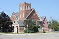
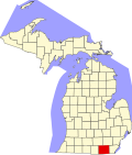
Blissfield is a village in Lenawee County in the U.S. state of Michigan. The population was 3,340 at the 2010 census. The village is mostly located within Blissfield Township with only very small portions extending west into Palmyra Township and south into Riga Township. The Blissfield post office first opened March 28, 1828. [4] Hervey Bliss, who was the first white settler in 1824 and for whom the town is named, was the first postmaster. [5]

Contents

History

During World War II, 16 German POWs, who were working on a sugar beet farm near Blissfield, were killed in an accident when their truck collided with a train as they were returning to Fort Custer. They are now buried at Fort Custer National Cemetery.

According to local legend, Blissfield was home to the first set of Triple Bridges in the world. These three bridges stood directly next to each other and crossed the River Raisin to accommodate train and vehicular travel. The interurban bridge was torn down and the road bridge was replaced with a larger bridge in place of both bridges.

In September–October 2014 Blissfield's village hall was moved to a former KeyBank location in the business district of the village. It is now two doors down from the Township offices. The police department was also moved with it.

Blissfield High School is the home of the Royals. The baseball team has won seven state titles, while the girls volleyball team won their first state title in 2005. [6]

The village contains three properties listed on the National Register of Historic Places: Blissfield Downtown Historic District, the David Carpenter House, and the First Presbyterian Church of Blissfield.

Geography

According to the United States Census Bureau, the village has a total area of 2.30 square miles (5.96 km2), of which 2.24 square miles (5.80 km2) is land and 0.06 square miles (0.16 km2) is water. [7]

The village occupies portions of three civil townships: Blissfield, Palmyra, and Riga. Of the township's 2.30 square miles (5.96 km2) of total area, 2.27 square miles (5.88 km2), or 98.7%, is located within Blissfield Township. Of the population of 3,340 at 2010 census, all but eight residents lived within Blissfield Township. The remaining eight lived in Palmyra Township, and no residents lived in the Riga Township portion of the village of Blissfield. [8]

Demographics

Historical population
CensusPop.Note
1880 1,222
1890 1,132−7.4%
1900 1,26812.0%
1910 1,47416.2%
1920 1,90629.3%
1930 2,10310.3%
1940 2,1441.9%
1950 2,36510.3%
1960 2,65312.2%
1970 2,7533.8%
1980 3,10712.9%
1990 3,1722.1%
2000 3,2231.6%
2010 3,3403.6%
2020 3,277−1.9%
U.S. Decennial Census [9]

2010 census

As of the census [10] of 2010, there were 3,340 people, 1,349 households, and 924 families living in the village. The population density was 1,491.1 inhabitants per square mile (575.7/km2). There were 1,470 housing units at an average density of 656.2 per square mile (253.4/km2). The racial makeup of the village was 96.6% White, 0.3% African American, 0.5% Native American, 0.2% Asian, 0.8% from other races, and 1.6% from two or more races. Hispanic or Latino of any race were 5.1% of the population.

There were 1,349 households, of which 34.2% had children under the age of 18 living with them, 52.2% were married couples living together, 12.5% had a female householder with no husband present, 3.8% had a male householder with no wife present, and 31.5% were non-families. 27.7% of all households were made up of individuals, and 13.6% had someone living alone who was 65 years of age or older. The average household size was 2.48 and the average family size was 3.00.

The median age in the village was 38.8 years. 25.6% of residents were under the age of 18; 7.3% were between the ages of 18 and 24; 25.3% were from 25 to 44; 26.2% were from 45 to 64; and 15.5% were 65 years of age or older. The gender makeup of the village was 48.3% male and 51.7% female.

2000 census

As of the census [2] of 2000, there were 3,223 people, 1,319 households, and 903 families living in the village. The population density was 1,520.7 inhabitants per square mile (587.1/km2). There were 1,388 housing units at an average density of 654.9 per square mile (252.9/km2). The racial makeup of the village was 96.59% White, 0.06% African American, 0.03% Native American, 0.06% Asian, 2.61% from other races, and 0.65% from two or more races. Hispanic or Latino of any race were 6.14% of the population.

There were 1,319 households, out of which 32.5% had children under the age of 18 living with them, 55.9% were married couples living together, 9.4% had a female householder with no husband present, and 31.5% were non-families. 27.5% of all households were made up of individuals, and 15.8% had someone living alone who was 65 years of age or older. The average household size was 2.42 and the average family size was 2.96.

In the village, the population was spread out, with 26.0% under the age of 18, 8.1% from 18 to 24, 28.0% from 25 to 44, 22.1% from 45 to 64, and 15.8% who were 65 years of age or older. The median age was 37 years. For every 100 females, there were 90.1 males. For every 100 females age 18 and over, there were 87.6 males.

The median income for a household in the village was $39,438, and the median income for a family was $48,964. Males had a median income of $37,218 versus $25,069 for females. The per capita income for the village was $19,255. About 6.9% of families and 8.4% of the population were below the poverty line, including 10.0% of those under age 18 and 9.4% of those age 65 or over.

2007 State Finals at Ford Field BlissfieldHSStateFinals.JPG
2007 State Finals at Ford Field

Transportation

Related Research Articles

<span class="mw-page-title-main">Palmyra, Indiana</span> Town in Indiana, United States

Palmyra is a town in Morgan Township, Harrison County, Indiana, United States. The population was 930 at the 2010 census.

<span class="mw-page-title-main">Adrian, Michigan</span> City in Michigan, United States

Adrian is a city in the U.S. state of Michigan and the county seat of Lenawee County. The population was 20,645 at the 2020 census. Adrian lies in Michigan's 5th congressional district.

<span class="mw-page-title-main">Adrian Charter Township, Michigan</span> Charter township in Michigan, United States

Adrian Charter Township is a charter township of Lenawee County in the U.S. state of Michigan. The township population was 6,401 at the 2020 census. The city of Adrian borders on the south, but the two are administered autonomously.

<span class="mw-page-title-main">Blissfield Township, Michigan</span> Civil township in Michigan, United States

Blissfield Township is a civil township of Lenawee County in the U.S. state of Michigan. As of the 2010 census, the township population was 3,973. The township was organized in 1827.

<span class="mw-page-title-main">Palmyra Township, Michigan</span> Civil township in Michigan, United States

Palmyra Township is a civil township of Lenawee County in the U.S. state of Michigan. The population was 2,366 at the 2000 census.

<span class="mw-page-title-main">Raisin Charter Township, Michigan</span> Charter township in Michigan, United States

Raisin Charter Township is a charter township of Lenawee County in the U.S. state of Michigan. The population was 7,900 at the 2020 census.

Palmyra Township is a township in Renville County, Minnesota, United States. The population was 215 at the 2000 census.

<span class="mw-page-title-main">Palmyra, Nebraska</span> Village in Nebraska, United States

Palmyra is a village in northwest Otoe County, Nebraska, United States. The population was 534 at the 2020 census.

<span class="mw-page-title-main">Aberdeen, Ohio</span> Village in Ohio, United States

Aberdeen is a village in Huntington Township, Brown County, Ohio, United States, along the Ohio River 50 miles (80 km) southeast of Cincinnati. The population was 1,515 at the 2020 census.

<span class="mw-page-title-main">Elizabeth Township, Lancaster County, Pennsylvania</span> Township in Pennsylvania, United States

Elizabeth Township is a township in north central Lancaster County, Pennsylvania, United States. The population was 3,998 at the 2020 census.

<span class="mw-page-title-main">Warwick Township, Lancaster County, Pennsylvania</span> Township in Pennsylvania, United States

Warwick Township is a township in north-central Lancaster County, Pennsylvania, United States. The population was 19,068 at the 2020 census. It completely surrounds the borough of Lititz and contains the unincorporated villages of Brunnerville, Disston, Kissel Hill, Lexington, Millway, and Rothsville.

<span class="mw-page-title-main">Palmyra Township, Pike County, Pennsylvania</span> Township in Pennsylvania, United States

Palmyra Township is a township in Pike County, Pennsylvania. The population was 3,312 at the 2010 census. The majority of its northwestern border is Lake Wallenpaupack.

<span class="mw-page-title-main">Lewis Township, Union County, Pennsylvania</span> Township in Pennsylvania, United States

Lewis Township is a township in Union County, Pennsylvania, United States. The population was 1,456 at the 2020 census. Sand Bridge State Park, a Pennsylvania state park, is in Lewis Township along Pennsylvania Route 192.

<span class="mw-page-title-main">Somerset Township, Washington County, Pennsylvania</span> Township in Pennsylvania, United States

Somerset Township is a township in Washington County, Pennsylvania, United States. The population was 2,579 at the 2020 census.

<span class="mw-page-title-main">West Finley Township, Washington County, Pennsylvania</span> Township in Pennsylvania, United States

West Finley Township is a township in Washington County, Pennsylvania, United States. The population was 813 at the 2020 census.

<span class="mw-page-title-main">Palmyra Township, Wayne County, Pennsylvania</span> Township in Pennsylvania, United States

Palmyra is a second-class township in Wayne County, Pennsylvania. The township's population was 1,339 at the time of the 2010 United States Census.

<span class="mw-page-title-main">Paupack Township, Wayne County, Pennsylvania</span> Township in Pennsylvania, United States

Paupack is a second-class township in Wayne County, Pennsylvania, United States. The township's population was 3,828 at the time of the 2010 United States Census.

<span class="mw-page-title-main">Lower Chanceford Township, York County, Pennsylvania</span> Township in Pennsylvania, United States

Lower Chanceford Township is a township in York County, Pennsylvania, United States. The population was 3,028 at the 2020 United States census|2020 census]].

Palmyra is a town in Jefferson County, Wisconsin, United States. The population was 1,707 at the 2020 census. The village of Palmyra is located within the town.

<span class="mw-page-title-main">Eagle, Wisconsin</span> Village in Wisconsin, United States

Eagle is a village in Waukesha County, Wisconsin, United States. At the 2020 census, the population was 2,071. The village is located within the Town of Eagle.

References

  1. "2020 U.S. Gazetteer Files". United States Census Bureau. Retrieved May 21, 2022.
  2. 1 2 "U.S. Census website". United States Census Bureau . Retrieved January 31, 2008.
  3. U.S. Geological Survey Geographic Names Information System: Blissfield, Michigan
  4. U.S. Geological Survey Geographic Names Information System: Blissfield Post Office
  5. 1999 Michigan Encyclopedia, retrieved 3-Nov-2014
  6. "Greatest Moments". Blissfield Athletics. Retrieved June 2, 2023.
  7. "US Gazetteer files 2010". United States Census Bureau. Archived from the original on January 25, 2012. Retrieved November 25, 2012.
  8. "Michigan: 2010 Population and Housing Unit Counts 2010 Census of Population and Housing" (PDF). 2010 United States Census . United States Census Bureau. September 2012. p. 30. Archived (PDF) from the original on October 19, 2012. Retrieved January 22, 2020.
  9. "Census of Population and Housing". Census.gov. Retrieved June 4, 2015.
  10. "U.S. Census website". United States Census Bureau . Retrieved November 25, 2012.