Woodstock Township, Michigan

Last updated

Woodstock Township, Michigan
Woodstock Township Hall Michigan.JPG
Woodstock Township Hall
Woodstock Township, MI location.png
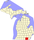
Location within Lenawee County and the administered portions of the villages of Addison (1), Cement City (2), and the CDP of Manitou Beach–Devils Lake (3)
USA Michigan location map.svg
Red pog.svg
Woodstock Township
Location within the state of Michigan
Usa edcp location map.svg
Red pog.svg
Woodstock Township
Woodstock Township (the United States)
Coordinates: 42°01′40″N84°18′03″W / 42.02778°N 84.30083°W / 42.02778; -84.30083
Country United States
State Michigan
County Lenawee
Government
  SupervisorJames Anderson
   Clerk Ashley Wilson
Area
  Total
35.7 sq mi (92.5 km2)
  Land33.9 sq mi (87.8 km2)
  Water1.8 sq mi (4.7 km2)
Elevation
1,066 ft (325 m)
Population
 (2020)
  Total
3,608
  Density106/sq mi (41.1/km2)
Time zone UTC-5 (Eastern (EST))
  Summer (DST) UTC-4 (EDT)
ZIP code(s)
49220 (Addison)
49230 (Brooklyn)
49233 (Cement City)
49253 (Manitou Beach)
Area code 517
FIPS code 26-88640 [1]
GNIS feature ID1627290 [2]
Website www.woodstocktownship.com

Woodstock Township is a civil township of Lenawee County, Michigan, United States. As of the 2020 census, the township population was 3,608. [3]

Contents

Communities

Geography

According to the United States Census Bureau, the township has a total area of 35.7 square miles (92 km2), of which 33.9 square miles (88 km2) is land and 1.8 square miles (4.7 km2) (5.12%) is water.

Demographics

As of the census [1] of 2000, there were 3,468 people, 1,344 households, and 1,006 families residing in the township. The population density was 102.3 inhabitants per square mile (39.5/km2). There were 1,753 housing units at an average density of 51.7 per square mile (20.0/km2). The racial makeup of the township was 97.87% White, 0.17% African American, 0.23% Native American, 0.17% Asian, 0.40% from other races, and 1.15% from two or more races. Hispanic or Latino of any race were 1.27% of the population.

There were 1,344 households, out of which 30.1% had children under the age of 18 living with them, 63.3% were married couples living together, 7.6% had a female householder with no husband present, and 25.1% were non-families. 21.3% of all households were made up of individuals, and 8.3% had someone living alone who was 65 years of age or older. The average household size was 2.58 and the average family size was 2.98.

In the township the population was spread out, with 25.1% under the age of 18, 6.3% from 18 to 24, 27.8% from 25 to 44, 28.1% from 45 to 64, and 12.8% who were 65 years of age or older. The median age was 40 years. For every 100 females, there were 102.3 males. For every 100 females age 18 and over, there were 101.5 males.

The median income for a household in the township was $42,882, and the median income for a family was $52,041. Males had a median income of $41,344 versus $26,512 for females. The per capita income for the township was $20,551. About 4.0% of families and 6.6% of the population were below the poverty line, including 8.4% of those under age 18 and 3.6% of those age 65 or over.

References

  1. 1 2 "U.S. Census website". United States Census Bureau . Retrieved January 31, 2008.
  2. U.S. Geological Survey Geographic Names Information System: Woodstock Township, Michigan
  3. "Explore Census Data". data.census.gov. Retrieved April 27, 2024.