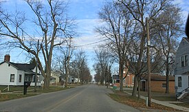
Clayton, Michigan

Last updated

Clayton, Michigan
Village of Clayton
Clayton Michigan State Street.JPG
Facing north along State Street
Clayton, MI location.png
Location within Lenawee County
USA Michigan location map.svg
Red pog.svg
Clayton
Location within the state of Michigan
Usa edcp location map.svg
Red pog.svg
Clayton
Location within the United States
Coordinates: 41°51′49″N84°14′07″W / 41.86361°N 84.23528°W / 41.86361; -84.23528
CountryUnited States
State Michigan
County Lenawee
Townships Dover and Hudson
Established1836
Platted 1843
Incorporated1870
Government
[1]
  Type Village council
  PresidentShannon Johnston
   Clerk Wendy Mullane
Area
[2]
  Total0.71 sq mi (1.84 km2)
  Land0.71 sq mi (1.84 km2)
  Water0.00 sq mi (0.00 km2)
Elevation
896 ft (273 m)
Population
 (2020)
  Total311
  Density436.80/sq mi (168.77/km2)
Time zone UTC-5 (Eastern (EST))
  Summer (DST) UTC-4 (EDT)
ZIP code(s)
49235
Area code 517
FIPS code 26-16280 [3]
GNIS feature ID0623395 [4]
Website Official website

Clayton is a village in Lenawee County of the U.S. state of Michigan. The population was 311 at the 2020 census. The village is located within Hudson Township to the west and Dover Township to the east.

Contents

History

The community was first settled in 1836 and named East Dover due to its location in eastern Dover Township. A post office began operating in East Dover on March 8, 1837, with Levi Soper serving as the first postmaster. Rueben Bird platted the community in 1843, and he had the post office name changed to Clayton on July 17, 1849, after his friend Reverend Clayton from New York. Clayton was incorporated as a village in 1870. [5]

Geography

According to the U.S. Census Bureau, the village has a total area of 0.71 square miles (1.84 km2), all land. [6]

Major highways

Demographics

Historical population
CensusPop.Note
1880 368
1900 370
1910 3720.5%
1920 306−17.7%
1930 37221.6%
1940 3750.8%
1950 46724.5%
1960 4700.6%
1970 5057.4%
1980 396−21.6%
1990 384−3.0%
2000 326−15.1%
2010 3445.5%
2020 311−9.6%
U.S. Decennial Census [7]

2010 census

As of the census [8] of 2010, there were 344 people, 118 households, and 90 families living in the village. The population density was 484.5 inhabitants per square mile (187.1/km2). There were 131 housing units at an average density of 184.5 per square mile (71.2/km2). The racial makeup of the village was 93.6% White, 1.7% African American, 0.3% Native American, 0.3% Asian, 1.7% from other races, and 2.3% from two or more races. Hispanic or Latino of any race were 5.5% of the population.

There were 118 households, of which 40.7% had children under the age of 18 living with them, 55.1% were married couples living together, 13.6% had a female householder with no husband present, 7.6% had a male householder with no wife present, and 23.7% were non-families. 17.8% of all households were made up of individuals, and 5.1% had someone living alone who was 65 years of age or older. The average household size was 2.92 and the average family size was 3.34.

The median age in the village was 31.5 years. 30.5% of residents were under the age of 18; 8.5% were between the ages of 18 and 24; 31.4% were from 25 to 44; 17.7% were from 45 to 64; and 11.9% were 65 years of age or older. The gender makeup of the village was 52.0% male and 48.0% female.

2000 census

As of the census [3] of 2000, there were 326 people, 113 households, and 83 families living in the village. The population density was 428.2 inhabitants per square mile (165.3/km2). There were 120 housing units at an average density of 157.6 per square mile (60.8/km2). The racial makeup of the village was 96.63% White, 0.31% African American, 0.31% Native American, 1.23% from other races, and 1.53% from two or more races. Hispanic or Latino of any race were 2.45% of the population.

There were 113 households, out of which 34.5% had children under the age of 18 living with them, 59.3% were married couples living together, 8.0% had a female householder with no husband present, and 25.7% were non-families. 19.5% of all households were made up of individuals, and 8.0% had someone living alone who was 65 years of age or older. The average household size was 2.88 and the average family size was 3.31.

In the village, the population was spread out, with 29.1% under the age of 18, 11.0% from 18 to 24, 26.4% from 25 to 44, 23.6% from 45 to 64, and 9.8% who were 65 years of age or older. The median age was 31 years. For every 100 females, there were 102.5 males. For every 100 females age 18 and over, there were 108.1 males.

The median income for a household in the village was $41,875, and the median income for a family was $46,172. Males had a median income of $30,000 versus $20,000 for females. The per capita income for the village was $17,941. About 5.5% of families and 6.5% of the population were below the poverty line, including 4.8% of those under age 18 and 10.0% of those age 65 or over.

Education

The village of Clayton is served by Hudson Area Schools to the west in the city of Hudson. [9]

Images

Related Research Articles

<span class="mw-page-title-main">Adrian, Michigan</span> City in Michigan, United States

Adrian is a city in the U.S. state of Michigan and the county seat of Lenawee County. The population was 20,645 at the 2020 census. Adrian lies in Michigan's 5th congressional district.

<span class="mw-page-title-main">Blissfield Township, Michigan</span> Civil township in Michigan, United States

Blissfield Township is a civil township of Lenawee County in the U.S. state of Michigan. As of the 2020 census, the township population was 3,924. The township was organized in 1827.

<span class="mw-page-title-main">Cambridge Township, Michigan</span> Civil township in Michigan, United States

Cambridge Township is a civil township of Lenawee County in the U.S. state of Michigan. The population was 5,722 at the 2020 census.

<span class="mw-page-title-main">Clinton, Lenawee County, Michigan</span> Village in Michigan, United States

Clinton is a village in Lenawee County in the Irish Hills area of the U.S. state of Michigan. The population was 2,336 at the 2010 census. The village is located within Clinton Township.

<span class="mw-page-title-main">Clinton Township, Lenawee County, Michigan</span> Civil township in Michigan, United States

Clinton Township is a civil township of Lenawee County in the U.S. state of Michigan. The population was 3,765 at the 2020 census. The village of Clinton is located within the township.

<span class="mw-page-title-main">Deerfield, Michigan</span> Village in Michigan, United States

Deerfield is a village in Lenawee County in the U.S. state of Michigan. The population was 901 at the 2020 census. The village is located within Deerfield Township.

<span class="mw-page-title-main">Hudson Township, Lenawee County, Michigan</span> Civil township in Michigan, United States

Hudson Township is a civil township of Lenawee County in the U.S. state of Michigan. As of the 2020 census, the township population was 1,499. The city of Hudson borders the township on the west, but the two are administered autonomously.

<span class="mw-page-title-main">Ogden Township, Michigan</span> Civil township in Michigan, United States

Ogden Township is a civil township of Lenawee County in the U.S. state of Michigan. The population was 913 as of the 2020 census.

<span class="mw-page-title-main">Palmyra Township, Michigan</span> Civil township in Michigan, United States

Palmyra Township is a civil township of Lenawee County in the U.S. state of Michigan. The population was 2,031 at the 2020 census.

<span class="mw-page-title-main">Ridgeway Township, Michigan</span> Civil township in Michigan, United States

Ridgeway Township is a civil township of Lenawee County in the U.S. state of Michigan. The population was 1,535 at the 2020 census. The unincorporated community of Ridgeway can be found within Ridgeway Township.

<span class="mw-page-title-main">Riga Township, Michigan</span> Civil township in Michigan, United States

Riga Township is a civil township of Lenawee County in the U.S. state of Michigan. The population was 1,286 at the 2020 census. The unincorporated community of Riga can be found within the township.

<span class="mw-page-title-main">Rollin Township, Michigan</span> Civil township in Michigan, United States

Rollin Township is a civil township of Lenawee County in the U.S. state of Michigan. The population was 3,035 at the 2020 census.

<span class="mw-page-title-main">Rome Township, Michigan</span> Civil township in Michigan, United States

Rome Township is a civil township of Lenawee County in the U.S. state of Michigan. The population was 1,824 at the 2020 census.

<span class="mw-page-title-main">Tecumseh Township, Michigan</span> Civil township in Michigan, United States

Tecumseh Township is a civil township of Lenawee County in the U.S. state of Michigan. The population was 2,042 at the 2020 census. The city of Tecumseh is surrounded by three sides by the Township. The township was first organized in 1827.

<span class="mw-page-title-main">Woodstock Township, Michigan</span> Civil township in Michigan, United States

Woodstock Township is a civil township of Lenawee County, Michigan, United States. As of the 2020 census, the township population was 3,608.

Lennon is a village in the U.S. state of Michigan. The population was 511 at the 2010 census. The village is located along M-13 within Venice Township in Shiawassee County to the west and Clayton Township in Genesee County to the east.

<span class="mw-page-title-main">Cement City, Michigan</span> Village in Michigan, United States

Cement City is a village in the U.S. state of Michigan. The village is located within Woodstock Township in Lenawee County, with a small northern portion within Columbia Township in Jackson County. The population was 438 at the 2010 census.

<span class="mw-page-title-main">Deerfield Township, Lenawee County, Michigan</span> Civil township in Michigan, United States

Deerfield Township is a civil township of Lenawee County in the U.S. state of Michigan. The population was 1,503 at the 2020 census. The village of Deerfield is located within the township.

<span class="mw-page-title-main">Dover Township, Lenawee County, Michigan</span> Civil township in Michigan, United States

Dover Township is a civil township of Lenawee County in the U.S. state of Michigan. As of the 2020 census, the township population was 1,662.

<span class="mw-page-title-main">Franklin Township, Lenawee County, Michigan</span> Civil township in Michigan, United States

Franklin Township is a civil township of Lenawee County in the U.S. state of Michigan. The population was 3,063 at the 2020 census.

References

  1. Lenawee County (2022). "Lenawee County, Michigan Government Directory". p. 37. Retrieved June 15, 2022.
  2. "2020 U.S. Gazetteer Files". United States Census Bureau. Retrieved May 21, 2022.
  3. 1 2 "U.S. Census website". United States Census Bureau . Retrieved January 31, 2008.
  4. "US Board on Geographic Names". United States Geological Survey. October 25, 2007. Retrieved January 31, 2008.
  5. Romig, Walter (October 1, 1986) [1973]. Michigan Place Names: The History of the Founding and the Naming of More Than Five Thousand Past and Present Michigan Communities (Paperback). Great Lakes Books Series. Detroit, Michigan: Wayne State University Press. pp. 119–120. ISBN   978-0-8143-1838-6.
  6. "US Gazetteer files 2010". United States Census Bureau. Archived from the original on January 25, 2012. Retrieved November 25, 2012.
  7. "Census of Population and Housing". Census.gov. Retrieved June 4, 2015.
  8. "U.S. Census website". United States Census Bureau . Retrieved November 25, 2012.
  9. Michigan Geographic Framework (November 15, 2013). "Lenawee County School Districts" (PDF). Archived (PDF) from the original on August 20, 2014. Retrieved June 18, 2022.