M-106 (Michigan highway)

Last updated

M-106 rectangle.svg

M-106

M-106 (Michigan highway)
M-106 highlighted in red
Route information
Maintained by MDOT
Length27.041 mi [1]  (43.518 km)
Existed1928 [2] [3] –present
Major junctions
South endBusiness Loop 94.svgBusiness plate.svg
US 127.svg
M-50.svg BL I-94  / Bus. US 127  / M-50 in Jackson
Major intersections
North endM-36.svg M-36 in Gregory
Location
Country United States
State Michigan
Counties Jackson, Ingham, Livingston
Highway system
M-105 1926.svg M-105 M-107.svg M-107

M-106 is a state trunkline highway in the Lower Peninsula of the US state of Michigan in and near the city of Jackson. M-106 travels in a southwest-to-northeast direction from Jackson to Gregory at a junction with M-36 just a few miles northwest of Hell. The highway was first designated in 1928 running north out of downtown Jackson. It connected U.S. Highway 12 (US 12) to the state prison and Bunkerhill Road. A pair of changes in the early 1930s resulted in the extension eastward to Gregory. From the 1960s until the early years of the 21st century, a section of M-106 in downtown Jackson was routed along one-way streets.

Contents

Route description

Intersection of M-106 (Plum Orchard Road) and Musbach Road, the boundary between Henrietta and Waterloo townships M-106 Highway Michigan.JPG
Intersection of M-106 (Plum Orchard Road) and Musbach Road, the boundary between Henrietta and Waterloo townships

M-106 starts in downtown Jackson at the corner of Cooper Street and Michigan Avenue. Michigan Avenue runs east–west carrying Business Loop Interstate 94 (BL I-94), Business US 127 (Bus. US 127) and M-50, and Cooper Street runs northwesterly from here carrying M-106. The highway passes through residential neighborhoods immediately north of downtown, and turns due north near Jackson Catholic Middle School and the historic Michigan State Prison. Continuing a few miles north through an interchange with I-94 and US 127, M-106 runs north out of town. Cooper Street continues out of town, and the trunkline runs by the State Prison of Southern Michigan. [4] [5]

North of the current prison, the highway curves to the northwest following Bunkerhill Road. Through this area, M-106 runs through farm fields and forests. The highway turns onto Plum Orchard Road near Batteese Lake and runs east into the community of Munith. M-106 merges onto Territorial Road east of the town before crossing the county line into Ingham County. South of Stockbridge, M-106 merges with M-52 and the two run concurrently into that community. M-106 turns east in the downtown area and continues along Morton Road into Livingston County. The highway ends at a junction with M-36 in Gregory. [4] [5]

Northern terminus of M-106 at M-36 in Unadilla Township Gregory, Michigan June 2022.jpg
Northern terminus of M-106 at M-36 in Unadilla Township

M-106 is maintained by MDOT like other state highways in Michigan. As a part of these maintenance responsibilities, the department tracks the volume of traffic that uses the roadways under its jurisdiction. These volumes are expressed using a metric called annual average daily traffic, which is a statistical calculation of the average daily number of vehicles on a segment of roadway. MDOT's surveys in 2010 showed that the highest traffic levels along M-106 were the 15,474 vehicles daily south of I-94; the lowest counts were the 1,550 vehicles per day in near the M-36 junction. [6] The only section of M-106 has been listed on the National Highway System (NHS) is between M-50 and I-94 in Jackson. [7] The NHS is a network of roads important to the country's economy, defense, and mobility. [8]

History

M-106 was first designated in 1928 on a route that ran from US 12 (Michigan Avenue) along Cooper Street to Bunkerhill Road, a total of 4+12 miles (7.2 km). [2] [3] This highway was extended north to Stockbridge in late 1930 or early 1931. A further realignment of M-36 resulted in the extension of M-106 to Gregory. [9] [10] Cooper Street in Jackson was converted to one-way, southbound traffic in 1967. A northbound routing along Milwaukee Street was established. The south end of southbound M-106 was trimmed back to end at BL I-94/Bus. US 127/M-50. [11] [12] Two-way traffic was restored in 2004. M-106 was shifted to run only along Cooper Street (formerly Milwaukee Street), and Francis Street (formerly Cooper Street) is left as an unsigned trunkline. [13] [14]

Major intersections

CountyLocationmi [1] kmDestinationsNotes
Jackson Jackson 0.0000.000Business Loop 94.svgBusiness plate.svg
US 127.svg
M-50.svg BL I-94  / Bus. US 127  / M-50 (Michigan Avenue)
Blackman Township 1.638–
1.645
2.636–
2.647
I-94.svgUS 127.svg I-94  / US 127  Chicago, Detroit, Lansing Exit 139 on I-94/US 127
Ingham Stockbridge 20.62033.185South plate.svg
M-52.svg
M-52 south Adrian
Southern end of M-52 concurrency
21.43834.501North plate.svg
M-52.svg
M-52 north Owosso
Northern end of M-52 concurrency
Livingston Unadilla Township 26.92543.332East plate county.svg
County D-32.svg
D-32 east Hell
Western terminus of D-32
Gregory 27.04143.518M-36.svg M-36  Mason, Pinckney
1.000 mi = 1.609 km; 1.000 km = 0.621 mi

See also

Related Research Articles

<span class="mw-page-title-main">M-60 (Michigan highway)</span> State highway in Michigan, United States

M-60 is an east–west state trunkline highway in the US state of Michigan. It runs from the Niles area at a junction with US Highway 12 (US 12) to the Jackson area where it ends at Interstate 94 (I-94). The trunkline passes through a mix of farm fields and woodlands, crosses or runs along several rivers and connects several small towns of the southern area of the state. The westernmost segment runs along divided highway while the easternmost section is a full freeway bypass of Jackson.

<span class="mw-page-title-main">M-89 (Michigan highway)</span> State highway in Michigan, United States

M-89 is an east–west state trunkline highway in the US state of Michigan that runs from near Ganges to Battle Creek. M-89 starts at an interchange with Interstate 196/US Highway 31 (I-196/US 31) and passes through Allegan, Kalamazoo County, Michigan, and Calhoun counties. The highway also briefly crosses the southwest corner of Barry County before it terminates an at intersection with Business Loop I-94 on the northwestern side of downtown Battle Creek. In between the trunkline runs parallel to the Kalamazoo River through rural southwestern Michigan farmlands while also running through the middle of several smaller towns in the area.

<span class="mw-page-title-main">M-21 (Michigan highway)</span> State highway in Michigan, United States

M-21 is an east–west state trunkline highway in the US state of Michigan connecting the cities of Grand Rapids and Flint. The highway passes through rural farming country and several small towns along its course through the Lower Peninsula. Following the course of a handful of rivers, M-21 also connects some of the state's freeways like Interstate 96 (I-96), US Highway 127 (US 127) and I-75. The highway is used by between 1,700 and 36,000 vehicles daily.

<span class="mw-page-title-main">M-62 (Michigan highway)</span> State highway in Cass and Berrien counties in Michigan, United States

M-62 is an arc-shaped state trunkline highway in the southwestern part of the US state of Michigan. The highway runs from the Indiana state line north and west to M-140 in Eau Claire. In between, it serves the western Cass County communities of Dowagiac and Cassopolis. The highway was formed in the 1920s, originally as a north–south route. It was later extended, taking the current arc-shaped routing. A short truncation in the 1950s produced the current routing, which has remained unchanged since. In total, M-62 runs about 28+13 miles (45.6 km) in the two counties.

<span class="mw-page-title-main">M-43 (Michigan highway)</span> State highway in Michigan, United States

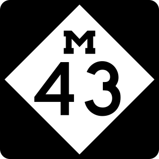
M-43 is a state trunkline highway in the southwestern and central parts of the US state of Michigan. The highway runs from South Haven to Webberville along an indirect path through both rural areas and larger cities. The trunkline follows five overall segments: a southeasterly track from South Haven to Oshtemo Township, a northerly path to Plainwell, a southeasterly route to Richland, a northeasterly course to the Hastings area and an easterly route through the Lansing area.

<span class="mw-page-title-main">M-40 (Michigan highway)</span> State highway in Cass, Van Buren, and Allegan counties in Michigan, United States

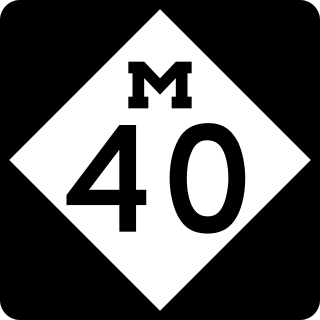
M-40 is a north–south state trunkline highway in the Lower Peninsula of the US state of Michigan. The highway runs from US Highway 12 (US 12) near the Indiana state line in Porter Township north through Paw Paw and Allegan to end in the outskirts of Holland. The current northern end is near Interstate 196 (I-196) at an intersection with US 31/Business Loop I-196 (BL 196). In between, M-40 runs through mixed agricultural and forest lands and along lakes and rivers through Southwest Michigan.

<span class="mw-page-title-main">M-50 (Michigan highway)</span> State highway in Michigan, United States

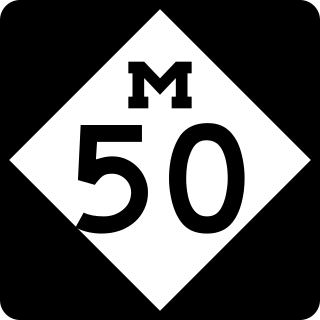
M-50 is a state trunkline highway in the US state of Michigan. Although designated as an east–west highway, it is nearly a diagonal northwest–southeast route. The western terminus is at exit 52 along Interstate 96 (I-96) near Alto a few miles east of the metro Grand Rapids area, and its eastern terminus is in downtown Monroe at US Highway 24. In between the trunkline runs through seven counties of the southern part of the Lower Peninsula mostly through rural farm fields and small communities. The highway also runs through downtown Jackson to connect between two freeway sections of US 127. In the Irish Hills area of the state southeast of Jackson, M-50 runs next to Michigan International Speedway.

<span class="mw-page-title-main">M-14 (Michigan highway)</span> State highway in Washtenaw and Wayne counties in Michigan, United States

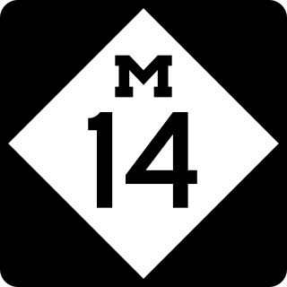
M-14 is an east–west state trunkline highway in the southeastern portion of the US state of Michigan. Entirely freeway, it runs for 22.250 miles (35.808 km) to connect Ann Arbor with Detroit by way of a connection with Interstate 96 (I-96). The western terminus is at a partial interchange with I-94 west of Ann Arbor. From there, the freeway curves around the north side of Ann Arbor and runs concurrently with US Highway 23 (US 23). East of that section, M-14 passes through woodlands and fields in Washtenaw County. In Wayne County, the freeway returns to a suburban area of mixed residential neighborhoods and light industrial areas. It crosses two different rivers and a pair of rail lines as it approaches Detroit's inner suburbs, where it terminates at an interchange between I-96 and I-275.

<span class="mw-page-title-main">M-10 (Michigan highway)</span> State highway in Wayne and Oakland counties in Michigan, United States

M-10 is a state trunkline highway in the Metro Detroit area of Michigan in the United States. Nominally labeled north-south, the route follows a northwest-southeast alignment. The southernmost portion follows Jefferson Avenue in downtown Detroit, and the southern terminus is at the intersection of Jefferson and M-3 next to the entrance to the Detroit–Windsor Tunnel. The northern terminus is in West Bloomfield Township at the intersection with Orchard Lake Road. The highway has several names as it runs through residential and commercial areas of the west side of Detroit and into the suburb of Southfield. It is called the John C. Lodge Freeway, James Couzens Highway, and Northwestern Highway. One segment has also been named the Aretha Franklin Memorial Highway.

<span class="mw-page-title-main">M-75 (Michigan highway)</span> State highway in Michigan, United States

M-75 is a 11.768-mile-long (18.939 km) segment of state trunkline highway located in Charlevoix County in the U.S. state of Michigan. This highway serves as a loop off US Highway 131 (US 131), providing access to Boyne City. The highway happens to be geographically close to Interstate 75 (I-75), but they are not related.

<span class="mw-page-title-main">M-58 (Michigan highway)</span> State highway in Saginaw County, Michigan, United States

M-58 is a 5.108-mile-long (8.221 km) east–west state trunkline highway in the US state of Michigan that runs from M-47 in Saginaw Township east to exit 3 of Interstate 675 (I-675) near the north part of downtown Saginaw. The trunkline follows State Street through the Saginaw area, and east of Lathrop Avenue, M-58 is split along two streets, using Davenport Avenue as well. This is the third time that the number has been used on a highway in Michigan; the first two were used in the Berrien County and Pontiac areas. The Saginaw version was designated in 1971, and it is listed on the National Highway System.

<span class="mw-page-title-main">M-39 (Michigan highway)</span> State highway in Michigan, United States

M-39 is a 16-mile-long (26 km) north–south state trunkline highway in Metro Detroit area of the US state of Michigan that runs from Lincoln Park, on the south end, to Southfield on the north. The official southern terminus of M-39 is at the corner of Southfield Road and Lafayette Boulevard in Lincoln Park, one block southeast of the junction of Interstate 75 and two blocks northwest of M-85. From there the highway heads northward. The first 2.3 miles (3.7 km) of the highway follows Southfield Road, a divided highway in the Downriver area. It then transitions into the Southfield Freeway, which is a 13.7-mile-long (22.0 km) freeway that runs from I-94 in Allen Park north through Dearborn, and then the west side of Detroit, to Southfield. The northern terminus is at M-10 in Southfield.

<span class="mw-page-title-main">M-85 (Michigan highway)</span> State highway in Wayne County, Michigan, United States

M-85, also known as Fort Street or Fort Road for its entire length, is a state trunkline highway in the U.S. state of Michigan. The highway serves several Downriver suburbs of Detroit, as well as neighborhoods in the city itself. From its southern terminus at exit 28 on Interstate 75 (I-75) to its second interchange with exit 43 on I-75 in southwest Detroit, M-85 is part of the Lake Erie Circle Tour. In between, it serves mostly residential areas running parallel to a pair of rail lines; the highway carries between 5,000 and 43,000 vehicles per day on average. Once in the city of Detroit, Fort Street runs parallel to I-75 for several miles before they separate near the Ambassador Bridge. The northern end of M-85 is at the intersection with Griswold Street in downtown Detroit, one block away from Campus Martius Park.

<span class="mw-page-title-main">M-64 (Michigan highway)</span> State highway in Gogebic and Ontonagon counties in Michigan, United States

M-64 is a north–south state trunkline highway in the Upper Peninsula of the US state of Michigan. It runs for approximately 63+34 miles (102.6 km) through the western part of the state in land that is part of the Ottawa National Forest. The highway connects with County Trunk Highway B (CTH-B) at the state line near Presque Isle, Wisconsin. As it passes through dense forests, M-64 runs along lakes Gogebic and Superior. The northern end is at a junction with US Highway 45 (US 45) in Ontonagon.

<span class="mw-page-title-main">M-150 (Michigan highway)</span> State highway in Oakland County, Michigan, United States

M-150 is a state trunkline highway in the US state of Michigan that runs through Rochester Hills and Rochester. It is more commonly known as Rochester Road and runs from a southern terminus at the M-59 freeway north through downtown Rochester to a northern terminus at Tienken Road. M-150 has been a state trunkline since around 1930, and within a few years of its commissioning, it was extended south through Royal Oak and north into rural Oakland County. After changes in the 1960s, the highway terminated in Troy at Interstate 75 (I-75) on the southern end and Tienken Road on the north. Since 1987, it has ended at M-59.

<span class="mw-page-title-main">M-81 (Michigan highway)</span> State highway in Michigan, United States

M-81 is an east–west state trunkline highway in the Lower Peninsula of the US state of Michigan. The trunkline travels from the city of Saginaw at the junction with M-13 to the junction with M-53 east of Cass City over the county line in Greenleaf Township in northwestern Sanilac County in The Thumb area of the state. Outside of the cities and villages along its route, M-81 passes through mostly rural farm country. Near Saginaw it intersects the freeway that carries both Interstate 75 (I-75) and US Highway 23 (US 23) in an industrial area.

<span class="mw-page-title-main">M-132 (Michigan highway)</span> Former state highway in Washtenaw County, Michigan, United States

M-132 was the designation of a former state trunkline highway in the Lower Peninsula of the US state of Michigan near Ann Arbor. The highway, commissioned in 1929, connected Ann Arbor and Dexter to the northwest along present-day Dexter–Ann Arbor Road. The roadway was turned back to local control around 1960.

<span class="mw-page-title-main">U.S. Route 12 in Michigan</span> US Highway in Michigan

US Highway 12 (US 12) is an east–west United States Numbered Highway that runs from Aberdeen, Washington, to Detroit, Michigan. In Michigan, it runs for 210 miles (340 km) between New Buffalo and Detroit as a state trunkline highway and Pure Michigan Byway. On its western end, the highway is mostly a two-lane road that runs through the southern tier of counties roughly parallel to the Indiana state line. It forms part of the Niles Bypass, a four-lane expressway south of Niles in the southwestern part of the state, and it runs concurrently with the Interstate 94 (I-94) freeway around the south side of Ypsilanti in the southeastern. In between Coldwater and the Ann Arbor area, the highway angles northeasterly and passes Michigan International Speedway. East of Ypsilanti, US 12 follows a divided highway routing on Michigan Avenue into Detroit, where it terminates at an intersection with Cass Avenue.

<span class="mw-page-title-main">Business routes of U.S. Route 131</span> Routes of a highway in Michigan

There are five business routes of US Highway 131 in the state of Michigan, and previously there was one bypass route and an additional business route. All of the business routes are former sections of US Highway 131 (US 131). These former sections of the mainline highway, along with the necessary connecting roads, allow traffic to access the downtowns business districts of cities bypassed by sections of US 131 built since the 1950s. The extant business loops connect to Constantine, Three Rivers, Kalamazoo, Big Rapids, Cadillac, and Manton. The former bypass route in Grand Rapids allowed traffic to bypass that city's downtown at a time when US 131 still ran through the heart of the city, and the later business route connected through downtown while US 131 ran on a freeway bypassing the central business district.

<span class="mw-page-title-main">Business routes of U.S. Route 127 in Michigan</span> Routes of a highway in Michigan

There have been 10 business routes of US Highway 127 in the state of Michigan. The business routes are all sections of state trunkline highway that run through the central business districts of their respective towns connecting them to the mainline highway outside of those downtown areas. These various business routes were formerly part of the routing of US Highway 127 (US 127) or its predecessor in Central Michigan, US 27, before the construction of highway bypasses. The southern two, in Jackson and Mason were previously parts of US 127, while seven of the northern eight were originally part of US 27, a highway which was replaced on its northern end by US 127 in 2002. The business loop through Alma was once numbered US 27A.

References

  1. 1 2 Michigan Department of Transportation (2021). Next Generation PR Finder (Map). Michigan Department of Transportation. Retrieved October 11, 2021.
  2. 1 2 Michigan State Highway Department (May 1, 1928). Official Highway Service Map (Map). [c. 1:810,000]. Lansing: Michigan State Highway Department. OCLC   12701195, 79754957.
  3. 1 2 Michigan State Highway Department (October 1, 1928). Official Highway Service Map (Map). [c. 1:810,000]. Lansing: Michigan State Highway Department. OCLC   12701195, 79754957.
  4. 1 2 Michigan Department of Transportation (2012). Pure Michigan: State Transportation Map (Map). c. 1:975,000. Lansing: Michigan Department of Transportation. §§ M11–M12. OCLC   42778335, 794857350.
  5. 1 2 Google (June 7, 2012). "Overview Map of M-106" (Map). Google Maps . Google. Retrieved June 7, 2012.
  6. Bureau of Transportation Planning (2008). "Traffic Monitoring Information System". Michigan Department of Transportation. Retrieved June 23, 2012.
  7. Michigan Department of Transportation (2005). National Highway System: Jackson Urbanized Area (PDF) (Map). Scale not given. Lansing: Michigan Department of Transportation. Retrieved January 1, 2012.
  8. Natzke, Stefan; Neathery, Mike & Adderly, Kevin (June 20, 2012). "What is the National Highway System?". National Highway System. Federal Highway Administration . Retrieved July 1, 2012.
  9. Michigan State Highway Department & H.M. Gousha (November 1, 1930). Official Highway Service Map (Map). [c. 1:810,000]. Lansing: Michigan State Highway Department. OCLC   12701195, 79754957.
  10. Michigan State Highway Department & Rand McNally (May 15, 1931). Official Highway Service Map (Map). [c. 1:840,000]. Lansing: Michigan State Highway Department. § M11. OCLC   12701053.
  11. Michigan Department of State Highways (1967). Michigan Water-Winter Wonderland: Official Highway Map (Map). Scale not given. Lansing: Michigan Department of State Highways. Jackson inset. OCLC   12701120 . Retrieved October 17, 2019 via Michigan History Center.
  12. Michigan Department of State Highways (1968). Official Highway Map (Map). c. 1:190,080. Lansing: Michigan Department of State Highways. Jackson inset. OCLC   12701120 . Retrieved October 17, 2019 via Michigan History Center.
  13. Michigan Department of Transportation (2004). Michigan: Official Department of Transportation Map (Map) (2003–2004 ed.). c. 1:190,080. Lansing: Michigan Department of Transportation. Jackson inset. OCLC   42778335, 53197160.
  14. Michigan Department of Transportation (2005). Truck Operator's Map (Map). c. 1:221,760. Lansing: Michigan Department of Transportation. Jackson inset.
Template:Attached KML/M-106 (Michigan highway)
KML is from Wikidata