
M-60 is an east–west state trunkline highway in the US state of Michigan. It runs from the Niles area at a junction with US Highway 12 (US 12) to the Jackson area where it ends at Interstate 94 (I-94). The trunkline passes through a mix of farm fields and woodlands, crosses or runs along several rivers and connects several small towns of the southern area of the state. The westernmost segment runs along divided highway while the easternmost section is a full freeway bypass of Jackson.
M-66 is a north–south state trunkline highway on the Lower Peninsula of the US state of Michigan. It runs from the Indiana state line in the south to Charlevoix in the north. M-66 is the only state highway to run the north–south distance of the Lower Peninsula. It starts as a continuation of State Road 9 (SR 9), which provides access to the Indiana Toll Road. The total length is approximately 272.9 miles (439.2 km), which includes almost 3.4 miles (5.5 km) of freeway between Interstate 94 (I-94) and downtown Battle Creek designated as I-194. A section of the highway immediately south of I-94 is an expressway, a type of divided limited-access highway, while the section along I-194 is a full freeway; otherwise M-66 is a two-lane rural highway. Two sections are listed on the National Highway System.

M-89 is an east–west state trunkline highway in the US state of Michigan that runs from near Ganges to Battle Creek. M-89 starts at an interchange with Interstate 196/US Highway 31 (I-196/US 31) and passes through Allegan, Kalamazoo County, Michigan, and Calhoun counties. The highway also briefly crosses the southwest corner of Barry County before it terminates an at intersection with Business Loop I-94 on the northwestern side of downtown Battle Creek. In between the trunkline runs parallel to the Kalamazoo River through rural southwestern Michigan farmlands while also running through the middle of several smaller towns in the area.

M-239 is a north–south state trunkline highway in Berrien County in the extreme southwestern corner of the US state of Michigan connecting State Road 39 (SR 39) in Indiana to Interstate 94 (I-94). The highway was designated in 1963, and it provided the only connection from the southern end of I-94 into Indiana until 1972.
M-99 is a north–south state trunkline highway in the Lower Peninsula of the US state of Michigan. It runs from the Ohio state border, where it connects to State Route 15 (SR 15), north to Lansing, where it terminates at a junction with Interstate 496 (I-496). The highway mainly serves local communities along the route as it passes through farm lands in the southern part of the state. One short segment, in Jonesville, is routed concurrently with US Highway 12 (US 12). The segment within Lansing follows Martin Luther King Jr. Boulevard.

M-96 is a state trunkline highway in the US state of Michigan that runs between Kalamazoo and Marshall. Its termini are both on business routes of Interstate 94 (I-94); the eastern one coincides with an intersection with I-69. Between Kalamazoo and Marshall it passes through Comstock, Galesburg, Augusta, and Battle Creek intersecting I-194/M-66 in Battle Creek and I-94 in Emmett Township.
M-3, known for most of its length as Gratiot Avenue, is a north–south state trunkline highway in the Detroit metropolitan area of the US state of Michigan. The trunkline starts in Downtown Detroit and runs through the city in a northeasterly direction along one of Detroit's five major avenues. The highway passes several historic landmarks and through a historic district. It also connects residential neighborhoods on the city's east side with suburbs in Macomb County and downtown.
M-50 is a state trunkline highway in the US state of Michigan. Although designated as an east–west highway, it is nearly a diagonal northwest–southeast route. The western terminus is at exit 52 along Interstate 96 (I-96) near Alto a few miles east of the metro Grand Rapids area, and its eastern terminus is in downtown Monroe at US Highway 24. In between the trunkline runs through seven counties of the southern part of the Lower Peninsula mostly through rural farm fields and small communities. The highway also runs through downtown Jackson to connect between two freeway sections of US 127. In the Irish Hills area of the state southeast of Jackson, M-50 runs next to Michigan International Speedway.

M-227 is a 6.834-mile (10.998 km) north–south state trunkline highway in the U.S. state of Michigan. It consists largely of a segment of old U.S. Highway 27 (US 27) along the south and west sides of Marshall. The highway passes the airport and serves an industrial section of town north of the Kalamazoo River. M-227 was created as a part of a program to add additional routes into the state's highway system under the leadership of Governor John Engler.

M-11 is a state trunkline highway in the US state of Michigan in the Grand Rapids metropolitan area. The highway runs through the western and southern sides of the metro area, starting over the border in Ottawa County at an interchange with Interstate 96 (I-96). It runs through both rural woodlands and busy commercial areas before it terminates at another interchange with I-96 in Cascade Township. Locally known as Wilson Avenue and 28th Street, the trunkline is listed on the National Highway System. M-11 carries between 8,000 and 42,000 vehicles on average each day.

M-153 is an east–west state trunkline highway in the Metro Detroit area of the US state of Michigan. It is also known as Ford Road for nearly its entire length, except for its westernmost portion where the highway follows a short expressway to M-14. Named for William Ford, father of Henry Ford, Ford Road runs from near Dixboro to the Dearborn–Detroit border. The M-153 designation continues along Wyoming Avenue where it terminates at a junction with Interstate 94 (I-94) and US Highway 12 (US 12) on the city line.
M-39 is a 16-mile-long (26 km) north–south state trunkline highway in Metro Detroit area of the US state of Michigan that runs from Lincoln Park, on the south end, to Southfield on the north. The official southern terminus of M-39 is at the corner of Southfield Road and Lafayette Boulevard in Lincoln Park, one block southeast of the junction of Interstate 75 and two blocks northwest of M-85. From there the highway heads northward. The first 2.3 miles (3.7 km) of the highway follows Southfield Road, a divided highway in the Downriver area. It then transitions into the Southfield Freeway, which is a 13.7-mile-long (22.0 km) freeway that runs from I-94 in Allen Park north through Dearborn, and then the west side of Detroit, to Southfield. The northern terminus is at M-10 in Southfield.

M-97 is a state trunkline highway in the U.S. state of Michigan. It runs from Detroit to north of Mt. Clemens following Groesbeck Highway. The highway starts south of 7 Mile Road and runs northeasterly through Macomb County suburbs to Hall Road, which takes the place of 20 Mile Road in the Mile Road System. In between the termini, Groesbeck Highway runs through suburban residential and commercial areas.
M-294 is a state trunkline highway in Calhoun County in the US state of Michigan. It is one of a handful of highways that was established or realigned as a result of a rationalization process initiated in 1998 during the tenure of Governor John Engler. M-294 is approximately two miles (3.2 km) east of Interstate 194 (I-194) and connects M-96 with I-94 southeast of Battle Creek.
M-331 was an unsigned state trunkline highway in the U.S. state of Michigan located within the city of Kalamazoo. It ran from the southern city limits north into downtown Kalamazoo. This was one of many highways to be established or realigned as a result of a rationalization process initiated in 1998 during the tenure of Governor John Engler. M-331 used streets in Kalamazoo that were once part of US Highway 131 (US 131) before a freeway was built that bypassed the downtown area. In 2019, the City of Kalamazoo and the Michigan Department of Transportation (MDOT) agreed to transfer control of various streets from state to city jurisdiction, and M-331 was decommissioned as a result.
M-199 is a state trunkline highway near Albion in the US state of Michigan. The western terminus of the 4.030-mile-long (6.486 km) road is in Sheridan Township at exit 119 off Interstate 94 (I-94). The eastern terminus is a junction with Business Loop I-94 downtown Albion. The entire road is within Calhoun County and runs through rural farm fields outside of Albion; in town it is a residential street. The M-199 designation had previously been applied to a highway in the Upper Peninsula in the 1930s. The current highway was previously part of other highways in the first half of the 20th century before it was transferred to local control around 1960. It was later transferred back to state control in 1998 and remains unchanged since.
M-19 is a north–south state trunkline highway in the US state of Michigan. The trunkline begins northeast of Detroit at a junction with Interstate 94 (I-94) near New Haven and runs northward to a junction with M-142 just east of Bad Axe in The Thumb region of the Lower Peninsula. The highway runs through mostly rural and agricultural areas, connecting several small communities.
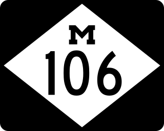
M-106 is a state trunkline highway in the Lower Peninsula of the US state of Michigan in and near the city of Jackson. M-106 travels in a southwest-to-northeast direction from Jackson to Gregory at a junction with M-36 just a few miles northwest of Hell. The highway was first designated in 1928 running north out of downtown Jackson. It connected U.S. Highway 12 (US 12) to the state prison and Bunkerhill Road. A pair of changes in the early 1930s resulted in the extension eastward to Gregory. From the 1960s until the early years of the 21st century, a section of M-106 in downtown Jackson was routed along one-way streets.

M-121 is a state trunkline highway in West Michigan. The highway follows Chicago Drive, a local roadway, from Zeeland to Grandville. Chicago Drive itself runs past the M-121 segment on either side from Holland to Wyoming. The roadway passes through rural farmland on a route that runs parallel to Interstate 196 (I-196). M-121 forms the main street through the center of Hudsonville as it runs southwest–northeast. It forms a major street through the unincorporated community of Jenison before M-121 terminates at I-196 in Grandville.

There are currently eight business routes of Interstate 94 (I-94) in the US state of Michigan. These business routes connect I-94 to the downtown business districts of neighboring cities. Seven of the eight routes are business loops which bear the Business Loop I-94 designation while one is a business spur that bears the Business Spur I-94. These loops are former routings of I-94's two predecessors in Michigan: US Highway 12 (US 12) or US 25. The westernmost BL I-94 runs through the twin cities of Benton Harbor and St. Joseph along the former routing of US 12 and US 31/US 33 that now includes a section of the Lake Michigan Circle Tour in the state. The loops in Kalamazoo, Battle Creek, Marshall, Albion, and Jackson were also formerly segments of US 12 which were later designated as separate version of Business US Highway 12 through their respective cities before becoming BL I-94s in 1960. The BL I-94 in Kalamazoo was converted into BS I-94 in 2019. The route of the business loop through Ann Arbor was previously US 12 and then later M-14 before receiving its current moniker. The BL I-94 through Port Huron was previously US 25 and then Business US Highway 25.


