M-20 (Michigan highway)

Last updated

M-20.svg

M-20

M-20 (Michigan highway)
M-20 highlighted in red
Route information
Maintained by MDOT
Length132.435 mi [1]  (213.133 km)
ExistedNovember 11, 1926 [2] –present
Major junctions
West endUS 31.svg US 31 near New Era
Major intersections
East endUS 10.svgBusiness plate.svg
US 10.svg
US 10  / Bus. US 10 in Midland
Location
Country United States
State Michigan
Counties Oceana, Newaygo, Mecosta, Isabella, Midland, Bay
Highway system
M-19.svg M-19 M-21.svg M-21
M-212 rectangle.svg M-212 M-213M-214 1948.svg M-214
County B-86.svg B-86 B-88County B-96.svg B-96

M-20 is a state trunkline highway in the US state of Michigan that runs from New Era to Midland. It crosses through rural Lower Peninsula forest land between the two ends. The highway serves the college towns of Big Rapids and Mt. Pleasant, home of the main campuses of Ferris State University and Central Michigan University, both located near the trunkline.

Contents

The original July 1919 routing took M-20 farther north along a corridor now used by US Highway 10 (US 10). The M-20 designation was shifted south to the current corridor in 1926. The eastern end was truncated from Bay City to Midland in 1960, following the opening of a freeway between the two cities. The western end was rerouted from Muskegon to New Era in 1969.

Route description

M-20 starts near Lake Michigan at the US 31 freeway in New Era where it runs east through the Manistee National Forest, crossing the North Branch of the White River near Ferry and the South Branch near Hesperia on the way to White Cloud. [3] There it turns south along M-37 and then east along a new routing following Baseline and Newcosta roads north of the Hardy Dam to meet the US 131 freeway at exit 131 near Stanwood. M-20 turns north, running concurrently along the US 131 freeway to Big Rapids and joins Business US 131 (Bus. US 131) at exit 139. [3] [4] The section along the freeway is listed on the National Highway System (NHS), a system of highways important to the nation's economy, defense and mobility. [5] Together Bus. US 131/M-20 runs along the Perry Street commercial corridor to State Street near the main campus of Ferris State University. The business loop turns north by the campus and at Maple Street, M-20 turns eastward to cross the Muskegon River in downtown Big Rapids, north of the campus. M-20 zig-zags southeast of town bypassing the Canadian Lakes area and turns due east through rural Remus in Mecosta County and the Isabella Indian Reservation in neighboring Isabella County. [3] [4]

M-20 in Wheatland Township, Mecosta County, looking east M 20 east of Remus.jpg
M-20 in Wheatland Township, Mecosta County, looking east

In Mt. Pleasant, M-20 runs near the campus of Central Michigan University crossing the Chippewa River, and the trunkline joins Bus. US 127 along the Mission Street business area to Pickard Road. The highway turns east on Pickard and passes under the US 127 freeway near the Soaring Eagle Casino. From Mt. Pleasant to Midland, M-20 is designed as a four–lane highway with a continuous center turn lane passing through rural forest land. [3] [4] M-20 picks up inclusion on the NHS from this point east. [5]

M-20 about to enter Homer Township just west of Midland M 20 homer township.jpg
M-20 about to enter Homer Township just west of Midland

Once M-20 reaches Midland on Jerome Street, it crosses the Tittabawassee River north of the Tridge, a three-legged bridge over the confluence of the Tittabawassee and Chippewa rivers. There it joins Business US 10 (Bus. US 10) on a pair of one-way streets: Indian Street (westbound) and Buttles Street (eastbound). The two streets pass by Dow Diamond, home to the Great Lakes Loons, the city's minor league baseball team. Bus. US 10/M-20 then passes some Dow Chemical Company buildings and curves into a freeway stub connecting with the US 10 freeway on the east side of town. This short section of business loop freeway has two interchanges before terminating at one final interchange. At this junction, both Bus. US 10 and M-20 have a common eastern terminus. Traffic headed eastbound on the business loop defaults onto eastbound US 10, and traffic destined for the business loop is fed from the westbound direction of the freeway only. [3] [4]

The Tridge in downtown Midland Tridge-Midland-MI.jpg
The Tridge in downtown Midland

History

Previous designation

On July 1, 1919, M-20 was routed from Ludington to Bay City, Michigan by way of Reed City and Clare. [6] This routing was redesignated as US 10 on November 11, 1926. [7] M-20 would be moved to a new routing. [2]

Current designation

The M-20 designation was moved to a new alignment, roughly today's current routing from Midland through Mt. Pleasant, Big Rapids and White Cloud continuing to Muskegon. [2] The western terminus was extended to end at Muskegon State Park in 1932. [8] [9] The last paving would be completed along M-20 in 1957 in Newaygo County. [10] [11]

M-213 1948.svg

M-213

Location MuskegonMuskegon State Park
Existed1961 [12] –1970 [13] [14]

The eastern end of M-20 was converted to freeway between Midland and Bay City in 1958. The former alignment along Midland Road, from Midland, going through Auburn, and ending at Euclid Avenue in Bay City, at the junction of what was then US 23, was returned to local control at the time. [11] [15] US 10 was rerouted along this freeway section and the Interstate 75/US 23 freeway in 1960. M-20 was truncated back to Midland with the US 10 rerouting. [16] The west end was rerouted through Muskegon to end at US 16 in 1961. [12] The former routing connecting to Muskegon State Park became a new state route designated M-213. M-213 was ultimately removed from the trunkline system in 1970. [13] [14] M-20 was completely rerouted on the west end in 1969 from White Cloud replacing M-82 to US 31 in New Era. [13] [17]

County B-88.svg

B-88

Location White CloudStanwood
Length15.416 mi [1]  (24.810 km)
Existed1984 [18] [19] –1998 [20]

The Michigan Department of Transportation (MDOT) swapped jurisdiction of M-20 and B-88 with Mecosta and Newaygo counties. The swap was finalized on October 1, 1998. [20] M-20 was rerouted south from Big Rapids, along US 131 from exit 139 to exit 131 at Stanwood. There M-20 replaced B-88 westward to M-37. [21]

Major intersections

All exits are unnumbered.

CountyLocationmi [1] kmDestinationsNotes
Oceana Shelby Township 0.0000.000US 31.svgLake Michigan Circle Tour.svg US 31  / LMCT  Muskegon, Ludington
Stony Lake Road
Exit 140 on US 31; roadway continues west as Stony Lake Road
OceanaNewaygo
county line
Hesperia 18.21929.321South plate.svg
M-120 rectangle.svg
M-120 south Muskegon
M-120 runs along the county line; northern terminus of M-120
Newaygo Wilcox Township 31.67650.978North plate.svg
M-37.svg
M-37 north Baldwin, Traverse City
Northern end of M-37 concurrency
White Cloud 32.94853.025South plate.svg
M-37.svg
M-37 south Newaygo, Grand Rapids
Southern end of M-37 concurrency
Mecosta Mecosta Township 48.36477.834South plate.svg
US 131.svg
US 131 south Grand Rapids
Southern end of US 131 concurrency; exit 131 on US 131
Big Rapids Township 55.81489.824North plate.svg
US 131.svg
US 131 north Cadillac
North plate.svg
Business plate.svg
US 131.svg
Bus. US 131 north (Perry Street) Big Rapids
Northern end of US 131 concurrency; western end of Bus. US 131 concurrency; exit 138 on US 131
Big Rapids 58.41994.016North plate.svg
Business plate.svg
US 131.svg
Bus. US 131 north (Michigan Avenue)
Eastern end of Bus. US 131 concurrency
Remus 81.814131.667M-66.svg M-66  Lake City, Ionia
Isabella Mt. Pleasant 100.767162.169South plate.svg
Business plate.svg
US 127.svg
Bus. US 127 south (Mission Street)
Southern end of Bus. US 127 concurrency
101.776163.793North plate.svg
Business plate.svg
US 127.svg
Bus. US 127 north (Mission Street)
Northern end of Bus. US 127 concurrency
Union Township 103.244166.155US 127.svg US 127  Clare, Lansing Exit 143 on US 127
Midland HomerLee township line121.781195.988M-30.svg M-30 (Meridian Road) West Branch
Midland 128.088206.138West plate.svg
Business plate.svg
US 10.svg
Bus. US 10 west
Western terminus of Bus. US 10 concurency
129.830208.941Western end of freeway
130.101209.377Saginaw RoadInterchange; eastbound exit and westbound entrance via roundabout with Patrick Road
131.272211.262Waldo RoadInterchange; westbound exit and eastbound entrance
Bay 132.435213.133West plate.svg
Business plate.svg
US 10.svg
Bus. US 10 west
East plate.svg
US 10.svg
US 10 east Bay City
Eastern terminus of Bus. US 10 and M-20; eastbound exit and westbound entrance
1.000 mi = 1.609 km; 1.000 km = 0.621 mi

See also

Related Research Articles

<span class="mw-page-title-main">M-66 (Michigan highway)</span> State highway in Michigan, United States

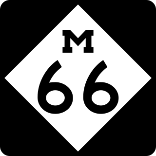
M-66 is a north–south state trunkline highway on the Lower Peninsula of the US state of Michigan. It runs from the Indiana state line in the south to Charlevoix in the north. M-66 is the only state highway to run the north–south distance of the Lower Peninsula. It starts as a continuation of State Road 9 (SR 9), which provides access to the Indiana Toll Road. The total length is approximately 272.9 miles (439.2 km), which includes almost 3.4 miles (5.5 km) of freeway between Interstate 94 (I-94) and downtown Battle Creek designated as I-194. A section of the highway immediately south of I-94 is an expressway, a type of divided limited-access highway, while the section along I-194 is a full freeway; otherwise M-66 is a two-lane rural highway. Two sections are listed on the National Highway System.

<span class="mw-page-title-main">M-78 (Michigan highway)</span> State highway in Michigan, United States

M-78 is a state trunkline highway in the US state of Michigan. The western terminus is the intersection with M-66 north of Battle Creek in Pennfield Township. The roadway runs 10.744 miles (17.291 km) through rural farmland and the community of Bellevue as it approaches its eastern terminus at an interchange with Interstate 69 (I-69) near Olivet. The highway is used by between 3,100 and 5,300 vehicles on a daily basis.

<span class="mw-page-title-main">M-89 (Michigan highway)</span> State highway in Michigan, United States

M-89 is an east–west state trunkline highway in the US state of Michigan that runs from near Ganges to Battle Creek. M-89 starts at an interchange with Interstate 196/US Highway 31 (I-196/US 31) and passes through Allegan, Kalamazoo County, Michigan, and Calhoun counties. The highway also briefly crosses the southwest corner of Barry County before it terminates an at intersection with Business Loop I-94 on the northwestern side of downtown Battle Creek. In between the trunkline runs parallel to the Kalamazoo River through rural southwestern Michigan farmlands while also running through the middle of several smaller towns in the area.

<span class="mw-page-title-main">M-21 (Michigan highway)</span> State highway in Michigan, United States

M-21 is an east–west state trunkline highway in the US state of Michigan connecting the cities of Grand Rapids and Flint. The highway passes through rural farming country and several small towns along its course through the Lower Peninsula. Following the course of a handful of rivers, M-21 also connects some of the state's freeways like Interstate 96 (I-96), US Highway 127 (US 127) and I-75. The highway is used by between 1,700 and 36,000 vehicles daily.

<span class="mw-page-title-main">Interstate 196</span> Interstate Highway in Michigan

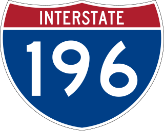
Interstate 196 (I-196) is an auxiliary Interstate Highway that runs for 80.6 miles (129.7 km) in the US state of Michigan. It is a state trunkline highway that links Benton Harbor, South Haven, Holland, and Grand Rapids. In Kent, Ottawa, and Allegan counties, I-196 is known as the Gerald R. Ford Freeway, or simply the Ford Freeway, after President Gerald Ford, who was raised in Grand Rapids and served Michigan in the House of Representatives for 25 years. This name generally refers only to the section between Holland and Grand Rapids. I-196 changes direction; it is signed as a north–south highway from its southern terminus to the junction with US Highway 31 (US 31) just south of Holland, and as an east–west trunkline from this point to its eastern terminus at an interchange with I-96, its parent highway. There are three business routes related to the main freeway. There are two business loops and one business spur that serve South Haven, Holland and the Grand Rapids areas. Another business spur for Muskegon had been designated relative to the I-196 number.
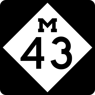
<span class="mw-page-title-main">M-46 (Michigan highway)</span> State highway in Michigan, United States

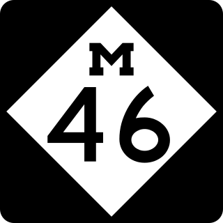
M-46 is an east–west state trunkline highway in the US state of Michigan between Muskegon and Port Sanilac, terminating near Lake Michigan and Lake Huron on each end. Except for the north–south segment that corresponds with the US Highway 131 (US 131) freeway between Cedar Springs and Howard City, M-46 is practically a due east–west surface highway. The road runs through rural sections of the Lower Peninsula connecting several freeways including US 31, US 131, US 127 and Interstate 75 (I-75).

<span class="mw-page-title-main">M-120 (Michigan highway)</span> State highway in Michigan, United States

M-120 is a state trunkline highway in the US state of Michigan in the southwest Lower Peninsula. The highway runs northeast from Muskegon to Hesperia. In between, the road passes through suburban Muskegon, forests and farmland. Some 5,900–26,000 vehicles use the highway each day on average as it runs long a series of roads that follow county lines in the area.

<span class="mw-page-title-main">M-47 (Michigan highway)</span> State highway in Saginaw and Bay counties in Michigan, United States

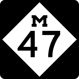
M-47 is a north–south state trunkline highway in the US state of Michigan. It runs near Saginaw and Midland in the Tri-Cities area of the Lower Peninsula. The highway runs through suburban and agricultural areas to connect the two cities with the airport in the area. The northernmost section of M-47 runs along a freeway to the terminus at US Highway 10 (US 10). M-47 runs for 14.328 miles (23.059 km), all of which has been listed as a part of the National Highway System.

<span class="mw-page-title-main">M-91 (Michigan highway)</span> State highway in Ionia and Montcalm counties in Michigan, United States

M-91 is a largely north–south state trunkline highway in the Lower Peninsula of the US state of Michigan. It runs from Belding to south of Lakeview. Its 24-mile (39 km) length exists entirely within Ionia and Montcalm counties. It is all undivided surface route. Aside from the two Michigan state highways that are its termini, it has only one other intersection with any Michigan state highway, and that is with M-57 in Greenville.

<span class="mw-page-title-main">M-55 (Michigan highway)</span> State highway in Michigan, United States

M-55 is a state trunkline highway in the northern part of the US state of Michigan. M-55 is one of only three state highways that extend across the Lower Peninsula from Lake Huron to Lake Michigan; the others are M-46 and M-72. The highway crosses through rural forest and farmlands to connect Manistee with Tawas City. M-55 crosses two of the major rivers in the state. Two sections of the highway follow along freeways near Cadillac and West Branch. Running for 150.944 miles (242.921 km) through the state, M-55 is maintained by the Michigan Department of Transportation (MDOT).

<span class="mw-page-title-main">M-18 (Michigan highway)</span> State highway in Michigan, United States

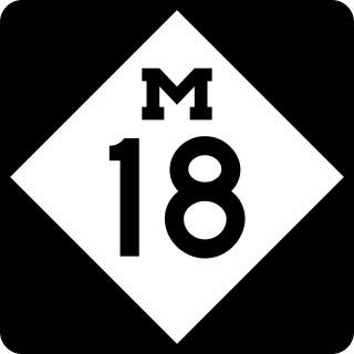
M-18 is a north–south state trunkline highway in the Lower Peninsula of the US state of Michigan. It runs for 77.530 miles (124.772 km) through the central region of the state connecting US Highway 10 (US 10) near North Bradley with M-72 in rural Crawford County near the community of Luzerne. In between, the roadway connects several smaller communities while running through woodlands in both state and national forest areas. Two segments of M-18 run along sections of county boundaries, and one part of the highway forms a component of the business loop for the village of Roscommon.

<span class="mw-page-title-main">M-82 (Michigan highway)</span> State highway in Newaygo and Montcalm counties in Michigan, United States

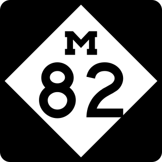
M-82 is a state trunkline in the Lower Peninsula in the US state of Michigan that travels between Fremont and Howard City. The section between Newaygo and Howard City travels through Fremont and along the southern edge of Manistee National Forest. The current version of M-82 is actually the second in the state; the first usage appeared in the Upper Peninsula by 1919. The Lower Peninsula routing has been in use since the 1920s. Various extensions and truncations have shifted the terminus as far west as New Era or Hesperia in the past. The current route was finalized in the late 1970s

<span class="mw-page-title-main">Business routes of U.S. Route 10 in Michigan</span> Routes of a highway in Michigan

There are three business routes of US Highway 10 (US 10) in the state of Michigan. They serve as connections from the main highway into Reed City, Clare, and Midland. Additionally, there were another two business routes that connected US 10 to the downtowns of Flint and Pontiac. All these business routes are, or were, former sections of US 10 that were marked Business US Highway 10 after the main highway was realigned to bypass the downtowns of the cities.

<span class="mw-page-title-main">Business routes of U.S. Route 131</span> Routes of a highway in Michigan

There are five business routes of US Highway 131 in the state of Michigan, and previously there was one bypass route and an additional business route. All of the business routes are former sections of US Highway 131 (US 131). These former sections of the mainline highway, along with the necessary connecting roads, allow traffic to access the downtowns business districts of cities bypassed by sections of US 131 built since the 1950s. The extant business loops connect to Constantine, Three Rivers, Kalamazoo, Big Rapids, Cadillac, and Manton. The former bypass route in Grand Rapids allowed traffic to bypass that city's downtown at a time when US 131 still ran through the heart of the city, and the later business route connected through downtown while US 131 ran on a freeway bypassing the central business district.

<span class="mw-page-title-main">U.S. Route 10 in Michigan</span> U.S. Highway in Michigan

US Highway 10 (US 10) is a part of the United States Numbered Highway System that runs from West Fargo, North Dakota, to the Lower Peninsula of the US state of Michigan. The highway enters Michigan on SS Badger, which crosses Lake Michigan between Manitowoc, Wisconsin, and Ludington. As the highway crosses the state, it is a two-lane undivided highway between Ludington and Farwell and a freeway from Farwell east to the highway's terminus in Bay City. US 10 runs concurrently with US 127 in the Clare area along a section of freeway that includes a welcome center in the median. Outside of the Clare and Midland areas, US 10 runs through rural areas of West and Central Michigan in a section of the Manistee National Forest as well as farmfields.

<span class="mw-page-title-main">Business routes of U.S. Route 31 in Michigan</span> Routes of a highway in Michigan

There have been seven business routes of US Highway 31 in the state of Michigan. All of the business routes are former sections of US Highway 31 (US 31). They connect the freeway mainline of US 31 to the various downtowns of cities bypassed by US 31. Two of the current business routes, for Hart and Ludington, are business spurs, connecting to US 31 on only one end, while the remainder for Muskegon, Whitehall–Montague and Pentwater, are business loops. The two former routes, for Niles and Holland were a business spur and loop, respectively.

<span class="mw-page-title-main">M-56 (1919–1957 Michigan highway)</span> Former state highway in Michigan

M-56 was a state trunkline highway in the southeastern part of the US state of Michigan. It existed from 1919 until 1957. The highway ran north from Monroe, where it connected with US Highway 24, to Flat Rock where it terminated at an intersection with US 24/US 25. Before a series of truncations in the 1950s, the highway continued along the Huron River to New Boston and Belleville. The trunkline was progressively scaled back to Flat Rock before being decommissioned in 1957.

References

  1. 1 2 3 Michigan Department of Transportation (2021). Next Generation PR Finder (Map). Michigan Department of Transportation. Retrieved October 11, 2021.
  2. 1 2 3 Michigan State Highway Department (December 1, 1926). Official Highway Condition Map (Map). [c. 1:823,680]. Lansing: Michigan State Highway Department.
  3. 1 2 3 4 5 Rand McNally (2008). "Michigan" (Map). The Road Atlas. Chicago: Rand McNally. pp. 50–1. § N4–N10. ISBN   0-528-93981-5.
  4. 1 2 3 4 Michigan Department of Transportation (2010). Uniquely Michigan: Official Department of Transportation Map (Map). c. 1:975,000. Lansing: Michigan Department of Transportation. §§ J7–J11. OCLC   42778335, 639960603.
  5. 1 2 Michigan Department of Transportation (April 23, 2006). National Highway System, Michigan (PDF) (Map). Lansing: Michigan Department of Transportation. Archived from the original (PDF) on October 4, 2012. Retrieved October 7, 2008.
  6. Michigan State Highway Department (July 1, 1919). State of Michigan (Map). Scale not given. Lansing: Michigan State Highway Department. Lower Peninsula sheet. OCLC   15607244 . Retrieved October 17, 2019 via Michigan History Center.
  7. Bureau of Public Roads & American Association of State Highway Officials (November 11, 1926). United States System of Highways Adopted for Uniform Marking by the American Association of State Highway Officials (Map). 1:7,000,000. Washington, DC: United States Geological Survey. OCLC   32889555 . Retrieved November 7, 2013 via Wikimedia Commons.
  8. Michigan State Highway Department & Rand McNally (April 1, 1932). Official Michigan Highway Map (Map). [c. 1:840,000]. Lansing: Michigan State Highway Department. § K7. OCLC   12701053.
  9. Michigan State Highway Department & Rand McNally (October 1, 1932). Official Michigan Highway Map (Map). [c. 1:840,000]. Lansing: Michigan State Highway Department. § K7. OCLC   12701053.
  10. Michigan State Highway Department (April 1, 1957). Official Highway Map (Map). [c. 1:918,720]. Lansing: Michigan State Highway Department. §§ J8–J9. OCLC   12701120 . Retrieved October 17, 2019 via Michigan History Center.
  11. 1 2 Michigan State Highway Department (October 1, 1957). Official Highway Map (Map). [c. 1:918,720]. Lansing: Michigan State Highway Department. §§ J8–J9, J11–J12. OCLC   12701120, 367386492.
  12. 1 2 Michigan State Highway Department (1961). Official Highway Map (Map). [c. 1:918,720]. Lansing: Michigan State Highway Department. §§ J7–J8. OCLC   12701120, 51857665 . Retrieved October 17, 2019 via Michigan History Center. (Includes all changes through July 1, 1961)
  13. 1 2 3 Michigan Department of State Highways (1970). Michigan, Great Lake State: Official Highway Map (Map). c. 1:918,720. Lansing: Michigan Department of State Highways. §§ J7–J8. OCLC   12701120.
  14. 1 2 Michigan Department of State Highways (1971). Michigan, Great Lake State: Official Highway Map (Map). c. 1:918,720. Lansing: Michigan Department of State Highways. §§ J7–J8. OCLC   12701120, 77960415.
  15. Michigan State Highway Department (1958). Official Highway Map (Map). [c. 1:918,720]. Lansing: Michigan State Highway Department. §§ J11–J12. OCLC   12701120, 51856742 . Retrieved October 17, 2019 via Michigan History Center. (Includes all changes through July 1, 1958)
  16. Michigan State Highway Department (1960). Official Highway Map (Map). [c. 1:918,720]. Lansing: Michigan State Highway Department. §§ J7–J8, J11–J12. OCLC   12701120, 81552576 . Retrieved October 17, 2019 via Michigan History Center. (Includes all changes through July 1, 1960)
  17. Michigan Department of State Highways & H.M. Gousha (1969). Michigan, Great Lake State: Official Highway Map (Map). c. 1:918,720. Lansing: Michigan Department of State Highways. §§ J7–J8. OCLC   12701120 . Retrieved October 17, 2019 via Michigan History Center.
  18. Michigan Department of Transportation (1983). Say Yes to Michigan!: Official Transportation Map (Map). c. 1:918,720. Lansing: Michigan Department of Transportation. §§ J8–J9. OCLC   12701177 . Retrieved October 17, 2019 via Michigan History Center.
  19. Michigan Department of Transportation (1985). Yes Michigan: Official Transportation Map (Map). c. 1:918,720. Lansing: Michigan Department of Transportation. §§ J8–J9. OCLC   12701177 . Retrieved October 17, 2019 via Michigan History Center.
  20. 1 2 Truscott, John (September 24, 1998). "MDOT Accepts Responsibility for 120 Miles of Local Roads" (Press release). Michigan Department of Transportation. Archived from the original on February 18, 2005.
  21. Michigan Department of Transportation (1999). Michigan Department of Transportation Map (Map). c. 1:918,720. Lansing: Michigan Department of Transportation. §§ J8–J9. OCLC   42778335, 55974644 . Retrieved October 17, 2019 via Michigan History Center.
Template:Attached KML/M-20 (Michigan highway)
KML is from Wikidata