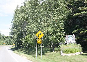
Northport, Michigan

Last updated

Northport, Michigan
Northport Michigan Looking North M-201.jpg
Downtown Northport, along M-201
Northport (village), MI location.png
Location within Leelanau County
USA Michigan location map.svg
Red pog.svg
Northport
Location within the state of Michigan
Coordinates: 45°07′51″N85°37′00″W / 45.13083°N 85.61667°W / 45.13083; -85.61667
Country Flag of the United States.svg United States
State Flag of Michigan.svg  Michigan
County Flag of Leelanau County, Michigan.svg Leelanau
Township Leelanau
Area
[1]
  Total
1.65 sq mi (4.28 km2)
  Land1.65 sq mi (4.27 km2)
  Water0.00 sq mi (0.01 km2)
Elevation
607 ft (185 m)
Population
 (2020)
  Total
496
  Density300.97/sq mi (116.24/km2)
Time zone UTC-5 (Eastern (EST))
  Summer (DST) UTC-4 (EDT)
ZIP code(s)
49670
Area code 231
FIPS code 26-58740 [2]
GNIS feature ID0633697 [3]
Website villageofnorthport.net
Betty L. Mork Administrative Building Northport, MI village hall.jpg
Betty L. Mork Administrative Building

Northport is a village in Leelanau County in the U.S. state of Michigan. Located near the northern tip of the Leelanau Peninsula, Northport is located within Leelanau Township, and lies on the shore of Grand Traverse Bay, a bay of Lake Michigan. Northport had a population of 496 at the 2020 census. The village is located about 29 miles (47 km) north of Traverse City, and is part of that city's metropolitan area. From 1863 to 1883, Northport served as the county seat of Leelanau County.

Contents

History

In 1848 Michigan suffered from a smallpox epidemic that affected the entire community of people. Chief Peter Waukazoo and Reverend George Smith moved the community as well as the Holland-area [4] Ottawa Mission up to the Leelanau Peninsula on boats or canoes. When the settlers had reached their destination they called it Waukazooville. Deacon Joseph Dame arrived at Waukazooville in 1854 and decided to change the name to Northport at this time. [5]

Northport was the largest town in Leelanau County for quite a while in the late 1800s and early 1900s. Several general stores were built in the town in 1859 which sold items such as cloth, thread, needles, foods, axes, and more. There was no doctor in town at this time so Reverend Smith was called on to deliver babies and help the ill. [5]

Many people that ended up living in Northport came from New York or Canada. The fishermen, farmers, and other community members would gather on the bay and cut chunks of ice for fisheries, hotels, or even private homes. [5]

The cherry industry that is prevalent in Northport today had just begun in 1853 on Reverend Smith's farm. Farmers began producing cherries so much within those first few years that cherries were being shipped to nearby cities for their markets. The cherry industry in Northport and Leelanau County remains one of the largest in the world.

Geography

According to the United States Census Bureau, the village has a total area of 1.65 square miles (4.27 km2), all land. [6]

Major highways

Climate

This climatic region has large seasonal temperature differences, with warm to hot (and often humid) summers and cold (sometimes severely cold) winters. According to the Köppen Climate Classification system, Northport has a humid continental climate, abbreviated "Dfb" on climate maps. [7]

Climate data for Northport, Michigan
MonthJanFebMarAprMayJunJulAugSepOctNovDecYear
Mean daily maximum °C (°F)−2.0
(28.4)
−1.1
(30.1)
3.4
(38.2)
10.3
(50.6)
16.1
(60.9)
21.3
(70.4)
24.0
(75.2)
23.8
(74.8)
20
(68)
13
(56)
6.5
(43.7)
0.4
(32.8)
11.4
(52.5)
Mean daily minimum °C (°F)−8
(17)
−9
(16)
−5.7
(21.8)
0.3
(32.5)
5.4
(41.7)
11.0
(51.8)
14.8
(58.6)
14.6
(58.3)
11.1
(51.9)
5.2
(41.3)
−0.5
(31.1)
−5.2
(22.6)
2.9
(37.2)
Average precipitation mm (inches)56
(2.2)
36
(1.4)
48
(1.9)
69
(2.7)
66
(2.6)
74
(2.9)
74
(2.9)
81
(3.2)
97
(3.8)
91
(3.6)
71
(2.8)
58
(2.3)
820
(32.3)
Source: Weatherbase [8]

Demographics

Historical population
CensusPop.Note
1860 393
1870 238−39.4%
1880 198−16.8%
1890 30453.5%
1910 524
1920 507−3.2%
1930 57713.8%
1940 6065.0%
1950 582−4.0%
1960 530−8.9%
1970 59412.1%
1980 6112.9%
1990 605−1.0%
2000 6487.1%
2010 526−18.8%
2020 496−5.7%
U.S. Decennial Census [9]

2010 census

As of the census [10] of 2010, there were 526 people, 251 households, and 147 families residing in the village. The population density was 318.8 inhabitants per square mile (123.1/km2). There were 405 housing units at an average density of 245.5 per square mile (94.8/km2). The racial makeup of the village was 93.2% White, 0.6% African American, 2.5% Native American, 0.2% Asian, 0.4% from other races, and 3.2% from two or more races. Hispanic or Latino of any race were 6.1% of the population.

There were 251 households, of which 15.9% had children under the age of 18 living with them, 48.2% were married couples living together, 8.0% had a female householder with no husband present, 2.4% had a male householder with no wife present, and 41.4% were non-families. 37.5% of all households were made up of individuals, and 19.9% had someone living alone who was 65 years of age or older. The average household size was 2.10 and the average family size was 2.63.

The median age in the village was 57.5 years. 14.4% of residents were under the age of 18; 6.6% were between the ages of 18 and 24; 13.5% were from 25 to 44; 29.4% were from 45 to 64; and 36.1% were 65 years of age or older. The gender makeup of the village was 46.4% male and 53.6% female.

2000 census

As of the census [2] of 2000, there were 648 people, 272 households, and 174 families residing in the village. The population density was 389.7 inhabitants per square mile (150.5/km2). There were 391 housing units at an average density of 235.1 per square mile (90.8/km2). The racial makeup of the village was 96.14% White, 0.31% African American, 2.16% Native American, 0.31% Asian, 0.31% from other races, and 0.77% from two or more races. Hispanic or Latino of any race were 3.55% of the population.

There were 272 households, out of which 21.7% had children under the age of 18 living with them, 52.2% were married couples living together, 9.2% had a female householder with no husband present, and 35.7% were non-families. 32.4% of all households were made up of individuals, and 15.1% had someone living alone who was 65 years of age or older. The average household size was 2.18 and the average family size was 2.69.

In the village, the population was spread out, with 18.4% under the age of 18, 4.2% from 18 to 24, 17.4% from 25 to 44, 28.7% from 45 to 64, and 31.3% who were 65 years of age or older. The median age was 50 years. For every 100 females, there were 86.7 males. For every 100 females age 18 and over, there were 83.0 males.

The median income for a household in the village was $40,368, and the median income for a family was $48,750. Males had a median income of $31,042 versus $26,786 for females. The per capita income for the village was $23,786. Roughly 6.7% of families and 9.1% of the population were below the poverty line, including 15.0% of those under age 18 and 3.9% of those age 65 or over.

Local attractions

Events

Places

Education

Notable residents

References

  1. "2020 U.S. Gazetteer Files". United States Census Bureau. Retrieved May 21, 2022.
  2. 1 2 "U.S. Census website". United States Census Bureau . Retrieved January 31, 2008.
  3. "US Board on Geographic Names". United States Geological Survey. October 25, 2007. Retrieved January 31, 2008.
  4. www.grcmc.org, Grand Rapids Community Media Center-. "Ottawa Band Seasonal Travel Map". History Grand Rapids.
  5. 1 2 3 The Leelanau Township Historical Writers Group (1995). A History of Leelanau Township. Leelanau County: Friends of Leelanau Township Library. p. 288.
  6. "US Gazetteer files 2010". United States Census Bureau. Archived from the original on July 2, 2012. Retrieved November 25, 2012.
  7. "Northport, Michigan Travel Weather Averages (Weatherbase)". Weatherbase. Retrieved March 14, 2023.
  8. "Weatherbase.com". Weatherbase. 2023. Retrieved on March 13, 2023.
  9. "Census of Population and Housing". Census.gov. Retrieved June 4, 2015.
  10. "U.S. Census website". United States Census Bureau . Retrieved November 25, 2012.
  11. Stevens, William (February 23, 2006). "Northport Winter Carnival". Absolute Michigan. Retrieved May 14, 2012.
  12. "Anglers gear up for Scott Brow Fish Derby". Leelanau Enterprise. April 28, 2016. Retrieved November 29, 2017.
  13. "Northport's Fly-In, Drive-In Pancake Breakfast". Pure Michigan (Michigan Economic Development Corporation). 2012. Retrieved May 14, 2012.
  14. Lopez, Joe (January 3, 2011). ""Cars in the Park" car show". Michigan Classics. Retrieved May 14, 2012.
  15. "Miles For Mammograms". Zonta Club of Leelanau County. Retrieved May 18, 2012.
  16. "Grand Traverse Lighthouse". 2012. Retrieved May 14, 2012.
  17. "Leelanau State Park". Michigan Department of Resources. Retrieved May 14, 2012.
  18. "Braman Hill Recreation Area, Leelanau Township". Leelanau County Board of Commissioners. October 11, 2010. Retrieved May 14, 2012.
  19. Gaukel, Nicole (June 17, 2019). "Page Not Found". Michigan.{{cite web}}: Cite uses generic title (help)
  20. 1 2 3 Leelanau Visitors Guide 2011 Archived May 3, 2012, at the Wayback Machine .
  21. Conlin, Jennifer. "For Mario Batali, It's Molto Michigan". The New York Times . August 17, 2007.
  22. "Leelanau Enterprise 17 November 1977 — Digital Michigan Newspapers Collection". digmichnews.cmich.edu. Retrieved March 14, 2023.
  23. CHASEdchase@record-eagle.com, DENNIS. "Olympian back to defend M-22 title". Traverse City Record-Eagle. Retrieved March 14, 2023.
  24. Ahmed, Azam. "New Investment Strategy: Preparing for End Times". The New York Times . June 29, 2011.

Further reading