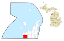
Leelanau County is a county located in the U.S. state of Michigan. As of the 2020 census, the population was 22,301. Since 2008, the county seat has been located within Suttons Bay Township, one mile east of the unincorporated village of Lake Leelanau. Before 2008, Leelanau County's seat was Leland. Leelanau County is included in the Traverse City Micropolitan Statistical Area of Northern Michigan. The largest settlement in Leelanau County by population is Greilickville, itself a suburb of Traverse City.
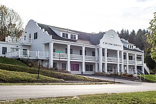
Benzie County is a county in the U.S. state of Michigan. As of the 2020 census, the population was 17,970. The county seat is Beulah. The county was initially set off in 1863 and organized in 1869. At 321 square miles (830 km2), Benzie County is the smallest of the 83 counties in Michigan in terms of land area.

Blaine Township is a civil township of Benzie County in the U.S. state of Michigan. As of the 2020 census, the township population was 484. It is located in the southwest portion of the county. There are no significant population centers in the township; the nearest towns are Arcadia to the south, Benzonia to the northeast, and Elberta to the northwest. M-22 is the township's main thoroughfare.

Lake Township is a civil township of Benzie County in the U.S. state of Michigan. The population was 694 at the 2020 census. The township is irregularly shaped, following the shore of Lake Michigan from Crystal Lake north to the border with Leelanau County. A portion of the Sleeping Bear Dunes National Lakeshore is located in the northern end of the township.

Long Lake Township, officially the Charter Township of Long Lake, is a charter township of Grand Traverse County in the U.S. state of Michigan. The population was 9,956 at the 2020 census, an increase from 8,662 at the 2010 census.
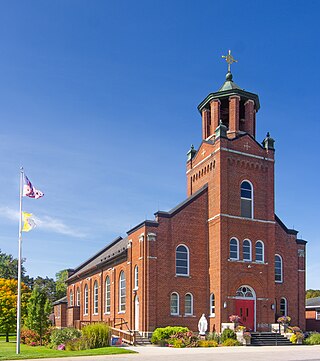
Centerville Township is a civil township of Leelanau County in the U.S. state of Michigan. The population was 1,243 at the 2020 census. The township is bounded to the east by Lake Leelanau.

Cleveland Township is a civil township of Leelanau County in the U.S. state of Michigan. The population of Cleveland Township was 1,103 at the 2020 census. Part of the township is located within Sleeping Bear Dunes National Lakeshore.

Elmwood Township is a charter township of Leelanau County in the U.S. state of Michigan. The population was 4,892 at the 2020 census, making it the largest township in Leelanau County by population. The southeasternmost township of Leelanau County, Elmwood Township is suburbanized, as it is immediately adjacent Traverse City, the largest city in Northern Michigan.

Empire is a village on Lake Michigan in the northwestern Lower Peninsula of Michigan. Located in southwestern Leelanau County, its population was 362 at the 2020 census. The village is located within Empire Township, and is famous for its proximity to the Sleeping Bear Dunes National Lakeshore. Empire is home to the lakeshore's headquarters, the Philip A. Hart Visitor Center.
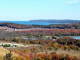
Glen Arbor Township is a civil township of Leelanau County in the U.S. state of Michigan. The population was 757 at the 2020 census. However, the population of the town expands rapidly during the summer months as a result of it being a summer colony.
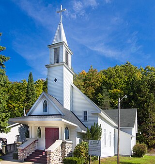
Kasson Township is a civil township of Leelanau County in the U.S. state of Michigan. The population was 1,647 as of the 2020 census. A small portion of the township is included in the Sleeping Bear Dunes National Lakeshore.
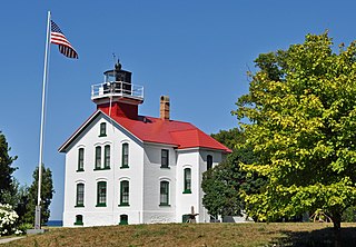
Leelanau Township is a civil township of Leelanau County in the U.S. state of Michigan. At the northern tip of the Leelanau Peninsula, Leelanau Township is part of Northern Michigan, and is home to the village of Northport. Leelanau Township also includes the Fox Islands, as well as mainland shorelines on both Lake Michigan and Grand Traverse Bay. The township population was 1,552 at the 2020 census.

Leland Township is a civil township of Leelanau County in the U.S. state of Michigan. As of the early 2000s, the unincorporated community of Leland, which lies totally within the township, was the county seat of Leelanau County. However, county voters on August 3, 2004, approved a proposal to build a new governmental center in adjacent Suttons Bay Township; the move to the new facility was completed in 2008. As of the 2020 census, Leland Township population was 2,126.

Sleeping Bear Dunes National Lakeshore is a U.S. national lakeshore in the northwestern Lower Peninsula of Michigan. Located within Benzie and Leelanau counties, the park extends along a 35-mile (56 km) stretch of Lake Michigan's eastern coastline, as well as North and South Manitou islands, preserving a total of 71,199 acres. The park is known for its outstanding natural features, including dune formations, forests, beaches, and ancient glacial phenomena. The lakeshore also contains many cultural features, including the 1871 South Manitou Island Lighthouse, three former stations of the Coast Guard, and an extensive rural historic farm district.
The Leelanau Peninsula is a peninsula of the U.S. state of Michigan that extends about 30 miles (50 km) from the western side of the Lower Peninsula of Michigan into Lake Michigan, forming Grand Traverse Bay. It is often referred to as the "little finger" of the mitten-shaped lower peninsula. The peninsula is a tourist hotspot, especially due to the popularity of Sleeping Bear Dunes National Lakeshore, which adorns the southwestern coast of the peninsula. The peninsula is also largely agricultural, and is a production hotspot for cherries and wine.

Glen Arbor is an unincorporated community and census-designated place in Glen Arbor Township, Leelanau County, Michigan, United States. A small tourist town, Glen Arbor lies on an isthmus between Lake Michigan and Glen Lake. It is adjacent to Sleeping Bear Dunes National Lakeshore.

Glen Lake is a lake located in Northern Michigan. Located in the southwestern Leelanau Peninsula, the lake is directly adjacent to Sleeping Bear Dunes National Lakeshore, and is, at its closest, about 0.94 miles (1.51 km) from Lake Michigan. The lake consists of two large bodies of water connected by a narrow channel, which is traversed by a causeway carrying the famous highway M-22. The body of water on the west of this causeway, which is far shallower and more elongated, is known as Little Glen Lake, and the body of water east of the causeway, which is nearly perfectly round and deeper, is known as Big Glen Lake.

Glen Haven is a restored port village on the shore of Lake Michigan on the Leelanau Peninsula within the now Sleeping Bear Dunes National Lakeshore. Attractions include the Lake Michigan beach, a restored General Store and Blacksmith Shop. The unincorporated community is located in Glen Arbor Township.
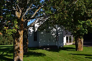
Bingham Township is a civil township of Leelanau County in the U.S. state of Michigan. As of the 2020 census, the township population was 2,577. The township is named for Kinsley S. Bingham, a U.S. Representative, U.S. Senator, and Governor of Michigan.

Solon Township is a civil township of Leelanau County in the U.S. state of Michigan. The population was 1,562 at the 2020 census. Solon Township is home to the community of Cedar.

