
M-78 is a state trunkline highway in the US state of Michigan. The western terminus is the intersection with M-66 north of Battle Creek in Pennfield Township. The roadway runs 10.744 miles (17.291 km) through rural farmland and the community of Bellevue as it approaches its eastern terminus at an interchange with Interstate 69 (I-69) near Olivet. The highway is used by between 3,100 and 5,300 vehicles on a daily basis.
M-40 is a north–south state trunkline highway in the Lower Peninsula of the US state of Michigan. The highway runs from US Highway 12 (US 12) near the Indiana state line in Porter Township north through Paw Paw and Allegan to end in the outskirts of Holland. The current northern end is near Interstate 196 (I-196) at an intersection with US 31/Business Loop I-196 (BL 196). In between, M-40 runs through mixed agricultural and forest lands and along lakes and rivers through Southwest Michigan.

M-79 is an east–west state trunkline highway in the central portion of Lower Peninsula of the U.S. state of Michigan. The western terminus is about three miles (4.8 km) southeast of Hastings at the junction with M-37 and the eastern terminus is in downtown Charlotte at the junction with M-50 and Business Loop Interstate 69 (BL I-69). It passes through Quimby and Nashville, where there is a junction with M-66. The entire highway is undivided surface road. It has no direct access with Interstate 69 (I-69), although a sign for the highway is located on southbound I-69 at exit 61.

M-13 is a 73.339-mile (118.028 km) north–south state trunkline highway that runs through the Saginaw Bay region of the US state of Michigan. It runs from Interstate 69 (I-69) south of Lennon to US Highway 23 (US 23) near Standish. The southern section of the trunkline runs along a pair of county lines in a rural area dominated by farm fields. The highway directly connects the downtown areas of both Saginaw and Bay City. North of the latter city, the Lake Huron Circle Tour follows M-13 along the Saginaw Bay.
M-108 was a state trunkline highway in the US state of Michigan. The highway followed Nicolet Street, although some maps also labeled it as Mackinaw Highway. The road was on the boundary between Emmet and Cheboygan counties.

M-76 is a former state trunkline highway designation in the Lower Peninsula of the US state of Michigan. The highway's designation was decommissioned when the last section of it was converted to freeway as a part of the present-day Interstate 75 (I-75). At that time, M-76 extended from US Highway 23 (US 23) near Standish northwesterly to I-75 south of Grayling. Two sections of the route followed freeways with a two-lane highway in between to connect them. The former routing of M-76 through West Branch before that city was bypassed was initially redesignated Business M-76. The highway itself ran through mixed fields and forests bypassing several other towns in the region.
M-33 is a north–south state trunkline highway in the US state of Michigan that runs from Interstate 75 (I-75) at Alger in Arenac County north to M-27 near Cheboygan. In between, the trunkline runs through rural sections of the northeastern Lower Peninsula including state and national forest areas. M-33 connects to a handful of parks and crosses several of the rivers in that section of the state. It runs concurrently with three other state highways, sharing pavement to connect through several small communities of Northern Michigan.

M-91 is a largely north–south state trunkline highway in the Lower Peninsula of the US state of Michigan. It runs from Belding to south of Lakeview. Its 24-mile (39 km) length exists entirely within Ionia and Montcalm counties. It is all undivided surface route. Aside from the two Michigan state highways that are its termini, it has only one other intersection with any Michigan state highway, and that is with M-57 in Greenville.

M-57 is an east–west state trunkline highway in the US state of Michigan. The 105.377-mile (169.588 km) highway connects US Highway 131 (US 131) near Rockford on the west end to M-15 near Otisville in the Lower Peninsula. In between, the mostly rural highway passes through farmland and connects several highways and smaller towns together. Three of these highways are freeways: US 131, US 127 and Interstate 75 (I-75). Along the way, between 3,700 and 22,300 vehicles use the highway daily.

M-55 is a state trunkline highway in the northern part of the US state of Michigan. M-55 is one of only three state highways that extend across the Lower Peninsula from Lake Huron to Lake Michigan; the others are M-46 and M-72. The highway crosses through rural forest and farmlands to connect Manistee with Tawas City. M-55 crosses two of the major rivers in the state. Two sections of the highway follow along freeways near Cadillac and West Branch. Running for 150.944 miles (242.921 km) through the state, M-55 is maintained by the Michigan Department of Transportation (MDOT).
M-61 is a state trunkline highway in the US state of Michigan that runs between Marion and Standish. The highway runs along the boundary area between Northern Michigan and Central Michigan in the Lower Peninsula. M-61 runs through rural forestland connecting several smaller communities together as it connects M-115, US Highway 127 (US 127), Interstate 75 (I-75) and US 23. Less than 10,000 vehicles a day use various segments of the roadway on average.
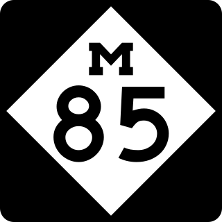
M-85, also known as Fort Street or Fort Road for its entire length, is a state trunkline highway in the U.S. state of Michigan. The highway serves several Downriver suburbs of Detroit, as well as neighborhoods in the city itself. From its southern terminus at exit 28 on Interstate 75 (I-75) to its second interchange with exit 43 on I-75 in southwest Detroit, M-85 is part of the Lake Erie Circle Tour. In between, it serves mostly residential areas running parallel to a pair of rail lines; the highway carries between 5,000 and 43,000 vehicles per day on average. Once in the city of Detroit, Fort Street runs parallel to I-75 for several miles before they separate near the Ambassador Bridge. The northern end of M-85 is at the intersection with Griswold Street in downtown Detroit, one block away from Campus Martius Park.

M-65 is a 103.176-mile-long (166.046 km) state trunkline highway in the US state of Michigan. The highway runs between termini on US Highway 23 (US 23) near Omer and Rogers City in the northeastern Lower Peninsula of the state. M-65 runs inland through several small communities in the region, passing through forests and fields along its course. M-65 crosses several watercourses, including the Au Sable River where it runs along the River Road National Scenic Byway. The region also includes the Huron National Forest and the Mackinaw State Forest areas.

M-98 is the designation of a former 16.2-mile (26.1 km) state trunkline highway in the Upper Peninsula of the US state of Michigan. It ran between M-77 at Germfask and M-28 near McMillan. The highway connected both small towns situated around Manistique Lake when it was designated with the rest of the original state highways in 1919. The section north of Helmer on the east side of the lake ran concurrently with M-135 after the latter's creation in the late 1920s. M-98 was extended at the end of the 1940s before the whole trunkline was removed from the highway system in the 1960s. Since the 1970s, part of M-98 has been designated as one of the two County Road H-44s in the state.

M-136 is a state trunkline highway in the US state of Michigan that runs from Brockway to Fort Gratiot in the lower part of The Thumb of the Lower Peninsula. The highway serves as a connector between M-19 on the west and M-25 northwest of Port Huron. In between, the highway runs through rural St. Clair County through farm fields and along a creek and river. The trunkline uses roads that were part of the state highway system in 1919. The M-136 designation was assigned in 1931 and extended to its current length in 1961.

M-222 is the current designation of a state trunkline highway in Allegan County of the US state of Michigan. It runs between the city of Allegan, where it connects with M-40/M-89, and the US Highway 131 (US 131) freeway near Martin. The highway runs along a series of streets in Allegan and through rural farm fields and woods between the two communities along 116th Avenue. The roadway was a state highway back in 1919 when the system was initially signed. It was assigned as part of M-89 and M-40 before being given its own number, M-118. That designation was applied to the highway until 1988 when that was retired in favor of the current M-222.
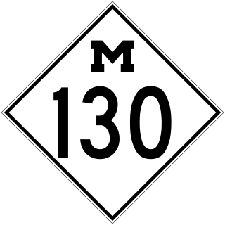
M-130 was the designation of a former state trunkline highway in the southeastern corner of the US state of Michigan. It ran from a junction with US Highway 23/M-50 (US 23/M-50) northward across the River Raisin and then turned southeasterly along North Custer Road on the north side of the river to Monroe. The highway designation was commissioned in 1929 and used until 1955. M-130 had a spur route that was created in 1938 and lasted until the main highway was removed from the state highway system. Both highways are now under local control.

H-33 is a county-designated highway in the Upper Peninsula of the US state of Michigan between Gould City and McMillan that was previously M-135, a former state trunkline highway. The roadway follows Manistique Lakes Road from Gould City at a junction with US Highway 2 (US 2) near Lake Michigan north to M-28 near McMillan. The northern section of the highway is also called County Road 135 (CR 135) in Luce County.

