
M-89 is an east–west state trunkline highway in the US state of Michigan that runs from near Ganges to Battle Creek. M-89 starts at an interchange with Interstate 196/US Highway 31 (I-196/US 31) and passes through Allegan, Kalamazoo County, Michigan, and Calhoun counties. The highway also briefly crosses the southwest corner of Barry County before it terminates an at intersection with Business Loop I-94 on the northwestern side of downtown Battle Creek. In between the trunkline runs parallel to the Kalamazoo River through rural southwestern Michigan farmlands while also running through the middle of several smaller towns in the area.

M-21 is an east–west state trunkline highway in the US state of Michigan connecting the cities of Grand Rapids and Flint. The highway passes through rural farming country and several small towns along its course through the Lower Peninsula. Following the course of a handful of rivers, M-21 also connects some of the state's freeways like Interstate 96 (I-96), US Highway 127 (US 127) and I-75. The highway is used by between 1,700 and 36,000 vehicles daily.
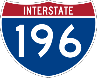
Interstate 196 (I-196) is an auxiliary Interstate Highway that runs for 80.6 miles (129.7 km) in the US state of Michigan. It is a state trunkline highway that links Benton Harbor, South Haven, Holland, and Grand Rapids. In Kent, Ottawa, and Allegan counties, I-196 is known as the Gerald R. Ford Freeway, or simply the Ford Freeway, after President Gerald Ford, who was raised in Grand Rapids and served Michigan in the House of Representatives for 25 years. This name generally refers only to the section between Holland and Grand Rapids. I-196 changes direction; it is signed as a north–south highway from its southern terminus to the junction with US Highway 31 (US 31) just south of Holland, and as an east–west trunkline from this point to its eastern terminus at an interchange with I-96, its parent highway. There are three business routes related to the main freeway. There are two business loops and one business spur that serve South Haven, Holland and the Grand Rapids areas. Another business spur for Muskegon had been designated relative to the I-196 number.

M-5, commonly referred to as Grand River Avenue and the northern section as the Haggerty Connector, is a 27.9-mile-long (44.9 km) state trunkline highway in the Metro Detroit area of the US state of Michigan. The highway runs through suburbs in Oakland and Wayne counties in addition to part of Detroit itself. It starts in Commerce Township as a north–south divided highway and freeway called the Haggerty Connector and connects with Interstate 96 (I-96) in Novi. The freeway then turns southeasterly to bypass the suburb of Farmington as an east–west highway. The freeway ends on the southeast side of Farmington, and M-5 follows Grand River Avenue as boulevard into Detroit. The eastern terminus is at the five-way intersection between Grand River Avenue, Cass Avenue, and Middle Street in Downtown Detroit, where it had been extended to in May 2016 from an interchange with I-96 on the northwest side of the city. The trunkline passes between suburban residential subdivisions and along urban commercial areas while serving 17,200–68,800 vehicles on average each day.
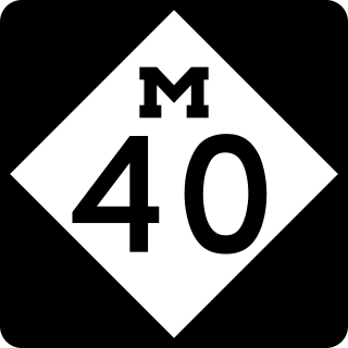
M-40 is a north–south state trunkline highway in the Lower Peninsula of the US state of Michigan. The highway runs from US Highway 12 (US 12) near the Indiana state line in Porter Township north through Paw Paw and Allegan to end in the outskirts of Holland. The current northern end is near Interstate 196 (I-196) at an intersection with US 31/Business Loop I-196 (BL 196). In between, M-40 runs through mixed agricultural and forest lands and along lakes and rivers through Southwest Michigan.

M-51 is a north–south state trunkline highway in the southwestern portion of the US state of Michigan. The southern terminus is at a connection with State Road 933 across the Michigan–Indiana state line near South Bend, Indiana. From there the trunkline runs north through an interchange with US Highway 12 (US 12) into Niles along a route that was once part of Business US 12. North of Niles, the highway runs parallel to a river and a rail line through rural areas. The northern terminus is on Interstate 94 (I-94) west of Paw Paw.

M-15 is a north–south state trunkline highway in the US state of Michigan. The southern terminus is a junction with US Highway 24 (US 24) just south of Clarkston on the northwestern edge of the Detroit metropolitan area. The trunkline is a recreational route running north and northwest to the Tri-Cities area. The northern terminus is the junction with M-25 on the east side of Bay City. The total length is about 73+2⁄3 miles (118.6 km) between the two regions.

M-11 is a state trunkline highway in the US state of Michigan in the Grand Rapids metropolitan area. The highway runs through the western and southern sides of the metro area, starting over the border in Ottawa County at an interchange with Interstate 96 (I-96). It runs through both rural woodlands and busy commercial areas before it terminates at another interchange with I-96 in Cascade Township. Locally known as Wilson Avenue and 28th Street, the trunkline is listed on the National Highway System. M-11 carries between 8,000 and 42,000 vehicles on average each day.
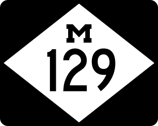
M-129 is a state trunkline highway in the Upper Peninsula (UP) of the US state of Michigan. It runs from Cedarville to Sault Ste. Marie. South of Nine Mile Road in Chippewa County, M-129 overlays the Michigan Meridian. The section of M-129 that overlays the meridian is named Meridian Road. The highway between M-48 and the northern terminus is a part of the larger Lake Huron Circle Tour.

M-80 is a state trunkline highway in the Upper Peninsula of the US state of Michigan. It runs from Kinross to M-129 near Donaldson. The highway serves the site of the former Kincheloe Air Force Base and the current Chippewa County International Airport. The designation has been used twice before on roads in the Lower Peninsula in the 1910s through 1930s while the current usage dates back to the mid-1990s.

M-63 is a state trunkline highway in the US state of Michigan that runs from M-139 at Scottdale through the cities of Benton Harbor and St. Joseph to Interstate 196/US Highway 31 (I-196/US 31) at exit 7 just outside Hagar Shores. The trunkline runs through residential areas south of St. Joseph and through the central business districts of the twin cities. Further north, M-63 runs along the Lake Michigan shoreline.

M-45 is a state trunkline highway in the US state of Michigan that is also called Lake Michigan Drive. The highway runs from Agnew near Lake Michigan to the west side of Grand Rapids in the western Lower Peninsula. Lake Michigan Drive continues in each direction from M-45's termini, extending west of US Highway 31 (US 31) and east of Interstate 196 (I-196). In between, the road runs through rural and suburban areas of Ottawa and Kent counties, including the main campus of Grand Valley State University in Allendale. Lake Michigan Drive was originally part of M-50 until the mid-1960s. Previously in the 1920s and 1930s, the M-45 number was designated along a highway in the Upper Peninsula (UP).
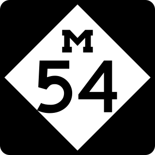
M-54 is a north–south state trunkline highway in the US state of Michigan that bypasses the city of Flint. It is named Dort Highway for much of its length, in honor of Flint carriage and automobile pioneer Josiah Dallas Dort. The portion from the north end of Dort Highway to Clio Road is part of the historic Saginaw Trail, and was also part of the old Dixie Highway. The modern highway runs for 30.276 miles (48.724 km) through Genesee and Saginaw counties from connections with Interstate 75 (I-75) near Grand Blanc on the south to Birch Run on the north. The highway serves mostly suburban and urban sections of the Flint area. Outside of the city, it also passes through agricultural areas in northern Genesee County and southeastern Saginaw County. It also shares a short east–west section with M-83 near Birch Run.
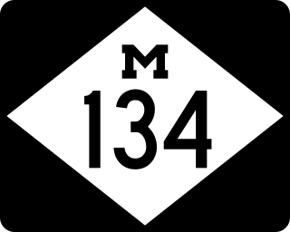
M-134 is an east–west state trunkline highway in the Upper Peninsula (UP) of the US state of Michigan. It connects Interstate 75 (I-75) north of St. Ignace with the communities of Hessel, Cedarville and De Tour Village along Lake Huron. East of De Tour, the highway crosses the De Tour Passage on a ferry to run south of the community of Drummond on Drummond Island. It is one of only three state trunklines in Michigan on islands; the others are M-154 on Harsens Island and M-185 on Mackinac Island. M-134 is also one of only two highways to utilize a ferry in Michigan; the other is US Highway 10 (US 10) which crosses Lake Michigan from Manitowoc, Wisconsin, to Ludington. Most of the mainland portion of M-134 is also part of the Lake Huron Circle Tour, and since 2015, it has been a Pure Michigan Byway under the name M-134 North Huron Byway.

M-48 is an east–west state trunkline highway in the Upper Peninsula (UP) of the US state of Michigan. It connects Rudyard with Pickford and continues to the far eastern end of the UP. The highway runs for 43.723 miles (70.365 km) through rural parts of Chippewa County, including along the county line with Mackinac County. Between 580 and 1,800 vehicles a day use the roadway daily.

M-114 was the designation of a former state trunkline highway and planned beltline in the US state of Michigan around the city of Grand Rapids. It was designated by the end of 1929 on various streets in adjoining cities and townships. By the 1940s, sections of it on the west and south sides of Grand Rapids were given new designations and the segment along the east side of town was finished. By late 1945 the highway designation was completely decommissioned in favor of other numbers. M-114 split into two branches, one running east–west and the other running north–south. The east–west spur routing is now local streets while the rest is part of state highways.

US Highway 31 (US 31) is a part of the United States Numbered Highway System that runs from Alabama to the Lower Peninsula of the US state of Michigan. In Michigan, it is a state trunkline highway that runs from the Indiana–Michigan state line at Bertrand Township north to its terminus at Interstate 75 (I-75) south of Mackinaw City. Along its 355.2-mile-long (571.6 km) route, US 31 follows the Michigan section of the St. Joseph Valley Parkway as well as other freeways and divided highways northward to Ludington. North of there, the trunkline is a rural undivided highway through the Northern Michigan tourist destinations of Traverse City and Petoskey before terminating south of Mackinaw City. Along its route, US 31 has been dedicated in memory of a few different organizations, and sections of it carry the Lake Michigan Circle Tour (LMCT) moniker. Four bridges used by the highway have been recognized for their historic character as well.

US Highway 2 (US 2) is a component of the United States Numbered Highway System that connects Everett, Washington, to the Upper Peninsula (UP) of the US state of Michigan, with a separate segment that runs from Rouses Point, New York, to Houlton, Maine. In Michigan, the highway runs through the UP in two segments as a part of the state trunkline highway system, entering the state at Ironwood and ending at St. Ignace; in between, US 2 briefly traverses the state of Wisconsin. As one of the major transportation arteries in the UP, US 2 is a major conduit for traffic through the state and neighboring northern Midwest states. Two sections of the roadway are included as part of the Great Lakes Circle Tours, and other segments are listed as state-designated Pure Michigan Byways. There are several memorial highway designations and historic bridges along US 2 that date to the 1910s and 1920s. The highway runs through rural sections of the UP, passing through two national and two state forests in the process.

The State Trunkline Highway System consists of all the state highways in Michigan, including those designated as Interstate, United States Numbered, or State Trunkline highways. In their abbreviated format, these classifications are applied to highway numbers with an I-, US, or M- prefix, respectively. The system is maintained by the Michigan Department of Transportation (MDOT) and comprises 9,669 miles (15,561 km) of trunklines in all 83 counties of the state on both the Upper and Lower peninsulas, which are linked by the Mackinac Bridge. Components of the system range in scale from 10-lane urban freeways with local-express lanes to two-lane rural undivided highways to a non-motorized highway on Mackinac Island where cars are forbidden. The longest highway is nearly 400 miles (640 km) long, while the shortest is about three-quarters of a mile. Some roads are unsigned highways, lacking signage to indicate their maintenance by MDOT; these may be remnants of highways that are still under state control whose designations were decommissioned or roadway segments left over from realignment projects.


