Prudenville, Michigan

Last updated

Prudenville, Michigan
PrudenvilleMichigan 2018.jpg
Houghton Lake Drive (M-55) at Gladwin Road (M-18)
Prudenville, MI location.png
Location within Roscommon County
USA Michigan location map.svg
Red pog.svg
Prudenville
Location within the state of Michigan
Usa edcp location map.svg
Red pog.svg
Prudenville
Prudenville (the United States)
Coordinates: 44°17′54″N84°39′07″W / 44.29833°N 84.65194°W / 44.29833; -84.65194
CountryUnited States
State Michigan
County Roscommon
Township Denton
Established1875
Area
[1]
  Total3.72 sq mi (9.63 km2)
  Land2.85 sq mi (7.39 km2)
  Water0.87 sq mi (2.24 km2)
Elevation
1,145 ft (349 m)
Population
 (2020)
  Total1,643
  Density576.49/sq mi (222.58/km2)
Time zone UTC-5 (Eastern (EST))
  Summer (DST) UTC-4 (EDT)
ZIP code(s)
48629 (Houghton Lake)
48651
Area code 989
FIPS code 26-66400 [2]
GNIS feature ID0635500 [3]

Prudenville is an unincorporated community and census-designated place (CDP) in Roscommon County in the U.S. state of Michigan. The population was 1,643 at the 2020 census. Prudenville is located within Denton Township.

Contents

History

Roscommon Lumber Company Historic Marker.jpg
Prudenville MI historic designation.jpg
Both sides of the joint Roscommon Lumber Company / Prudenville historic marker in Trestle Park

The area received its first post office on September 6, 1875 under the name Prudenville, and it was soon changed to the name Edna on January 10, 1876. The name Edna existed until it was changed back to Prudenville on January 14, 1886. The Prudenville post office was discontinued on August 15, 1911, but reestablished 10 years later on August 30, 1921. The post office remains in operation and is located at 899 West Houghton Lake Drive (M-55). [4]

The Homestead Act of 1862, which granted free land to travelers moving west, prompted settlers to the Prudenville area in 1870 due to its plentiful lumber resources. The growing community was named after early developer Peter Pruden, and the community grew to include a post office, two hotels, many businesses, and a school. In 1882, the Roscommon Lumber Company built a "stand-alone" trestle railroad to assist logging crews in pushing timber into the east bay of Houghton Lake. The logs were floated across the lake into the draining Muskegon River and further down the river to the mills of Muskegon on the shores of Lake Michigan. During its operation from 1882 to 1887, the company employed 700 workers and logged 175 million board feet of white and Norway pine. [5]

In 2004, the Roscommon Lumber Company and the community of Prudenville were dually listed as a Michigan State Historic Site. A historic marker was dedicated in Trestle Park on September 6, 2014. [5] [6]

Geography

East Bay view of Houghton Lake from Prudenville Houghton Lake (Michigan) September 2021.jpg
East Bay view of Houghton Lake from Prudenville

According to the U.S. Census Bureau, the CDP has a total area of 3.72 square miles (9.63 km2), of which 2.85 square miles (7.38 km2) is land and 0.87 square miles (2.25 km2) (23.38%) is water. [1]

Prudenville has its own post office with the 48651 ZIP Code. [7] The Prudenville post office serves most of Denton Township and smaller portions of Roscommon Township to the south, Nester Township to the southwest, and Backus Township and Higgins Township to the northeast. [8] Prudenville is an unincorporated community listed by the U.S. Census Bureau as a census-designated place (CDP) for statistical purposes only, and the community itself has no legal autonomy as an incorporated municipality. The western portion of the Prudenville CDP also includes a small portion of the Houghton Lake 48629 ZIP Code. [9]

Prudenville is considered part of the Northern Michigan region. It is located on the southeast shores of Houghton Lake, which is the state's largest inland lake. Portions of the Au Sable State Forest (Roscommon State Forest Management Unit) and Backus Creek State Game Area are within close proximity.

Major highways

Demographics

Historical population
CensusPop.Note
1990 1,513
2000 1,73714.8%
2010 1,682−3.2%
2020 1,643−2.3%
U.S. Decennial Census [10]
U.S. Post Office in Prudenville Prudenville, MI post office.jpg
U.S. Post Office in Prudenville

As of the census [2] of 2000, there were 1,737 people, 818 households, and 542 families residing in the CDP. The population density was 620.1 inhabitants per square mile (239.4/km2). There were 1,395 housing units at an average density of 498.0 per square mile (192.3/km2). The racial makeup of the CDP was 98.39% White, 0.12% African American, 0.69% Native American, 0.12% Asian, 0.06% from other races, and 0.63% from two or more races. Hispanic or Latino of any race were 0.52% of the population.

There were 819 households, out of which 18.2% had children under the age of 18 living with them, 55.3% were married couples living together, 7.6% had a female householder with no husband present, and 33.7% were non-families. 30.1% of all households were made up of individuals, and 16.9% had someone living alone who was 65 years of age or older. The average household size was 2.12 and the average family size was 2.58.

In the CDP, the population was spread out, with 17.6% under the age of 18, 5.2% from 18 to 24, 18.9% from 25 to 44, 29.5% from 45 to 64, and 28.8% who were 65 years of age or older. The median age was 52 years. For every 100 females, there were 89.6 males. For every 100 females age 18 and over, there were 84.1 males.

The median income for a household in the CDP was $29,821, and the median income for a family was $36,313. Males had a median income of $34,135 versus $20,625 for females. The per capita income for the CDP was $19,018. About 9.4% of families and 11.6% of the population were below the poverty line, including 25.4% of those under age 18 and 6.1% of those age 65 or over.

Related Research Articles

<span class="mw-page-title-main">Roscommon County, Michigan</span> County in Michigan, United States

Roscommon County is a county located in the U.S. state of Michigan. As of the 2020 Census, the population was 23,459. The county seat is Roscommon. The county was founded in 1840 and organized in 1875.

<span class="mw-page-title-main">Alcona Township, Michigan</span> Civil township in Michigan, United States

Alcona Township is a civil township of Alcona County in the U.S. state of Michigan. The population was 966 at the 2020 census.

<span class="mw-page-title-main">Caledonia Township, Alcona County, Michigan</span> Civil township in Michigan, United States

Caledonia Township is a civil township of Alcona County in the U.S. state of Michigan. The population was 1,161 at the 2010 census.

<span class="mw-page-title-main">Greenbush Township, Alcona County, Michigan</span> Civil township in Michigan, United States

Greenbush Township is a civil township of Alcona County in the U.S. state of Michigan. The population was 1,275 at the 2020 census. The population in 2021 is estimated to be 1,281.

<span class="mw-page-title-main">Mikado Township, Michigan</span> Civil township in Michigan, United States

Mikado Township is a civil township of Alcona County in the U.S. state of Michigan. The population was 947 at the 2010 census.

<span class="mw-page-title-main">Indian River, Michigan</span> Census-designated place & unincorporated community in Michigan, United States

Indian River is an unincorporated community and census-designated place (CDP) in Cheboygan County in the U.S. state of Michigan. The population was 1,950 at the 2020 census. The CDP is located in Tuscarora Township between Burt Lake and Mullett Lake.

<span class="mw-page-title-main">Wolverine, Michigan</span> Village in Michigan, United States

Wolverine is a village in Cheboygan County in the U.S. state of Michigan. The population was 244 at the 2010 census.

<span class="mw-page-title-main">Argentine, Michigan</span> Census-designated place & unincorporated community in Michigan, United States

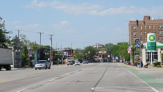
Argentine is an unincorporated community and census-designated place (CDP) in Argentine Township, Genesee County, in the U.S. state of Michigan. The population was 2,685 as of the 2020 census, up from 2,525 at the 2010 census. It was first settled in 1836.

<span class="mw-page-title-main">Allouez Township, Michigan</span> Civil township in Michigan, United States

Allouez Township is a civil township of Keweenaw County in the U.S. state of Michigan. The population was 1,428 at the 2020 census.

<span class="mw-page-title-main">Manitou Beach–Devils Lake, Michigan</span> Census-designated place & unincorporated community in Michigan, United States

Manitou Beach–Devils Lake is a census-designated place (CDP) in Lenawee County in the U.S. state of Michigan. The population of the CDP was 2,032 at the 2020 census. It is located within Rollin Township to the south and Woodstock Township to the north.

<span class="mw-page-title-main">Big Bay, Michigan</span> Census-designated place & unincorporated community in Michigan, United States

Big Bay is an unincorporated community in Marquette County of the U.S. state of Michigan. It is a census-designated place (CDP) for statistical purposes and does not have any legal status as an incorporated municipality. As of the 2020 census, the CDP had a population of 257, down from 319 in 2010. The community is located within Powell Township near the shore of Big Bay on Lake Superior.

<span class="mw-page-title-main">Lambertville, Michigan</span> Census-designated place & unincorporated community in Michigan, United States

Lambertville is an unincorporated community and census-designated place (CDP) in Monroe County in the U.S. state of Michigan. The population was 10,433 at the 2020 census. The CDP is located within Bedford Township.

Montcalm Township is a civil township of Montcalm County in the U.S. state of Michigan. The population was 3,178 at the 2000 census.

<span class="mw-page-title-main">Denton Township, Michigan</span> Civil township in Michigan, United States

Denton Township is a civil township of Roscommon County in the U.S. state of Michigan. The population was 5,293 at the 2020 census.

<span class="mw-page-title-main">Houghton Lake, Michigan</span> Census-designated place & unincorporated community in Michigan, United States

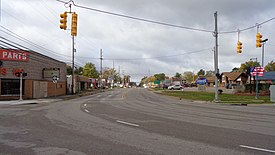
Houghton Lake is an unincorporated community and census-designated place (CDP) in Roscommon County in the U.S. state of Michigan. The population was 5,294 at the time of the 2020 census, making it the largest unincorporated community in Northern Michigan. The CDP is located within Denton, Lake, and Roscommon townships.

<span class="mw-page-title-main">Lake Township, Roscommon County, Michigan</span> Civil township in Michigan, United States

Lake Township is a civil township of Roscommon County in the U.S. state of Michigan. The population was 1,119 at the 2020 census.

<span class="mw-page-title-main">Roscommon, Michigan</span> Village in Michigan, United States

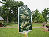
Roscommon is a village in Roscommon County the U.S. state of Michigan. The population was 981 at the 2020 census. Roscommon is the county seat of Roscommon County.

<span class="mw-page-title-main">Roscommon Township, Michigan</span> Civil township in Michigan, United States

Roscommon Township is a civil township of Roscommon County in the U.S. state of Michigan. The population was 4,397 at the 2020 census.

<span class="mw-page-title-main">River Rouge, Michigan</span> City in Michigan, United States

River Rouge is a city in Wayne County in the U.S. state of Michigan. The population was 7,224 at the 2020 census.

Maple Valley Township is a civil township of Montcalm County in the U.S. state of Michigan. The population was 2,083 at the 2000 census.

References

  1. 1 2 "2020 U.S. Gazetteer Files". United States Census Bureau. Retrieved May 21, 2022.
  2. 1 2 "U.S. Census website". United States Census Bureau . Retrieved January 31, 2008.
  3. U.S. Geological Survey Geographic Names Information System: Prudenville, Michigan
  4. U.S. Geological Survey Geographic Names Information System: Prudenville Post Office
  5. 1 2 MichMarkers.com (2020). "Prudenville / Roscommon Lumber Co. – Registered Site L2257" . Retrieved October 13, 2020.
  6. Denton Township (2020). "Denton Township: Parks – Trestle Park" . Retrieved October 12, 2020.
  7. UnitedStatesZipCodes.org (2020). "ZIP Code 48651" . Retrieved October 9, 2020.
  8. Google (October 9, 2020). "48651 ZIP Code map" (Map). Google Maps . Google. Retrieved October 9, 2020.
  9. Google (October 11, 2020). "48629 ZIP Code map" (Map). Google Maps . Google. Retrieved October 11, 2020.
  10. "Census of Population and Housing". Census.gov. Retrieved June 4, 2016.