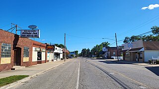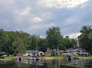
Cheboygan County is a county in the U.S. state of Michigan. As of the 2020 census, the population was 25,579. The county seat is Cheboygan. The county boundaries were set off in 1840, with land partitioned from Michilimackinac County. The Cheboygan County government was organized and combined with the former Wyandot County in 1853.

Ossineke is an unincorporated community and census-designated place in Alpena County in the U.S. state of Michigan. The population was 932 at the 2020 census. The community is located within Sanborn Township, several miles south of Alpena on U.S. Highway 23.

Shorewood–Tower Hills–Harbert is a census-designated place (CDP) composed of several small unincorporated communities in Chikaming Township of Berrien County in the U.S. state of Michigan. The population was 1,249 at the 2020 census. The CDP is limited to Chikaming Township, although some of the communities extend into southern Lake Township. All of the communities are located either upon or just east of the dunes on the shore of Lake Michigan. Most of the communities lie west of Interstate 94, although the CDP includes a small area east of the freeway up to Sawyer, Michigan. The township is a popular resort destination.

Benton Township is a civil township of Cheboygan County in the U.S. state of Michigan. As of the 2020 census, the township population was 3,133.

Burt Township is a civil township of Cheboygan County in the U.S. state of Michigan. As of the 2020 census, the township population was 710.

Ellis Township is a civil township of Cheboygan County in the U.S. state of Michigan. The population was 557 at the 2020 census.

Inverness Township is a civil township of Cheboygan County in the U.S. state of Michigan. The population was 2,159 at the 2020 census. It was named after Inverness in Scotland.

Koehler Township is a civil township of Cheboygan County in the U.S. state of Michigan. The population was 1,193 at the 2020 census.

Mullett Township is a civil township of Cheboygan County in the U.S. state of Michigan. The population was 1,236 at the 2020 census. Both the township and Mullett Lake are named for John Mullett, who surveyed much of the area between 1840 and 1843.

Tuscarora Township is a civil township of Cheboygan County in the U.S. state of Michigan. The population was 3,080 at the 2020 census.

Alanson is a village in Emmet County in the U.S. state of Michigan. The population was 778 at the 2020 census.

Argentine is an unincorporated community and census-designated place (CDP) in Argentine Township, Genesee County, in the U.S. state of Michigan. The population was 2,685 as of the 2020 census, up from 2,525 at the 2010 census. It was first settled in 1836.

Weidman is an unincorporated community and census-designated place (CDP) in Isabella County in the U.S. state of Michigan. The CDP had a population of 920 at the 2020 census. The community is located within Nottawa Township to the east and Sherman Township to the west.

Michigamme is an unincorporated community in Marquette County in the U.S. state of Michigan. It is located within Michigamme Township on the north shores of Lake Michigamme. For statistical purposes, the United States Census Bureau has defined Michigamme as a census-designated place (CDP). The CDP had a population of 255 at the 2020 census.

Canadian Lakes is an unincorporated community and census-designated place (CDP) in Mecosta County in the U.S. state of Michigan. The area is mostly within the southwest portion of Morton Township, southwest of Mecosta and east of Stanwood. As of the 2020 census, the CDP population was 3,202, up from 2,756 in 2010. The area defined by the CDP includes small portions in eastern Austin Township.

Atlanta is a census-designated place and unincorporated community in the U.S. state of Michigan. It is the county seat of Montmorency County. The community had a population of 720 at the 2020 census, down from 827 in 2010. Atlanta has been nicknamed the "Elk Capital of Michigan".

Twin Lake is an unincorporated community in Muskegon County of the U.S. state of Michigan. It is a census-designated place (CDP) for statistical purposes. Local government services are provided by Dalton Township, though the Twin Lake ZIP code serves parts of neighboring townships. As of the 2020 census, the population of the CDP was 2,056. The surrounding area is the home of Blue Lake Fine Arts Camp, the YMCA's Camp Pinewood, and the Boy Scouts' Gerber Scout Reservation and Owasippe Scout Reservation.

Prudenville is an unincorporated community and census-designated place (CDP) in Roscommon County in the U.S. state of Michigan. The population was 1,643 at the 2020 census. Prudenville is located within Denton Township.

Burt is a census-designated place (CDP) and Unincorporated community for statistical purposes in Taymouth Township, Saginaw County in the U.S. state of Michigan. The CDP's population was 1,122 at the 2000 census. Burt is also the name of a post office with ZIP code 48417, which includes the area of the CDP as well as portions of Taymouth Township to the north of the CDP and the eastern part of Albee Township and a small area of southeastern Spaulding Township. The town is named for Wellington R. Burt.

Topinabee is an unincorporated community in Cheboygan County in the U.S. state of Michigan. The community is located within Mullet Township along the southwestern shores of Mullett Lake.


