Cheboygan County is a county in the U.S. state of Michigan. As of the 2020 census, the population was 25,579. The county seat is Cheboygan. The county boundaries were set off in 1840, with land partitioned from Michilimackinac County. The Cheboygan County government was organized and combined with the former Wyandot County in 1853.

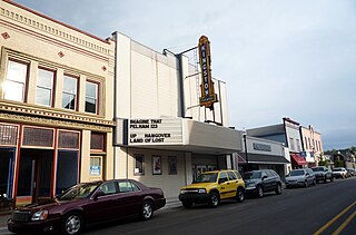
Cheboygan is a city in the U.S. state of Michigan. It is the county seat and largest settlement of Cheboygan County. At the 2020 census, Cheboygan had a population 4,770.

Gaylord is a city in the U.S. state of Michigan. It is the county seat of Otsego County, and is the only city within the county. Gaylord had a population of 4,286 at the 2020 census, an increase from 3,645 at the 2010 census.

Mackinaw City is a village at the northernmost point of the Lower Peninsula of Michigan, United States. Divided between Cheboygan and Emmet counties, Mackinaw City is located at the southern end of the Mackinac Bridge, which carries Interstate 75 over the Straits of Mackinac to St. Ignace, in the Upper Peninsula. Mackinaw City and St. Ignace also serve as access points for ferries to and from Mackinac Island. For these reasons, Mackinaw City is considered one of Michigan's most popular tourist attractions.
Mackinac or Mackinaw may refer to:

Mullett Lake is a lake in Cheboygan County in the U.S. state of Michigan. The lake is named after John Mullett, who, together with William A. Burt, made a federal survey of the area from 1840 to 1843. A neighboring lake was named after Burt. Historically, Mullett Lake has been recorded as Mullet Lake, Mullet's Lake, and Mullett's Lake on maps and documents.

Topinabee is an unincorporated community in Cheboygan County in the U.S. state of Michigan. The community is located within Mullet Township along the southwestern shores of Mullett Lake.

Northern Michigan, also known as Northern Lower Michigan, is a region of the U.S. state of Michigan. A popular tourist destination, it is home to several small- to medium-sized cities, extensive state and national forests, lakes and rivers, and a large portion of Great Lakes shoreline. The region has a significant seasonal population much like other regions that depend on tourism as their main industry. Northern Lower Michigan is distinct from the more northerly Upper Peninsula and Isle Royale, which are also located in "northern" Michigan. In the northernmost 21 counties in the Lower Peninsula of Michigan, the total population of the region is 506,658 people.

The Detroit and Mackinac Railway, informally known as the "Turtle Line", was a railroad in the northeastern part of the Lower Peninsula of the U.S. state of Michigan. The railroad had its main offices and shops in Tawas City with its main line running from Bay City north to Cheboygan, and operated from 1894 to 1992. In 1946, it became the first all diesel haul railroad in the United States.
The Boyne City Railroad was a railway based at Boyne City, Michigan, U.S., during 1893–1978.

The Mackinaw State Forest is a 717,500-acre (2,904 km2) forested area owned by the U.S. state of Michigan and operated by the Michigan Department of Natural Resources. It is located in the northern area of the Lower Peninsula within the eight counties of Alpena, Antrim, Charlevoix, Cheboygan, Emmet, Montmorency, Otsego, and Presque Isle. The forest is served by Interstate 75, U.S. Highway 23 (US 23), and US 131.

Interstate 75 (I-75) is a part of the Interstate Highway System that runs north–south from Miami, Florida, to Sault Ste. Marie in the Upper Peninsula of the US state of Michigan. I-75 enters the state from Ohio in the south, north of Toledo, and runs generally northward through Detroit, Flint, and Bay City, crosses the Mackinac Bridge, and ends at the Canadian border in Sault Ste. Marie. The freeway runs for approximately 396 miles (637 km) on both of Michigan's major peninsulas. The landscapes traversed by I-75 include Southern Michigan farmland, northern forests, suburban bedroom communities, and the urban core of Detroit. The freeway also uses three of the state's monumental bridges to cross major bodies of water. There are four auxiliary Interstates in the state related to I-75, as well as nine current or former business routes, with either Business Loop I-75 or Business Spur I-75 designations.

Elmira is an unincorporated community in the U.S. state of Michigan. Located along M-32, the community is on the county line between Warner Township in Antrim County to the west and Elmira Township in Otsego County to the east.

Waters is an unincorporated community in southern Otsego County in the U.S. state of Michigan. The community is located within Otsego Lake Township.

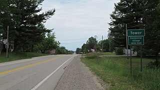
Tower is an unincorporated community and census-designated place (CDP) in Cheboygan County in the U.S. state of Michigan. The population of the CDP was 248 at the 2020 census. It is located along the concurrency of M-33 and M-68 within Forest Township. As an unincorporated community, Tower has no legal autonomy of its own.

Lake State Railway is a railroad operating in the Saginaw Valley and northeastern quadrant of the Lower Peninsula of Michigan. The railroad moves large quantities of aggregate and limestone, as well as coal, grain, and chemical products. Some of the company's largest customers include Dow Chemical Company, S. C. Johnson & Son, Lafarge, ConAgra Foods, Archer Daniels Midland, Conrad Yelvington Distributors, and Consumers Energy.
The North Eastern State Trail is a 71-mile (114 km) bicycle and hiking trail in Michigan that creates a non-highway right-of-way between Alpena and Cheboygan within three northern counties of Michigan's Lower Peninsula. The trail uses a section of the former roadbed of the Detroit and Mackinac Railway.

Gete Mino Mshkiigan, pronounced “geh-teh-mino-mush-key-gun,” is an undeveloped state park located in Cheboygan County in the U.S. state of Michigan. The park occupies 147 acres (59 ha) along the shores of Mullett Lake. The North Central State Trail, a 75-mile long state-owned rail trail, runs through the property close to the shoreline of the lake. The shoreline itself consists of 1,500 feet of undeveloped lakefront. According to the Michigan Department of Natural Resources (DNR), "the undulating terrain is dominated by mixed coniferous/deciduous forest, with approximately 35% of the land identified as emergent wetlands."


