The city is located in the northeast of Michigan's Lower Peninsula, along the shore of Lake Huron. Within the city's limits is the world's largest open-pit limestone quarry, the Port of Calcite. The port is one of the largest shipping ports on the Great Lakes.
History
Rogers City was established in 1868, when William E. Rogers, Albert Molitor, Frederick Denny Larke, and John Raymond arrived to survey the area and for logging. In 1870, a post office opened in the settlement under the name Rogers' Mills, though this name was changed several times; to Rogers City in 1872, to Rogers in 1895, and back to Rogers City in 1928. The community was incorporated as a village in 1877, and as a city in 1944.[4][5]
According to the United States Census Bureau, the city has a total area of 8.34 square miles (21.60km2), of which 4.52 square miles (11.71km2) is land and 3.82 square miles (9.89km2) is water.[7] The city is considered to be part of Northern Michigan.
As of the census[11] of 2010, there were 2,827 people, 1,328 households, and 800 families residing in the city. The population density was 625.4 inhabitants per square mile (241.5/km2). There were 1,628 housing units at an average density of 360.2 per square mile (139.1/km2). The racial makeup of the city was 97.3% White, 0.6% African American, 0.5% Native American, 0.7% Asian, and 0.8% from two or more races. Hispanic or Latino of any race were 0.8% of the population.
There were 1,328 households, of which 20.4% had children under the age of 18 living with them, 47.8% were married couples living together, 8.6% had a female householder with no husband present, 3.8% had a male householder with no wife present, and 39.8% were non-families. 36.2% of all households were made up of individuals, and 18% had someone living alone who was 65 years of age or older. The average household size was 2.03 and the average family size was 2.60.
The median age in the city was 51.9 years. 15.7% of residents were under the age of 18; 5% were between the ages of 18 and 24; 19% were from 25 to 44; 31.4% were from 45 to 64; and 29% were 65 years of age or older. The gender makeup of the city was 47.7% male and 52.3% female.
2000 census
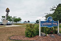
Lakeside Park
As of the census[2] of 2000, there were 3,322 people, 1,480 households, and 914 families residing in the city. The population density was 727.2 inhabitants per square mile (280.8/km2). There were 1,626 housing units at an average density of 355.9 per square mile (137.4/km2). The racial makeup of the city was 98.43% White, 0.03% African American, 0.69% Native American, 0.27% Asian, 0.03% from other races, and 0.54% from two or more races. Hispanic or Latino of any race were 0.45% of the population.
There were 1,480 households, out of which 24.3% had children under the age of 18 living with them, 50.9% were married couples living together, 7.8% had a female householder with no husband present, and 38.2% were non-families. 35.1% of all households were made up of individuals, and 18.9% had someone living alone who was 65 years of age or older. The average household size was 2.17 and the average family size was 2.78.
In the city, the population was spread out, with 20.4% under the age of 18, 7.2% from 18 to 24, 23.2% from 25 to 44, 23.5% from 45 to 64, and 25.8% who were 65 years of age or older. The median age was 44 years. For every 100 females, there were 89.9 males. For every 100 females age 18 and over, there were 84.8 males.
The median income for a household in the city was $29,531, and the median income for a family was $36,310. Males had a median income of $31,515 versus $19,107 for females. The per capita income for the city was $17,750. About 5.3% of families and 7.6% of the population were below the poverty line, including 4.5% of those under age 18 and 10.3% of those age 65 or over.
The northeast corner of Michigan has an industrial base. Rogers City is the locale of the world's largest limestone quarry and one of the world's largest limestone processing plant, which is also used in steel making all along the Great Lakes. Water transport has been formative to the economy. This ties to the world's largest cement plant, which is in Alpena to the south. Both of these landmarks are recognized by historical markers.[12]
Local attractions
Rogers City Municipal Marina has nearly 100 slips, most on floating docks. There is a fishing platform on the east wall for breakwater fishing.
P. H. Hoeft State Park has one mile (1.6km) of sandy shoreline and 301 acres (1.22km2) on Lake Huron. Hiking trails run through the forest and along the lake. There is a 142 site campground. The day use area has a playground, picnic sites, and a beach.[13] It was one of the fourteen original Michigan state parks, and the land was donated by lumber baron Paul H. Hoeft on January 2, 1922.[14] It is a 'four season park' offering camping even in the winter.[15]
Rogers City Nautical Festival, first complete week in August
Fat Hogs Fishing Frenzie, annual Salmon Tournament, Labor Day weekend
Posen Potato Festival, Posen, Michigan, first weekend in September
Annual Great Lakes Lighthouse Festival—Four days in second week in October, Forty Mile Point Open For Tours All Four Days[16]
Media
Newspapers
The local newspaper, the Presque Isle County Advance, has served the area since 1878. The Advance made statewide news itself in February 2006, when it fell victim to a fire that also destroyed Big D's Pizza. Both businesses recovered, with Big D's moving to a new location and the Advance moving into a new building on the same location 10 months later.
The Alpena News is also widely available in the area.
Television
The following television stations are available over-the-air:
WHAK-AM 960 is the heritage station in Rogers City. All three local stations licensed to Rogers City now broadcast out of studios in Alpena, leaving Rogers City without a truly locally based station of its own.
The following radio stations can be heard in Rogers City
↑Romig, Walter (1986). Michigan Place Names: The History of the Founding and the Naming of More Than Five Thousand Past and Present Michigan Communities. Detroit: Wayne State University Press. pp.481–482. ISBN0-8143-1838-X.
This page is based on this Wikipedia article Text is available under the CC BY-SA 4.0 license; additional terms may apply. Images, videos and audio are available under their respective licenses.