
M-78 is a state trunkline highway in the US state of Michigan. The western terminus is the intersection with M-66 north of Battle Creek in Pennfield Township. The roadway runs 10.744 miles (17.291 km) through rural farmland and the community of Bellevue as it approaches its eastern terminus at an interchange with Interstate 69 (I-69) near Olivet. The highway is used by between 3,100 and 5,300 vehicles on a daily basis.

M-21 is an east–west state trunkline highway in the US state of Michigan connecting the cities of Grand Rapids and Flint. The highway passes through rural farming country and several small towns along its course through the Lower Peninsula. Following the course of a handful of rivers, M-21 also connects some of the state's freeways like Interstate 96 (I-96), US Highway 127 (US 127) and I-75. The highway is used by between 1,700 and 36,000 vehicles daily.
M-3, known for most of its length as Gratiot Avenue, is a north–south state trunkline highway in the Detroit metropolitan area of the US state of Michigan. The trunkline starts in Downtown Detroit and runs through the city in a northeasterly direction along one of Detroit's five major avenues. The highway passes several historic landmarks and through a historic district. It also connects residential neighborhoods on the city's east side with suburbs in Macomb County and downtown.
M-25 is a state trunkline highway in the US state of Michigan. The route follows an arc-like shape closely along the Lake Huron shore of the Thumb in the eastern Lower Peninsula between Port Huron and Bay City. It serves the lakeshore resorts along Lake Huron and Saginaw Bay and generally lies within sight of the lake and the bay. All is surface road and generally scenic, except for the freeway segment near the junction with Interstate 75 (I-75) and connection into the US Highway 10 (US 10) freeway.
M-46 is an east–west state trunkline highway in the US state of Michigan between Muskegon and Port Sanilac, terminating near Lake Michigan and Lake Huron on each end. Except for the north–south segment that corresponds with the US Highway 131 (US 131) freeway between Cedar Springs and Howard City, M-46 is practically a due east–west surface highway. The road runs through rural sections of the Lower Peninsula connecting several freeways including US 31, US 131, US 127 and Interstate 75 (I-75).

M-13 is a 73.339-mile (118.028 km) north–south state trunkline highway that runs through the Saginaw Bay region of the US state of Michigan. It runs from Interstate 69 (I-69) south of Lennon to US Highway 23 (US 23) near Standish. The southern section of the trunkline runs along a pair of county lines in a rural area dominated by farm fields. The highway directly connects the downtown areas of both Saginaw and Bay City. North of the latter city, the Lake Huron Circle Tour follows M-13 along the Saginaw Bay.

M-58 is a 5.108-mile-long (8.221 km) east–west state trunkline highway in the US state of Michigan that runs from M-47 in Saginaw Township east to exit 3 of Interstate 675 (I-675) near the north part of downtown Saginaw. The trunkline follows State Street through the Saginaw area, and east of Lathrop Avenue, M-58 is split along two streets, using Davenport Avenue as well. This is the third time that the number has been used on a highway in Michigan; the first two were used in the Berrien County and Pontiac areas. The Saginaw version was designated in 1971, and it is listed on the National Highway System.

M-143, also known as Michigan Avenue, is a previously unsigned spur state trunkline highway in the south central region of the US state of Michigan. The M-143 portion of Michigan Avenue runs from the East Lansing city limit to a junction with M-43 at Grand River Avenue. This highway is the second time that there has been an M-143 in Michigan. The first was a connection to the original Cheboygan State Park. The current is a remnant of M-43 in the Lansing area.
M-85, also known as Fort Street or Fort Road for its entire length, is a state trunkline highway in the U.S. state of Michigan. The highway serves several Downriver suburbs of Detroit, as well as neighborhoods in the city itself. From its southern terminus at exit 28 on Interstate 75 (I-75) to its second interchange with exit 43 on I-75 in southwest Detroit, M-85 is part of the Lake Erie Circle Tour. In between, it serves mostly residential areas running parallel to a pair of rail lines; the highway carries between 5,000 and 43,000 vehicles per day on average. Once in the city of Detroit, Fort Street runs parallel to I-75 for several miles before they separate near the Ambassador Bridge. The northern end of M-85 is at the intersection with Griswold Street in downtown Detroit, one block away from Campus Martius Park.
M-54 is a north–south state trunkline highway in the US state of Michigan that bypasses the city of Flint. It is named Dort Highway for much of its length, in honor of Flint carriage and automobile pioneer Josiah Dallas Dort. The portion from the north end of Dort Highway to Clio Road is part of the historic Saginaw Trail, and was also part of the old Dixie Highway. The modern highway runs for 30.276 miles (48.724 km) through Genesee and Saginaw counties from connections with Interstate 75 (I-75) near Grand Blanc on the south to Birch Run on the north. The highway serves mostly suburban and urban sections of the Flint area. Outside of the city, it also passes through agricultural areas in northern Genesee County and southeastern Saginaw County. It also shares a short east–west section with M-83 near Birch Run.
M-331 was an unsigned state trunkline highway in the U.S. state of Michigan located within the city of Kalamazoo. It ran from the southern city limits north into downtown Kalamazoo. This was one of many highways to be established or realigned as a result of a rationalization process initiated in 1998 during the tenure of Governor John Engler. M-331 used streets in Kalamazoo that were once part of US Highway 131 (US 131) before a freeway was built that bypassed the downtown area. In 2019, the City of Kalamazoo and the Michigan Department of Transportation (MDOT) agreed to transfer control of various streets from state to city jurisdiction, and M-331 was decommissioned as a result.

M-150 is a state trunkline highway in the US state of Michigan that runs through Rochester Hills and Rochester. It is more commonly known as Rochester Road and runs from a southern terminus at the M-59 freeway north through downtown Rochester to a northern terminus at Tienken Road. M-150 has been a state trunkline since around 1930, and within a few years of its commissioning, it was extended south through Royal Oak and north into rural Oakland County. After changes in the 1960s, the highway terminated in Troy at Interstate 75 (I-75) on the southern end and Tienken Road on the north. Since 1987, it has ended at M-59.
M-81 is an east–west state trunkline highway in the Lower Peninsula of the US state of Michigan. The trunkline travels from the city of Saginaw at the junction with M-13 to the junction with M-53 east of Cass City over the county line in Greenleaf Township in northwestern Sanilac County in The Thumb area of the state. Outside of the cities and villages along its route, M-81 passes through mostly rural farm country. Near Saginaw it intersects the freeway that carries both Interstate 75 (I-75) and US Highway 23 (US 23) in an industrial area.
M-83 is a north–south state trunkline highway in the Lower Peninsula of the US state of Michigan primarily serving as a link between Interstate 75/US Highway 23 (I-75/US 23) in Birch Run, including a short east–west section with M-54, and the Bavarian-themed town of Frankenmuth. M-83 is primarily a north–south trunkline that passes by such landmarks as Bronner's Christmas Wonderland, Zehnder's and the Bavarian Inn before leaving town. The landscape in the remainder of the area is composed of farm fields between Frankenmuth and the northern terminus at M-15 near Richville.
M-139 is a state trunkline highway entirely within Berrien County in the US state of Michigan. The highway starts at US Highway 12 (US 12) southwest of Niles and runs through rural areas of the county to terminate at an intersection with Business Loop Interstate 94 in Benton Harbor. The highway runs parallel to the St. Joseph River, crossing the river several times as it follows a set of roads previously used for US 31 in the area. The highway was first designated in the 1930s as a bypass of the Benton Harbor and St. Joseph area. Its termini have been moved over the years since, extending and contracting the length of the highway between Niles and Benton Harbor. M-139 now serves to provide access through the area from a set of bypasses consisting of I-94 and US 31.

There are three business routes of US Highway 10 (US 10) in the state of Michigan. They serve as connections from the main highway into Reed City, Clare, and Midland. Additionally, there were another two business routes that connected US 10 to the downtowns of Flint and Pontiac. All these business routes are, or were, former sections of US 10 that were marked Business US Highway 10 after the main highway was realigned to bypass the downtowns of the cities.
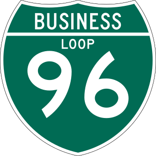
There have been six business routes of Interstate 96 (I-96) in the US state of Michigan. There are two business loops designated Business Loop Interstate 96 : one through Lansing and one through Howell. Both follow the old route of US Highway 16 (US 16), with appropriate connections to I-96. There are three former business spurs that were designated Business Spur Interstate 96. One connected to the carferry docks in Muskegon, running concurrently with part of Business US 31 along former US 16, but it has been eliminated. The second spur ran into downtown Portland until it was decommissioned in 2007. Two routes in the Detroit area—a loop through Farmington and a spur into Detroit—both using Grand River Avenue, and meeting at the temporary end of I-96 near Purdue Avenue, were eliminated when I-96 was moved to the completed Jeffries Freeway in 1977. The Farmington business route is still state-maintained as an unsigned highway, while the Detroit business route remained unsigned until it was decommissioned in 2016 and replaced by an extension of M-5.
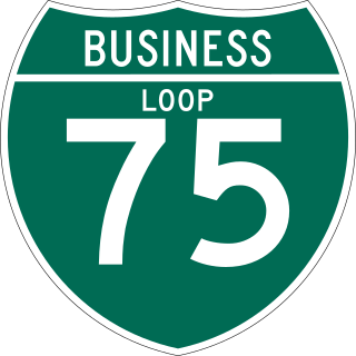
There have been nine business routes for Interstate 75 in the US state of Michigan. Numbered either Business Loop Interstate 75 or Business Spur Interstate 75 depending if they are a full business loop or a business spur, these highways are former routings of I-75's predecessor highways in the state. They were designated as I-75 was completed through the various areas of Michigan. The business loop in Pontiac runs through that city's downtown along a section of Woodward Avenue and a segment of roadway formerly used by M-24. The former Saginaw business loop was once a part of US Highway 23 (US 23), as was most of the original Bay City business loop. The roadways that make up the business loops in West Branch and Roscommon were previously part of M-76, I-75's predecessor through that part of the state. In Northern Michigan, the Grayling and Gaylord BL I-75s were part of US 27, and the two business routes in St. Ignace and Sault Ste. Marie in the Upper Peninsula of Michigan were part of US 2. A tenth business route, a loop through Indian River has been proposed. Each of the business loops connects to I-75 on both ends and runs through their respective cities' downtown areas. The two business spurs only connect to I-75 on one end and run into the appropriate downtown.
US Highway 10 (US 10) is a part of the United States Numbered Highway System that runs from West Fargo, North Dakota, to the Lower Peninsula of the US state of Michigan. The highway enters Michigan on SS Badger, which crosses Lake Michigan between Manitowoc, Wisconsin, and Ludington. As the highway crosses the state, it is a two-lane undivided highway between Ludington and Farwell and a freeway from Farwell east to the highway's terminus in Bay City. US 10 runs concurrently with US 127 in the Clare area along a section of freeway that includes a welcome center in the median. Outside of the Clare and Midland areas, US 10 runs through rural areas of West and Central Michigan in a section of the Manistee National Forest as well as farmfields.

There have been five different business routes of US Highway 23 in the state of Michigan. These business routes were designated along former sections of US Highway 23 (US 23) to provide signed access from the main highway to the downtowns of cities bypassed by new routings of US 23. Two are still extant, connecting through downtown Ann Arbor and Rogers City. Three others have been decommissioned. The former Business US 23 in Fenton was split in half during the 1970s and later completely turned back to local control in 2006. The former business loops through Saginaw and Bay City were renumbered as business loops of Interstate 75 in the 1960s.

