M-3, known for most of its length as Gratiot Avenue, is a north–south state trunkline highway in the Detroit metropolitan area of the US state of Michigan. The trunkline starts in Downtown Detroit and runs through the city in a northeasterly direction along one of Detroit's five major avenues. The highway passes several historic landmarks and through a historic district. It also connects residential neighborhoods on the city's east side with suburbs in Macomb County and downtown.

M-5, commonly referred to as Grand River Avenue and the northern section as the Haggerty Connector, is a 27.9-mile-long (44.9 km) state trunkline highway in the Metro Detroit area of the US state of Michigan. The highway runs through suburbs in Oakland and Wayne counties in addition to part of Detroit itself. It starts in Commerce Township as a north–south divided highway and freeway called the Haggerty Connector and connects with Interstate 96 (I-96) in Novi. The freeway then turns southeasterly to bypass the suburb of Farmington as an east–west highway. The freeway ends on the southeast side of Farmington, and M-5 follows Grand River Avenue as a boulevard into Detroit. The eastern terminus is at the five-way intersection between Grand River Avenue, Cass Avenue, and Middle Street in Downtown Detroit, where it had been extended to in May 2016 from an interchange with I-96 on the northwest side of the city. The trunkline passes between suburban residential subdivisions and along urban commercial areas while serving 17,200–68,800 vehicles on average each day.

US Highway 16 (US 16), also called Grand River Avenue for much of its length in the state, was one of the principal roads prior to the post-World War II construction of freeways in the state of Michigan. Before the creation of the United States Numbered Highway System in 1926, the highway had been designated as a state highway numbered M-16. The modern route of Grand River Avenue cuts across the Lower Peninsula in a northwest–southeast fashion from near Grand Rapids to Detroit. Before the late 1950s and early 1960s, US 16 followed other roads between Muskegon and Grand Rapids, and then Grand River Avenue through Lansing to Detroit. In the years immediately preceding the creation of the Interstate Highway System, US 16 was shifted from older roads to newer freeways. Later, it was co-designated as an Interstate. When the gap in the freeway was filled in around Lansing, the US 16 designation was decommissioned in the state. The freeway was solely designated Interstate 96 (I-96) east of Grand Rapids and I-196 west of that city.
M-168 was one of the shortest state trunkline highways in the US state of Michigan, extending just under a mile (1.6 km) from a junction with M-22 in downtown Elberta to the former Ann Arbor Railroad ferry docks. It followed the south shore of Lake Betsie. The highway was commissioned in 1931 and served as a connection to the car ferries until 1984. The road was reconstructed by the Michigan Department of Transportation (MDOT) in preparation to transfer it to village control. That transfer happened on April 24, 2012, and now the former highway is a village street.
M-8 is a 5.5-mile (8.9 km) state trunkline highway in the U.S. state of Michigan lying within the cities of Detroit and Highland Park. Much of it is the Davison Freeway, the nation's first urban depressed freeway, which became a connector between the Lodge (M-10) and the Chrysler freeways.
M-46 is an east–west state trunkline highway in the US state of Michigan between Muskegon and Port Sanilac, terminating near Lake Michigan and Lake Huron on each end. Except for the north–south segment that corresponds with the US Highway 131 (US 131) freeway between Cedar Springs and Howard City, M-46 is practically a due east–west surface highway. The road runs through rural sections of the Lower Peninsula connecting several freeways including US 31, US 131, US 127 and Interstate 75 (I-75).

M-102 is an east–west state trunkline highway in the US state of Michigan that runs along the northern boundary of Detroit following 8 Mile Road. The highway follows the Michigan Baseline, a part of the land survey of the state, and the roadway is also called Base Line Road in places. As a county road or city street, 8 Mile Road extends both east and west of the M-102 designation, which leaves 8 Mile on the eastern end to follow Vernier Road. The western terminus of M-102 is at the junction of 8 Mile Road and M-5 and the opposite end is at Vernier Road and Interstate 94 (I-94). The 8 Mile Road name extends west to Pontiac Trail near South Lyon with a discontinuous segment located west of US Highway 23 (US 23). The eastern end of 8 Mile Road is in Grosse Pointe Woods, near I-94, with a short, discontinuous segment east of Mack Avenue.

M-59 is an east–west state trunkline highway that crosses the northern part of Metropolitan Detroit in the US state of Michigan. It runs between Howell at Interstate 96 (I-96) and I-94 on the Chesterfield–Harrison township line near the Selfridge Air National Guard Base. While primarily a multi-lane surface highway, it is a full freeway from just east of downtown Pontiac near Opdyke Road to just east of the Mound Road/Merrill Road exit in Utica. The various surface highway segments are named either Highland Road, Huron Street or Hall Road, with the latter known as an area for shopping and dining. The rural sections west of Pontiac pass through Oakland County lake country, passing through two state recreational areas.
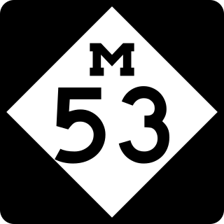
M-53 is a north–south state trunkline highway in the US state of Michigan that connects Detroit to The Thumb region. The highway starts in Detroit at a connection with M-3 and ends in Port Austin, Michigan at M-25. In between, the trunkline passes through the northern suburbs of Metro Detroit, connects to freeways like Interstate 69 (I-69) and provides access to rural farmland. In Macomb County, M-53 follows the Christopher Columbus Freeway and POW/MIA Memorial Freeway, while the remainder of the highway is known as Van Dyke Avenue in the metro area or Van Dyke Road elsewhere. The highway has also been named the Earle Memorial Highway for one of the pioneers of the Good Roads Movement and Michigan's highway system.
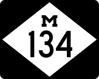
M-134 is an east–west state trunkline highway in the Upper Peninsula (UP) of the US state of Michigan. It connects Interstate 75 (I-75) north of St. Ignace with the communities of Hessel, Cedarville and De Tour Village along Lake Huron. East of De Tour, the highway crosses the De Tour Passage on a ferry to run south of the community of Drummond on Drummond Island. It is one of only three state trunklines in Michigan on islands; the others are M-154 on Harsens Island and M-185 on Mackinac Island. M-134 is also one of only two highways to utilize a ferry in Michigan; the other is US Highway 10 (US 10) which crosses Lake Michigan from Manitowoc, Wisconsin, to Ludington. Most of the mainland portion of M-134 is also part of the Lake Huron Circle Tour, and since 2015, it has been a Pure Michigan Byway under the name M-134 North Huron Byway.
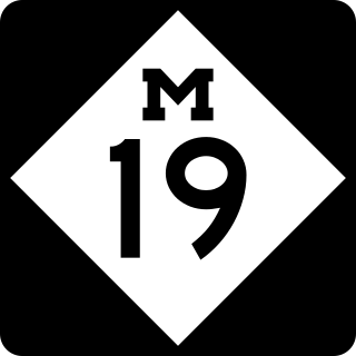
M-19 is a north–south state trunkline highway in the US state of Michigan. The trunkline begins northeast of Detroit at a junction with Interstate 94 (I-94) near New Haven and runs northward to a junction with M-142 just east of Bad Axe in The Thumb region of the Lower Peninsula. The highway runs through mostly rural and agricultural areas, connecting several small communities.

M-29 is a state trunkline highway in the US state of Michigan that runs in a south–north direction from Chesterfield Township to Marysville. It generally runs along the shore of Lake St. Clair and the St. Clair River.

M-189 is a north–south state trunkline highway in the Upper Peninsula of the US state of Michigan. It serves as the continuation of Highway 139 (WIS 139) from Wisconsin into Michigan, connecting to US Highway 2 (US 2) in Iron River. M-189 has been largely unchanged since being designated in the 1930s, although a new bridge over the Brule River at the state line was built in 1988.
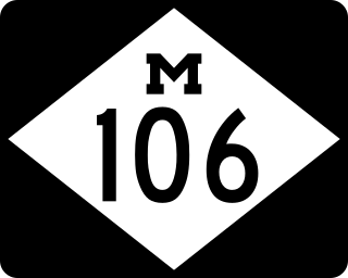
M-106 is a state trunkline highway in the Lower Peninsula of the US state of Michigan in and near the city of Jackson. M-106 travels in a southwest-to-northeast direction from Jackson to Gregory at a junction with M-36 just a few miles northwest of Hell. The highway was first designated in 1928 running north out of downtown Jackson. It connected U.S. Highway 12 (US 12) to the state prison and Bunkerhill Road. A pair of changes in the early 1930s resulted in the extension eastward to Gregory. From the 1960s until the early years of the 21st century, a section of M-106 in downtown Jackson was routed along one-way streets.

M-109 is the designation of a state trunkline highway in the Lower Peninsula of the US state of Michigan that runs between Empire and Glen Arbor. The highway is a loop connected to M-22 at both ends that allows tourists access to Sleeping Bear Dunes National Lakeshore and the Pierce Stocking Scenic Drive located on a section of sandy forest land between Lake Michigan and Glen Lake. The trunkline traverses an area named the "Most Beautiful Place in America" by Good Morning America, the morning show on ABC. The highway was designated by 1929 and fully paved in 1939.

M-136 is a state trunkline highway in the US state of Michigan that runs from Brockway to Fort Gratiot in the lower part of The Thumb of the Lower Peninsula. The highway serves as a connector between M-19 on the west and M-25 northwest of Port Huron. In between, the highway runs through rural St. Clair County through farm fields and along a creek and river. The trunkline uses roads that were part of the state highway system in 1919. The M-136 designation was assigned in 1931 and extended to its current length in 1961.

M-121 is a state trunkline highway in West Michigan. The highway follows Chicago Drive, a local roadway, from Zeeland to Grandville. Chicago Drive itself runs past the M-121 segment on either side from Holland to Wyoming. The roadway passes through rural farmland on a route that runs parallel to Interstate 196 (I-196). M-121 forms the main street through the center of Hudsonville as it runs southwest–northeast. It forms a major street through the unincorporated community of Jenison before M-121 terminates at I-196 in Grandville.

US Highway 12 (US 12) is an east–west United States Numbered Highway that runs from Aberdeen, Washington, to Detroit, Michigan. In Michigan, it runs for 210 miles (340 km) between New Buffalo and Detroit as a state trunkline highway and Pure Michigan Byway. On its western end, the highway is mostly a two-lane road that runs through the southern tier of counties roughly parallel to the Indiana state line. It forms part of the Niles Bypass, a four-lane expressway south of Niles in the southwestern part of the state, and it runs concurrently with the Interstate 94 (I-94) freeway around the south side of Ypsilanti in southeastern Michigan. In between Coldwater and the Ann Arbor area, the highway angles northeasterly and passes Michigan International Speedway. East of Ypsilanti, US 12 follows a divided highway routing on Michigan Avenue into Detroit, where it terminates at an intersection with Cass Avenue.

US Highway 25 (US 25) was a part of the United States Numbered Highway System in the state of Michigan that ran from the Ohio state line near Toledo and ended at the tip of The Thumb in Port Austin. The general routing of this state trunkline highway took it northeasterly from the state line through Monroe and Detroit to Port Huron. Along this southern half, it followed undivided highways and ran concurrently along two freeways, Interstate 75 (I-75) and I-94. Near the foot of the Blue Water Bridge in Port Huron, US 25 turned north and northwesterly along the Lake Huron shoreline to Port Austin.

