
M-60 is an east–west state trunkline highway in the US state of Michigan. It runs from the Niles area at a junction with US Highway 12 (US 12) to the Jackson area where it ends at Interstate 94 (I-94). The trunkline passes through a mix of farm fields and woodlands, crosses or runs along several rivers and connects several small towns of the southern area of the state. The westernmost segment runs along divided highway while the easternmost section is a full freeway bypass of Jackson.
M-168 was one of the shortest state trunkline highways in the US state of Michigan, extending just under a mile (1.6 km) from a junction with M-22 in downtown Elberta to the former Ann Arbor Railroad ferry docks. It followed the south shore of Lake Betsie. The highway was commissioned in 1931 and served as a connection to the car ferries until 1984. The road was reconstructed by the Michigan Department of Transportation (MDOT) in preparation to transfer it to village control. That transfer happened on April 24, 2012, and now the former highway is a village street.

M-13 is a 73.339-mile (118.028 km) north–south state trunkline highway that runs through the Saginaw Bay region of the US state of Michigan. It runs from Interstate 69 (I-69) south of Lennon to US Highway 23 (US 23) near Standish. The southern section of the trunkline runs along a pair of county lines in a rural area dominated by farm fields. The highway directly connects the downtown areas of both Saginaw and Bay City. North of the latter city, the Lake Huron Circle Tour follows M-13 along the Saginaw Bay.

M-125 is a 19+1⁄2-mile-long (31.4 km) state trunkline highway in the US state of Michigan. The highway is entirely within Monroe County with the southern terminus on the Ohio state border near Toledo and a northern terminus at US Highway 24 (US 24) in Frenchtown Township, 5 miles (8.0 km) north of Monroe. M-125 runs through rural farmlands and connects a couple of smaller towns with Monroe. It has an unsigned connector highway that links the main highway with Interstate 75 (I-75).

M-119 is a 27.548-mile (44.334 km) state trunkline highway entirely within Emmet County in the US state of Michigan. The highway follows the shore of Lake Michigan and the Little Traverse Bay, with its southern terminus at US Highway 31 (US 31) near Bay View, about four miles (6.4 km) east of Petoskey; the northern terminus is at a junction with county roads C-66 and C-77 in Cross Village. North of Harbor Springs, the highway is known as the Tunnel of Trees Scenic Heritage Route. This section of highway lacks a centerline and is known for its scenic beauty. On an average day, between 2,000 and 15,000 vehicles use various parts of the highway.

F-41 is a county-designated highway in the Lower Peninsula of Michigan. It was previously designated as M-171, a former state trunkline highway, until 1960, running from US Highway 23 (US 23) just north of Oscoda, and coming back to US 23 about 20 miles (32 km) south of Alpena. The road runs through rural, forested areas of Iosco and Alcona counties, inland from Lake Huron.

M-186 is a state trunkline highway in the US state of Michigan. Entirely within Fife Lake Township, in southeastern Grand Traverse County, the highway serves as a short connector between M-113 near Kingsley and US Highway 131 (US 131) at the village of Fife Lake. The current incarnation of M-186 is the second usage of the designation, as it was originally used for a highway in Delta County in the 1930s.
M-134 is an east–west state trunkline highway in the Upper Peninsula (UP) of the US state of Michigan. It connects Interstate 75 (I-75) north of St. Ignace with the communities of Hessel, Cedarville and De Tour Village along Lake Huron. East of De Tour, the highway crosses the De Tour Passage on a ferry to run south of the community of Drummond on Drummond Island. It is one of only three state trunklines in Michigan on islands; the others are M-154 on Harsens Island and M-185 on Mackinac Island. M-134 is also one of only two highways to utilize a ferry in Michigan; the other is US Highway 10 (US 10) which crosses Lake Michigan from Manitowoc, Wisconsin, to Ludington. Most of the mainland portion of M-134 is also part of the Lake Huron Circle Tour, and since 2015, it has been a Pure Michigan Byway under the name M-134 North Huron Byway.
M-95, designated the Leif Erickson Memorial Highway, is a state trunkline highway in the Upper Peninsula of the US state of Michigan. Running from Kingsford to near Champion in Humboldt Township, it is the main connection between Iron Mountain and Marquette along with US Highway 41.

M-189 is a north–south state trunkline highway in the Upper Peninsula of the US state of Michigan. It serves as the continuation of Highway 139 (WIS 139) from Wisconsin into Michigan, connecting to US Highway 2 (US 2) in Iron River. M-189 has been largely unchanged since being designated in the 1930s, although a new bridge over the Brule River at the state line was built in 1988.

M-65 is a 103.176-mile-long (166.046 km) state trunkline highway in the US state of Michigan. The highway runs between termini on US Highway 23 (US 23) near Omer and Rogers City in the northeastern Lower Peninsula of the state. M-65 runs inland through several small communities in the region, passing through forests and fields along its course. M-65 crosses several watercourses, including the Au Sable River where it runs along the River Road National Scenic Byway. The region also includes the Huron National Forest and the Mackinaw State Forest areas.
M-116 is a 7.018-mile-long (11.294 km) state trunkline highway in the US state of Michigan that begins in Ludington at an intersection with US Highway 10 (US 10) at James Street and Ludington Avenue. The road travels northward, much of it along the shore of Lake Michigan before reaching its terminus at the entrance to Ludington State Park. The roadway has been in the state highway system since the late 1920s. It has been realigned a few times, most recently in the late 1990s.

M-124 is a state trunkline highway in the Lower Peninsula of the US state of Michigan that runs on the north side of Vineyard and Wamplers lakes near Brooklyn in Jackson County near the Irish Hills area. The highway travels directly through W. J. Hayes State Park before ending in Lenawee County. The designation was created in 1929 for a road that accessed the state park, connecting it to US Highway 112. It was later extended westward to M-50 in Brooklyn in the 1930s.

M-156 is a state trunkline highway in the US state of Michigan. The highway is entirely within Lenawee County and begins in Morenci at the Ohio state line with State Route 108 (SR 108) and runs north to M-34 at Clayton. The highway runs through farm land along Lime Creek outside of the two communities, providing access to the Lake Hudson State Recreation Area. The trunkline dates back to the early 1930s, and has been unchanged since a realignment in 1980.

M-140 is a north–south state trunkline highway in Berrien and Van Buren counties of the US state of Michigan. The highway starts in the Niles area at M-139 and runs north through Watervliet to South Haven, ending at Interstate 196/US Highway 31 (I-196/US 31). In between, it runs through farm fields and past lakes in the southwestern part of the Lower Peninsula. The trunkline is used, on average, by between 1,500 and 10,200 vehicles.
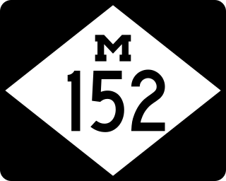
M-152 is a state trunkline highway in the US state of Michigan in Cass and Van Buren counties. The highway runs through the Sister Lakes area providing access to the lake cabins and adjoining farmlands. The highway has existed mostly unchanged since the designation was commissioned in the 1930s.
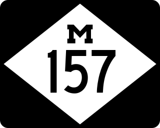
M-157 is a short state trunkline highway in the US state of Michigan. The highway is entirely within Roscommon County in the Lower Peninsula. It is the fourth-shortest state highway in the system, and it serves as a connector route between M-18 and M-55 just east of Prudenville. The current roadway was built and designated as M-157 in the 1930s.

US Highway 2 (US 2) is a component of the United States Numbered Highway System that connects Everett, Washington, to the Upper Peninsula (UP) of the US state of Michigan, with a separate segment that runs from Rouses Point, New York, to Houlton, Maine. In Michigan, the highway runs through the UP in two segments as a part of the state trunkline highway system, entering the state at Ironwood and ending at St. Ignace; in between, US 2 briefly traverses the state of Wisconsin. As one of the major transportation arteries in the UP, US 2 is a major conduit for traffic through the state and neighboring northern Midwest states. Two sections of the roadway are included as part of the Great Lakes Circle Tours, and other segments are listed as state-designated Pure Michigan Byways. There are several memorial highway designations and historic bridges along US 2 that date to the 1910s and 1920s. The highway runs through rural sections of the UP, passing through two national and two state forests in the process.

