
M-78 is a state trunkline highway in the US state of Michigan. The western terminus is the intersection with M-66 north of Battle Creek in Pennfield Township. The roadway runs 10.744 miles (17.291 km) through rural farmland and the community of Bellevue as it approaches its eastern terminus at an interchange with Interstate 69 (I-69) near Olivet. The highway is used by between 3,100 and 5,300 vehicles on a daily basis.
M-99 is a north–south state trunkline highway in the Lower Peninsula of the US state of Michigan. It runs from the Ohio state border, where it connects to State Route 15 (SR 15), north to Lansing, where it terminates at a junction with Interstate 496 (I-496). The highway mainly serves local communities along the route as it passes through farm lands in the southern part of the state. One short segment, in Jonesville, is routed concurrently with US Highway 12 (US 12). The segment within Lansing follows Martin Luther King Jr. Boulevard.
M-86 is an east–west state trunkline highway in the US state of Michigan in the southern portion of the Lower Peninsula. The highway starts at Business US Highway 131 and M-60 in Three Rivers and ends at US Highway 12 (US 12) near Coldwater. In between, it crosses farm country and runs along a section of the Prairie River. Following a highway originally numbered M-7, the roadway was renumbered M-86 in 1940. It has been a part of the state highway system at least since 1927. Two other roadways carried the M-86 designation in the 1920s. Two bridges along the road are eligible for inclusion on the National Register of Historic Places (NRHP).
M-43 is a state trunkline highway in the southwestern and central parts of the US state of Michigan. The highway runs from South Haven to Webberville along an indirect path through both rural areas and larger cities. The trunkline follows five overall segments: a southeasterly track from South Haven to Oshtemo Township, a northerly path to Plainwell, a southeasterly route to Richland, a northeasterly course to the Hastings area and an easterly route through the Lansing area.

M-49 is a north–south state trunkline highway in the south-central portion of the US state of Michigan. It runs from the Ohio state line north to Litchfield through rural Hillsdale County. M-49 is the only Michigan highway in which the road crossing into another state has the same state highway number. M-49 continues as State Route 49 (SR 49), near the Indiana–Michigan–Ohio tripoint south of Camden. The highway dates back to 1930 and was only altered once in the 1940s. M-49 runs through Southern Michigan farmlands connecting several small towns along its path. At one point, M-49 briefly runs concurrently with US Highway 12 (US 12).
M-40 is a north–south state trunkline highway in the Lower Peninsula of the US state of Michigan. The highway runs from US Highway 12 (US 12) near the Indiana state line in Porter Township north through Paw Paw and Allegan to end in the outskirts of Holland. The current northern end is near Interstate 196 (I-196) at an intersection with US 31/Business Loop I-196 (BL 196). In between, M-40 runs through mixed agricultural and forest lands and along lakes and rivers through Southwest Michigan.
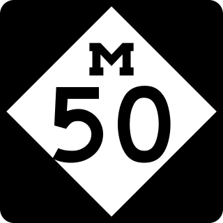
M-50 is a state trunkline highway in the US state of Michigan. Although designated as an east–west highway, it is nearly a diagonal northwest–southeast route. The western terminus is at exit 52 along Interstate 96 (I-96) near Alto a few miles east of the metro Grand Rapids area, and its eastern terminus is in downtown Monroe at US Highway 24. In between the trunkline runs through seven counties of the southern part of the Lower Peninsula mostly through rural farm fields and small communities. The highway also runs through downtown Jackson to connect between two freeway sections of US 127. In the Irish Hills area of the state southeast of Jackson, M-50 runs next to Michigan International Speedway.

M-51 is a north–south state trunkline highway in the southwestern portion of the US state of Michigan. The southern terminus is at a connection with State Road 933 across the Michigan–Indiana state line near South Bend, Indiana. From there the trunkline runs north through an interchange with US Highway 12 (US 12) into Niles along a route that was once part of Business US 12. North of Niles, the highway runs parallel to a river and a rail line through rural areas. The northern terminus is on Interstate 94 (I-94) west of Paw Paw.

M-13 is a 73.339-mile (118.028 km) north–south state trunkline highway that runs through the Saginaw Bay region of the US state of Michigan. It runs from Interstate 69 (I-69) south of Lennon to US Highway 23 (US 23) near Standish. The southern section of the trunkline runs along a pair of county lines in a rural area dominated by farm fields. The highway directly connects the downtown areas of both Saginaw and Bay City. North of the latter city, the Lake Huron Circle Tour follows M-13 along the Saginaw Bay.

M-76 is a former state trunkline highway designation in the Lower Peninsula of the US state of Michigan. The highway's designation was decommissioned when the last section of it was converted to freeway as a part of the present-day Interstate 75 (I-75). At that time, M-76 extended from US Highway 23 (US 23) near Standish northwesterly to I-75 south of Grayling. Two sections of the route followed freeways with a two-lane highway in between to connect them. The former routing of M-76 through West Branch before that city was bypassed was initially redesignated Business M-76. The highway itself ran through mixed fields and forests bypassing several other towns in the region.
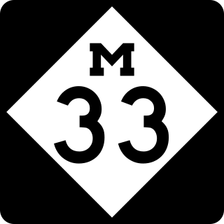
M-33 is a north–south state trunkline highway in the US state of Michigan that runs from Interstate 75 (I-75) at Alger in Arenac County north to M-27 near Cheboygan. In between, the trunkline runs through rural sections of the northeastern Lower Peninsula including state and national forest areas. M-33 connects to a handful of parks and crosses several of the rivers in that section of the state. It runs concurrently with three other state highways, sharing pavement to connect through several small communities of Northern Michigan.

M-142 is an east–west state trunkline highway in The Thumb region of the US state of Michigan. It is a "trans-peninsular" highway in that it travels through an agricultural area from Bay Port on Saginaw Bay to Harbor Beach on Lake Huron. The current trunkline in Huron County was originally parts of other state highways that date back to the initial 1919 signposting of the state highway system in the state. The designation was applied in 1939, and the road has remained unchanged since it was completely paved in the 1950s. One other highway, near Lake City, carried the number in the 1930s.

M-57 is an east–west state trunkline highway in the US state of Michigan. The 105.377-mile (169.588 km) highway connects US Highway 131 (US 131) near Rockford on the west end to M-15 near Otisville in the Lower Peninsula. In between, the mostly rural highway passes through farmland and connects several highways and smaller towns together. Three of these highways are freeways: US 131, US 127 and Interstate 75 (I-75). Along the way, between 3,700 and 22,300 vehicles use the highway daily.
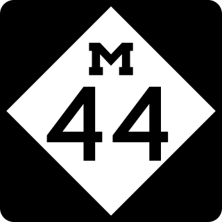
M-44 is a 37.463-mile (60.291 km) state trunkline highway in the western region of the US state of Michigan. It runs northward from the intersection of M-11 and M-37 toward the Rockford area. The highway then turns eastward to Belding, and it ends six miles (10 km) north of Ionia at M-66. M-44 is known in Grand Rapids as the "East Beltline" and intersects with its related highway, Connector M-44, in Plainfield Township. This highway runs concurrently with M-37 between M-11 and Interstate 96 (I-96).
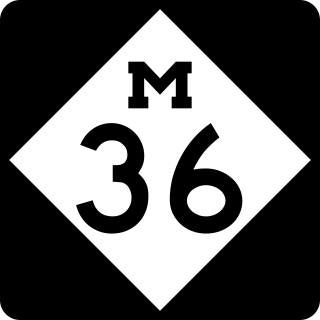
M-36 is a state trunkline highway in the Lower Peninsula of the US state of Michigan that runs in a west–east direction from Mason to Whitmore Lake. The trunkline connects US Highway 127 (US 127) south of Lansing and US 23 north of Ann Arbor. The highway connects several smaller communities in the rural areas along its route. M-36 also runs concurrently with two other roadways, sharing pavement with M-52 and County Road D-19. According to traffic surveys in 2010, between 650 and 15,300 vehicles used the highway on average each day.

M-64 is a north–south state trunkline highway in the Upper Peninsula of the US state of Michigan. It runs for approximately 63+3⁄4 miles (102.6 km) through the western part of the state in land that is part of the Ottawa National Forest. The highway connects with County Trunk Highway B (CTH-B) at the state line near Presque Isle, Wisconsin. As it passes through dense forests, M-64 runs along lakes Gogebic and Superior. The northern end is at a junction with US Highway 45 (US 45) in Ontonagon.

M-65 is a 103.176-mile-long (166.046 km) state trunkline highway in the US state of Michigan. The highway runs between termini on US Highway 23 (US 23) near Omer and Rogers City in the northeastern Lower Peninsula of the state. M-65 runs inland through several small communities in the region, passing through forests and fields along its course. M-65 crosses several watercourses, including the Au Sable River where it runs along the River Road National Scenic Byway. The region also includes the Huron National Forest and the Mackinaw State Forest areas.

M-150 is a state trunkline highway in the US state of Michigan that runs through Rochester Hills and Rochester. It is more commonly known as Rochester Road and runs from a southern terminus at the M-59 freeway north through downtown Rochester to a northern terminus at Tienken Road. M-150 has been a state trunkline since around 1930, and within a few years of its commissioning, it was extended south through Royal Oak and north into rural Oakland County. After changes in the 1960s, the highway terminated in Troy at Interstate 75 (I-75) on the southern end and Tienken Road on the north. Since 1987, it has ended at M-59.
M-106 is a state trunkline highway in the Lower Peninsula of the US state of Michigan in and near the city of Jackson. M-106 travels in a southwest-to-northeast direction from Jackson to Gregory at a junction with M-36 just a few miles northwest of Hell. The highway was first designated in 1928 running north out of downtown Jackson. It connected U.S. Highway 12 (US 12) to the state prison and Bunkerhill Road. A pair of changes in the early 1930s resulted in the extension eastward to Gregory. From the 1960s until the early years of the 21st century, a section of M-106 in downtown Jackson was routed along one-way streets.

M-136 is a state trunkline highway in the US state of Michigan that runs from Brockway to Fort Gratiot in the lower part of The Thumb of the Lower Peninsula. The highway serves as a connector between M-19 on the west and M-25 northwest of Port Huron. In between, the highway runs through rural St. Clair County through farm fields and along a creek and river. The trunkline uses roads that were part of the state highway system in 1919. The M-136 designation was assigned in 1931 and extended to its current length in 1961.


