The earliest English-speaking settlers also called this area The Forks, because it is at the confluence of the north and south branches of the Kalamazoo River. In the early 20th century, immigrants came to Albion from various eastern European nations, including the current Lithuania and Russia. More recently, Latino immigrants have come from Mexico and Central America. The Festival of the Forks has been held annually since 1967 to celebrate Albion's diverse ethnic heritage.
Since the 19th century, several major manufacturers were established in Albion, which became known as a factory town. This changed after several manufacturers closed. In the 21st century, Albion's culture is changing to that of a college town whose residents have a strong interest in technology and sustainability. Albion College is a private liberal arts college with a student population of about 1,250. Albion is a sister city with Noisy-le-Roi, France.
History
The first European-American settler, Tenney Peabody, arrived in 1833 along with his brother-in-law, Charles Blanchard, and another young man, Clark Dowling. Peabody's family followed soon after. In 1835, the Albion Company, a land development company formed by Jesse Crowell, platted a village. Peabody's wife was asked to name the settlement. She considered the name "Peabodyville", but selected "Albion" instead, after the former residence of Jesse Crowell. Crowell was appointed in 1838 as the first US postmaster there.
Many early settlers migrated to Albion from western New York and New England, part of a movement after the construction of the Erie Canal and the opening of new lands in Michigan and other Great Lakes territories. They first developed agriculture and it became a rural trading village. Settlers were strong supporters of education and in 1835, Methodists established Albion College affiliated with their church. Its first classes were held in 1843. The college was known by a few other names before 1861. At that time it was fully authorized to confer four-year degrees on both men and women.
Albion incorporated as a village in 1855, following construction of the railroad here in 1852, which stimulated development. It became a city in 1885.[4][5]
Mills were constructed to operate on the water power of the forks of the Kalamazoo River. They were the first industry in the town, used to process lumber, grain, and other products to build the village. Albion quickly became a mill town as well as an agricultural market. The river that powered industry also flooded the town.
In the Great Flood of 1908, there was severe property damage. In February, several feet of snow fell across the region. Heavy rains and warmer conditions in early March created water saturation in the ground and risk of flooding because of the rivers' high flow. After the Homer Dam broke around 3 p.m. on March 7, the Kalamazoo River flooded Albion. By midnight, the bridges surrounding town were underwater. Six buildings in Albion collapsed, resulting in more than $125,000 in damage (1908 dollars).[6][7] The town struggled to recover.
In the late 19th and early 20th centuries, numerous Lithuanian and other Eastern European immigrants settled there, most working for the Albion Malleable Iron Company, and some in the coal mine north of town. The iron company initially made agricultural implements, but around World War I shifted to making automotive parts. The Malleable merged in 1969 with the Hayes Corporation, becoming the Hayes-Albion Corporation. Now known as a division of Harvard Industries, the company continues to produce automotive castings in Albion. Molder Statue Park downtown is dedicated to the many molders who dealt with molten iron.[8]
There were soon enough Lithuanians in town to establish Holy Ascension Orthodox Church, which they built in 1916. It is part of the Orthodox Church in America. Today its services are in English.[9]
Albion's population peaked in 1960.[10] In 1973 Albion was named an All-America City by the National Civic League. It celebrated the award on May 15, 1974, when Michigan Governor William Milliken and many other dignitaries came to town. In 1975 the closure of a major factory began a difficult period of industrial restructuring and decline in jobs and population.
Since that time citizens have mobilized, founding the Albion Community Foundation in 1968. They formed the Albion Volunteer Service Organization in the 1980s, with support from Albion College, to address the challenge of diminishing economic opportunity.[citation needed]
Albion's historic brick main street was first laid in 1903. It was reconstructed in 1993 with hand-laid, kiln-fired clay bricks.
1960s: Columnist Ann Landers was presented with a key upon her visit to Starr Commonwealth for Boys.[11]
Law and government
Albion has a council-manager government. City residents elect a mayor at-large and City Council members from each of six single-member districts. The council in turn selects a city manager to handle the city's day-to-day affairs. The mayor presides over and is a voting member of the council. Council members are elected to four-year terms, staggered every two years. A mayor is elected every two years.[12] The city levies an income tax of 1% on residents and 0.5% on nonresidents.[13]
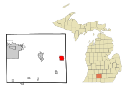
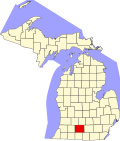
Geography
According to the United States Census Bureau, the city has an area of 4.51 square miles (11.68km2), of which 4.41 square miles (11.42km2) is land and 0.10 square miles (0.26km2) is water.[14] Albion is 42.24 degrees north of the equator and 84.75 degrees west of the prime meridian.
Helen Rose Hull, author and university professor, was born in Albion. Her 1932 book Heat Lightning concerns a family that owns agricultural implement and automotive parts factories in a small town during the 1930s.
↑ "Brian Tyler". July 10, 2010. Archived from the original on July 10, 2010. Retrieved June 19, 2023.{{cite web}}: CS1 maint: bot: original URL status unknown (link)
This page is based on this Wikipedia article Text is available under the CC BY-SA 4.0 license; additional terms may apply. Images, videos and audio are available under their respective licenses.