Waldron, Michigan

Last updated

Waldron, Michigan
Village of Waldron
Waldron, Michigan (2022).jpg
Looking south along Main Street
Waldron, MI location.png
Location within Hillsdale County
USA Michigan location map.svg
Red pog.svg
Waldron
Location within the state of Michigan
Usa edcp location map.svg
Red pog.svg
Waldron
Location within the United States
Coordinates: 41°43′35″N84°25′05″W / 41.72639°N 84.41806°W / 41.72639; -84.41806
CountryUnited States
State Michigan
County Hillsdale
Township Wright
Settled1835
Incorporated1905
Government
  Type Village council
  PresidentRuss Platt
   Clerk Casey Gravelle
Area
[1]
  Total1.00 sq mi (2.59 km2)
  Land1.00 sq mi (2.59 km2)
  Water0.00 sq mi (0.00 km2)
Elevation
899 ft (274 m)
Population
 (2020)
  Total505
  Density505.00/sq mi (195.04/km2)
Time zone UTC-5 (Eastern (EST))
  Summer (DST) UTC-4 (EDT)
ZIP code(s)
49288
Area code 517
FIPS code 26-82880 [2]
GNIS feature ID1615686 [3]

Waldron is a village in Hillsdale County in the U.S. state of Michigan. The population was 505 at the 2020 census. The village is located within Wright Township.

Contents

History

The first settler to the area was Russell Coman, who came from New York in 1835. In 1837, the early settlers submitted the new name of the community as Coman, but a clerical error ended up assigning the community's name as Canaan. It was renamed Wright after the township in 1844. A post office opened on November 2, 1855, and was named South Wright due to the community's southern location in the township. In 1877, portions of the community were formally platted and adopted under the name Waldron after congressman Henry Waldron of Hillsdale, who represented the area in the U.S. House of Representatives. Waldron incorporated as a village in 1905. [4]

Geography

According to the U.S. Census Bureau, the village has a total area of 1.00 square mile (2.59 km2), all land. [1]

Demographics

Historical population
CensusPop.Note
1890 365
1910 435
1920 4575.1%
1930 307−32.8%
1940 42438.1%
1950 4270.7%
1960 4546.3%
1970 56424.2%
1980 5701.1%
1990 5811.9%
2000 5901.5%
2010 538−8.8%
2020 505−6.1%
U.S. Decennial Census [5]

2010 census

As of the census [6] of 2010, there were 538 people, 211 households, and 137 families living in the village. The population density was 538.0 inhabitants per square mile (207.7/km2). There were 253 housing units at an average density of 253.0 per square mile (97.7/km2). The racial makeup of the village was 97.6% White, 0.6% African American, 0.9% Native American, and 0.9% from two or more races. Hispanic or Latino of any race were 0.7% of the population.

There were 211 households, of which 40.3% had children under the age of 18 living with them, 44.1% were married couples living together, 14.2% had a female householder with no husband present, 6.6% had a male householder with no wife present, and 35.1% were non-families. 32.2% of all households were made up of individuals, and 10.9% had someone living alone who was 65 years of age or older. The average household size was 2.55 and the average family size was 3.18.

The median age in the village was 34.1 years. 30.1% of residents were under the age of 18; 7.8% were between the ages of 18 and 24; 26% were from 25 to 44; 24.2% were from 45 to 64; and 11.9% were 65 years of age or older. The gender makeup of the village was 47.4% male and 52.6% female.

2000 census

As of the census [2] of 2000, there were 590 people, 231 households, and 152 families living in the village. The population density was 575.6 inhabitants per square mile (222.2/km2). There were 249 housing units at an average density of 242.9 per square mile (93.8/km2). The racial makeup of the village was 97.80% White, 0.34% African American, 0.34% Native American, and 1.53% from two or more races. Hispanic or Latino of any race were 1.02% of the population.

There were 231 households, out of which 35.9% had children under the age of 18 living with them, 47.6% were married couples living together, 14.3% had a female householder with no husband present, and 33.8% were non-families. 29.0% of all households were made up of individuals, and 10.4% had someone living alone who was 65 years of age or older. The average household size was 2.54 and the average family size was 3.13.

In the village, the population was spread out, with 29.8% under the age of 18, 9.0% from 18 to 24, 30.0% from 25 to 44, 18.3% from 45 to 64, and 12.9% who were 65 years of age or older. The median age was 33 years. For every 100 females, there were 92.2 males. For every 100 females age 18 and over, there were 86.5 males.

The median income for a household in the village was $30,417, and the median income for a family was $36,125. Males had a median income of $28,958 versus $19,375 for females. The per capita income for the village was $15,083. About 10.3% of families and 16.4% of the population were below the poverty line, including 21.0% of those under age 18 and 5.9% of those age 65 or over.

Education

The village is served entirely by the Waldron Area Schools, which has its main campus just north of the village boundaries. [7]

Notable people

Images

Related Research Articles

<span class="mw-page-title-main">Hillsdale County, Michigan</span> County in Michigan, United States

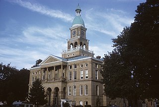
Hillsdale County is a county located in the U.S. state of Michigan. As of the 2020 Census, the population was 45,746. The county seat is Hillsdale.

<span class="mw-page-title-main">Adams Township, Hillsdale County, Michigan</span> Civil township in Michigan, United States

Adams Township is a civil township of Hillsdale County in the U.S. state of Michigan. The population was 2,262 at the 2020 census.

<span class="mw-page-title-main">Allen, Michigan</span> Village in Michigan, United States

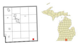
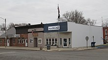
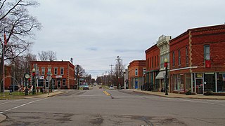
Allen is a village in Hillsdale County in the U.S. state of Michigan. The population was 201 at the 2020 census.

<span class="mw-page-title-main">Allen Township, Michigan</span> Civil township in Michigan, United States

Allen Township is a civil township of Hillsdale County in the U.S. state of Michigan. The population was 1,334 at the 2020 census.

<span class="mw-page-title-main">Amboy Township, Michigan</span> Civil township in Michigan, United States

Amboy Township is a civil township of Hillsdale County in the U.S. state of Michigan. The population was 1,064 at the 2020 census.

<span class="mw-page-title-main">Camden, Michigan</span> Village in Michigan, United States

Camden is a village in Hillsdale County in the U.S. state of Michigan. The population was 496 at the 2020 census. The village is located within Camden Township.

<span class="mw-page-title-main">Camden Township, Michigan</span> Civil township in Michigan, United States

Camden Township is a civil township of Hillsdale County in the U.S. state of Michigan. The population was 2,093 at the 2020 census. The villages of Camden and Montgomery are within the township.

<span class="mw-page-title-main">Fayette Township, Michigan</span> Civil township in Michigan, United States

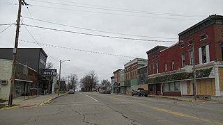
Fayette Township is a civil township of Hillsdale County in the U.S. state of Michigan. The population was 990 at the 2020 census, which ranks it the least-populated township in the county. This is a significant decrease from 3,326 at the 2010 census, which was due to the village of Jonesville incorporating as an autonomous city in 2014.

<span class="mw-page-title-main">Hillsdale, Michigan</span> City in Michigan, United States

Hillsdale is the largest city and county seat of Hillsdale County in the U.S. state of Michigan. The population was 8,036 at the 2020 census. The city is the home of Hillsdale College, a private liberal arts college.

<span class="mw-page-title-main">Jonesville, Michigan</span> City in Michigan, United States

Jonesville is a city in Hillsdale County in the U.S. state of Michigan. The population was 2,176 at the 2020 census.

<span class="mw-page-title-main">Litchfield, Michigan</span> City in Michigan, United States

Litchfield is a city in Hillsdale County in the U.S. state of Michigan. The population was 1,399 at the 2020 census.

<span class="mw-page-title-main">Montgomery, Michigan</span> Village in Michigan, United States

Montgomery is a village in Hillsdale County in the U.S. state of Michigan. The population was 322 at the 2020 census. The village is located within Camden Township.

<span class="mw-page-title-main">North Adams, Michigan</span> Village in Michigan, United States

North Adams is a village in Hillsdale County in the U.S. state of Michigan. The population was 452 at the 2020 census. The village is located within Adams Township.

<span class="mw-page-title-main">Reading Township, Michigan</span> Civil township in Michigan, United States

Reading Township is a civil township of Hillsdale County in the U.S. state of Michigan. The population was 1,910 at the 2020 census.

<span class="mw-page-title-main">Wright Township, Hillsdale County, Michigan</span> Civil township in Michigan, United States

Wright Township is a civil township of Hillsdale County in the U.S. state of Michigan. The population was 1,542 at the 2020 census.

<span class="mw-page-title-main">Hanover Township, Jackson County, Michigan</span> Civil township in Michigan, United States

Hanover Township is a civil township of Jackson County in the U.S. state of Michigan. The population was 3,695 at the 2010 census.

<span class="mw-page-title-main">Pulaski Township, Michigan</span> Civil township in Michigan, United States

Pulaski Township is a civil township of Jackson County in the southern portion of the U.S. state of Michigan. As of the 2010 census, the township population was 2,075.

<span class="mw-page-title-main">Luther, Michigan</span> Village in Michigan, United States

Luther is a village in Lake County in the U.S. state of Michigan. The population was 318 at the 2010 census. The village is on the boundary between Newkirk Township on the west and Ellsworth Township on the east, with about half of the village in each. It is the site of Hillsdale College's G.H. Gordon Biological Research Station.

<span class="mw-page-title-main">Medina Township, Michigan</span> Civil township in Michigan, United States

Medina Township is a civil township of Lenawee County in the U.S. state of Michigan. The population was 1,227 at the 2010 census.

<span class="mw-page-title-main">Hillsdale, Missouri</span> Village in Missouri, United States

Hillsdale is a village in St. Louis County, Missouri, United States. Hillsdale consists of 67th, 68th, 69th, St.Louis Ave and sometimes Rosebud. Hillsdale is also home of Greenwood Cemetery. The population was 1,478 at the 2010 census.

References

  1. 1 2 "2020 U.S. Gazetteer Files". United States Census Bureau. Retrieved May 21, 2022.
  2. 1 2 "U.S. Census website". United States Census Bureau . Retrieved January 31, 2008.
  3. U.S. Geological Survey Geographic Names Information System: Waldron, Michigan
  4. Romig, Walter (October 1, 1986) [1973]. Michigan Place Names: The History of the Founding and the Naming of More Than Five Thousand Past and Present Michigan Communities (Paperback). Detroit, Michigan: Wayne State University Press. pp. 587–579. ISBN   978-0-8143-1838-6.
  5. "Census of Population and Housing". Census.gov. Retrieved June 4, 2015.
  6. "U.S. Census website". United States Census Bureau . Retrieved November 25, 2012.
  7. Michigan Geographic Framework (November 15, 2013). "Hillsdale County School Districts" (PDF). Retrieved December 11, 2022.