This article needs additional citations for verification .(September 2018) |
System information | |
---|---|
Notes | Minnesota's Trunk Highways are state-maintained [2] |
Highway names | |
Interstates | Interstate X (I-X) |
US Highways | U.S. Highway X (US X) |
State | Trunk Highway X (MN X or TH X) |
System links | |
|
The organized system of Minnesota State Highways (typically abbreviated as MN or TH, and called Trunk Highways), the state highway system for the US state of Minnesota, was created in 1920 under the "Babcock Amendment" to the state constitution. No real pattern exists for the numbering of highways. Route commissioning beyond these routes was by legislative action, thus the term legislative route. This included additions and revisions that took place when US and Interstate Highway Systems were commissioned.
Minnesota state highway markers use Type D FHWA font for all route numbers and type C for three-digit route markers only if type D font cannot be used. All routes except interstates use 24-by-24-inch (610 mm × 610 mm) or 36-by-36-inch (910 mm × 910 mm) markers. Interstate markers for three-digit routes are wider shields, 24 by 30 inches (610 mm × 760 mm) and 36 by 45 inches (910 mm × 1,140 mm) respectively. [3]
Although Minnesota state highways do not follow a distinctive pattern in numbering, they are numbered to avoid conflicting with Interstate Highways and US Highways. Any instance of a state number that matches one is often a continuation of the particular route (e.g., U.S. Route 169 and Trunk Highway 169). The Minnesota Department of Transportation (MnDOT) does not consider this a violation of the rule.[ citation needed ]
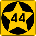
Number | Length (mi) [4] | Length (km) | Southern or western terminus | Northern or eastern terminus | Formed | Removed | Notes | |
---|---|---|---|---|---|---|---|---|
MN 1 | 345.954 | 556.759 | ND 54 towards Ardoch, ND | MN 61 at Illgen City | 1934 | current | ||
TH 1 | — | — | US 65 towards Northwood, IA | Scott Highway towards Thunder Bay, ON | 1920 | 1934 | ||
TH 2 | — | — | US 10 towards Fargo, ND | US 61/TH 1 in Duluth | 1920 | 1934 | ||
MN 3 | 43.749 | 70.407 | MN 21 in Faribault | MN 5 in Saint Paul | 1965 | current | ||
MN 3 | — | — | ND 13 towards Wahpeton, ND | US 10 in Staples | 1920 | 1955 | c.Became part of MN 210 | |
MN 4 | 167.136 | 268.979 | Iowa 4 towards Estherville, IA | I-94 southeast of Sauk Centre | 1920 | current | ||
TH 5 | — | — | US 169 towards Ledyard, IA | US 2/TH 8 in Swan River | 1920 | 1934 | ||
MN 5 | 76.347 | 122.869 | MN 19/MN 22 in Gaylord | MN 120 at the Maplewood-Oakdale border | 1934 | current | ||
MN 6 | 147.775 | 237.821 | MN 18 northwest of Garrison | US 71 in Big Falls | 1934 | current | ||
TH 6 | — | — | US 75 towards Rock Rapids, IA | PTH 14 towards Emerson, MB | 1920 | 1934 | Became US 75 | |
MN 7 | 194.174 | 312.493 | MN 28 east of Beardsley | MN 100 in St. Louis Park | 1934 | current | ||
TH 7 | — | — | US 14 towards Elkton, SD | US 61/TH 3 in Winona | 1920 | 1934 | Became US 14 | |
TH 8 | — | — | US 2 towards Grand Forks, ND | US 61/TH 1 in Duluth | 1920 | 1934 | ||
MN 9 | 225.945 | 363.623 | MN 23 in New London | US 2 east of Crookston | 1934 | current | ||
TH 9 | — | — | US 16 towards Brandon, SD | TH 3 in La Crescent | 1920 | 1934 | Became US 16 | |
TH 10 | — | — | US 75/TH 6 in Wheaton | US 10/TH 3 in Minneapolis | 1920 | 1934 | ||
MN 11 | 209.975 | 337.922 | ND 66 towards Drayton, ND | Near Island View | 1920 | current | ||
TH 12 | — | — | TH 6 near Madison | WIS 12 towards Hudson, WI | 1920 | 1934 | ||
MN 13 | 111.664 | 179.706 | US 65 in Albert Lea | MN 149 in St. Paul | 1920 | current | ||
TH 14 | — | — | US 75/TH 6 in Ivanhoe | TH 22 in Gaylord | 1920 | 1934 | Renumbered MN 19 | |
MN 15 | 154.322 | 248.357 | Iowa 15 towards Armstrong, IA | US 10 north of Sauk Rapids | 1920 | current | ||
MN 16 | 87.635 | 141.035 | I-90 in Dexter | US 14/US 61 in La Crescent | 1979 | current | ||
TH 16 | — | — | US 16/TH 9 in Worthington | US 169/TH 5 near Mankato | 1920 | 1934 | ||
TH 17 | — | — | TH 19 near Marshall | US 71 in Willmar | 1920 | 1940 | c.||
MN 17 | — | — | US 12 in Benson | US 71 west of New London | 1940 | c.1962 | ||
MN 17 | 9.025 | 14.524 | I-90 in Beaver Creek | US 75 in Luverne | 1970 | 1980 | ||
MN 18 | 78.206 | 125.860 | MN 25 in Brainerd | MN 23 north of Sandstone | 1920 | current | ||
MN 19 | 207.877 | 334.546 | SD 30 towards White, SD | US 61 in Red Wing | 1934 | current | ||
TH 19 | — | — | US 210/TH 2 near Brainerd | US 2/TH 8 in Cass Lake | 1920 | 1934 | Became part of US 371 | |
MN 20 | 7.471 | 12.023 | MN 19 in Cannon Falls | MN 50 west of Miesville | 1920 | current | ||
MN 21 | 38.370 | 61.751 | MN 60 in Faribault | US 169 in Jordan | 1920 | current | ||
MN 22 | 166.325 | 267.674 | CR R50 (Winnebago County, Iowa) towards Forest City, IA | MN 23 in Richmond | 1920 | current | ||
MN 23 | 339.805 | 546.863 | I-90 west of Beaver Creek | I-35/US 2 in Duluth | 1920 | current | The highway crosses through Wisconsin for a short distance near Fond du Lac south of Duluth. | |
MN 24 | 47.832 | 76.978 | US 12/MN 22 in Litchfield | US 10 in Clear Lake | 1920 | current | ||
MN 25 | 156.066 | 251.164 | US 169 in Belle Plaine | MN 210 in Brainerd | 1920 | current | ||
MN 26 | 21.121 | 33.991 | Iowa 26 in New Albin, IA | MN 16 south of La Crescent | 1934 | current | ||
TH 26 | — | — | US 75/TH 6 in Ortonville | TH 10 in Benson | 1920 | 1934 | Became part of US 12 | |
MN 27 | 247.623 | 398.511 | MN 28 in Browns Valley | I-35 east of Moose Lake | 1934 | current | ||
TH 27 | — | — | US 10/TH 3 in St. Cloud | US 210/TH 2 in Brainerd | 1920 | 1934 | ||
MN 28 | 142.324 | 229.048 | SD 10 towards Sisseton, SD | MN 27 in Little Falls | 1920 | current | ||
MN 29 | 126.592 | 203.730 | US 59/US 212 in Montevideo | US 71 in Wadena | 1920 | current | ||
MN 30 | 265.634 | 427.496 | SD 34 towards Flandreau, SD | MN 43 in Rushford | 1934 | current | ||
TH 30 | — | — | US 10S/TH 3 in Fergus Falls | US 2/TH 8 east of Erskine | 1920 | 1934 | Renumbered MN 73 | |
MN 31 | — | — | ND 7 towards Hillsboro, ND | US 371 north of Walker | 1920 | 1969 | Became part of MN 200 | |
MN 32 | 144.845 | 233.105 | MN 34 east of Barnesville | MN 11 in Greenbush | 1920 | current | ||
MN 33 | 19.748 | 31.781 | I-35 in Cloquet | US 53 at Independence | 1934 | current | ||
TH 33 | — | — | US 75/TH 6 in Warren | TH 32 in Thief River Falls | 1920 | 1934 | Renumbered MN 1 | |
MN 34 | 103.163 | 166.025 | MN 9 in Barnesville | MN 200/MN 371 in Walker | 1920 | current | ||
MN 35 | 36.160 | 58.194 | US 53 in Virginia | MN 1/MN 169 in Tower | 1920 | 1958 | ||
MN 36 | 21.718 | 34.952 | I-35W in Roseville | WIS 64 towards Somerset, WI | 1934 | current | ||
TH 36 | — | — | US 10S/TH 3 in Fergus Falls | TH 29 near Henning | 1920 | 1934 | Renumbered MN 3 | |
MN 37 | 28.325 | 45.585 | US 169/MN 73 in Hibbing | MN 135 in Gilbert | 1934 | current | ||
TH 37 | — | — | TH 27 in Little Falls | US 210/TH 2 in Motley | 1920 | 1934 | Became part of US 10 | |
MN 38 | 46.766 | 75.263 | US 2/US 169 in Grand Rapids | MN 1 in Effie | 1934 | current | ||
TH 38 | 55 | 89 | TH 12 in Montevideo | TH 28 in Starbuck | 1920 | 1934 | Renumbered MN 29 | |
MN 39 | 1.080 | 1.738 | MN 23 in Duluth | WIS 105 in Superior, WI | 1943 | current | ||
TH 39 | — | — | — | — | 1934 | 1940 | c.||
TH 39 | — | — | US 16/TH 9 east of Brush Creek | US 14/TH 7 in Mankato | 1920 | 1934 | Renumbered MN 22 | |
MN 40 | 73.874 | 118.889 | SD 20 towards Revillo, SD | CR 5 in Willmar | 1934 | current | ||
TH 40 | — | — | US 218 towards St. Ansgar, IA | US 14/TH 7 in Owatonna | 1920 | 1934 | Became US 218 | |
MN 41 | 9.382 | 15.099 | US 169 southwest of Shakopee | MN 7 in Shorewood | 1934 | current | ||
TH 41 | — | — | US 218/TH 40 in Blooming Prairie | TH 56 near Hayfield | 1920 | 1934 | Renumbered MN 30 | |
MN 42 | 30.717 | 49.434 | I-90 south of Eyota | US 61 in Kellogg | 1920 | current | ||
MN 43 | 44.952 | 72.343 | MN 44 in Mabel | WIS 54 towards Galesville, WI | 1920 | current | ||
MN 44 | 35.978 | 57.901 | US 52 southeast of Canton | MN 16 in Hokah | 1920 | current | ||
MN 45 | 2.628 | 4.229 | MN 210 in Carlton | I-35 in Scanlon | 1934 | current | ||
TH 45 | — | — | US 61/TH 1 in St. Paul | WIS 64 towards Houlton, WI | 1920 | 1934 | Became part of US 212 | |
MN 46 | 46.377 | 74.637 | US 2 west of Deer River | MN 1 in Northome | 1934 | current | ||
TH 46 | — | — | US 61/TH 1 in Wyoming | US 8 towards St. Croix Falls, WI | 1920 | 1934 | Became part of US 8 | |
MN 47 | 124.186 | 199.858 | MN 65 in Minneapolis | US 169 in Aitkin | 1961 | current | ||
MN 47 | — | — | SD 34 towards Flandreau, SD | MN 4 north of St. James | 1920 | 1961 | Became part of MN 30 | |
MN 48 | 23.527 | 37.863 | I-35 in Hinckley | WIS 77 towards Minong, WI | 1934 | current | ||
TH 48 | — | — | US 75/TH 6 north of Canby | TH 17 west of Granite Falls | 1920 | 1934 | Renumbered MN 19 | |
MN 49 | — | — | — | — | 1934 | 1999 | ||
TH 49 | — | — | TH 12 in Montevideo | US 71/TH 4 south of Willmar | 1920 | 1934 | ||
MN 50 | 15.082 | 24.272 | MN 3 in Farmington | US 61 west of Miesville | 1920 | current | ||
MN 51 | 11.274 | 18.144 | MN 5 in St. Paul | I-694/US 10 in Arden Hills | 1934 | current | ||
TH 51 | — | — | TH 12 in Chaska | US 169/TH 5 north of Shakopee | 1920 | 1934 | Became part of US 212 | |
TH 52 | — | — | US 169/TH 5 in Eden Prairie | TH 1 in St. Paul | 1920 | 1934 | ||
TH 53 | — | — | US 61/TH 3 in Hastings | TH 12 in St. Paul | 1920 | 1934 | ||
MN 54 | 10.851 | 17.463 | MN 27 east of Herman | US 59/MN 55 in Elbow Lake | 1920 | 2020 | Became Grant CSAH 54 | |
MN 55 | 218.418 | 351.510 | ND 11 towards Fairmount, ND I-35W/I-94 in Minneapolis | I-94 in Minneapolis US 61 in Hastings | 1934 | current | ||
TH 55 | — | — | US 61/TH 1 in Scanlon | Cloquet | 1920 | 1934 | Renumbered MN 45 | |
MN 56 | 99.121 | 159.520 | US 63 east of Le Roy | US 52/MN 50 in Hampton | 1920 | current | ||
MN 57 | 25.578 | 41.164 | US 14 in Kasson | US 52 northwest of Zumbrota | 1920 | current | ||
MN 58 | 23.538 | 37.881 | US 52 in Zumbrota | US 61/US 63 in Red Wing | 1920 | current | ||
TH 59 | — | — | Iowa 59 towards Chester, IA | US 61/TH 3 in Lake City | 1920 | 1934 | became US 63 | |
MN 60 | 221.578 | 356.595 | Iowa 60 towards Sibley, IA | WIS 25 towards Nelson, WI | 1920 | current | ||
MN 61 | 150.321 | 241.918 | I-35 in Duluth | Hwy. 61 towards Thunder Bay, ON | 1990 | c.current | formerly US 61 | |
TH 61 | — | — | US 2/TH 8 in Deer River | US 71/TH 4 in Big Falls | 1920 | 1934 | Renumbered MN 6 | |
MN 62 | 23.992 | 38.611 | US 59 in Fulda | US 71/MN 60 in Windom | 1934 | current | Western segment | |
MN 62 | 17.595 | 28.316 | I-494 in Eden Prairie | I-494 in Inver Grove Heights | 1988 | current | Eastern segment | |
TH 62 | — | — | US 10/TH 3 in St. Paul | US 10/TH 3 in Anoka | 1920 | 1934 | Became part of US 10 | |
TH 63 | — | — | TH 27 south of Kettle River | US 53 south of Gheen | 1934 | 1935 | Renumbered MN 73 | |
TH 63 | — | — | US 10/TH 3 in Minneapolis | US 61/TH 1 south of Forest Lake | 1920 | 1934 | Became part of US 8 | |
MN 64 | 64.817 | 104.313 | MN 210 northeast of Motley | MN 200 west of Laporte | 1934 | current | ||
TH 64 | — | — | TH 30 north of Fergus Falls | US 75/TH 6 south of Moorhead | 1920 | 1934 | Became part of US 52 | |
MN 65 | 270.775 | 435.770 | Minneapolis | US 71 in Littlefork | 1934 | current | ||
TH 65 | — | — | TH 32 south of Red Lake Falls | US 2/TH 8 in Bagley | 1920 | 1934 | Renumbered MN 92 | |
MN 66 | 12.059 | 19.407 | Good Thunder | US 169/MN 60 in Mankato | 1961 | 2016 | Became Blue Earth CSAH 1 | |
MN 66 | — | — | MN 56 east of Isle | US 61 east of Finlayson | 1934 | 1961 | ||
TH 66 | — | — | TH 12 in Montevideo | TH 26 north of Appleton | 1920 | 1934 | Renumbered MN 7 | |
MN 67 | 83.026 | 133.617 | US 75 northeast of Canby | MN 68 in Morgan | 1920 | current | ||
MN 68 | 141.026 | 226.959 | SD 22 towards Clear Lake, SD | US 169/MN 60 southwest of Mankato | 1920 | current | ||
TH 69 | — | — | US 2 west of Hermantown | US 61 in Duluth | 1934 | 1935 | Renumbered MN 94 | |
TH 69 | — | — | TH 4 in Paynesville | TH 25 in Buffalo | 1920 | 1934 | Renumbered MN 55 | |
MN 70 | 29.333 | 47.207 | MN 65 south of Mora | WIS 70 towards Grantsburg, WI | 1934 | current | ||
TH 70 | — | — | US 14/TH 7 in Sleepy Eye | TH 12 in Hector | 1920 | 1934 | Renumbered MN 4 | |
MN 72 | 76.810 | 123.614 | US 71 in Blackduck | Hwy 11 towards Rainy River, ON | 1923 | current | ||
MN 73 | 119.697 | 192.634 | I-35 southeast of Moose Lake | US 53 south of Gheen | 1935 | current | ||
TH 73 | — | — | Iowa 73 towards Allendorf, IA | Red River of the North at St. Vincent | 1934 | 1935 | Renumbered US 59 | |
MN 74 | 34.956 | 56.256 | US 52/MN 30 in Chatfield | US 61 at Weaver | 1934 | current | ||
MN 76 | 36.767 | 59.171 | Iowa 76 towards Waukon, IA | I-90 west of Dakota | 1934 | current | ||
MN 77 | 10.495 | 16.890 | Apple Valley | MN 62 in Minneapolis | 1980 | current | ||
MN 78 | 46.694 | 75.147 | MN 79 near Erdahl | US 10 in Perham | 1934 | current | ||
MN 79 | 12.128 | 19.518 | US 59/MN 55 in Elbow Lake | I-94 west of Evansville | 1934 | current | ||
MN 80 | 8.431 | 13.568 | MN 16 south of Wykoff | US 52 in Fountain | 1945 | current | ||
TH 80 | — | — | US 16 in Wykoff | US 52 in Preston | 1934 | 1945 | Became part of US 16 (now MN 16) | |
MN 81 | — | — | US 75 north of Hendrum | US 2 in Crookston | 1934 | 1955 | Became part of US 75 | |
MN 81 | — | — | I-94 in Minneapolis | MN 100 in Crystal | 1985 | 1988 | ||
MN 82 | — | — | MN 3 in Breckenridge | US 75 in Ada | 1934 | 1955 | Became part of MN 9 | |
MN 83 | 23.760 | 38.238 | MN 30 south of Waldorf | MN 22 in Mankato | 1934 | current | ||
MN 84 | 29.865 | 48.063 | MN 371 in Pine River | MN 200 north of Longville | 1934 | current | ||
MN 85 | — | — | US 371 near Leech Lake | US 71 east of Lake George | 1934 | 1949 | c.||
MN 86 | 22.850 | 36.774 | Iowa 86 towards Spirit Lake, IA | MN 60 east of Wilder | 1934 | current | ||
MN 87 | 83.211 | 133.915 | US 10 southwest of Frazee | MN 84 east of Backus | 1934 | current | ||
MN 88 | — | — | MN 218 in Eagan | MN 5 in St. Paul | 1934 | 1950 | c.||
MN 88 | — | — | I-35W in Minneapolis | I-35W in New Brighton | 1980 | c.1996 | ||
MN 89 | 143.627 | 231.145 | US 2 northeast of Wilton | Hwy. 89 towards Piney, MB | 1934 | current | ||
MN 90 | — | — | MN 121 in Minneapolis | MN 36 in Minneapolis | 1934 | 1958 | Renumbered MN 190 | |
MN 91 | 61.456 | 98.904 | CR L14 towards George, IA | MN 23 in Russell | 1934 | current | ||
MN 92 | 71.526 | 115.110 | MN 32 south of Red Lake Falls | MN 200 south of Bagley | 1934 | current | ||
MN 93 | 5.599 | 9.011 | MN 112 in Le Sueur | MN 19 in Henderson | 1961 | current | ||
MN 93 | — | — | US 71 in Redwood Falls | MN 4 north of Sleepy Eye | 1934 | 1961 | ||
TH 94 | — | — | US 61 north of Hastings | WIS 34 towards Prescott, WI | 1934 | 1935 | Became part of US 10 | |
MN 94 | 17.392 | 27.990 | US 2 in Solway Township | MN 281 in Duluth | 1935 | 1958 | Renumbered MN 194 | |
MN 95 | 126.842 | 204.132 | MN 23 east of Sauk Rapids | US 10/US 61 in Cottage Grove | 1934 | current | ||
MN 96 | 10.179 | 16.382 | US 61 in White Bear Lake | MN 95 in Stillwater | 1934 | current | ||
MN 97 | 13.173 | 21.200 | I-35 in Columbus | MN 95 north of Marine on St. Croix | 1934 | current | ||
MN 98 | — | — | US 61 in Forest Lake | US 8 in Chisago City | 1934 | 1955 | Became part of US 8 | |
MN 98 | — | — | US 61 in Wyoming | US 8 in Chisago City | 1955 | 1996 | ||
MN 99 | 40.827 | 65.705 | US 14 west of Nicollet | MN 21 northwest of Faribault | 1934 | current | ||
MN 100 | 16.178 | 26.036 | I-494/MN 5 in Bloomington | I-694 in Brooklyn Center | 1934 | current | ||
MN 101 | 14.061 | 22.629 | Chanhassen I-94 in Rogers | Eden Prairie US 10/US 169 in Elk River | 1934 | current | ||
MN 102 | 19.297 | 31.056 | MN 32 north of Fertile | MN 9 southeast of Crookston | 1934 | current | ||
MN 103 | — | — | US 75 in Ortonville | MN 28 in Beardsley | 1934 | 1955 | ||
MN 103 | — | — | — | — | 1990 | c.1995 | ||
MN 104 | 27.320 | 43.967 | MN 9 in Sunburg | MN 28/MN 29 in Glenwood | 1934 | current | ||
MN 105 | 13.645 | 21.959 | CR S70 towards St. Ansgar, IA | I-90 in Austin | 1934 | current | ||
MN 106 | 7.365 | 11.853 | MN 29 in Deer Creek | US 10 southeast of New York Mills | 1934 | current | ||
MN 107 | 17.571 | 28.278 | MN 65 southwest of Braham | MN 23 southwest of Brook Park | 1934 | current | ||
MN 108 | 61.371 | 98.767 | I-94 northwest of Rothsay | MN 210 in Henning | 1934 | current | ||
MN 109 | 32.833 | 52.840 | US 169 in Winnebago | I-90 in Alden | 1934 | current | ||
MN 110 | 5.245 | 8.441 | MN 55 in Mendota Heights | I-494 in Inver Grove Heights | 1965 | 2018 | Renumbered as a part of MN 62 | |
MN 110 | — | — | MN 7 in St. Bonifacius | US 12 in Maple Plain | 1934 | 1955 | ||
MN 111 | 9.789 | 15.754 | US 14 in Nicollet | MN 22 northwest of St. Peter | 1934 | current | ||
MN 112 | 15.012 | 24.159 | US 169 in Le Sueur | MN 99 west of Le Center | 1934 | 2019 | Became Le Sueur CSAH 22 | |
MN 113 | 54.592 | 87.857 | MN 32 at Syre | US 71 north of Park Rapids | 1934 | current | ||
MN 114 | 19.955 | 32.114 | MN 28/MN 29 in Starbuck | I-94 west of Alexandria | 1934 | current | ||
MN 115 | 8.736 | 14.059 | US 10 in Randall | MN 371 north of Little Falls | 1934 | current | ||
MN 116 | — | — | ND 7 towards Hillsboro, ND | MN 81 in Halstad | 1934 | 1955 | ||
MN 116 | — | — | — | — | 1965 | 1976 | ||
MN 117 | 1.797 | 2.892 | SD 19 towards Sisseton, SD | MN 27 southwest of Wheaton | 1934 | current | ||
TH 118 | 18.25 | 29.37 | MN 95 in Cambridge | MN 65 west of Brunswick | 1934 | 1943 | ||
MN 118 | — | — | — | — | 1975 | 1999 | ||
MN 119 | 15.108 | 24.314 | US 212 in Dawson | US 12 north of Appleton | 1934 | current | ||
MN 120 | 7.341 | 11.814 | I-94 in Maplewood | MN 244 in White Bear Lake | 1965 | current | Removed by the legislature in 2001, so proposed to be eliminated | |
MN 121 | 0.937 | 1.508 | I-35W/MN 62 in Richfield | Minneapolis | 1934 | current | ||
MN 122 | 0.69 | 1.11 | I-35W in Minneapolis | US 52 in Minneapolis | 1988 | 1998 | ||
MN 123 | 8.037 | 12.934 | MN 23 in Sandstone | MN 23 west of Askov | 1945 | current | ||
MN 124 | — | — | — | — | 1965 | 2002 | ||
MN 127 | 2.531 | 4.073 | I-94 south of Osakis | MN 27 in Osakis | 1965 | 2013 | ||
MN 135 | 36.160 | 58.194 | US 53 in Virginia | MN 1/MN 169 in Tower | 1958 | current | ||
MN 139 | 3.913 | 6.297 | Iowa 139 towards Cresco, IA | US 52 in Harmony | 1934 | current | ||
MN 149 | 9.924 | 15.971 | MN 3 in Inver Grove Heights | MN 5 in St. Paul | 1980 | c.current | ||
MN 152 | — | — | US 52 in Minneapolis | US 10 in Sauk Rapids | 1934 | 1988 | ||
MN 156 | 4.201 | 6.761 | I-494 in South St. Paul | US 52 in St. Paul | 1993 | current | ||
MN 165 | — | — | — | — | 1934 | 1955 | ||
MN 167 | 7.304 | 11.755 | MN 23 in Granite Falls | Upper Sioux Agency State Park | [5] | 2022current | ||
MN 169 | 48.884 | 78.671 | US 53 north of Virginia | Near Section Thirty | 1934 | current | ||
MN 171 | 1.886 | 3.035 | ND 59 towards Pembina, ND | US 75 east of St. Vincent | 1936 | current | ||
MN 172 | 11.515 | 18.532 | MN 11 west of Baudette | Near Hackett | 1961 | current | ||
MN 175 | 21.200 | 34.118 | ND 5 towards Hamilton, ND | US 59 northwest of Lake Bronson | 1965 | current | ||
MN 190 | — | — | — | — | 1955 | 1980 | c.||
MN 194 | 17.392 | 27.990 | US 2 in Solway Township | I-35 in Duluth | 1958 | current | ||
MN 197 | 6.997 | 11.261 | US 2/US 71 south of Bemidji | US 2 in Bemidji | 1985 | current | ||
MN 200 | 201.203 | 323.805 | ND 200 towards Hillsboro, ND | US 2 northwest of Floodwood | 1965 | current | ||
MN 201 | — | — | — | — | 1961 | 1987 | ||
MN 202 | — | — | — | — | 1965 | 1965 | ||
MN 210 | 227.993 | 366.919 | ND 210 in Wahpeton, ND | MN 23 in Duluth | 1975 | current | ||
MN 212 | — | — | — | — | 1935 | 1985 | ||
MN 216 | — | — | — | — | 1949 | 1965 | ||
MN 217 | 17.342 | 27.909 | MN 65 in Littlefork | US 53 southeast of International Falls | 1949 | current | ||
MN 218 | — | — | — | — | 1934 | 1961 | ||
MN 219 | 15.331 | 24.673 | MN 1 south of Goodridge | MN 89 west of Grygla | 1949 | current | ||
MN 220 | 78.536 | 126.391 | US 75 in Climax | MN 11 east of Robbin | 1949 | current | ||
MN 221 | — | — | — | — | 1949 | 1955 | ||
MN 222 | 1.474 | 2.372 | MN 92 south of Oklee | Oklee | 1949 | current | ||
MN 223 | 7.643 | 12.300 | MN 92 south of Clearbrook | Leonard | 1949 | current | ||
MN 224 | — | — | — | — | 1949 | 2005 | ||
MN 225 | 8.809 | 14.177 | Ponsford | MN 34 at Osage | 1949 | 2017 | ||
MN 226 | 1.494 | 2.404 | MN 34 east of Park Rapids | Dorset | 1949 | current | ||
MN 227 | 10.680 | 17.188 | US 71 in Sebeka | Nimrod | 1949 | 2012 | ||
MN 228 | 7.785 | 12.529 | Vergas | US 10 northwest of Perham | 1949 | 2015 | ||
MN 231 | — | — | US 10 | I-94 | 1960 | c.1985 | now BL I-94 | |
MN 232 | 9.540 | 15.353 | Palisade | MN 65 north of McGregor | 1949 | 2012 | ||
MN 235 | 10.027 | 16.137 | Urbank | MN 29 in Parkers Prairie | 1949 | 2013 | ||
MN 236 | — | — | — | — | 1949 | 1987 | ||
MN 237 | 2.754 | 4.432 | New Munich | I-94 east of Melrose | 1949 | current | ||
MN 238 | 34.709 | 55.859 | I-94 in Albany | MN 27/MN 28 west of Little Falls | 1949 | current | ||
MN 240 | 17.1 | 27.5 | MN 55 in Annandale | US 10 in Clear Lake | 1949 | 1961 | Became part of MN 24 | |
MN 241 | 3.531 | 5.683 | St. Michael | I-94 in St. Michael | 1955 | current | ||
MN 242 | 5.2 | 8.4 | US 10/MN 47 in Coon Rapids | MN 65 in Blaine | 1949 | 2007 | ||
MN 243 | 1.233 | 1.984 | MN 95 southwest of Taylors Falls | WIS 243 in Osceola, WI | 1949 | current | ||
MN 244 | 4.705 | 7.572 | MN 120 in White Bear Lake | MN 96 in Dellwood | 1949 | current | Removed by the legislature in 2001, so proposed to be eliminated | |
MN 246 | 18.221 | 29.324 | MN 3 in Northfield | MN 56 north of Kenyon | 1949 | current | ||
MN 247 | 12.604 | 20.284 | US 63 north of Rochester | MN 42 in Plainview | 1949 | current | ||
MN 248 | 11.219 | 18.055 | Altura | US 61 northwest of Minnesota City | 1949 | current | ||
MN 249 | — | — | — | — | 1949 | 1989 | ||
MN 250 | 9.479 | 15.255 | MN 16 in Lanesboro | MN 30 west of Rushford | 1949 | current | ||
MN 251 | 16.374 | 26.351 | I-35 east of Clarks Grove | US 218 north of Austin | 1949 | current | ||
MN 252 | 4.353 | 7.005 | I-94/I-694 in Brooklyn Center | MN 610 in Brooklyn Park | 1985 | current | ||
MN 252 | — | — | — | — | 1965 | 1967 | ||
MN 253 | 6.472 | 10.416 | Bricelyn | I-90 east of Blue Earth | 1949 | 2019 | Became Faribault CSAH 23 | |
MN 254 | 4.796 | 7.718 | Frost | I-90 east of Blue Earth | 1949 | 2019 | Became Faribault CSAH 17 | |
MN 256 | — | — | — | — | 1949 | 1965 | ||
MN 257 | 3.991 | 6.423 | Hanska | MN 15 east of Hanska | 1949 | current | ||
MN 258 | 10.811 | 17.399 | Comfrey | US 14 northeast of Springfield | 1949 | 2013 | ||
MN 259 | — | — | — | — | 1949 | 1965 | ||
MN 261 | — | — | — | — | 1949 | 1997 | ||
MN 262 | 2.050 | 3.299 | I-90 east of Fairmont | Granada | 1949 | 2007 | ||
MN 263 | 11.226 | 18.066 | Ceylon | I-90 north of Welcome | 1949 | current | ||
MN 264 | 7.394 | 11.899 | Round Lake | I-90 east of Worthington | 1949 | current | ||
MN 266 | — | — | — | — | 1949 | 2004 | Became Nobles CSAH 25 | |
MN 267 | 5.353 | 8.615 | Iona | MN 30 west of Slayton | 1949 | current | ||
MN 268 | — | — | US 75 | Edgerton | 1949 | 2005 | Became Pipestone CSAH 9 | |
MN 269 | 2.653 | 4.270 | SD 11 towards Garretson, SD | MN 23 in Jasper | 1949 | current | ||
MN 270 | 7.659 | 12.326 | Hills | US 75 south of Luverne | 1949 | current | ||
MN 271 | 8.591 | 13.826 | MN 19 west of Ivanhoe | SD 28 towards Astoria, SD | 1949 | current | ||
MN 272 | — | — | MN 19 east of Marshall | MN 93 in Morgan | 1949 | 1963 | Became part of MN 68 | |
MN 273 | — | — | MN 19 west of Redwood Falls | Belview | 1949 | 2004 | Became Redwood CSAH 7 | |
MN 274 | 8.515 | 13.704 | Wood Lake | MN 23 south of Granite Falls | 1949 | [5] | 2022Mostly became part of MN 67; rest turned back | |
MN 275 | 6.519 | 10.491 | Boyd | US 212 east of Dawson | 1949 | 2017 | Became Lac qui Parle CSAH 29 | |
MN 277 | 11.025 | 17.743 | MN 7 west of Clara City | MN 40 east of Milan | 1949 | 2019 | Became Chippewa CSAH 4 | |
MN 278 | — | — | MN 100 in Robbinsdale | MN 152 in Minneapolis | 1949 | 1982 | ||
MN 280 | 3.710 | 5.971 | I-94 in St. Paul | I-35W in Roseville | 1955 | current | ||
MN 281 | — | — | — | — | 1949 | 1965 | ||
MN 282 | 7.655 | 12.320 | US 169 in Jordan | MN 13 southwest of Prior Lake | 1949 | current | ||
MN 284 | 5.651 | 9.094 | US 212 south of Cologne | MN 5 in Waconia | 1949 | current | ||
MN 286 | 4.302 | 6.923 | MN 6 at Talmoon | MN 38 at Marcell | 1949 | current | ||
MN 287 | 14.423 | 23.212 | MN 28 in Grey Eagle | US 71 in Long Prairie | 1949 | current | ||
MN 288 | — | — | — | — | 1951 | 1999 | ||
MN 289 | 0.512 | 0.824 | MN 73 in Moose Lake | Minnesota Correctional Facility - Moose Lake | 1951 | current | ||
MN 290 | 0.400 | 0.644 | Ah-Gwah-Ching Center | MN 200/MN 371 southeast of Walker | 1951 | 2009 | ||
MN 291 | 1.318 | 2.121 | US 61 in Hastings | Minnesota Veterans Home - Hastings | 1951 | 2014 | c.||
MN 292 | 1.307 | 2.103 | Minnesota Correctional Facility - Red Wing | US 61/US 63 in Red Wing | 1951 | current | ||
MN 293 | 1.683 | 2.709 | Cambridge | MN 95 in Cambridge | 1951 | 2009 | ||
MN 294 | 1.646 | 2.649 | Willmar State Hospital | US 71/MN 23 | 1951 | 2006 | ||
MN 295 | 1.160 | 1.867 | Minnesota Security Hospital | US 169 in St. Peter | 1951 | 2010 | c.||
MN 296 | — | — | — | — | 1951 | 1989 | ||
MN 297 | 0.475 | 0.764 | Fergus Falls | Fergus Falls State Hospital | 1951 | 2010 | ||
MN 298 | 1.092 | 1.757 | Minnesota Correctional Facility - Faribault and Minnesota State Academy for the Blind | MN 60/MN 299 in Faribault | 1951 | current | ||
MN 299 | 0.674 | 1.085 | MN 60/MN 298 in Faribault | Minnesota State Academy for the Deaf | 1951 | current | ||
MN 300 | — | — | — | — | 1951 | 1998 | ||
MN 301 | 1.059 | 1.704 | Minnesota Correctional Facility - St. Cloud | US 10 in St. Cloud | 1951 | current | ||
MN 302 | — | — | — | — | 1951 | 2003 | ||
MN 303 | — | — | — | — | 1951 | 1973 | ||
MN 308 | 1.277 | 2.055 | MN 11 northeast of Badger | MN 89 west of Roseau | 1955 | current | ||
MN 309 | 0.274 | 0.441 | MN 18 southeast of Brainerd | MN 18 southeast of Brainerd | 1955 | 2014 | ||
MN 310 | 10.495 | 16.890 | MN 11/MN 89 in Roseau | Hwy. 310 towards South Junction, MB | 1959 | current | ||
MN 312 | — | — | — | — | 2002 | 2008 | ||
MN 313 | 6.267 | 10.086 | MN 11 in Warroad | Hwy. 12 towards Winnipeg, MB | 1959 | current | ||
MN 316 | 9.809 | 15.786 | US 61 west of Red Wing | US 61 in Hastings | 1959 | current | ||
MN 317 | 1.444 | 2.324 | ND 17 towards Grafton, ND | MN 220 north of Oslo | 1959 | current | ||
MN 318 | — | — | — | — | 1959 | 1986 | ||
MN 322 | — | — | — | — | 1955 | 2000 | c.||
MN 323 | — | — | — | — | 2009 | 2010 | ||
MN 324 | — | — | — | — | 1965 | 2003 | ||
MN 326 | — | — | — | — | 1963 | 1969 | ||
MN 329 | 1.112 | 1.790 | US 59 in Morris | West Central Experiment Station | 1970 | c.current | ||
MN 330 | 2.020 | 3.251 | US 14 | University of Minnesota Southwest Research and Outreach Center | 1971 | current | ||
MN 332 | 7.220 | 11.619 | US 71/MN 11 south of International Falls | MN 11 in International Falls | 1976 | 2011 | ||
MN 333 | 0.492 | 0.792 | Minnesota Security Hospital | MN 99 in St. Peter | 1985 | 2010 | c.||
MN 336 | 2.249 | 3.619 | I-94 east of Moorhead | US 10 east of Dilworth | 1995 | current | ||
MN 361 | 7.177 | 11.550 | I-35 in Rush City | MN 70 in Rock Creek | 1965 | 2011 | ||
MN 371 | 107.411 | 172.861 | US 10 in Little Falls | US 2 in Cass Lake | 1975 | current | Former US 371 | |
MN 610 | 9.828 | 15.817 | I-94 in Maple Grove | US 10/MN 47 in Coon Rapids | 1975 | current | ||
|
Special routes
Number | Length (mi) | Length (km) | Southern or western terminus | Northern or eastern terminus | Formed | Removed | Notes | |
---|---|---|---|---|---|---|---|---|
Bus. MN 23 | 4.65 | 7.48 | — | — | — | — | Serves Willmar | |
Bus. MN 371 | 6.526 | 10.503 | MN 371 southwest of Brainerd | MN 210 in Brainerd | 2000 | current | Only state-maintained business route | |
There are also routes officially numbered in the 805 and 905, but they do not have signage. Examples include part of the Sibley Memorial Highway that was bypassed in Mendota in the mid 1995 (MN 913A, numbered for former designation MN 13), and Robert Street between I-494 and University Avenue in St. Paul and West St. Paul (MN 952, numbered for former designation US 52).
Other roads under Minnesota jurisdiction include the MN 371 Business Route, which follows the former route of MN 371 through Brainerd. MN 23 also has a designated business route through the city of Willmar (as MN 23 is bypassed around the city), but unlike Business MN 371, Business MN 23 is under local jurisdiction.
Legislative routes defined in the Minnesota Constitution were signed until 1934, when many were renumbered. Several routes, like US Highway 208, were planned in the 1934 renumbering but eliminated before the final plan.
Interstate 535 (I-535) is a 2.78-mile-long (4.47 km) auxiliary Interstate Highway spur route of I-35 in the US states of Minnesota and Wisconsin. It is paired with U.S. Highway 53 (US 53) along its entire route. The Interstate was part of the original 1956 Interstate Highway System and was completed in 1971. Since then, weight limits have been added to the Blatnik Bridge that carries the highway over Saint Louis Bay between Superior, Wisconsin, and Duluth, Minnesota.
Interstate 494 (I-494) is an auxiliary Interstate Highway making up part of a beltway of I-94, circling through the southern and western portions of the Minneapolis–Saint Paul metropolitan area in Minnesota. The 42.94-mile (69.11 km) road is coupled with I-694 at each end and composes more than half of the major beltway of the region. I-694/I-494 also act as loop routes for I-35E and I-35W.
U.S. Highway 8 (US 8) is a United States Numbered Highway that runs primarily east–west for 280 miles (451 km), mostly within the state of Wisconsin. It connects Interstate 35 (I-35) in Forest Lake, Minnesota, to US 2 at Norway, Michigan. Except for the short freeway segment near Forest Lake, a section near the St. Croix River bridge, the interchange with US 51, and a three-mile (4.8 km) stretch west of Rhinelander, Wisconsin, it is mostly an undivided surface road. As a state highway in the three states, US 8 is maintained by the Minnesota, Wisconsin and Michigan departments of transportation.
U.S. Route 53, or U.S. Highway 53 (U.S. 53), is a north–south U.S. highway that runs for 404 miles (650 km) from La Crosse, Wisconsin to International Falls, Minnesota. It is the primary north–south route in northwestern Wisconsin, serving as a vital link between I-94 at Eau Claire, Wisconsin and the Twin Ports of Superior, Wisconsin, and Duluth, Minnesota. The entire route from Eau Claire to the city limits of Superior is a four lane divided highway. The highway's northern terminus is at the Fort Frances–International Falls International Bridge in International Falls, Minnesota, at the Canada–US border. Its southern terminus is in La Crosse, Wisconsin, at U.S. Highway 14.
Minnesota State Highway 77 (MN 77) is a 11.403-mile-long (18.351 km) highway in Minnesota, which runs from its intersection with 138th Street in Apple Valley and continues north to its northern terminus at its interchange with State Highway 62 in Minneapolis. MN 77 is also known as Cedar Avenue.
Minnesota State Highway 610 (MN 610) is an east–west freeway in the Twin Cities region of Minnesota. The freeway connects Interstate 94 (I-94), County Road 81, and CR 130 in northern Hennepin County to U.S. Highway 10 (US 10) in southern Anoka County. MN 610 crosses the Mississippi River on the Richard P. Braun Bridge between suburban Brooklyn Park and Coon Rapids. The highway is 12.3 miles (19.8 km) long.
Minnesota State Highway 371 (MN 371) is a 107.411-mile-long (172.861 km) state highway in central and north-central Minnesota. The route connects Minnesota's northern lakes region with the central part of the state. It runs north–south from U.S. Highway 10 (US 10) in Little Falls to US 2 in Cass Lake. MN 371 has become a heavily traveled arterial route that was once a two-lane roadway over almost all of its length, but has been widened to four lanes across most of its southern half. Much of the traffic on the route is Twin Cities-based traffic heading to their cabins on one of the many northern lakes.
The Massachusetts State Highway System in the U.S. Commonwealth of Massachusetts is a system of state-numbered routes assigned and marked by the highway division of the Massachusetts Department of Transportation (MassDOT). U.S. Highways and Interstate Highways are included in the system; the only overlaps are with the end-to-end U.S. Route 3 and Route 3 and the far-apart Interstate 295, shared with Rhode Island, and Route 295, shared with New York State. A state highway in Massachusetts is a road maintained by the state, which may or may not have a number. Not all numbered routes are maintained or owned by the state.
Interstate 35E (I-35E) is an Interstate Highway in the US state of Minnesota, passing through downtown Saint Paul. It is one of two through routes for I-35 through the Twin Cities of Minneapolis and Saint Paul, the other being I-35W through Minneapolis. Thus, both ends of I-35E are shared with I-35W and I-35.
In the state of Maine, the Maine Department of Transportation (MaineDOT) has a system of numbered highways, defined as the "connected main highways throughout the state which primarily serve arterial or through traffic." As of 2006, 22,236 miles of roadway are included in the highway system, including Interstate highways, U.S. Routes, state highways, and other urban and rural local roads.
Minnesota State Highway 252 (MN 252) is a 4.4-mile-long (7.1 km) state highway in Minnesota, which runs from its interchange with Interstate 94 (I-94), I-694 and US Highway 52 (US 52) in Brooklyn Center and continues north to its northern terminus at its interchange with MN 610 in Brooklyn Park. MN 252 generally follows not far from the west bank of the Mississippi River throughout its route.
Minnesota State Highway 101 is a state highway in the U.S. state of Minnesota. The present day route currently has two separate segments. The roadway was a continuous route until 1988.
Minnesota State Highway 254 was a 4.796-mile-long (7.718 km) highway in south-central Minnesota, which ran from its intersection with Faribault County Road 17 in the city of Frost and continued north to its northern terminus at its interchange with Interstate 90 in Emerald Township, 8 miles east of Blue Earth.
In the U.S. state of Pennsylvania, state highways are generally maintained by the Pennsylvania Department of Transportation (PennDOT). Each is assigned a four-digit State Route (SR) number in the present Location Referencing System. Traffic Routes are signed as Interstate Highways, U.S. Routes and Pennsylvania Routes, and are prefixed with one to three zeroes to give a four-digit number. PA Routes are also called Pennsylvania Traffic Routes, and formerly State Highway Routes.
In New York, a reference marker is a small green sign mounted approximately every one-tenth mile on highways maintained by the New York State Department of Transportation. This was initiated in response to the Highway Safety Act of 1966 enacted by Congress, in an effort to monitor traffic and identify high-accident locations. New York's system inventories and indexes all touring and reference routes, in addition to service and rest areas, ramps, and reservation roads.
The primary highway system makes up over 9,000 miles (14,000 km), approximately 8 percent of the U.S. state of Iowa's public road system. The Iowa Department of Transportation is responsible for the day-to-day maintenance of the primary highway system, which consists of Interstate Highways, United States Highways, and Iowa state highways. Currently, the longest primary highway is U.S. Highway 30 at 332 miles (534 km). The shortest highway is Interstate 129 at 0.27 miles (430 m).
The Arkansas Highway System is made up of all the highways designated as Interstates, U.S. Highways and State Highways in the US state of Arkansas. The system is maintained by the Arkansas Department of Transportation (ArDOT), known as the Arkansas State Highway Department (AHD) until 1977 and the Arkansas State Highway and Transportation Department (AHTD) from 1977 to 2017. The system contains 16,442.90 miles (26,462.28 km) of Interstates, U.S. Routes, state highways, and special routes. The shortest members are unsigned state highways Arkansas Highway 806 and Arkansas Highway 885, both 0.09 miles (0.14 km) in length. The longest route is U.S. Route 67, which runs 296.95 miles (477.89 km) from Texarkana to Missouri.