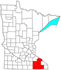
Preston, Minnesota

Last updated

Preston
DowntownBlockPrestonMN.jpg
Preston Main Street commercial district
Nickname: 
"Minnesota's Trout Capitol"
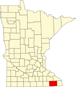
Fillmore County Minnesota Incorporated and Unincorporated areas Preston Highlighted.svg
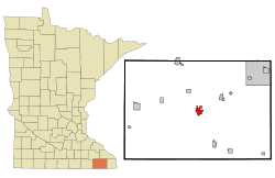
Location of Preston
within Fillmore County and state of Minnesota
Coordinates: 43°40′21″N92°04′58″W / 43.67250°N 92.08278°W / 43.67250; -92.08278
Country United States
State Minnesota
County Fillmore
Area
[1]
  Total2.46 sq mi (6.38 km2)
  Land2.46 sq mi (6.38 km2)
  Water0.00 sq mi (0.00 km2)
Elevation
[2]
955 ft (291 m)
Population
 (2020)
  Total1,322
  Density536.31/sq mi (207.11/km2)
Time zone UTC-6 (Central (CST))
  Summer (DST) UTC-5 (CDT)
ZIP code
55965
Area code 507
FIPS code 27-52450 [3]
GNIS feature ID2396272 [2]

Preston is a city and the county seat of Fillmore County, Minnesota, United States. The population was 1,325 at the 2010 census. [4] [5] The Root River runs through it, and Mystery Cave State Park is nearby. It bills itself as "America's Trout Capital," [6] with a 20-foot trout [7] placed along Minnesota State Highway 16.

Contents

History

Preston was platted in 1855. [8] The community was named for Luther Preston, a millwright [9] and postmaster. [10] The old Preston grain elevator used to be known as the Milwaukee Elevator Company Grain Elevator. It was built around 1890 for holding grain for shipment by railroad to the Eastern cities of the United States. The elevator was last used in the 1980s. It was built with "cribbed" construction, which has to do with interlocking bins. At the time it was a lot stronger and a lot more expensive to build it this way than to build it in stud construction. Now the Preston Historical Society is trying to restore the structure.

The Preston Overlook on the bluff above the city 2009-0528-Preston-Overlook.jpg
The Preston Overlook on the bluff above the city

The Preston Overlook was built in 1937 by the Minnesota Department of Highways under the program of Federal Relief Construction during the New Deal. A site was chosen on the highest point on the bluffs above the Root River, 90 feet below. The Preston Overlook was listed on the National Register of Historic Places in 2003.

Geography

According to the United States Census Bureau, the city has a total area of 2.45 square miles (6.35 km2), all land. [11] The South Branch of the Root River snakes through the city.

U.S. Highway 52 and Minnesota Highway 16 are two of the main routes in the city.

Climate

According to the Köppen Climate Classification system, Preston has a warm-summer humid continental climate, abbreviated "Dfb" on climate maps. The hottest temperature recorded in Preston was 101 °F (38.3 °C) on July 18, 1964, August 2, 1964, July 14, 1995, and July 7, 2012, while the coldest temperature recorded was −45 °F (−42.8 °C) on February 3, 1996 and February 1, 2019. [12]

Climate data for Preston, Minnesota, 1991–2020 normals, extremes 1952–present
MonthJanFebMarAprMayJunJulAugSepOctNovDecYear
Record high °F (°C)57
(14)
65
(18)
82
(28)
91
(33)
94
(34)
100
(38)
101
(38)
101
(38)
98
(37)
92
(33)
76
(24)
63
(17)
101
(38)
Mean maximum °F (°C)44.2
(6.8)
48.1
(8.9)
65.7
(18.7)
78.5
(25.8)
86.2
(30.1)
91.2
(32.9)
92.0
(33.3)
90.6
(32.6)
87.4
(30.8)
80.8
(27.1)
64.4
(18.0)
48.3
(9.1)
94.0
(34.4)
Mean daily maximum °F (°C)23.6
(−4.7)
28.2
(−2.1)
40.9
(4.9)
55.4
(13.0)
67.6
(19.8)
77.7
(25.4)
81.1
(27.3)
79.3
(26.3)
72.5
(22.5)
58.8
(14.9)
42.7
(5.9)
29.4
(−1.4)
54.8
(12.6)
Daily mean °F (°C)13.8
(−10.1)
18.1
(−7.7)
30.7
(−0.7)
43.7
(6.5)
55.7
(13.2)
65.9
(18.8)
69.6
(20.9)
67.5
(19.7)
59.9
(15.5)
46.7
(8.2)
33.0
(0.6)
20.5
(−6.4)
43.8
(6.5)
Mean daily minimum °F (°C)4.1
(−15.5)
8.0
(−13.3)
20.6
(−6.3)
32.1
(0.1)
43.7
(6.5)
54.0
(12.2)
58.2
(14.6)
55.7
(13.2)
47.3
(8.5)
34.6
(1.4)
23.2
(−4.9)
11.7
(−11.3)
32.8
(0.4)
Mean minimum °F (°C)−19.9
(−28.8)
−15.3
(−26.3)
−2.7
(−19.3)
17.9
(−7.8)
28.3
(−2.1)
40.6
(4.8)
47.4
(8.6)
46.0
(7.8)
32.2
(0.1)
19.9
(−6.7)
6.5
(−14.2)
−10.4
(−23.6)
−24.1
(−31.2)
Record low °F (°C)−44
(−42)
−45
(−43)
−35
(−37)
−8
(−22)
18
(−8)
31
(−1)
35
(2)
30
(−1)
19
(−7)
7
(−14)
−19
(−28)
−35
(−37)
−45
(−43)
Average precipitation inches (mm)1.09
(28)
1.18
(30)
2.00
(51)
3.84
(98)
4.52
(115)
5.95
(151)
4.17
(106)
4.29
(109)
3.68
(93)
2.73
(69)
1.89
(48)
1.44
(37)
36.78
(935)
Average snowfall inches (cm)11.0
(28)
8.2
(21)
7.5
(19)
2.5
(6.4)
0.3
(0.76)
0.0
(0.0)
0.0
(0.0)
0.0
(0.0)
0.0
(0.0)
0.3
(0.76)
2.6
(6.6)
9.8
(25)
42.2
(107.52)
Average precipitation days (≥ 0.01 in)8.47.08.611.013.813.110.610.49.69.97.48.9118.7
Average snowy days (≥ 0.1 in)7.96.54.01.40.10.00.00.00.00.32.27.229.6
Source 1: NOAA [13]
Source 2: National Weather Service [12]

Demographics

Historical population
CensusPop.Note
1870 600
1880 93956.5%
1900 1,278
1910 1,193−6.7%
1920 1,2272.8%
1930 1,214−1.1%
1940 1,44719.2%
1950 1,399−3.3%
1960 1,4916.6%
1970 1,413−5.2%
1980 1,4784.6%
1990 1,5303.5%
2000 1,426−6.8%
2010 1,325−7.1%
2020 1,322−0.2%
U.S. Decennial Census

2010 census

As of the census [14] of 2010, there were 1,325 people, 603 households, and 361 families living in the city. The population density was 540.8 inhabitants per square mile (208.8/km2). There were 675 housing units at an average density of 275.5 per square mile (106.4/km2). The racial makeup of the city was 98.3% White, 0.2% African American, 0.2% Native American, 0.2% Asian, and 1.1% from two or more races. Hispanic or Latino of any race were 0.6% of the population.

There were 603 households, of which 24.9% had children under the age of 18 living with them, 47.3% were married couples living together, 8.6% had a female householder with no husband present, 4.0% had a male householder with no wife present, and 40.1% were non-families. 36.3% of all households were made up of individuals, and 16.6% had someone living alone who was 65 years of age or older. The average household size was 2.15 and the average family size was 2.79.

The median age in the city was 43.8 years. 21.4% of residents were under the age of 18; 7.4% were between the ages of 18 and 24; 22.5% were from 25 to 44; 28% were from 45 to 64; and 20.8% were 65 years of age or older. The gender makeup of the city was 49.4% male and 50.6% female.

2000 census

As of the census [3] of 2000, there were 1,426 people, 583 households, and 374 families living in the city. The population density was 606.3 inhabitants per square mile (234.1/km2). There were 616 housing units at an average density of 261.9 per square mile (101.1/km2). The racial makeup of the city was 98.95% White, 0.14% African American, 0.14% Native American, 0.14% Asian, 0.14% from other races, and 0.49% from two or more races. Hispanic or Latino of any race were 0.42% of the population.

There were 583 households, out of which 28.8% had children under the age of 18 living with them, 54.9% were married couples living together, 6.2% had a female householder with no husband present, and 35.8% were non-families. 32.9% of all households were made up of individuals, and 15.8% had someone living alone who was 65 years of age or older. The average household size was 2.28 and the average family size was 2.89.

In the city, the population was spread out, with 23.5% under the age of 18, 5.3% from 18 to 24, 26.2% from 25 to 44, 20.8% from 45 to 64, and 24.2% who were 65 years of age or older. The median age was 42 years. For every 100 females, there were 101.1 males. For every 100 females age 18 and over, there were 97.6 males.

The median income for a household in the city was $37,016, and the median income for a family was $50,234. Males had a median income of $30,463 versus $21,520 for females. The per capita income for the city was $18,578. About 4.3% of families and 8.3% of the population were below the poverty line, including 9.0% of those under age 18 and 15.0% of those age 65 or over.

Trail connection

Preston is intersected by the Harmony-Preston Valley segment of the Blufflands State Trail.

Education

See also

Related Research Articles

<span class="mw-page-title-main">Fillmore County, Minnesota</span> County in Minnesota, United States

Fillmore County is a county in the U.S. state of Minnesota. As of the 2020 census, the population was 21,228. Its county seat is Preston. Fillmore County is included in the Rochester metropolitan area.

<span class="mw-page-title-main">Fillmore, Indiana</span> Town in Indiana, United States

Fillmore is a town in Marion Township, Putnam County, in the U.S. state of Indiana. The population was 532 at the 2020 census.

<span class="mw-page-title-main">Audubon, Minnesota</span> City in Minnesota, United States

Audubon is a city in Becker County, Minnesota, United States. The population was 560 at the 2020 census.

<span class="mw-page-title-main">Canton, Minnesota</span> City in Minnesota, United States

Canton is a city in Fillmore County, Minnesota, United States. The population was 346 at the 2010 census.

Fillmore Township is a township in Fillmore County, Minnesota, United States. The population was 485 at the 2000 census.

<span class="mw-page-title-main">Fountain, Minnesota</span> City in Minnesota, United States

Fountain is a city in Fillmore County, Minnesota, United States. The population was 410 at the 2010 census. Fountain is the western terminus of the Root River segment of the Root River State Trail. Local attractions include the Fillmore County History Center.

<span class="mw-page-title-main">Harmony, Minnesota</span> City in Minnesota, United States

Harmony is a city in Fillmore County, Minnesota, United States. The population was 1,020 at the 2010 census. The town bills itself as the "Biggest Little Town in Southern Minnesota" and features the largest Amish community in the state.

<span class="mw-page-title-main">Mabel, Minnesota</span> City in Minnesota, United States

Mabel is a city in Fillmore County, Minnesota, United States. The population was 780 at the 2010 census.

<span class="mw-page-title-main">Ostrander, Minnesota</span> City in Minnesota, United States

Ostrander is a city in Fillmore County, Minnesota, United States. The population was 254 at the 2010 census.

<span class="mw-page-title-main">Peterson, Minnesota</span> City in Minnesota, United States

Peterson is a city in Fillmore County, Minnesota, United States. The population was 199 at the 2010 census.

Preston Township is a township in Fillmore County, Minnesota, United States. The population was 374 at the 2000 census.

<span class="mw-page-title-main">Rushford Village, Minnesota</span> City in Minnesota, United States

Rushford Village is a city in Fillmore County, Minnesota, United States. The population was 807 at the 2010 census. It surrounds the city of Rushford.

Spring Valley Township is a township in Fillmore County, Minnesota, United States. The population was 590 at the 2000 census.

<span class="mw-page-title-main">Whalan, Minnesota</span> City in Minnesota, United States

Whalan is a city in Fillmore County, Minnesota, United States. The population was 63 at the 2010 census.

<span class="mw-page-title-main">Wykoff, Minnesota</span> City in Minnesota, United States

Wykoff is a city in Fillmore County, Minnesota, United States. The population was 444 at the 2010 census.

York Township is a township in Fillmore County, Minnesota, United States. The population was 409 at the 2000 census. York Township borders Forestville Township, Bloomfield Township, Beaver Township, Carimona Township, and Bristol Township.

<span class="mw-page-title-main">Goodhue, Minnesota</span> City in Minnesota, United States

Goodhue is a city in Goodhue County, Minnesota, United States. The population was 1,176 at the 2010 census.

<span class="mw-page-title-main">Morristown, Minnesota</span> City in Minnesota, United States

Morristown is a city in Rice County, Minnesota, United States. The population was 949 at the 2020 census.

<span class="mw-page-title-main">Lake Wilson, Minnesota</span> City in Minnesota, United States

Lake Wilson is a city in Murray County, Minnesota, United States. The population was 251 at the 2010 census.

<span class="mw-page-title-main">Chatfield, Minnesota</span> City in Minnesota, United States

Chatfield is a city in Fillmore and Olmsted counties in the U.S. state of Minnesota. The population was 2,779 at the 2010 census. The city's area is split almost equally between the two counties. Chatfield is known as "The Gateway to Bluff Country" and "The Chosen Valley".

References

  1. "2020 U.S. Gazetteer Files". United States Census Bureau. Retrieved July 24, 2022.
  2. 1 2 U.S. Geological Survey Geographic Names Information System: Preston, Minnesota
  3. 1 2 "U.S. Census website". United States Census Bureau . Retrieved January 31, 2008.
  4. "2010 Census Redistricting Data (Public Law 94-171) Summary File". American FactFinder. United States Census Bureau . Retrieved April 27, 2011.[ dead link ]
  5. "Find a County". National Association of Counties. Retrieved June 7, 2011.
  6. Visit Preston, Minnesota Archived 2008-05-16 at the Wayback Machine
  7. Visit Preston, Minnesota Archived 2008-05-16 at the Wayback Machine
  8. Upham, Warren (1920). Minnesota Geographic Names: Their Origin and Historic Significance. Minnesota Historical Society. p.  194.
  9. "Profile for Preston, Minnesota". ePodunk. Archived from the original on July 8, 2015. Retrieved May 30, 2010.
  10. "Where Did Minnesota Towns Get Names? Most Colorful in U.S." The Winona Republican-Herald. July 12, 1949. p. 15. Retrieved January 24, 2015 via Newspapers.com. Open Access logo PLoS transparent.svg
  11. "US Gazetteer files 2010". United States Census Bureau. Archived from the original on January 25, 2012. Retrieved November 13, 2012.
  12. 1 2 "NOAA Online Weather Data - NWS La Crosse". National Weather Service. Retrieved October 30, 2022.
  13. "U.S. Climate Normals Quick Access - Station: Preston, MN". National Oceanic and Atmospheric Administration. Retrieved October 30, 2022.
  14. "U.S. Census website". United States Census Bureau . Retrieved November 13, 2012.
  15. Southeastern Libraries Cooperating (SELCO)
  16. "Preston Public Library". preston.lib.mn.us. Retrieved June 4, 2022.

43°40′10.10″N92°4′55.13″W / 43.6694722°N 92.0819806°W / 43.6694722; -92.0819806