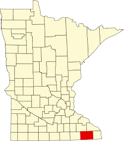
Lenora, Minnesota

Last updated

Lenora
USA Minnesota location map.svg
Red pog.svg
Lenora
Usa edcp location map.svg
Red pog.svg
Lenora
Coordinates: 43°34′21″N91°52′57″W / 43.57250°N 91.88250°W / 43.57250; -91.88250
Country United States
State Minnesota
County Fillmore
Elevation
1,106 ft (337 m)
Time zone UTC-6 (Central (CST))
  Summer (DST) UTC-5 (CDT)
Area code 507
GNIS feature ID646598 [1]

Lenora is an unincorporated community in Fillmore County, in the U.S. state of Minnesota. [1]

History

Lenora was laid out in 1855. [2] A post office was established at Lenora in 1856, and remained in operation until it was discontinued in 1905. [3]

Historical population
CensusPop.Note
1880 100
U.S. Decennial Census [4]

References

  1. 1 2 U.S. Geological Survey Geographic Names Information System: Lenora, Minnesota
  2. Upham, Warren (1920). Minnesota Geographic Names: Their Origin and Historic Significance. Minnesota Historical Society. p.  194.
  3. "Fillmore County". Jim Forte Postal History. Retrieved 30 May 2015.
  4. "Census of Population and Housing". Census.gov. Archived from the original on 7 May 2015. Retrieved 4 August 2019.