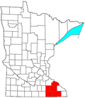
Mabel, Minnesota

Last updated
Mabel
Downtown Mabel, MN.jpg
Downtown Mabel in 2018
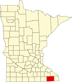
Fillmore County Minnesota Incorporated and Unincorporated areas Mabel Highlighted.svg
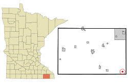
Location of Mabel, Minnesota
Coordinates: 43°31′19″N91°46′10″W / 43.52194°N 91.76944°W / 43.52194; -91.76944
Country United States
State Minnesota
County Fillmore
Area
[1]
  Total0.48 sq mi (1.25 km2)
  Land0.48 sq mi (1.25 km2)
  Water0.00 sq mi (0.00 km2)
Elevation
1,132 ft (345 m)
Population
 (2020)
  Total716
  Density1,488.57/sq mi (574.41/km2)
Time zone UTC-6 (Central (CST))
  Summer (DST) UTC-5 (CDT)
ZIP code
55954
Area code 507
FIPS code 27-38888 [2]
GNIS feature ID647346 [3]
Website www.mabelmn.com

Mabel is a city in Fillmore County, Minnesota, United States. The population was 780 at the 2010 census. [4]

Contents

History

A post office called Mabel has been in operation since 1880. [5] The city was named for the daughter of a railroad official. [6]

Transportation

Minnesota State Highways 43 and 44 are two of the main routes in the community.

Geography

According to the United States Census Bureau, the city has a total area of 0.48 square miles (1.24 km2), all land. [7]

Climate

Climate data for Mabel, Minnesota (1991–2020)
MonthJanFebMarAprMayJunJulAugSepOctNovDecYear
Average high °F (°C)23.8
(−4.6)
27.9
(−2.3)
40.4
(4.7)
55.4
(13.0)
66.9
(19.4)
76.2
(24.6)
79.8
(26.6)
78.1
(25.6)
71.7
(22.1)
58.3
(14.6)
43.0
(6.1)
30.0
(−1.1)
54.3
(12.4)
Daily mean °F (°C)13.9
(−10.1)
17.7
(−7.9)
30.2
(−1.0)
43.6
(6.4)
55.7
(13.2)
65.8
(18.8)
68.9
(20.5)
66.5
(19.2)
59.2
(15.1)
46.7
(8.2)
33.1
(0.6)
21.2
(−6.0)
43.5
(6.4)
Average low °F (°C)4.0
(−15.6)
7.4
(−13.7)
20.0
(−6.7)
31.7
(−0.2)
44.4
(6.9)
55.3
(12.9)
58.0
(14.4)
54.9
(12.7)
46.6
(8.1)
35.1
(1.7)
23.2
(−4.9)
12.4
(−10.9)
32.8
(0.4)
Average precipitation inches (mm)1.00
(25)
1.01
(26)
1.90
(48)
3.90
(99)
4.78
(121)
6.14
(156)
4.47
(114)
4.59
(117)
4.37
(111)
3.13
(80)
1.89
(48)
1.40
(36)
38.58
(981)
Source: NOAA [8]

Demographics

Historical population
CensusPop.Note
1890 273
1900 49481.0%
1910 54911.1%
1920 5500.2%
1930 68624.7%
1940 7418.0%
1950 7886.3%
1960 8153.4%
1970 8889.0%
1980 861−3.0%
1990 745−13.5%
2000 7662.8%
2010 7801.8%
2020 716−8.2%
U.S. Decennial Census [9]

2010 census

As of the census [10] of 2010, there were 780 people, 359 households, and 192 families living in the city. The population density was 1,625.0 inhabitants per square mile (627.4/km2). There were 394 housing units at an average density of 820.8 per square mile (316.9/km2). The racial makeup of the city was 99.0% White, 0.1% Native American, 0.1% Asian, 0.3% from other races, and 0.5% from two or more races. Hispanic or Latino of any race were 0.6% of the population.

There were 359 households, of which 21.4% had children under the age of 18 living with them, 39.6% were married couples living together, 8.6% had a female householder with no husband present, 5.3% had a male householder with no wife present, and 46.5% were non-families. 39.8% of all households were made up of individuals, and 23.4% had someone living alone who was 65 years of age or older. The average household size was 2.03 and the average family size was 2.70.

The median age in the city was 49.6 years. 19.1% of residents were under the age of 18; 6.3% were between the ages of 18 and 24; 20% were from 25 to 44; 23.2% were from 45 to 64; and 31.5% were 65 years of age or older. The gender makeup of the city was 45.8% male and 54.2% female.

2000 census

As of the census [2] of 2000, there were 766 people, 337 households, and 199 families living in the city. The population density was 1,618.4 inhabitants per square mile (624.9/km2). There were 365 housing units at an average density of 771.2 per square mile (297.8/km2). The racial makeup of the city was 99.09% White, 0.13% from other races, and 0.78% from two or more races. Hispanic or Latino of any race were 0.65% of the population.

There were 337 households, out of which 20.2% had children under the age of 18 living with them, 48.4% were married couples living together, 7.7% had a female householder with no husband present, and 40.9% were non-families. 37.7% of all households were made up of individuals, and 24.3% had someone living alone who was 65 years of age or older. The average household size was 2.09 and the average family size was 2.72.

In the city, the population was spread out, with 20.1% under the age of 18, 5.1% from 18 to 24, 18.8% from 25 to 44, 20.4% from 45 to 64, and 35.6% who were 65 years of age or older. The median age was 51 years. For every 100 females, there were 82.4 males. For every 100 females age 18 and over, there were 78.9 males.

The median income for a household in the city was $27,228, and the median income for a family was $35,227. Males had a median income of $25,625 versus $16,442 for females. The per capita income for the city was $15,496. About 8.5% of families and 10.7% of the population were below the poverty line, including 18.6% of those under age 18 and 10.6% of those age 65 or over.

Education

Mabel-Canton Public Schools operates area public schools.

The school colors of the pre-merger Mabel School were purple and white. The first graduating class at the Mabel School did so in 1903. In 1966 it consolidated into Mabel-Canton. [11]

Notable people

See also

Related Research Articles

<span class="mw-page-title-main">Winneshiek County, Iowa</span> County in Iowa, United States

Winneshiek County is a county located in the U.S. state of Iowa. As of the 2020 census, the population was 20,070. The county seat is Decorah.

<span class="mw-page-title-main">Hanska, Minnesota</span> City in Minnesota, United States

Hanska is a city in Brown County, Minnesota, United States. The population was 402 at the 2010 census.

<span class="mw-page-title-main">Chickamaw Beach, Minnesota</span> City in Minnesota, United States

Chickamaw Beach is a city in Cass County, Minnesota, United States. The population was 114 at the 2010 census. It is part of the Brainerd Micropolitan Statistical Area.

<span class="mw-page-title-main">Shafer, Minnesota</span> City in Minnesota, United States

Shafer is a city in Chisago County, Minnesota, United States. The population was 1,045 at the 2010 census. The city was named for Jacob Shafer, a pioneer settler.

<span class="mw-page-title-main">Stacy, Minnesota</span> City in Minnesota, United States

Stacy is a city in Chisago County, Minnesota, United States, along the Sunrise River. The population was 1,456 at the 2010 census.

<span class="mw-page-title-main">Miltona, Minnesota</span> City in Minnesota, United States

Miltona is a city in Douglas County, Minnesota, United States. The population was 431 at the 2020 census.

<span class="mw-page-title-main">Canton, Minnesota</span> City in Minnesota, United States

Canton is a city in Fillmore County, Minnesota, United States. The population was 346 at the 2010 census.

<span class="mw-page-title-main">Kenyon, Minnesota</span> City in Minnesota, United States

Kenyon is a city in southwestern Goodhue County, Minnesota, United States, located along the North Fork of the Zumbro River. It was founded in 1856 and named in honor of Kenyon College. It is known for the Boulevard of roses on main street, which is the namesake of the town festival "Rosefest" held every August. The population was 1,815 at the 2010 census.

<span class="mw-page-title-main">Caledonia, Minnesota</span> City in Minnesota, United States

Caledonia is a city and the county seat of Houston County, Minnesota, United States and is part of the La Crosse, Wisconsin Metropolitan Statistical Area. The population was 2,847 at the 2020 census.

<span class="mw-page-title-main">Spring Grove, Minnesota</span> City in Minnesota, United States

Spring Grove is a city in Houston County, Minnesota, United States. The population was 1,330 at the 2010 census. It is part of the La Crosse-Onalaska, WI-MN Metropolitan Statistical Area.

<span class="mw-page-title-main">Nashwauk, Minnesota</span> City in Minnesota, United States

Nashwauk is a city in Itasca County, Minnesota, United States. The population was 983 at the 2010 census.

<span class="mw-page-title-main">Upsala, Minnesota</span> City in Minnesota, United States

Upsala is a city in Morrison County, Minnesota, United States. The population was 487 at the 2020 census.

<span class="mw-page-title-main">Underwood, Minnesota</span> City in Minnesota, United States

Underwood is a city in Otter Tail County, Minnesota, United States. The population was 356 at the 2020 census.

<span class="mw-page-title-main">Kerrick, Minnesota</span> City in Minnesota, United States

Kerrick is a city in Pine County, Minnesota, United States. The population was 65 at the 2010 census.

<span class="mw-page-title-main">St. Martin, Minnesota</span> City in Minnesota, United States

St. Martin or Saint Martin, Smartin to locals, is a city in Stearns County, Minnesota, United States. The population was 308 at the 2010 census. It is part of the St. Cloud Metropolitan Statistical Area.

<span class="mw-page-title-main">West Union, Minnesota</span> City in Minnesota, United States

West Union is a city in Todd County, Minnesota, United States. The population was 111 at the 2010 census.

<span class="mw-page-title-main">Hammond, Minnesota</span> City in Minnesota, United States

Hammond is a city in Wabasha County, Minnesota, United States. The population was 132 at the 2010 census.

<span class="mw-page-title-main">Otsego, Minnesota</span> City in Minnesota, United States

Otsego is a city in Wright County, Minnesota, United States. It is a northwest suburb within the Minneapolis–Saint Paul metropolitan area. It had a population of 19,966 at the 2020 census. Following the 2020 census, Otsego was determined to be the largest city in Wright County, and the 60th largest in Minnesota. Minnesota State Highway 101 and Interstate 94 serve as the main routes in the city.

<span class="mw-page-title-main">Silver Lake, Minnesota</span> City in Minnesota, United States

Silver Lake is a city in McLeod County, Minnesota, United States. The population was 866 at the 2020 census.

<span class="mw-page-title-main">Flandreau, South Dakota</span> City in South Dakota, United States

FlandreauFLAN-droo is a city in and county seat of Moody County, South Dakota, United States. The population was 2,372 at the 2020 census. It was named in honor of Charles Eugene Flandrau, a judge in the territory and state of Minnesota. He is credited with saving the community of New Ulm, Minnesota, from destruction during conflict with the Sioux tribe in 1862.

References

  1. "2020 U.S. Gazetteer Files". United States Census Bureau. Retrieved July 24, 2022.
  2. 1 2 "U.S. Census website". United States Census Bureau . Retrieved 2008-01-31.
  3. "Mabel". Geographic Names Information System . United States Geological Survey, United States Department of the Interior . Retrieved May 25, 2023.
  4. "2010 Census Redistricting Data (Public Law 94-171) Summary File". American FactFinder. United States Census Bureau . Retrieved 27 April 2011.[ dead link ]
  5. "Fillmore County". Jim Forte Postal History. Retrieved 30 May 2015.
  6. Upham, Warren (1920). Minnesota Geographic Names: Their Origin and Historic Significance. Minnesota Historical Society. p. 194.
  7. "US Gazetteer files 2010". United States Census Bureau. Archived from the original on 2012-01-25. Retrieved 2012-11-13.
  8. "NOAA NCEI U.S. Climate Normals Quick Access". NOAA. Retrieved 2023-03-13.
  9. "Census of Population and Housing". Census.gov. Retrieved June 4, 2015.
  10. "U.S. Census website". United States Census Bureau . Retrieved 2012-11-13.
  11. "The Making of Mabel-Canton School District #238". Mabel-Canton Public Schools. Retrieved 2020-04-06. - Linked from home page under "M-C Info"
  12. "Douglas K. Amdahl, Chief Justice". Minnesota State Law Library. Archived from the original on 2016-05-07. Retrieved 2017-04-18.
  13. Dan-Knuth-obituary