West Concord, Minnesota

Last updated

West Concord
West Concord, Minnesota 6.jpg
Downtown West Concord
Motto(s): 
"A Proud Heritage; A Bright Future"
Dodge County Minnesota Incorporated and Unincorporated areas West Concord Highlighted.svg
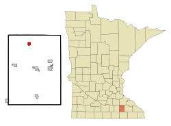
Location of West Concord, Minnesota
Coordinates: 44°09′10″N92°53′58″W / 44.15278°N 92.89944°W / 44.15278; -92.89944
Country United States
State Minnesota
County Dodge
20082008
Government
  MayorJeffrey E. McCool
Area
[1]
  Total1.08 sq mi (2.79 km2)
  Land1.07 sq mi (2.78 km2)
  Water0.00 sq mi (0.00 km2)
Elevation
[2]
1,230 ft (370 m)
Population
 (2020)
  Total861
  Density800.93/sq mi (309.38/km2)
Time zone UTC-6 (Central (CST))
  Summer (DST) UTC-5 (CDT)
ZIP code
55985
Area code 507
FIPS code 27-69304 [3]
GNIS feature ID2397265 [2]
Website www.westconcordmn.com

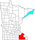
West Concord is a city in Dodge County, Minnesota, United States. [4] The population was 861 at the 2020 census.

Contents

History

West Concord was platted in 1885. [5] A large share of the early settlers of the area were from New England, New York or Pennsylvania and West Concord, and well as Concord Township which surrounds it, were named after Concord, New Hampshire. [6] A post office has been in operation at West Concord since 1885. [7]

Geography

According to the United States Census Bureau, the city has a total area of 1.06 square miles (2.75 km2), all land. [8]

Minnesota State Highway 56 runs north and south through the city.

Dodge County Road 24 runs through the north end of the city going east and west.

Demographics

Historical population
CensusPop.Note
1900 635
1910 584−8.0%
1920 70420.5%
1930 613−12.9%
1940 74421.4%
1950 7703.5%
1960 8105.2%
1970 718−11.4%
1980 7626.1%
1990 87114.3%
2000 836−4.0%
2010 782−6.5%
2020 86110.1%
U.S. Decennial Census [9]

2010 census

As of the census [10] of 2010, there were 782 people, 319 households, and 215 families living in the city. The population density was 737.7 inhabitants per square mile (284.8/km2). There were 372 housing units at an average density of 350.9 per square mile (135.5/km2). The racial makeup of the city was 93.0% White, 0.1% African American, 0.5% Native American, 2.8% from other races, and 3.6% from two or more races. Hispanic or Latino of any race were 8.1% of the population.

There were 319 households, of which 34.2% had children under the age of 18 living with them, 51.1% were married couples living together, 7.5% had a female householder with no husband present, 8.8% had a male householder with no wife present, and 32.6% were non-families. 28.2% of all households were made up of individuals, and 13.4% had someone living alone who was 65 years of age or older. The average household size was 2.43 and the average family size was 2.93.

The median age in the city was 36.2 years. 27.1% of residents were under the age of 18; 8% were between the ages of 18 and 24; 26.9% were from 25 to 44; 21.3% were from 45 to 64; and 16.6% were 65 years of age or older. The gender makeup of the city was 50.9% male and 49.1% female.

2000 census

As of the census [3] of 2000, there were 836 people, 334 households, and 230 families living in the city. The population density was 784.0 inhabitants per square mile (302.7/km2). There were 344 housing units at an average density of 322.6 per square mile (124.6/km2). The racial makeup of the city was 95.57% White, 0.12% Native American, 0.12% Asian, 3.11% from other races, and 1.08% from two or more races. Hispanic or Latino of any race were 5.38% of the population.

There were 334 households, out of which 35.6% had children under the age of 18 living with them, 56.6% were married couples living together, 8.7% had a female householder with no husband present, and 31.1% were non-families. 26.3% of all households were made up of individuals, and 15.0% had someone living alone who was 65 years of age or older. The average household size was 2.49 and the average family size was 3.01.

In the city, the population was spread out, with 27.8% under the age of 18, 8.1% from 18 to 24, 27.6% from 25 to 44, 17.9% from 45 to 64, and 18.5% who were 65 years of age or older. The median age was 35 years. For every 100 females, there were 98.1 males. For every 100 females age 18 and over, there were 93.6 males.

The median income for a household in the city was $39,453, and the median income for a family was $48,438. Males had a median income of $31,797 versus $22,368 for females. The per capita income for the city was $16,958. About 6.0% of families and 7.9% of the population were below the poverty line, including 8.8% of those under age 18 and 14.1% of those age 65 or over.

Schools

Historic West Concord school building 2020WestConcordSchool.jpg
Historic West Concord school building

West Concord High School's mascot was the Cardinal. The school colors were red and white.

In 1990, West Concord's school district merged with the towns of Dodge Center, MN and Claremont, MN to form Triton Public Schools. [11] West Concord's former high school building became Triton Junior High. Dodge Center is now home to Triton Primary, Triton Middle School and Triton Senior High School. The first commencement exercises of Triton High School were held in 1991.

Triton's school mascot is the Cobra. The school colors are maroon and gray. The annual yearbook is titled Triton Tradition and the first volume was published in 1991.

West Concord Public Charter School, located in West Concord, Minnesota, is a free public school that was established in July 2012, and opened to students in fall 2013. Due to low enrollment the school closed four years after opening. [12]

See also

Related Research Articles

<span class="mw-page-title-main">Dodge County, Minnesota</span> County in Minnesota, United States

Dodge County is a county in the U.S. state of Minnesota. The population was 20,867 as of the 2020 census. Its county seat is Mantorville.

<span class="mw-page-title-main">Badger, Iowa</span> City in Iowa, United States

Badger is a Town in Webster County, Iowa, United States. The population was 522 at the 2020 census. The town got its name from Badger Creek, which itself got its name when a group of soldiers from Fort Dodge in the early 1850s saw a badger for the first time.

<span class="mw-page-title-main">Otho, Iowa</span> City in Iowa, United States

Otho is a city in Webster County, Iowa, United States. The population was 429 at the time of the 2020 census.

<span class="mw-page-title-main">Claremont, Minnesota</span> City in Minnesota, United States

Claremont is a city in Dodge County, Minnesota, United States. The population was 548 at the 2010 census.

Concord Township is a township in Dodge County, Minnesota, United States. The population was 587 at the 2000 census. The unincorporated community of Concord is located within Concord Township. The city of West Concord is located within the township geographically but is a separate entity.

<span class="mw-page-title-main">Dodge Center, Minnesota</span> City in Minnesota, United States

Dodge Center is a city in Dodge County, Minnesota, United States. Approximately 15 miles west of Rochester, the population of Dodge Center was 2,670 at the 2010 census. Dodge Center is part of the Rochester, MN Metropolitan Statistical Area.

<span class="mw-page-title-main">Hayfield, Minnesota</span> City in Minnesota, United States

Hayfield is a city in Dodge County, Minnesota, United States. The population was 1,340 at the 2010 census.

<span class="mw-page-title-main">Kasson, Minnesota</span> City in Minnesota, United States

Kasson is a city in Dodge County, Minnesota, United States. The population was 6,851 at the 2020 census. The city is located 13 miles (21 km) west of Rochester along U.S. Highway 14 and is one of the endpoints of Minnesota State Highway 57. The Dakota, Minnesota and Eastern Railroad's main freight rail line also runs through the city. Kasson shares a school system with nearby Mantorville. The K–M school system is a member of the Zumbro Education school district (ZED). Kasson is part of the Rochester, MN Metropolitan Statistical Area.

<span class="mw-page-title-main">Cleveland, Minnesota</span> City in Minnesota, United States

Cleveland is a city in Le Sueur County, Minnesota, United States. The population was 719 at the 2010 census and 747 at the 2020 census.

<span class="mw-page-title-main">Dalton, Minnesota</span> City in Minnesota, United States

Dalton is a city in Otter Tail County, Minnesota, United States. The population was 215 at the 2020 census.

<span class="mw-page-title-main">Oakdale, Minnesota</span> City in Minnesota, United States

Oakdale is a city in Washington County, Minnesota, United States. It is a suburb of Saint Paul and is on the eastern side of the Twin Cities Metropolitan area. The population was 28,303 at the 2020 census. Oakdale is the 36th largest city in Minnesota by population.

<span class="mw-page-title-main">Mantorville, Minnesota</span> City in Minnesota, United States

Mantorville is a city in Dodge County, Minnesota, United States. The population was 1,197 at the 2010 census. It is the county seat of Dodge County. Founded in 1854, the city is one of the oldest in Minnesota.

<span class="mw-page-title-main">St. Bonifacius, Minnesota</span> City in Minnesota, United States

Saint Bonifacius, often stylized as St. Bonifacius, is a small city in Hennepin County, Minnesota, United States, 25 miles west of Minneapolis. Settled in the 1850s, the town has a combination of rural and exurban features. It is completely surrounded by Minnetrista, Minnesota, and is close to the county line with Carver County. It hosted a Nike Hercules battery during the Cold War, one of four protecting Minneapolis–Saint Paul from Soviet bombers.

<span class="mw-page-title-main">St. Stephen, Minnesota</span> City in Minnesota, United States

Saint Stephen is a city in Stearns County, Minnesota, United States. The population was 851 at the 2010 census.

<span class="mw-page-title-main">Concord, Missouri</span> CDP in Missouri, United States

Concord is a census-designated place (CDP) in St. Louis County, Missouri, United States. The population was 16,421 at the 2010 census. It should not be confused with Concord Township; which the CDP shares much land with, but these areas' boundaries are not identical.

<span class="mw-page-title-main">Fairmount, North Dakota</span> City in Richland County, North Dakota, United States

Fairmount is a city in Richland County, North Dakota, United States. The population was 343 at the 2020 census. Fairmount was founded in 1884. It is part of the Wahpeton, ND–MN Micropolitan Statistical Area.

<span class="mw-page-title-main">Spring Lake Park, Minnesota</span> City in Minnesota, United States

Spring Lake Park is a city in Anoka and Ramsey counties in the state of Minnesota. The population was 6,412 at the 2010 census. The city is located mainly within Anoka County. Minnesota State Highways 47 and 65 and County Highway 10 are three of the main routes in the city.

<span class="mw-page-title-main">Ortonville, Minnesota</span> City in Minnesota, United States

Ortonville is a city in Big Stone County in the U.S. state of Minnesota at the southern tip of Big Stone Lake, along the border with South Dakota. The population was 2,021 at the 2020 census. It is the county seat of Big Stone County. Big Stone Lake State Park is nearby.

<span class="mw-page-title-main">Motley, Minnesota</span> City in Minnesota, United States

Motley is a city in Cass and Morrison counties in the U.S. state of Minnesota. The population was 680 at the 2020 census. The main part of Motley is located within Morrison County; only a minor part of the city extends into Cass County

<span class="mw-page-title-main">Blooming Prairie, Minnesota</span> City in Minnesota, United States

Blooming Prairie is a city in Dodge and Steele counties in the U.S. state of Minnesota. The population was 1,996 at the 2010 census. Most of the city is located within Steele County; only a small part of the city extends into Dodge County.

References

  1. "2020 U.S. Gazetteer Files". United States Census Bureau. Retrieved July 24, 2022.
  2. 1 2 U.S. Geological Survey Geographic Names Information System: West Concord, Minnesota
  3. 1 2 "U.S. Census website". United States Census Bureau . Retrieved January 31, 2008.
  4. "2010 Census Redistricting Data (Public Law 94-171) Summary File". American FactFinder. United States Census Bureau . Retrieved April 27, 2011.[ dead link ]
  5. Upham, Warren (1920). Minnesota Geographic Names: Their Origin and Historic Significance. Minnesota Historical Society. p.  174.
  6. Robert M. Frame III, Minnesota Historic Properties Inventory Form: Perry Nelson House, June 5, 1981; copy accessed at State Historic Preservation Office in the Minnesota History Center.
  7. "Dodge County". Jim Forte Postal History. Retrieved May 14, 2015.
  8. "US Gazetteer files 2010". United States Census Bureau . Retrieved November 13, 2012.
  9. "Census of Population and Housing". Census.gov. Retrieved June 4, 2015.
  10. "U.S. Census website". United States Census Bureau . Retrieved November 13, 2012.
  11. Triton Public Schools
  12. "Friends of Education :: Authorized Charter Schools".