Wabasha County, Minnesota

Last updated

Wabasha County
Wabasha City Hall 1.JPG
Old Wabasha City Hall in Wabasha, Minnesota.
Map of Minnesota highlighting Wabasha County.svg
Location within the U.S. state of Minnesota
Minnesota in United States.svg
Minnesota's location within the U.S.
Coordinates: 44°17′N92°14′W / 44.28°N 92.24°W / 44.28; -92.24
CountryFlag of the United States.svg United States
StateFlag of Minnesota.svg  Minnesota
FoundedOctober 27, 1849
Named for Wabasha (city)
Seat Wabasha
Largest city Lake City
Area
  Total550 sq mi (1,400 km2)
  Land523 sq mi (1,350 km2)
  Water27 sq mi (70 km2)  4.8%
Population
 (2020)
  Total21,387
  Estimate 
(2023)
21,683 Increase2.svg
  Density40.9/sq mi (15.8/km2)
Time zone UTC−6 (Central)
  Summer (DST) UTC−5 (CDT)
Congressional district 2nd
Website www.co.wabasha.mn.us

Wabasha County is a county in the U.S. state of Minnesota. As of the 2020 census, the population was 21,387. [1] Its county seat is Wabasha. [2]

Contents

Wabasha County is part of the Rochester Metropolitan Statistical Area.

History

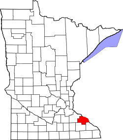
The recently organized Minnesota Territory legislature created Wabasha County on October 27, 1849, one of nine original counties in the territory. An area on the Mississippi River's west bank, originally called Cratte's Landing, had grown into a town named Wabasha, then a city, and when the legislature created the county west of the river around this city, Wabasha was designated the county seat. The city had been named for three successive chiefs of Mississippi bands of Dakota Indians. [3]

Wabasha County's area was reduced in 1853 when sections were partitioned off to create Fillmore, Goodhue, and Rice counties. More area was partitioned off in 1854 to create Winona County, and another part in 1855 to create Olmsted County. The county boundaries have remained the same since 1855.

Geography

Soils of Wabasha County Wabasha Co Pie Chart No Text Version.pdf
Soils of Wabasha County

Wabasha County lies on Minnesota's border with Wisconsin (across the Mississippi River. The Mississippi flows southeast along the county's eastern line. The North Fork of the Whitewater River flows east through the southern part of the county, then discharges into the Whitewater in Olmsted County. The combined Whitewater then enters the southeastern part of Wabasha County, flowing northeast to its discharge point into the Mississippi. The Zumbro River flows east-northeast through the county to its discharge point into the Mississippi. East Indian Creek and Miller Creek drain the northern part of the county into the Mississippi. The county terrain consists of low rolling hills, considerably rutted by drainages, with all available area devoted to agriculture. [5] The terrain slopes to the east and south, with its highest point on its upper west border at 1,191 ft (363 m) ASL. [6] The county has a total area of 550 square miles (1,400 km2), of which 523 square miles (1,350 km2) is land and 27 square miles (70 km2) (4.8%) is water. [7] Wabasha is one of 17 Minnesota counties with more savanna soils than either forest or prairie soils.

Major highways

Adjacent counties

Protected areas [5]

  • Carley State Park
  • Kellogg-Weaver Dunes Scientific and Natural Area
  • Mazeppa State Wildlife Management Area
  • McCarthy Lake State Wildlife Management Area
  • Miller Creek Aquatic Management Area [8]
  • Zumbro Falls Woods Scientific and Natural Area

Lakes [5]

Demographics

Historical population
CensusPop.Note
1850 243
1860 7,2282,874.5%
1870 15,850119.3%
1880 18,20614.9%
1890 16,972−6.8%
1900 18,92411.5%
1910 18,554−2.0%
1920 17,919−3.4%
1930 19,6139.5%
1940 17,653−10.0%
1950 16,878−4.4%
1960 17,0070.8%
1970 17,2241.3%
1980 19,33512.3%
1990 19,7442.1%
2000 21,6109.5%
2010 21,6760.3%
2020 21,387−1.3%
2023 (est.)21,683 [9] 1.4%
U.S. Decennial Census [10]
1790-1960 [11] 1900-1990 [12]
1990-2000 [13] 2010-2020 [1]

2020 Census

Wabasha County Racial Composition [14]
RaceNum.Perc.
White (NH)19,92193.2%
Black or African American (NH)1210.6%
Native American (NH)320.2%
Asian (NH)970.5%
Pacific Islander (NH)60.03%
Other/Mixed (NH)5022.35%
Hispanic or Latino 7083.31%

2000 census

Age pyramid of county residents based on 2000 census data USA Wabasha County, Minnesota age pyramid.svg
Age pyramid of county residents based on 2000 census data

As of the census of 2000, there were 21,610 people, 8,277 households, and 5,876 families in the county. The population density was 41.3 per square mile (15.9/km2). There were 9,066 housing units at an average density of 17.3 per square mile (6.7/km2). The racial makeup of the county was 97.97% White, 0.25% Black or African American, 0.27% Native American, 0.43% Asian, 0.62% from other races, and 0.45% from two or more races. 1.68% of the population were Hispanic or Latino of any race. 53.3% were of German, 11.1% Norwegian, 7.3% Irish and 5.0% American ancestry.

There were 8,277 households, out of which 33.80% had children under the age of 18 living with them, 60.80% were married couples living together, 6.50% had a female householder with no husband present, and 29.00% were non-families. 24.30% of all households were made up of individuals, and 10.80% had someone living alone who was 65 years of age or older. The average household size was 2.57 and the average family size was 3.07.

The county population contained 27.10% under the age of 18, 7.20% from 18 to 24, 27.00% from 25 to 44, 23.80% from 45 to 64, and 15.00% who were 65 years of age or older. The median age was 38 years. For every 100 females, there were 100.00 males. For every 100 females age 18 and over, there were 97.90 males.

The median income for a household in the county was $42,117, and the median income for a family was $50,480. Males had a median income of $33,053 versus $24,316 for females. The per capita income for the county was $19,664. About 4.10% of families and 6.00% of the population were below the poverty line, including 6.00% of those under age 18 and 9.30% of those age 65 or over.

Communities

Wabasha County Jail, built 1916. WabashaMinnesotaCountyJail2006.JPG
Wabasha County Jail, built 1916.

Cities

Unincorporated communities

Townships

Politics

Wabasha County voters have traditionally voted Republican. In only two national elections since 1964 has the county selected the Democratic Party candidate (as of 2020).

United States presidential election results for Wabasha County, Minnesota [15]
Year Republican Democratic Third party
No.%No.%No.%
2020 8,15362.13%4,69635.78%2742.09%
2016 6,98959.07%3,86632.67%9778.26%
2012 6,04951.42%5,41546.03%2992.54%
2008 5,93549.90%5,64647.47%3122.62%
2004 6,12051.71%5,54846.88%1671.41%
2000 5,24549.81%4,52242.94%7647.25%
1996 3,45236.06%4,52347.25%1,59816.69%
1992 3,39733.25%3,73636.57%3,08430.18%
1988 4,68150.80%4,44248.20%921.00%
1984 5,29957.31%3,87241.87%760.82%
1980 4,98652.75%3,71239.27%7557.99%
1976 4,48449.55%4,28647.36%2793.08%
1972 5,15861.31%3,01735.86%2382.83%
1968 4,08151.75%3,45243.77%3534.48%
1964 3,13341.75%4,36758.20%40.05%
1960 4,56655.70%3,62844.26%30.04%
1956 4,72866.89%2,30132.56%390.55%
1952 5,46169.63%2,35630.04%260.33%
1948 3,29746.42%3,73052.52%751.06%
1944 4,21362.62%2,48236.89%330.49%
1940 5,65667.95%2,65531.90%130.16%
1936 2,66334.60%4,12253.55%91211.85%
1932 2,31933.23%4,54065.06%1191.71%
1928 3,94455.84%3,08743.71%320.45%
1924 2,83444.93%64410.21%2,82944.85%
1920 4,90777.11%1,27520.03%1822.86%
1916 1,78753.11%1,44943.06%1293.83%
1912 79723.32%1,42241.62%1,19835.06%
1908 2,15058.36%1,41638.44%1183.20%
1904 2,31566.14%1,08330.94%1022.91%
1900 2,11457.68%1,40638.36%1453.96%
1896 2,53058.86%1,63037.92%1383.21%
1892 1,58043.16%1,77448.46%3078.39%

See also

Related Research Articles

<span class="mw-page-title-main">Pepin County, Wisconsin</span> County in Wisconsin, United States

Pepin County is a county in the U.S. state of Wisconsin. As of the 2020 census, the population was 7,318, making it the fourth-least populous county in Wisconsin; it is also the smallest county in Wisconsin by area. Its county seat is Durand.

<span class="mw-page-title-main">Winona County, Minnesota</span> County in Minnesota, United States

Winona County is a county in the U.S. state of Minnesota. As of the 2020 census, its population was 49,671. Its county seat is Winona. Winona County comprises the Winona, MN Micropolitan Statistical Area.

<span class="mw-page-title-main">Rice County, Minnesota</span> County in Minnesota, United States

Rice County is a county located in the south central portion of the U.S. state of Minnesota. As of the 2020 census, the population was 67,097. Its county seat is Faribault.

<span class="mw-page-title-main">Olmsted County, Minnesota</span> County in Minnesota, United States

Olmsted County is a county in the U.S. state of Minnesota. As of the 2020 census, the population is 162,847. Its county seat and most populous city is Rochester.

<span class="mw-page-title-main">Goodhue County, Minnesota</span> County in Minnesota, United States

Goodhue County is a county in the U.S. state of Minnesota. As of the 2020 census, the population was 47,582. Its county seat is Red Wing. Nearly all of Prairie Island Indian Community is within the county.

<span class="mw-page-title-main">Dodge County, Minnesota</span> County in Minnesota, United States

Dodge County is a county in the U.S. state of Minnesota. The population was 20,867 as of the 2020 census. Its county seat is Mantorville.

<span class="mw-page-title-main">Zumbrota, Minnesota</span> City in Minnesota, United States

Zumbrota is a city in Goodhue County, Minnesota, United States, along the North Fork of the Zumbro River. The population was 3,252 at the 2010 census. It promotes itself as "the only Zumbrota in the world."

<span class="mw-page-title-main">Rochester, Minnesota</span> City in Minnesota, United States

Rochester is a city in and the county seat of Olmsted County, Minnesota, United States. Located on rolling bluffs on the Zumbro River's south fork in Southeast Minnesota, the city is the home and birthplace of Mayo Clinic.

<span class="mw-page-title-main">Mazeppa, Minnesota</span> City in Minnesota, United States

Mazeppa is a city in Wabasha County, Minnesota, United States, along the North Fork of the Zumbro River. The population was 874 at the 2020 census.

<span class="mw-page-title-main">Mazeppa Township, Wabasha County, Minnesota</span> Township in Minnesota, United States

Mazeppa Township is a township in Wabasha County, Minnesota, United States. The population was 743 at the 2000 census. Mazeppa Township was organized in 1858 and named in honor of Ivan Mazepa, a 17th-century Cossack chief popularized by Lord Byron's poem "Mazeppa".

Minneiska Township is a township in Wabasha County, Minnesota, in the United States. The population was 205 at the 2000 census. The unincorporated community of Weaver is located within the township.

<span class="mw-page-title-main">Wabasha, Minnesota</span> City in Minnesota, United States

Wabasha is a city and the county seat of Wabasha County, Minnesota, United States. The population was 2,559 at the time of the 2020 census. It is on the Mississippi River, near its confluence with the Zumbro River.

<span class="mw-page-title-main">Lake City, Minnesota</span> City in Minnesota, United States

Lake City is a city in Goodhue and Wabasha counties in the U.S. state of Minnesota. It lies along Lake Pepin, a wide portion of the Mississippi River. The population was 5,252 at the 2020 census. Most of Lake City is located within Wabasha County with only a small portion in Goodhue County. Lake City is part of the Rochester, Minnesota Metropolitan Statistical Area.

<span class="mw-page-title-main">Pine Island, Minnesota</span> City in Minnesota, United States

Pine Island is a city in Goodhue and Olmsted counties in the U.S. state of Minnesota. Most of Pine Island is in Goodhue County, but a small part extends into Olmsted County, making that portion part of the Rochester metropolitan area. As of the 2020 census, the population was 3,769.

<span class="mw-page-title-main">Minneiska, Minnesota</span> City in Minnesota, United States

Minneiska is a city in Wabasha and Winona counties in the U.S. state of Minnesota. The population was 97 at the 2020 census.

Nelson is a town in Buffalo County in the U.S. state of Wisconsin. The population was 571 at the 2010 census. The village of Nelson is located within the town. The unincorporated community of Misha Mokwa and railroad junction Trevino are located in the town. The unincorporated community of Urne is located partially in the town.

<span class="mw-page-title-main">Zumbro River</span> River in the United States of America

The Zumbro River is a tributary of the Mississippi River in the Driftless Area of southeastern Minnesota in the United States. It is 64.6 miles (104.0 km) long from the confluence of its principal tributaries and drains a watershed of 1,428 square miles (3,700 km2). The river's name in English is a change from its French name Rivière des Embarras due to its mouth near Pine Island in the Mississippi River; the pronunciation changed from to. The Dakota name for this river is Wapka Wazi Oju, having reference to the grove of great white pines at Pine Island.

<span class="mw-page-title-main">South Troy, Minnesota</span> Unincorporated community in Minnesota, United States

South Troy is an unincorporated community in Zumbro Township, Wabasha County, Minnesota, United States. It is located on U.S. Highway 63 about 13 miles north of Rochester. Nearby places include Hammond, Zumbro Falls, Mazeppa, Potsdam, and Oronoco. Wabasha County Roads 7 and 11 are nearby.

The Richard J. Dorer Memorial Hardwood State Forest is a 1,016,204 acres (4,112.43 km2) reserve of current and former forest in Minnesota's Driftless Area. Only 45,000 acres (180 km2) of the land is state owned, with the remainder owned by private individuals and community groups, governed by easements. Non-contiguous units are spread over seven counties, generally in areas just west of the Mississippi River, but extending much further west into the valleys of the Root and Zumbro Rivers.

<span class="mw-page-title-main">Rochester metropolitan area, Minnesota</span> Metropolitan area in the United States

The United States Census Bureau defines the Rochester, Minnesota Metropolitan Statistical Area (MSA) as an area consisting of five counties in southeast Minnesota, anchored by the city of Rochester. As of 2018, the US Census Bureau estimates that the Rochester metropolitan statistical area has a population of 221,587. The Rochester–Austin combined statistical area has a population of 259,813 as of 2018.

References

  1. 1 2 "State & County QuickFacts". United States Census Bureau. Retrieved April 20, 2023.
  2. "Find a County". National Association of Counties. Retrieved June 7, 2011.
  3. Upham, Warren (1920). Minnesota Geographic Names: Their Origin and Historic Significance. Minnesota Historical Society. p.  555.
  4. Nelson, Steven (2011). Savanna Soils of Minnesota. Minnesota: Self. pp. 43-48. ISBN   978-0-615-50320-2
  5. 1 2 3 Wabasha County MN Google Maps (accessed April 20, 2019)
  6. "Find an Altitude/Wabasha County MN" Google Maps (accessed April 20, 2019)
  7. "2010 Census Gazetteer Files". United States Census Bureau. August 22, 2012. Archived from the original on October 6, 2014. Retrieved October 25, 2014.
  8. "Miller Creek AMA" . Retrieved July 1, 2021.
  9. "Annual Estimates of the Resident Population for Counties: April 1, 2020 to July 1, 2023" . Retrieved March 18, 2024.
  10. "U.S. Decennial Census". United States Census Bureau. Retrieved October 25, 2014.
  11. "Historical Census Browser". University of Virginia Library. Retrieved October 25, 2014.
  12. "Population of Counties by Decennial Census: 1900 to 1990". United States Census Bureau. Retrieved October 25, 2014.
  13. "Census 2000 PHC-T-4. Ranking Tables for Counties: 1990 and 2000" (PDF). United States Census Bureau. Archived (PDF) from the original on March 27, 2010. Retrieved October 25, 2014.
  14. "P2 HISPANIC OR LATINO, AND NOT HISPANIC OR LATINO BY RACE – 2020: DEC Redistricting Data (PL 94-171) – Wabasha County, Minnesota".
  15. Leip, David. "Atlas of US Presidential Elections". uselectionatlas.org. Retrieved April 9, 2018.

44°17′N92°14′W / 44.28°N 92.24°W / 44.28; -92.24