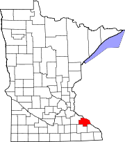
Zumbro Township, Wabasha County, Minnesota

Last updated

Zumbro Township, Minnesota
USA Minnesota location map.svg
Red pog.svg
Zumbro Township, Minnesota
Location within the state of Minnesota
Usa edcp location map.svg
Red pog.svg
Zumbro Township, Minnesota
Zumbro Township, Minnesota (the United States)
Coordinates: 44°12′57″N92°24′47″W / 44.21583°N 92.41306°W / 44.21583; -92.41306
Country United States
State Minnesota
County Wabasha
Area
  Total32.3 sq mi (83.6 km2)
  Land31.7 sq mi (82.0 km2)
  Water0.6 sq mi (1.6 km2)
Elevation
1,125 ft (343 m)
Population
 (2000)
  Total715
  Density22.6/sq mi (8.7/km2)
Time zone UTC-6 (Central (CST))
  Summer (DST) UTC-5 (CDT)
FIPS code 27-72292 [1]
GNIS feature ID0666074 [2]

Zumbro Township is a township in Wabasha County, Minnesota, United States. The population was 715 at the 2000 census. The unincorporated community of South Troy is in Zumbro Township.

Contents

Zumbro Township was organized in 1861, and named after the Zumbro River. [3]

Geography

According to the United States Census Bureau, the township has a total area of 32.3 square miles (83.6 km2); 31.7 square miles (82.0 km2) of it is land and 0.6 square miles (1.6 km2) of it (1.89%) is water.

Demographics

As of the census [1] of 2000, there were 715 people, 283 households, and 217 families residing in the township. The population density was 22.6 inhabitants per square mile (8.7/km2). There were 322 housing units at an average density of 10.2 per square mile (3.9/km2). The racial makeup of the township was 97.48% White, 0.42% African American, 0.14% Native American, 0.70% Asian, 0.28% from other races, and 0.98% from two or more races. Hispanic or Latino of any race were 0.42% of the population.

There were 283 households, out of which 29.7% had children under the age of 18 living with them, 71.4% were married couples living together, 4.6% had a female householder with no husband present, and 23.0% were non-families. 19.8% of all households were made up of individuals, and 3.5% had someone living alone who was 65 years of age or older. The average household size was 2.53 and the average family size was 2.86.

In the township the population was spread out, with 24.6% under the age of 18, 4.3% from 18 to 24, 31.3% from 25 to 44, 30.6% from 45 to 64, and 9.1% who were 65 years of age or older. The median age was 40 years. For every 100 females, there were 110.3 males. For every 100 females age 18 and over, there were 112.2 males.

The median income for a household in the township was $51,477, and the median income for a family was $55,156. Males had a median income of $39,688 versus $28,977 for females. The per capita income for the township was $23,827. About 1.9% of families and 2.8% of the population were below the poverty line, including 1.8% of those under age 18 and 3.2% of those age 65 or over.

Related Research Articles

Twin Lakes Township is a township in Carlton County, Minnesota, United States. The population was 1,912 as of the 2000 census.

Elkton Township is a township in Clay County, Minnesota, United States. The population was 283 at the 2000 census.

Minerva Township is a township in Clearwater County, Minnesota, United States. The population was 283 at the 2000 census.

Carson Township is a township in Cottonwood County, Minnesota, United States. The population was 283 at the 2020 census.
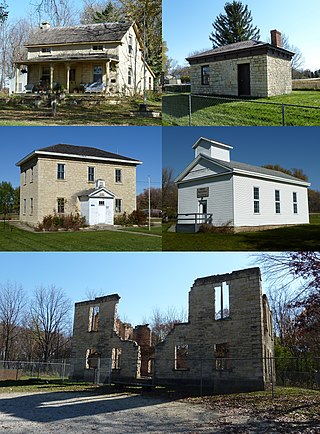
<span class="mw-page-title-main">Wasioja Township, Dodge County, Minnesota</span> Township in Minnesota, United States

Wasioja Township is a township in Dodge County, Minnesota. The population was 963 at the time of the 2000 census. The unincorporated community of Wasioja is located within the township.

Verona Township is a township in Faribault County, Minnesota, United States. The population was 391 at the 2000 census.

<span class="mw-page-title-main">Kenyon, Minnesota</span> City in Minnesota, United States

Kenyon is a city in southwestern Goodhue County, Minnesota, United States, located along the North Fork of the Zumbro River. It was founded in 1856 and named in honor of Kenyon College. It is known for the Boulevard of roses on main street, which is the namesake of the town festival "Rosefest" held every August. The population was 1,815 at the 2010 census.

<span class="mw-page-title-main">Wanamingo, Minnesota</span> City in Minnesota, United States

Wanamingo is a community in Goodhue County, Minnesota, United States, incorporated as a city. It lies along the North Fork of the Zumbro River. The population was 1,086 at the 2010 census.

Courtland Township is a township in Nicollet County, Minnesota, United States. The population was 715 at the 2000 census.

<span class="mw-page-title-main">Dover, Minnesota</span> City in Minnesota, United States

Dover is a city in Olmsted County, Minnesota, United States. The population was 735 at the 2010 census.

<span class="mw-page-title-main">Oronoco, Minnesota</span> City in Minnesota, United States

Oronoco is a city in Olmsted County, Minnesota, United States, along the Middle Fork of the Zumbro River. The population was 1,802 at the 2020 census.

Buse Township is a township in Otter Tail County, Minnesota, United States. The population was 690 at the 2000 census.

<span class="mw-page-title-main">Hammond, Minnesota</span> City in Minnesota, United States

Hammond is a city in Wabasha County, Minnesota, United States. The population was 132 at the 2010 census.

Hyde Park Township is a township in Wabasha County, Minnesota, United States. The population was 275 at the 2000 census.

<span class="mw-page-title-main">Mazeppa Township, Wabasha County, Minnesota</span> Township in Minnesota, United States

Mazeppa Township is a township in Wabasha County, Minnesota, United States. The population was 743 at the 2000 census. Mazeppa Township was organized in 1858 and named in honor of Ivan Mazepa, a 17th-century Cossack chief popularized by Lord Byron's poem "Mazeppa".

<span class="mw-page-title-main">Millville, Minnesota</span> City in Minnesota, United States

Millville is a city along the Zumbro River in Wabasha County, Minnesota, United States. The population was 182 at the 2010 census.

<span class="mw-page-title-main">Zumbro Falls, Minnesota</span> City in Minnesota, United States

Zumbro Falls is a city along the Zumbro River in Wabasha County, Minnesota, United States. The population was 155 at the 2020 census. U.S. Highway 63 and Minnesota 60 intersect in Zumbro Falls.

Grey Cloud Island Township is a township in Washington County, Minnesota, United States. The population was 283 at the 2020 census. The township formerly included all of Lower Grey Cloud Island but that area has been annexed by the neighboring city of Cottage Grove. Since then the township has been made up of Upper Grey Cloud Island, an area to the north bounded by Grey Cloud Trail and Geneva Avenue, and a small piece of Lower Grey Cloud Island.
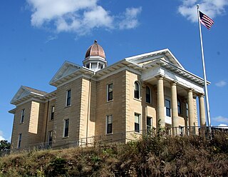
<span class="mw-page-title-main">Mantorville, Minnesota</span> City in Minnesota, United States

Mantorville is a city in Dodge County, Minnesota, United States. The population was 1,197 at the 2010 census. It is the county seat of Dodge County. Founded in 1854, the city is one of the oldest in Minnesota.
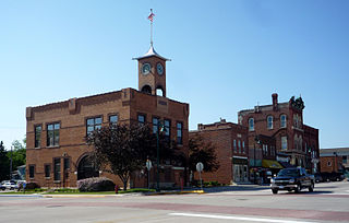
<span class="mw-page-title-main">Pine Island, Minnesota</span> City in Minnesota, United States

Pine Island is a city in Goodhue and Olmsted counties in the U.S. state of Minnesota. Most of Pine Island is in Goodhue County, but a small part extends into Olmsted County, making that portion part of the Rochester metropolitan area. As of the 2020 census, the population was 3,769.

References

  1. 1 2 "U.S. Census website". United States Census Bureau . Retrieved January 31, 2008.
  2. "US Board on Geographic Names". United States Geological Survey. October 25, 2007. Retrieved January 31, 2008.
  3. Upham, Warren (1920). Minnesota Geographic Names: Their Origin and Historic Significance. Minnesota Historical Society. p.  559.