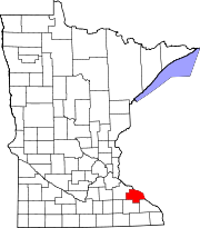
Plainview, Minnesota

Last updated

Plainview
Plainview Welcome Home sign (Plainview, Minnesota) 001.jpg
Plainview's town sign
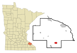
Wabasha County Minnesota Incorporated and Unincorporated areas Plainview Highlighted.svg
Location of Plainview, Minnesota
Coordinates: 44°9′52″N92°10′9″W / 44.16444°N 92.16917°W / 44.16444; -92.16917
Country United States
State Minnesota
County Wabasha
Area
[1]
  Total2.14 sq mi (5.55 km2)
  Land2.14 sq mi (5.55 km2)
  Water0.00 sq mi (0.00 km2)
Elevation
1,161 ft (354 m)
Population
 (2020)
  Total3,483
  Density1,626.05/sq mi (627.95/km2)
Time zone UTC-6 (Central (CST))
  Summer (DST) UTC-5 (CDT)
ZIP code
55964
Area code 507
FIPS code 27-51424 [2]
GNIS feature ID0649536 [3]
Website www.plainviewmn.com

Plainview is a city in Wabasha County, Minnesota, United States. The population was 3,483 at the 2020 census, up from 3,340 at the 2010 census. [4] The author Jon Hassler was raised in Plainview and some of the places in his writing are based on the town.

Contents

History

Plainview was platted in 1857. [5] The city was named from its location on a plain at a lofty elevation, where a "plain view" can be had of the surrounding area. [6] A post office has been in operation at Plainview since 1857. [7] Plainview was incorporated in 1875. [5]

Geography

According to the United States Census Bureau, the city has a total area of 2.16 square miles (5.59 km2), all of it land. [8]

Minnesota Highway 42, Minnesota Highway 247, and County Highway 4 are three of the main routes in the city.

Demographics

Historical population
CensusPop.Note
1870 637
1880 6684.9%
1900 1,088
1910 1,1758.0%
1920 1,37016.6%
1930 1,233−10.0%
1940 1,50021.7%
1950 1,5241.6%
1960 1,83320.3%
1970 2,09314.2%
1980 2,41615.4%
1990 2,76814.6%
2000 3,19015.2%
2010 3,3404.7%
2020 3,4834.3%
U.S. Decennial Census

2010 census

As of the census [9] of 2010, there were 3,340 people, 1,278 households, and 868 families living in the city. The population density was 1,546.3 inhabitants per square mile (597.0/km2). There were 1,355 housing units at an average density of 627.3 per square mile (242.2/km2). The racial makeup of the city was 94.9% White, 0.2% African American, 0.1% Native American, 0.3% Asian, 3.5% from other races, and 1.0% from two or more races. Hispanic or Latino of any race were 7.8% of the population.

There were 1,278 households, of which 36.5% had children under the age of 18 living with them, 53.1% were married couples living together, 10.4% had a female householder with no husband present, 4.5% had a male householder with no wife present, and 32.1% were non-families. 26.0% of all households were made up of individuals, and 13.8% had someone living alone who was 65 years of age or older. The average household size was 2.57 and the average family size was 3.13.

The median age in the city was 34.8 years. 27.5% of residents were under the age of 18; 7% were between the ages of 18 and 24; 28% were from 25 to 44; 22.4% were from 45 to 64; and 15.2% were 65 years of age or older. The gender makeup of the city was 48.1% male and 51.9% female.

2000 census

As of the census [2] of 2000, there were 3,190 people, 1,157 households, and 824 families living in the city. The population density was 1,452.5 inhabitants per square mile (560.8/km2). There were 1,223 housing units at an average density of 556.9 per square mile (215.0/km2). The racial makeup of the city was 96.83% White, 0.03% African American, 0.06% Native American, 0.09% Asian, 2.45% from other races, and 0.53% from two or more races. Hispanic or Latino of any race were 5.14% of the population.

There were 1,157 households, out of which 39.8% had children under the age of 18 living with them, 58.8% were married couples living together, 9.2% had a female householder with no husband present, and 28.7% were non-families. 24.0% of all households were made up of individuals, and 13.0% had someone living alone who was 65 years of age or older. The average household size was 2.65 and the average family size was 3.16.

In the city the population was spread out, with 29.3% under the age of 18, 8.6% from 18 to 24, 28.0% from 25 to 44, 17.9% from 45 to 64, and 16.2% who were 65 years of age or older. The median age was 34 years. For every 100 females, there were 93.5 males. For every 100 females age 18 and over, there were 90.0 males.

The median income for a household in the city was $39,952, and the median income for a family was $48,971. Males had a median income of $32,179 versus $22,754 for females. The per capita income for the city was $16,494. About 5.5% of families and 6.4% of the population were below the poverty line, including 4.5% of those under age 18 and 12.4% of those age 65 or over.

Notable residents

Related Research Articles

<span class="mw-page-title-main">Wabasha County, Minnesota</span> County in Minnesota, United States

Wabasha County is a county in the U.S. state of Minnesota. As of the 2020 census, the population was 21,387. Its county seat is Wabasha.

<span class="mw-page-title-main">Chickamaw Beach, Minnesota</span> City in Minnesota, United States

Chickamaw Beach is a city in Cass County, Minnesota, United States. The population was 114 at the 2010 census. It is part of the Brainerd Micropolitan Statistical Area.

<span class="mw-page-title-main">Hitterdal, Minnesota</span> City in Minnesota, United States

Hitterdal is a city in Clay County, Minnesota, United States. The population was 199 at the 2020 census.

<span class="mw-page-title-main">Chester Township, Wabasha County, Minnesota</span> Township in Minnesota, United States

Chester Township is a township in Wabasha County, Minnesota, United States. The population was 470 at the 2000 census.

<span class="mw-page-title-main">Elgin, Minnesota</span> City in Minnesota, United States

Elgin is a city in Wabasha County, Minnesota, United States on Minnesota State Highway 42. The population was 1,089 at the 2010 census. Its annual festival is Elgin Cheese Days.

Glasgow Township is a township in Wabasha County, Minnesota, United States. The population was 298 at the 2000 census.

<span class="mw-page-title-main">Hammond, Minnesota</span> City in Minnesota, United States

Hammond is a city in Wabasha County, Minnesota, United States. The population was 132 at the 2010 census.

<span class="mw-page-title-main">Kellogg, Minnesota</span> City in Minnesota, United States

Kellogg is a city in Wabasha County, Minnesota, along the Zumbro River. The population was 456 at the 2010 census.

Minneiska Township is a township in Wabasha County, Minnesota, in the United States. The population was 205 at the 2000 census. The unincorporated community of Weaver is located within the township.

Oakwood Township is a township in Wabasha County, Minnesota, United States. The population was 433 at the 2000 census.

Plainview Township is a township in Wabasha County, Minnesota, United States. The population was 498 at the 2000 census.

<span class="mw-page-title-main">Wabasha, Minnesota</span> City in Minnesota, United States

Wabasha is a city and the county seat of Wabasha County, Minnesota. The population was 2,559 at the time of the 2020 census. It is on the Mississippi River, near its confluence with the Zumbro River.

Watopa Township is a township in Wabasha County, Minnesota, United States. The population was 265 at the 2000 census.

<span class="mw-page-title-main">Zumbro Falls, Minnesota</span> City in Minnesota, United States

Zumbro Falls is a city along the Zumbro River in Wabasha County, Minnesota, United States. The population was 207 at the 2010 census. U.S. Highway 63 and Minnesota 60 intersect in Zumbro Falls.

<span class="mw-page-title-main">Dakota, Minnesota</span> City in Minnesota, United States

Dakota is a city in Winona County, Minnesota, United States. The population was 295 at the 2020 census.

<span class="mw-page-title-main">Bellechester, Minnesota</span> City in Minnesota, United States

Bellechester is a city in Goodhue and Wabasha counties in the U.S. state of Minnesota. The population was 175 at the 2010 census. Most of Bellchester is in Goodhue County, with only a small part extending into Wabasha County.

<span class="mw-page-title-main">Lake City, Minnesota</span> City in Minnesota, United States

Lake City is a city in Goodhue and Wabasha counties in the U.S. state of Minnesota. It lies along Lake Pepin, a wide portion of the Mississippi River. The population was 5,063 at the 2010 census. Most of Lake City is located within Wabasha County with only a small portion in Goodhue County. Lake City is part of the Rochester, Minnesota Metropolitan Statistical Area.

<span class="mw-page-title-main">Minneiska, Minnesota</span> City in Minnesota, United States

Minneiska is a city in Wabasha and Winona counties in the U.S. state of Minnesota. The population was 111 at the 2010 census.

<span class="mw-page-title-main">Alma, Wisconsin</span> City in Wisconsin, United States

Alma is a city in and the county seat of Buffalo County, Wisconsin, United States. The population was 716 at the 2020 census.

<span class="mw-page-title-main">Nelson, Wisconsin</span> Village in Wisconsin, United States

Nelson is a village in Buffalo County in the U.S. state of Wisconsin. The population was 374 at the 2010 census. The village is surrounded by the Town of Nelson.

References

  1. "2020 U.S. Gazetteer Files". United States Census Bureau. Retrieved July 24, 2022.
  2. 1 2 "U.S. Census website". United States Census Bureau . Retrieved January 31, 2008.
  3. "US Board on Geographic Names". United States Geological Survey. October 25, 2007. Retrieved January 31, 2008.
  4. "2010 Census Redistricting Data (Public Law 94-171) Summary File". American FactFinder. United States Census Bureau . Retrieved April 27, 2011.[ dead link ]
  5. 1 2 Upham, Warren (1920). Minnesota Geographic Names: Their Origin and Historic Significance. Minnesota Historical Society. p.  558.
  6. Chicago and North Western Railway Company (1908). A History of the Origin of the Place Names Connected with the Chicago & North Western and Chicago, St. Paul, Minneapolis & Omaha Railways. p. 114.
  7. "Wabasha County". Jim Forte Postal History. Retrieved August 10, 2015.
  8. "US Gazetteer files 2010". United States Census Bureau. Archived from the original on January 25, 2012. Retrieved November 13, 2012.
  9. "U.S. Census website". United States Census Bureau . Retrieved November 13, 2012.

44°09′54″N92°10′18″W / 44.16500°N 92.17167°W / 44.16500; -92.17167