Pepin Township, Wabasha County, Minnesota

Last updated

Pepin Township, Minnesota
USA Minnesota location map.svg
Red pog.svg
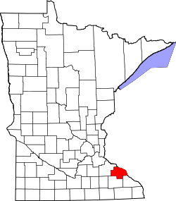
Pepin Township, Minnesota
Location within the state of Minnesota
Usa edcp location map.svg
Red pog.svg
Pepin Township, Minnesota
Pepin Township, Minnesota (the United States)
Coordinates: 44°22′51″N92°7′42″W / 44.38083°N 92.12833°W / 44.38083; -92.12833
Country United States
State Minnesota
County Wabasha
Area
  Total21.6 sq mi (55.8 km2)
  Land17.6 sq mi (45.5 km2)
  Water4.0 sq mi (10.3 km2)
Elevation
1,109 ft (338 m)
Population
 (2000)
  Total471
  Density26.8/sq mi (10.3/km2)
Time zone UTC-6 (Central (CST))
  Summer (DST) UTC-5 (CDT)
FIPS code 27-50362 [1]
GNIS feature ID0665278 [2]

Pepin Township is a township in Wabasha County, Minnesota, United States. The population was 471 at the 2000 census. The unincorporated communities of Maple Springs, Camp Lacupolis and Reads Landing are located within the township.

Contents

Pepin Township was organized in 1858, and named after Lake Pepin. [3]

Geography

According to the United States Census Bureau, the township has a total area of 21.6 square miles (55.8 km2); 17.6 square miles (45.5 km2) of it is land and 4.0 square miles (10.3 km2) of it (18.51%) is water. The township contains three properties listed on the National Register of Historic Places: the Precolumbian King Coulee Site, the 1870 Reads Landing School, and the 1940 Reads Landing Overlook. [4]

Demographics

As of the census [1] of 2000, there were 471 people, 170 households, and 131 families residing in the township. The population density was 26.8 inhabitants per square mile (10.3/km2). There were 210 housing units at an average density of 11.9/sq mi (4.6/km2). The racial makeup of the township was 98.30% White, 0.42% Native American, 0.85% Asian, and 0.42% from two or more races. Hispanic or Latino of any race were 1.91% of the population.

There were 170 households, out of which 37.1% had children under the age of 18 living with them, 68.2% were married couples living together, 3.5% had a female householder with no husband present, and 22.9% were non-families. 17.1% of all households were made up of individuals, and 4.1% had someone living alone who was 65 years of age or older. The average household size was 2.77 and the average family size was 3.14.

In the township the population was spread out, with 27.6% under the age of 18, 7.4% from 18 to 24, 22.9% from 25 to 44, 28.2% from 45 to 64, and 13.8% who were 65 years of age or older. The median age was 41 years. For every 100 females, there were 94.6 males. For every 100 females age 18 and over, there were 96.0 males.

The median income for a household in the township was $46,563, and the median income for a family was $51,563. Males had a median income of $32,000 versus $26,250 for females. The per capita income for the township was $20,741. About 5.3% of families and 5.5% of the population were below the poverty line, including none of those under age 18 and 17.7% of those age 65 or over.

Related Research Articles

McGregor Township is a township in Aitkin County, Minnesota, United States. The population was 105 as of the 2010 census.

Big Bend Township is a township in Chippewa County, Minnesota, United States. The population was 257 at the 2000 census.

Bay Lake Township is a township in Crow Wing County, Minnesota, United States. The population was 923 at the 2000 census. This township took its name from Bay Lake.

Daggett Brook Township is a township in Crow Wing County, Minnesota, United States. The population was 448 at the 2000 census. This township took its name from Daggett Brook.

Wolford Township is a township in Crow Wing County, Minnesota, United States. The population was 326 at the 2000 census. Wolford Township was named for Richard Wolford, an early settler.

Florence Township is a township in Goodhue County, Minnesota, United States. The population was 1,450 at the 2000 census. A small part of the city of Lake City extends geographically within the township, but is a separate entity. The unincorporated area of Frontenac is also located within the township.

Norway Lake Township is a township in Kandiyohi County, Minnesota, United States. The population was 284 at the 2000 census.

Hamlin Township is a township in Lac qui Parle County, Minnesota, United States. The population was 185 at the 2000 census.

Kasota Township is a township in Le Sueur County, Minnesota, United States. The population was 1,487 at the 2000 census.

La Garde Township is a township in Mahnomen County, Minnesota, United States. The township was named for Moses Lagarde, an early settler.

Pembina Township is a township in Mahnomen County, Minnesota in the United States. The population was 471 at the 2000 census.

Veldt Township is a township in Marshall County, Minnesota, United States. The population was 56 at the 2000 census.

Aastad Township is a township in Otter Tail County, Minnesota, United States. The population was 187 at the 2000 census.

Girard Township is a township in Otter Tail County, Minnesota, United States. The population was 697 at the 2000 census.

Pine Lake Township is a township in Otter Tail County, Minnesota, United States. The population was 656 at the 2000 census.

Kerrick Township is a township in Pine County, Minnesota, United States. The population was 272 at the 2000 census.

Esther Township is a township in Polk County, Minnesota, United States. It is part of the Grand Forks-ND-MN Metropolitan Statistical Area. The population was 158 at the 2000 census.

Higdem Township is a township in Polk County, Minnesota, United States. It is part of the Grand Forks-ND-MN Metropolitan Statistical Area. The population was 99 at the 2000 census.

<span class="mw-page-title-main">Willow Lake Township, Redwood County, Minnesota</span> Township in Minnesota, United States

Willow Lake Township is one of the twenty-six townships of Redwood County, Minnesota, United States. The population was 247 at the 2000 census.

Highland Township is a township in Wabasha County, Minnesota, United States. The population was 471 at the 2000 census.

References

  1. 1 2 "U.S. Census website". United States Census Bureau . Retrieved January 31, 2008.
  2. "US Board on Geographic Names". United States Geological Survey. October 25, 2007. Retrieved January 31, 2008.
  3. Upham, Warren (1920). Minnesota Geographic Names: Their Origin and Historic Significance. Minnesota Historical Society. p.  558.
  4. "Minnesota National Register Properties Database". Minnesota Historical Society. 2009. Retrieved February 11, 2018.