Jarrett, Minnesota

Last updated
Jarrett
USA Minnesota location map.svg
Red pog.svg
Jarrett
Location of the community of Jarrett
within Wabasha County
Usa edcp location map.svg
Red pog.svg
Jarrett
Jarrett (the United States)
Coordinates: 44°14′10″N92°20′21″W / 44.23611°N 92.33917°W / 44.23611; -92.33917 Coordinates: 44°14′10″N92°20′21″W / 44.23611°N 92.33917°W / 44.23611; -92.33917
Country United States
State Minnesota
County Wabasha County
Township Hyde Park Township and Zumbro Township
Elevation
794 ft (242 m)
Time zone UTC-6 (Central (CST))
  Summer (DST) UTC-5 (CDT)
ZIP code
55991 and 55957
Area code(s) 507
GNIS feature ID645581 [1]

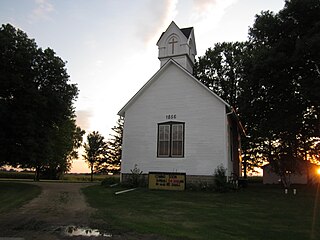
Jarrett is an unincorporated community in Wabasha County, Minnesota, United States.

Unincorporated area Region of land not governed by own local government

In law, an unincorporated area is a region of land that is not governed by a local municipal corporation; similarly an unincorporated community is a settlement that is not governed by its own local municipal corporation, but rather is administered as part of larger administrative divisions, such as a township, parish, borough, county, city, canton, state, province or country. Occasionally, municipalities dissolve or disincorporate, which may happen if they become fiscally insolvent, and services become the responsibility of a higher administration. Widespread unincorporated communities and areas are a distinguishing feature of the United States and Canada. In most other countries of the world, there are either no unincorporated areas at all, or these are very rare; typically remote, outlying, sparsely populated or uninhabited areas.

Wabasha County, Minnesota County in the United States

Wabasha County is a county in the U.S. state of Minnesota. As of the 2010 United States Census, the population was 21,676. Its county seat is Wabasha.

Minnesota State of the United States of America

Minnesota is a state in the Upper Midwest, Great Lakes, and northern regions of the United States. Minnesota was admitted as the 32nd U.S. state on May 11, 1858, created from the eastern half of the Minnesota Territory. The state has a large number of lakes, and is known by the slogan the "Land of 10,000 Lakes". Its official motto is L'Étoile du Nord.

Contents

Geography

The community is located between Hammond and Millville along Wabasha County Road 11 near the intersection with 334th Avenue. Jarrett is located within Hyde Park Township and Zumbro Township. Silver Spring Creek and the Zumbro River meet at Jarrett. Other nearby communities include Millville, Hammond, Zumbro Falls, Potsdam, and South Troy.

Hyde Park Township, Wabasha County, Minnesota Township in Minnesota, United States

Hyde Park Township is a township in Wabasha County, Minnesota, United States. The population was 275 at the 2000 census.

Zumbro Township, Wabasha County, Minnesota Township in Minnesota, United States

Zumbro Township is a township in Wabasha County, Minnesota, United States. The population was 715 at the 2000 census. The unincorporated community of South Troy is in Zumbro Township.

Zumbro River river in the United States of America

The Zumbro River is a tributary of the Mississippi River in the Driftless Area of southeastern Minnesota in the United States. It is 64.6 miles (104.0 km) long from the confluence of its principal tributaries and drains a watershed of 1,428 square miles (3,700 km2). The river's name in English is a change from its French name Rivière des Embarras due to its mouth located near Pine Island in the Mississippi River; the Dakota name for this river is Wapka Wazi Oju, having reference to the grove of great white pines at Pine Island.

History

A post office called Jarretts was established in 1879, and remained in operation until 1919. [2] The community took its name from Jarrett's Ford, a shallow crossing over the Zumbro River. [3]

Related Research Articles

Millville, Minnesota City in Minnesota, United States

Millville is a city along the Zumbro River in Wabasha County, Minnesota, United States. The population was 182 at the 2010 census.

Weaver, Minnesota Unincorporated community in Minnesota, United States

Weaver is an unincorporated community in Minneiska Township, Wabasha County, Minnesota, United States. The Whitewater River and the Mississippi River meet at Weaver.

West Albany, Minnesota Unincorporated community in Minnesota, United States

West Albany is an unincorporated community in West Albany Township, Wabasha County, Minnesota, United States.

South Troy, Minnesota Unincorporated community in Minnesota, United States

South Troy is an unincorporated community in Zumbro Township, Wabasha County, Minnesota, United States. It is located on U.S. Highway 63 about 13 miles north of Rochester. Nearby places include Hammond, Zumbro Falls, Mazeppa, Potsdam, and Oronoco. Wabasha County Roads 7 and 11 are nearby.

Rochester metropolitan area, Minnesota an area consisting of three counties in southeast Minnesota

The United States Census Bureau defines the Rochester, Minnesota Metropolitan Statistical Area (MSA) as an area consisting of three counties in southeast Minnesota, anchored by the city of Rochester. As of the 2010 census, the MSA had a population of 186,011. However, as of 2012, the Rochester metropolitan area – as distinct from the Metropolitan Statistical Area – had an estimated population of 209,607. The Rochester–Austin combined statistical area has a population of 255,047 as of 2016.

Maple Springs, Minnesota Unincorporated community in Minnesota, United States

Maple Springs is an unincorporated community in Pepin Township, Wabasha County, Minnesota, United States, along the Mississippi River and Lake Pepin. The Mississippi River and King Creek meet at Maple Springs.

Reads Landing, Minnesota Unincorporated community in Minnesota, United States

Reads Landing is an unincorporated community in Pepin Township, Wabasha County, Minnesota, United States, along the Mississippi River.

Camp Lacupolis, Minnesota Unincorporated community in Minnesota, United States

Camp Lacupolis is an unincorporated community in Pepin Township, Wabasha County, Minnesota, United States, along the Mississippi River and Lake Pepin.

Oak Center, Minnesota Unincorporated community in Minnesota, United States

Oak Center is an unincorporated community in Gillford Township, Wabasha County, Minnesota, United States.

Genoa, Minnesota Unincorporated community in Minnesota, United States

Genoa is an unincorporated community in Olmsted County, Minnesota, United States. The community is located along 75th Street NW near Exchange Avenue. Genoa is located within New Haven Township and Kalmar Township. Nearby places include Oronoco, Pine Island, and Byron. The South Branch Middle Fork of the Zumbro River flows nearby.

Theilman, Minnesota Unincorporated community in Minnesota, United States

Theilman is an unincorporated community in Wabasha County, Minnesota, United States.

Forest Mills, Minnesota Unincorporated community in Minnesota, United States

Forest Mills is an unincorporated community in Zumbrota Township, Goodhue County, Minnesota, United States.

Dumfries, Minnesota Unincorporated community in Minnesota, United States

Dumfries is an unincorporated community in Glasgow Township, Wabasha County, Minnesota, United States.

Conception, Minnesota Unincorporated community in Minnesota, United States

Conception is an unincorporated community in Highland Township, Wabasha County, Minnesota, United States.

Bear Valley, Minnesota Unincorporated community in Minnesota, United States

Bear Valley is an unincorporated community in Chester Township, Wabasha County, Minnesota, United States.

Rock Dell, Minnesota Unincorporated community in Minnesota, United States

Rock Dell is an unincorporated community in Rock Dell Township, Olmsted County, Minnesota, United States. The community is located near the junction of Olmsted County Roads 3, 26, and 126. The South Fork of the Zumbro River flows through the community. Nearby places include Byron, Hayfield, Stewartville, and Rochester.

Oslo, Dodge County, Minnesota Unincorporated community in Minnesota, United States

Oslo is an unincorporated community in Vernon Township, Dodge County, Minnesota, United States, near Hayfield. The community is located near the junction of State Highway 30 and Dodge County Road 13. The South Fork of the Zumbro River flows nearby.

References

  1. "Jarrett, Minnesota". Geographic Names Information System . United States Geological Survey.
  2. "Wabasha County". Jim Forte Postal History. Retrieved 10 August 2015.
  3. Upham, Warren (1920). Minnesota Geographic Names: Their Origin and Historic Significance. Minnesota Historical Society. p. 557.