Transportation in Minnesota

Last updated

The Stone Arch Bridge and lock at St. Anthony Falls in Minneapolis Stone Arch Bridge and lock.jpg
The Stone Arch Bridge and lock at St. Anthony Falls in Minneapolis

Transportation in the U.S. State of Minnesota consists of a complex network of roadways, railways, waterways and airports. The transportation system is generally overseen by the Minnesota Department of Transportation, a cabinet-level agency of the state government. Additionally, regional governments such as the Metropolitan Council have authority over regional planning for the transportation system and local governments such as cities and counties oversee the local transportation network. [1]

Contents

Ground transportation

Minnesota State Highway 62 MN-62.svg
Minnesota State Highway 62

Almost all north–south through railroads and long-distance four-lane freeways in Minnesota have a connection to Minneapolis-Saint Paul metropolitan area. Most east–west through routes do also, except for a northern corridor from the North Dakota border to the port of Duluth/Superior comprising two BNSF rail routes and U.S. Route 2, and a corridor across southern Minnesota from South Dakota to the Mississippi River and Wisconsin including I-90, Minnesota State Highway 60, U.S. Route 14, and the DM&E Railroad.

Highway transportation

Minnesota's major Interstate Highways are I-35, I-90, and I-94. I-535 is a spur route from Duluth to Superior, Wisconsin. In the Twin Cities I-35 splits into I-35W through Minneapolis and I-35E through St. Paul. I-94 has one spur, Interstate 394 from Minneapolis to the western suburbs, and two loop routes, Interstate 494 and Interstate 694, which form a beltway around the Twin Cities.

The interstate highways are part of a class of routes known as interregional corridors, which also includes U.S. Routes 2, 8, 10, 14, 52, 53, 61, 63, 169, and 212 and Minnesota State Highways 23, 34, 36, 60, 210, and 371. [2] Interregional corridors represent two percent of the state's highways but account for one-third of all vehicle miles traveled. [3] Less heavily traveled regional corridors include U.S. Routes 12, 59, 71, and 75, and a number of state highways.

The Minnesota Legislature identified many of the original trunk highways in the state in the state Constitution by constitutional amendment. A 1920 amendment laid out seventy routes connecting a number of cities. Today, these Constitutional Routes are made up of interstates, U.S. highways, and state highways. [4] While these routes were identified by the legislature, many of the routes were vaguely described in law and effectively they cease to have major impact on the transportation system today.

Bus services

Transit buses

An articulated bus in Minneapolis Metro Transit articulated.jpg
An articulated bus in Minneapolis

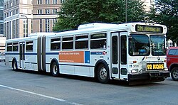
Regular route bus transit systems exist in Rochester, Winona, Duluth, St. Cloud, East Grand Forks, Mankato (Mankato Transit System), Moorhead and the Minneapolis–St. Paul area. The last is served by the Metro Transit system, which has an extensive system with over 100 routes. Some portions of the Twin Cities region have opted out of service from Metro Transit and have created their own transit systems. SouthWest Transit and the Minnesota Valley Transit Authority are two major "opt out" transit providers that serve the southwestern and south-central portions of Scott, Dakota and Carver counties.

Many rural areas and smaller towns also have rural bus service, though many of those are dial-a-ride services instead of using fixed routes. All but four Minnesota counties have some form of public transit service. [5]

Intercity bus lines

Intercity bus service on a skeletal network of lines is provided by Jefferson Lines, Greyhound Lines, and Megabus. Jefferson Lines, which is based in Minneapolis, provides the largest number of intercity bus routes and serves the largest number of cities. The other providers focus on providing express service with limited numbers of stops. The number of intercity bus routes has declined significantly since the early 1990s, and several routes went away when Greyhound restructured in the mid-2000s decade. Greyhound was founded in Hibbing, Minnesota, but cutbacks have led that city to be cut out of the normal intercity bus route network.

In addition to traditional intercity bus services, a network of independently operated long distance airport shuttles serving Minneapolis–Saint Paul International Airport has developed in recent years. Brainerd, Duluth, Mankato, Rochester, Saint Cloud, Eau Claire (WI), and La Crosse (WI) are all connected by daily scheduled shuttle service with the Minneapolis–Saint Paul airport. The shuttles provide transportation between area cities as well as serving airport passengers.

Railroads

Light rail

A two-unit METRO Blue Line train approaches 46th Street station from the south. Hiawatha Line 46th Street Station.jpg
A two-unit METRO Blue Line train approaches 46th Street station from the south.

Decades before Metro Transit, the Twin City Rapid Transit Company operated streetcars in the Twin Cities area from the 1890s until 1954, when buses supplanted the streetcars. Light Rail in Minnesota currently consists of two lines, the Blue Line and Green Line, operated by Metro Transit. Completed in 2004, the Blue Line runs from the Mall of America, through the MSP airport via a tunnel, and along Hiawatha Avenue into downtown Minneapolis. The line has been very successful, receiving a 65% higher ridership than expected in its first year of service. [6] The Green Line, which connects downtown Minneapolis to downtown St. Paul, opened to the public on June 14, 2014.

In the future, other light rail lines may be built. The Southwest Corridor light rail (an extension of the Green Line) from downtown Minneapolis to the southwest metro, was approved by the FTA to begin preliminary engineering in September 2011. [7] In 2006, a constitutional amendment was passed that required sales and use taxes on motor vehicles to fund transportation, with at least 40% dedicated to public transit. [8] A few years later, a regional sales tax was implemented in several counties in the Twin Cities area. It supplies the Counties Transit Improvement Board with funds to help operate and expand the region's bus and rail transit network.

Commuter and intercity rail

Minnesota passenger rail stations
BSicon CONTg cerulean.svg
BSicon HST cerulean.svg
Detroit Lakes
BSicon HST cerulean.svg
Staples
BSicon HST cerulean.svg
St. Cloud
BSicon KBHFa.svg
BSicon BHF cerulean.svg
Big Lake
BSicon HST.svg
Elk River
BSicon HST.svg
Ramsey
BSicon HST.svg
Anoka
BSicon HST.svg
Coon Rapids–Riverdale
BSicon HST.svg
Fridley
BSicon KINTaq.svg
BSicon STRr.svg
BSicon STR cerulean.svg
Minneapolis–Target Field
Metro Minnesota icon.svg
BSicon INT cerulean.svg
Saint Paul
Metro Minnesota icon.svg
BSicon HST cerulean.svg
Red Wing
BSicon HST cerulean.svg
Winona
BSicon CONTf cerulean.svg
Services
BSicon LOGO Amtrak2.svg
BSicon HST cerulean.svg
Amtrak
BSicon HST.svg
Northstar Line

The 82-mile (132 km) Northstar Corridor line, envisioned to connect Minneapolis with St. Cloud along the BNSF Railway, started service on the first 40 miles (64 km) to Big Lake in November 2009. [9]

The state is served by one intercity passenger rail line, Amtrak's Empire Builder , which stops daily in each direction at Winona, Red Wing, St. Paul, St. Cloud, Staples, and Detroit Lakes. The Northern Lights Express (NLX) is planned to restore service between Minneapolis and Duluth, which used to have train service until 1985.

Freight rail

Major freight railroads in Minnesota include BNSF Railway, Union Pacific Railroad, Canadian National Railway, and Canadian Pacific Railway and its Dakota, Minnesota and Eastern Railroad and Soo Line Railroad subsidiaries. Principal ladings include coal from the Powder River Basin to ports and eastern power plants, grain and other agricultural products from farm to processors and ports, taconite (a form of iron ore) from the Iron Range in northeastern Minnesota to Lake Superior ports or on all-rail routes to steel mills, timber and forest products, and intermodal traffic.

Minnesota has had many more railroads and rail lines in the past, and reached a peak of over 9,100 miles (14,600 km) of rails around 1920. In 2007, there was almost exactly half as much track, 4,545 miles (7,314 km). Most of the reduction occurred in the 1970s and 1980s. [10]

Bicycle trails

Cedar Lake bike trail in Minneapolis CedarLakeTrail5.jpg
Cedar Lake bike trail in Minneapolis

A 2006 report stated that Minnesota had more miles of bike trails than any other state, [11] and Metro Transit buses feature bike racks for combination commuters. A number of the bike trails are rail trails, utilizing the right-of-ways originally secured for railroads.

Minneapolis MN Public Transportation Statistics

The average amount of time people spend commuting with public transit in Minneapolis-St. Paul on a weekday is 66 minutes. 19% of public transit riders, ride for more than 2 hours every day. The average amount of time people wait at a stop or station for public transit is 13 min, while 14% of riders wait for over 20 minutes on average every day. The average distance people usually ride in a single trip with public transit is 8.3 km, while 20% travel for over 12 km in a single direction. [12]

Water transportation

The lift bridge in Stillwater Stillwater Minnesota.jpg
The lift bridge in Stillwater
Boats at Lock and Dam No. 2 on the Mississippi River near Hastings LockAndDamNo2 HastingsMN.JPG
Boats at Lock and Dam No. 2 on the Mississippi River near Hastings

Much of Minnesota's early transportation followed the numerous rivers and lakes. Early European explorers and settlers followed the routes used by the voyageurs and coureurs des bois in the fur trading days, and later on steamboat services operated on the principal rivers. Commercial water transportation now is limited to the shipment of bulk commodities on two routes. Barges haul grain and other products down the Mississippi River system from the ports of Minneapolis (the head of navigation), St. Paul, Red Wing and Winona on the Mississippi, and Savage (on the Minnesota River), to downstream river ports, and to ports on the Gulf of Mexico for transshipment to ocean-going cargo ships. Cargo vessels known as lakers haul grain, coal, and iron ore from the Lake Superior ports of Duluth, Superior, Two Harbors, and Silver Bay, through Lake Superior to the lower Great Lakes, while ocean-going ships referred to as salties operate from the Twin Ports through the St. Lawrence Seaway to the Atlantic Ocean. [13]

Air transportation

Minnesota’s principal airport is Minneapolis–St. Paul International Airport (MSP), a major passenger and freight hub for Delta Air Lines. MSP is also a hub for Sun Country Airlines, and is served by most other domestic carriers. Large commercial jet service is also provided to and from Duluth International Airport and Rochester International Airport. Scheduled commuter service is available at Bemidji, Brainerd, Hibbing, International Falls, St. Cloud, and Thief River Falls.

See also

Related Research Articles

<span class="mw-page-title-main">Metro Blue Line (Minnesota)</span> Light rail line in Hennepin County, Minnesota

The Metro Blue Line is a 12-mile (19.3 km) light rail line in Hennepin County, Minnesota, that is part of the Metro network. It travels from downtown Minneapolis to Minneapolis–Saint Paul International Airport and the southern suburb of Bloomington. Formerly the Hiawatha Line prior to May 2013, the line was originally named after the Milwaukee Road's Hiawatha passenger train and Hiawatha Avenue, reusing infrastructure from the former and running parallel to the latter for a portion of the route. The line opened June 26, 2004, and was the first light rail service in Minnesota. An extension, Bottineau LRT, is planned to open in 2028.

<span class="mw-page-title-main">Twin City Rapid Transit Company</span>

The Twin City Rapid Transit Company (TCRT), also known as Twin City Lines (TCL), was a transportation company that operated streetcars and buses in the Minneapolis-St. Paul metropolitan area in the U.S. state of Minnesota. Other types of transportation were tested including taxicabs and steamboats, along with the operation of some destination sites such as amusement parks. It existed under the TCRT name from a merger in the 1890s until it was purchased in 1962. At its height in the early 20th century, the company operated an intercity streetcar system that was believed to be one of the best in the United States. It is a predecessor of the current Metro Transit bus and light rail system that operates in the metro area.

<span class="mw-page-title-main">Northstar Line</span> Commuter rail route in Minnesota, United States

The Northstar Line is a commuter rail route in the US state of Minnesota. Northstar runs 40 miles (64 km) from Big Lake to downtown Minneapolis at Target Field using existing track and right-of-way owned by the BNSF Railway. Passenger service began on November 16, 2009. The rail line serves part of the Northstar Corridor between Minneapolis and St. Cloud. Planning for the line began in 1997 when the Northstar Corridor Development Authority (NCDA) was formed. The corridor is also served by Interstate 94 and U.S. Highway 10. In 2022, the system had a ridership of 77,100, or about 300 per weekday as of the third quarter of 2023.

Metro Transit is the primary public transportation operator in the Minneapolis–Saint Paul area of the U.S. state of Minnesota and the largest operator in the state. Although Metro Transit is one of the smallest transit systems for a large metropolitan area in the United States, it has previously been ranked as one of the best. In 2022, the system had a ridership of 38,794,700, or about 138,800 per weekday as of the third quarter of 2023.

<span class="mw-page-title-main">Metro Green Line (Minnesota)</span> Light rail transit line in Minnesota, US

The Metro Green Line is an 11-mile (18 km) light rail line that connects the central business districts of Minneapolis and Saint Paul in Minnesota as well as the University of Minnesota. An extension is under construction that will extend the line to the southwest connecting St. Louis Park, Hopkins, Minnetonka and Eden Prairie. The line follows the path of former Metro Transit bus route 16 along University Avenue and Washington Avenue. It is the second light-rail line in the region, after the Blue Line, which opened in 2004 and connects Minneapolis with the southern suburb of Bloomington.

<span class="mw-page-title-main">Saint Paul Union Depot</span> Train station in Saint Paul, Minnesota

Saint Paul Union Depot is a historic railroad station and intermodal transit hub in the Lowertown neighborhood of Saint Paul, Minnesota. It serves light rail, intercity rail, intercity bus, and local bus services.

<span class="mw-page-title-main">Amtrak Thruway</span> Connecting transportation services brand

Amtrak Thruway is a system of through-ticketed transportation services to connect passengers with areas not served by Amtrak trains. In most cases these are dedicated motorcoach routes, but can also be non-dedicated intercity bus services, transit buses, vans, taxis, ferry boats and commuter rail trains.

Transportation in New York is made up of some of the most extensive and one of the oldest transportation infrastructures in the country. Engineering difficulties because of the terrain of the State of New York and the unique issues of New York City brought on by urban crowding have had to be overcome since the state was young. Population expansion of the state generally followed the path of the early waterways, first the Hudson River and then the Erie Canal. Today, railroad lines and the New York State Thruway follow the same general route.

<span class="mw-page-title-main">Minnesota Valley Transit Authority</span> Public transportation agency in Minnesota, US

The Minnesota Valley Transit Authority, also known by the acronym MVTA, is a public transportation agency that serves seven communities in the southern portion of the Minneapolis–Saint Paul metropolitan area. The agency provides fixed-route and demand-responsive transit within the service area of the communities and to select destinations in the region.

The Riverview Corridor is a transit corridor connecting Downtown Saint Paul and the Mall of America in Bloomington via the Minneapolis-Saint Paul International Airport. The corridor serves an area from the Saint Paul Union Depot to the Mall via a route along West 7th Street, which runs southwest from Downtown Saint Paul. The corridor creates a triangle connecting opposite ends of the Blue Line and Green Line.

There are several passenger rail projects being discussed in Minnesota. There is one existing commuter rail service in the state, the Northstar Line, and one existing long-distance intercity rail service, the Empire Builder. Future projects include a mixture of short-distance commuter rail and medium-distance regional rail lines which would run from the Twin Cities outward to neighboring states and perhaps Canada.

<span class="mw-page-title-main">Interstate 35 in Minnesota</span> Section of Interstate Highway in Minnesota, United States

Interstate 35 (I-35) is a north–south Interstate Highway that stretches from Laredo, Texas, to Duluth, Minnesota. In the US state of Minnesota, I-35 enters from Iowa and heads north toward the twin cities of Minneapolis and Saint Paul. South of the metropolitan area, I-35 splits into two branches; I-35E runs through Saint Paul and I-35W through Minneapolis. These two branches rejoin north of the Twin Cities, and the highway continues north to Duluth, where it terminates at State Highway 61 (MN 61). The highway was authorized in 1956 and the first segment opened in 1958. It reached Duluth in 1971, and the final segment to east Duluth opened in 1992.

The Northern Lights Express (NLX) is a planned higher-speed rail service that would run 155 miles (249 km) between Minneapolis and Duluth primarily in the U.S. state of Minnesota. A portion of the proposed line would run through neighboring Wisconsin to serve Duluth's "Twin Port" of Superior. Plans are to upgrade an existing BNSF Railway freight line to allow trains to travel at up to 90 miles per hour (145 km/h). The train service is said to provide an alternative to traveling Interstate 35 between Duluth and the Twin Cities or to other destinations along the line such as the casino in Hinckley.

<span class="mw-page-title-main">Dan Patch Corridor</span>

The Dan Patch Corridor is a proposed commuter rail line that would serve a region which runs from Minneapolis to Northfield, Minnesota. The corridor consists of the tracks on the former Minneapolis St. Paul Rochester and Dubuque Electric Traction Company lines, which came to be known as the Dan Patch lines. It was proposed as a passenger rail line in 2000 after being identified as a "Tier One" corridor in the Minnesota Department of Transportation's 2000 Commuter Rail System Plan before being given a study ban during the 2002 Minnesota legislative session. It sat in relative silence until 2008, when bills were introduced in the Minnesota State Legislature to potentially revive discussion. On May 21, 2023, the Minnesota House of Representatives and Minnesota Senate passed an omnibus transit bill that removed the study ban for the Dan Patch line.

The transportation system of Georgia is a cooperation of complex systems of infrastructure comprising over 1,200 miles (1,900 km) of interstates and more than 120 airports and airbases serving a regional population of 59,425 people.

<span class="mw-page-title-main">Fridley station</span>

Fridley station is a commuter rail station in Fridley, Minnesota, located at Main Street NE and 61st Avenue NE. It is served by the Northstar Commuter Rail line. The station features bicycle lockers and two park and ride lots with a total capacity of 611 spaces. The commute time to downtown Minneapolis from this station is about 20 minutes. The station has a single platform on one main track, which is accessible on either side of the tracks through a tunnel.

<span class="mw-page-title-main">Transportation in New Jersey</span> Overview of the transportation in New Jersey

Transportation in New Jersey utilizes a combination of road, rail, air, and water modes. New Jersey is situated between Philadelphia and New York City, two major metropolitan centers of the Boston-Washington megalopolis, making it a regional corridor for transportation. As a result, New Jersey's freeways carry high volumes of interstate traffic and products. The main thoroughfare for long distance travel is the New Jersey Turnpike, the nation's fifth-busiest toll road. The Garden State Parkway connects the state's densely populated north to its southern shore region. New Jersey has the 4th smallest area of U.S. states, but its population density of 1,196 persons per sq. mi causes congestion to be a major issue for motorists.

<span class="mw-page-title-main">Metro (Minnesota)</span> Rapid transit network in the Minneapolis metropolitan area of the United States

Metro is a transit network in Minnesota serving the cities of Minneapolis and Saint Paul. It also provides service to some suburban areas. As of 2022, the system consists of two light rail lines and five bus rapid transit (BRT) lines all of which are operated by the local public transit company: Metro Transit. The five lines connect Downtown Minneapolis and St Paul with the Bloomington, Minneapolis-St Paul International Airport, Roseville, Richfield, Burnsville and Brooklyn Center.

<span class="mw-page-title-main">Transportation in Montana</span>

Transportation in Montana comprises many different forms of travel. Montana shares a long border with Canada, hence international crossings are prevalent in the northern section of the state; there are 13 road crossings and one rail crossing.

<span class="mw-page-title-main">Metro A Line (Minnesota)</span> Bus rapid transit line in the Minneapolis metropolitan area of the United States

The Metro A Line is a bus rapid transit line in the Twin Cities, Minnesota operated by Metro Transit. The A Line operates primarily along the Snelling Avenue corridor and travels through the cities of Minneapolis, Saint Paul, Falcon Heights, and Roseville. From the Blue Line in Minneapolis, the line travels past Minnehaha Park, through the Highland Village commercial area, past Macalester College, and connects to the Green Line near Allianz Field. The line continues through Saint Paul, past Hamline University, before traveling through Falcon Heights and Roseville, where the line passes the Minnesota State Fairgrounds, Har Mar Mall, and terminates at Rosedale Center.

References

  1. "Minnesota Department of Transportation Summary" (PDF). State of Minnesota Administration Website. Minnesota Management and Budget Statement. Retrieved April 30, 2018.
  2. "Interregional Corridors and Regional Trade Centers" (PDF). Minnesota Department of Transportation. Archived from the original (PDF) on June 16, 2006. Retrieved June 30, 2006.
  3. "Office of Investment Management: The Minnesota Interregional Corridor System". 2005. Archived from the original on June 14, 2006. Retrieved June 30, 2006.
  4. "Legal Basis for Establishment of Trunk Highways" . Retrieved December 7, 2006.
  5. deFiebre, Conrad (December 16, 2009). "Greater Minnesota gets on board: Transit ridership grows while investment declines". Twin Cities Daily Planet. Retrieved December 17, 2009.
  6. "Facts about trains and construction". Archived from the original on June 29, 2006. Retrieved July 1, 2006.
  7. "News". Archived from the original on September 10, 2012. Retrieved November 5, 2011.
  8. "Transportation amendment update". Minnesota Department of Transportation. 2006. Archived from the original on November 17, 2006. Retrieved November 24, 2006.
  9. "Northstar Corridor Rail Project Summary". Minnesota Department of Transportation. Archived from the original on September 24, 2006. Retrieved December 7, 2006.
  10. Cambridge Systematics, Inc., Kimley Horn and Associates, Inc., and TKDA, Inc. (December 2009). "Minnesota Comprehensive Statewide Freight and Passenger Rail Plan (Draft Final Report)" (PDF). Minnesota Department of Transportation. Retrieved January 8, 2010.{{cite web}}: CS1 maint: multiple names: authors list (link)
  11. "Take to the Trails! Explore Minnesota Biking". Minnesota Department of Tourism. Archived from the original on October 8, 2006. Retrieved December 2, 2006.
  12. "Minneapolis-St. Paul, MN Public Transportation Statistics". Global Public Transit Index by Moovit. Retrieved June 19, 2017. CC-BY icon.svg Material was copied from this source, which is available under a Creative Commons Attribution 4.0 International License.
  13. "Minnesota Ports and Waterways". Minnesota Department of Transportation. Archived from the original on March 17, 2008.