Inver Grove Heights, Minnesota

Last updated

Inver Grove Heights, Minnesota
Schmidt Lake in Inver Grove Heights.jpg
Nickname: 
Inver Grove
Inver Grove Heights, Minnesota
Interactive map outlining Inver Grove Heights
Dakota County Minnesota Incorporated and Unincorporated areas Inver Grove Heights Highlighted.svg
Location of Inver Grove Heights, Minnesota
Coordinates: 44°50′15″N93°3′6″W / 44.83750°N 93.05167°W / 44.83750; -93.05167
CountryUnited States
State Minnesota
County Dakota
Established1852
Incorporated March 9, 1965
Government
  Type Weak Mayor–Council
   Mayor Brenda Dietrich
Area
[1]
  Total30.22 sq mi (78.27 km2)
  Land27.85 sq mi (72.14 km2)
  Water2.37 sq mi (6.13 km2)
Elevation
879 ft (268 m)
Population
 (2020) [2]
  Total35,801
  Estimate 
(2022) [3]
35,701
  Density1,285.31/sq mi (496.25/km2)
Time zone UTC-6 (Central)
  Summer (DST) UTC-5 (CDT)
ZIP codes
55076, 55077
Area code 651
FIPS code 27-31076
GNIS feature ID0645437 [4]
Website ighmn.gov

Inver Grove Heights is a city in Dakota County, Minnesota, United States. The population was 35,801 at the 2020 census. [2] The city was formed on March 9, 1965, with the merger of the village of Inver Grove and Inver Grove Township. [5]

Contents

It is one of 186 cities and townships in the seven-county Minneapolis-Saint Paul metropolitan area. [6] Inver Grove Heights is 9 miles (14 km) southeast of Saint Paul; nearby communities are South St. Paul, West St. Paul, Sunfish Lake, Eagan, Newport, and Saint Paul Park (the last two across the Mississippi River).

History

Map of Inver Grove in 1874 Map of Inver Grove from the 1874 Minnesota State Atlas (cropped).jpg
Map of Inver Grove in 1874

After the signing of the Treaty of Traverse des Sioux in 1851, settlers from Ireland and Germany quickly staked claims in the rolling countryside west of the Mississippi River. Those of Irish descent farmed the eastern part of the community, while Germans cleared the wooded land to the west for their farms. French and English settlers built their homes along the river. The township of Inver Grove Heights was named after the Irish fishing village of Inver and the German town of Grove. [5] Records show that 240 farms, four churches, and four school districts were founded by 1880. [7] On March 9, 1965, the village of Inver Grove and Inver Grove Township merged to form Inver Grove Heights. [8]

Historic sites in Inver Grove Heights include:

Geography

According to the United States Census Bureau, the city has an area of 30.12 square miles (78.01 km2), of which 27.76 square miles (71.90 km2) is land and 2.36 square miles (6.11 km2) is water. [14]

Interstate Highway 494 (a beltway bypass of Minneapolis–Saint Paul), U.S. Highway 52, Minnesota Highway 55, and Minnesota Highway 3 are four of Inver Grove Heights's main routes. 80th Street East (numbered from downtown Saint Paul) crosses the city in an east–west direction.

In 2022, a meteoric impact crater was identified in the Pine Bend Bluffs Scientific and Natural Area in southern Inver Grove Heights. It has been informally named the "Pine Bend impact" and has been dated to 500 million years ago. It has a diameter of about four kilometers. [15]

Demographics

Historical population
CensusPop.Note
1860 646
1870 97150.3%
1880 791−18.5%
1890 1,21153.1%
1900 1,40215.8%
1910 1,384−1.3%
1920 1,57313.7%
1930 1,6172.8%
1940 1,88716.7%
1950 2,41928.2%
1960 6,266159.0%
1970 12,14893.9%
1980 17,17141.3%
1990 22,47730.9%
2000 29,75132.4%
2010 33,88013.9%
2020 35,8015.7%
2022 (est.)35,701 [3] −0.3%
U.S. Decennial Census [16]
2020 Census [2]

Note: Inver Grove and Inver Grove
Township were merged in 1965 to
form Inver Grove Heights.

2010 census

As of the census of 2010, there were 33,880 people, 13,476 households, and 9,036 families living in the city. The population density was 1,220.5 inhabitants per square mile (471.2/km2). There were 14,062 housing units at an average density of 506.6 per square mile (195.6/km2). The racial makeup of the city was 85.7% White, 3.8% African American, 0.4% Native American, 3.4% Asian, 0.1% Pacific Islander, 3.5% from other races, and 3.1% from two or more races. Hispanic or Latino of any race were 8.9% of the population.

There were 13,476 households, of which 32.9% had children under the age of 18 living with them, 51.4% were married couples living together, 11.4% had a female householder with no husband present, 4.3% had a male householder with no wife present, and 32.9% were non-families. 26.2% of all households were made up of individuals, and 8.8% had someone living alone who was 65 years of age or older. The average household size was 2.50 and the average family size was 3.04.

The median age in the city was 38.4 years. 24.5% of residents were under the age of 18; 8.5% were between the ages of 18 and 24; 26.3% were from 25 to 44; 29.1% were from 45 to 64; and 11.8% were 65 years of age or older. The gender makeup of the city was 48.0% male and 52.0% female.

2000 census

As of the census of 2000, there were 29,751 people, 11,257 households, and 7,924 families living in the city. The population density was 1,038.8 inhabitants per square mile (401.1/km2). There were 11,457 housing units at an average density of 400.1 per square mile (154.5/km2). The racial makeup of the city was 91.80% White, 2.10% African American, 0.48% Native American, 2.01% Asian, 0.02% Pacific Islander, 1.73% from other races, and 1.86% from two or more races. Hispanic or Latino of any race were 4.22% of the population.

There were 11,257 households, out of which 37.3% had children under the age of 18 living with them, 56.4% were married couples living together, 10.3% had a female householder with no husband present, and 29.6% were non-families. 21.5% of all households were made up of individuals, and 4.7% had someone living alone who was 65 years of age or older. The average household size was 2.62 and the average family size was 3.09.

In the city, the population was spread out, with 27.3% under the age of 18, 9.2% from 18 to 24, 33.9% from 25 to 44, 21.7% from 45 to 64, and 7.8% who were 65 years of age or older. The median age was 34 years. For every 100 females, there were 98.2 males. For every 100 females age 18 and over, there were 94.5 males.

The median income for a household in the city was $59,090, and the median income for a family was $68,629. Males had a median income of $45,369 versus $32,080 for females. The per capita income for the city was $25,493. About 3.0% of families and 4.2% of the population were below the poverty line, including 5.2% of those under age 18 and 4.9% of those age 65 or over.

Economy

In 2007, the Metropolitan Council estimated the employment in Inver Grove Heights to be 11,158. [17] The city hosts the headquarters of CHS, Inc., an agricultural cooperative ranked 12th in the 2007 ICA Global 300 list of mutuals and cooperatives, and 145th on the Fortune 500 list of U.S. corporations. [18] [19] Pine Bend Refinery, the largest oil refinery in Minnesota and fourteenth largest in the U.S., straddles the border with Rosemount. It is operated by Flint Hills Resources.

Inver Grove Heights is also the home of Gertens Greenhouses, one of the largest garden center locations in the United States. [20]

Top employers

According to Inver Grove Heights's 2021 Comprehensive Annual Financial Report, [21] the largest employers in the city are:

#Employer# of Employees
1Cenex / CHS Cooperatives 1,600
2ISD 199 (Inver Grove Heights Community Schools)668
3Gertens435
4City of Inver Grove Heights421
5Travel Tags350
6 Inver Hills Community College 337
7Total Construction and Equipment250
8 Walmart 210
9Woodlyn Heights Senior Living200
10 Cub Foods 160

Education

The Inver Grove Heights Community Schools district or Independent School District 199 operates five schools in the city:

There is one private school for preschool through eighth grade in Inver Grove Heights: Berea Lutheran Church. [26]

The western part of the city is served by Independent School District 196, with students attending Dakota Hills Middle School, Rosemount Middle School, Eagan High School, and Rosemount High School. [27]

Inver Grove Heights is also home to Inver Hills Community College.

Government and politics

Inver Grove Heights's municipal government provides for a council of five members, one of whom is the mayor. The mayor is Brenda Dietrich, who was elected in 2022.

The other council members are: [28]

In general, city government is nonpartisan. Candidates need not be selected or endorsed by political parties, and by state law no such endorsement appears on the ballot. The mayor is elected every two years while council members are elected every four. Terms are staggered with two council members elected one election cycle and the two others two years later. The non-mayoral seats are elected in pairs, giving voters the chance to vote for up to two candidates. If necessary, races are narrowed down during a primary election. [29]

As a part of Dakota County, Inver Grove Heights's northern and central precincts (1, 8-10) join with regions northward to form the Second District on the County Commission. It has been represented by former South St. Paul Mayor Kathleen A. Gaylord since 2003. The southern, eastern, and far western portions of the city (precincts 2-7) are joined by regions south and west to form the Fourth District of the County Commission, which has been represented by former State Representative and former Inver Grove Heights Mayor Joe Atkins since 2017. County commissioners serve four-year terms. [30]

Inver Grove Heights is in Minnesota's 2nd congressional district, represented by Angie Craig since 2019.

The city is in the state's 53rd legislative district, represented in the Minnesota Senate by Matt Klein. Most of the city is in Minnesota House district 53A, represented by Mary Frances Clardy; the northeast of the city is in House district 52B, represented by Rick Hansen.

Election results

Presidential election results
2020 Precinct Results Spreadsheet [31] 2016 Precinct Results Spreadsheet [32] 2012 Precinct Results Spreadsheet [33] 2008 Precinct Results Spreadsheet [34] 2004 Precinct Results Spreadsheet [35] 2000 Precinct Results Spreadsheet [36] 1996 Precinct Results [37] 1992 Precinct Results [38] 1988 Precinct Results [39] 1984 Precinct Results [40] 1980 Precinct Results [41] 1976 Precinct Results [42] 1968 Precinct Results [43] 1964 Precinct Results [44] 1960 Precinct Results [45]
Year Republican Democratic Third parties
2020 41.3% 8,85156.2%12,0342.5% 526
2016 42.4% 8,15548.6%9,3549.0% 1,727
2012 45.0% 8,57352.8%10,0422.2% 418
2008 43.4% 8,35654.3%10,4682.3% 446
2004 46.7% 8,51552.3%9,5311.0% 194
2000 42.0% 6,44250.7%7,7637.3% 1,120
1996 30.9% 3,64756.6%6,69112.6% 1,483
1992 27.0% 3,36146.3%5,75426.7% 3,325
1988 40.8% 4,03159.2%5,8450.0% 0
1984 44.2% 3,69255.8%4,6540.0% 0
1980 36.3% 2,74753.7%4,06910.0% 759
1976 36.9% 2,37060.6%3,8922.5% 161
1968 31.6% 1,21063.1%2,4145.3% 204
1964 10.7% 3589.3%2910.0% 0
1960 25.6% 7574.1%2170.3% 1

Sports and recreation

Facilities include Inver Wood Golf Course and Arbor Pointe Golf Club. There is also an 18-hole disc golf course called North Valley. The city also has a public community center with a waterpark, two sheets of ice and a full gym shared with the National Guard.

Related Research Articles

<span class="mw-page-title-main">Lake Crystal, Minnesota</span> City in Minnesota, United States

Lake Crystal is a city in Blue Earth County, Minnesota, United States, established in 1869. The population was 2,539 at the 2020 census. It is part of the Mankato-North Mankato Metropolitan Statistical Area.

Benton Township is a rural township in Carver County, Minnesota, United States. The population was 939 as of the 2000 census.

Camden Township is a rural township in Carver County, Minnesota, United States. The population was 955 as of the 2000 census.

<span class="mw-page-title-main">Hancock Township, Carver County, Minnesota</span> Township in Minnesota, United States

Hancock Township is a township in Carver County, Minnesota, United States. The population was 367 as of the 2000 census.

Hollywood Township is a rural township in Carver County, Minnesota, United States. The population was 1,102 as of the 2000 census.

Laketown Township is a township in Carver County, Minnesota, United States. The population was 2,331 as of the 2000 census.

<span class="mw-page-title-main">Apple Valley, Minnesota</span> City in Minnesota, United States

Apple Valley is a city in northwestern Dakota County in the State of Minnesota, and a suburb of the Twin Cities. The population was 56,374 at the 2020 census, making it the 17th most populous city in Minnesota. In 2014, Money.com named Apple Valley the 17th best place to live in the United States, up from 20th in 2010, 24th in 2008 and 28th in 2007.

<span class="mw-page-title-main">Farmington, Minnesota</span> City in Minnesota, United States

Farmington is a city in Dakota County, Minnesota, United States. The population was 23,632 at the 2020 census. It is a part of the Minneapolis-St. Paul metropolitan area.

<span class="mw-page-title-main">Lakeville, Minnesota</span> City in the United States

Lakeville is an exurb of Minneapolis-Saint Paul, and the largest city in Dakota County, Minnesota, United States. It is approximately 20 miles (32 km) south of both downtown Minneapolis and downtown St. Paul along Interstate Highway 35. Starting as a flourishing milling center, its agriculture industry and other major industries are still in operation. Lakeville is one of the fastest-growing cities in the Twin Cities area. The population was 69,490 at the 2020 census. making it Minnesota's tenth most populous city.

<span class="mw-page-title-main">Mendota Heights, Minnesota</span> City in Minnesota, United States

Mendota Heights is a city in Dakota County, Minnesota, United States. It is a first ring southern suburb of the Twin Cities. The population was 11,744 at the 2020 census.

<span class="mw-page-title-main">Greenfield, Minnesota</span> City in Minnesota, United States

Greenfield is a city in northwestern Hennepin County, Minnesota. It has a population of 2,903 residents, according to the 2020 United States Census, and is located 26.5 miles northwest of Minneapolis. It is part of the Twin Cities Metropolitan Statistical Area.

<span class="mw-page-title-main">Long Lake, Minnesota</span> City in Minnesota, United States

Long Lake is a small city in Hennepin County, Minnesota, United States named after the lake the eastern end of town lies on. A commercial hub for the surrounding communities, Long Lake is home to many local shops and businesses. U.S. Highway 12 runs through the town. The population was 1,768 at the 2010 census.

<span class="mw-page-title-main">Glencoe, Minnesota</span> City in Minnesota, United States

Glencoe is a city and the county seat of McLeod County, Minnesota, United States. The population was 5,631 at the 2010 census.

<span class="mw-page-title-main">Hutchinson, Minnesota</span> City in Minnesota, United States

Hutchinson is the largest city in McLeod County, Minnesota, United States. It lies along the South Fork of the Crow River. The population was 14,599 at the 2020 census.

<span class="mw-page-title-main">Lester Prairie, Minnesota</span> City in Minnesota, United States

Lester Prairie is a city in McLeod County, Minnesota, United States, along the South Fork of the Crow River. The population was 1,730 at the 2010 census. Noted composer and conductor of The Concordia Choir, Rene Clausen was raised in Lester Prairie.

<span class="mw-page-title-main">Montrose, Minnesota</span> City in Minnesota, United States

Montrose is a small city in Wright County, Minnesota, United States. Montrose is surrounded by farmland, prairies, and lakes. The population was 2,847 at the 2010 census.

<span class="mw-page-title-main">Arden Hills, Minnesota</span> City in Minnesota, United States

Arden Hills is a city in Ramsey County, Minnesota, United States. The population was 9,939 at the 2020 census. Bethel University and its seminary is located in the city. Also, the campus of University of Northwestern – St. Paul straddles the Arden Hills – Roseville border. The city contains the headquarters of Land O'Lakes and Catholic United Financial, a fraternal benefit society. Boston Scientific also has a large campus within Arden Hills as well.

<span class="mw-page-title-main">Howard Lake, Minnesota</span> City in Minnesota, United States

Howard Lake is a city in Wright County, Minnesota, United States. It is the host of the annual Wright county fair. The population was 1,962 at the 2010 census.

<span class="mw-page-title-main">Hastings, Minnesota</span> City in Minnesota, United States

Hastings is a city mostly in Dakota County, Minnesota, of which it is the county seat, with a portion in Washington County, Minnesota, United States. It is near the confluence of the Mississippi, Vermillion, and St. Croix Rivers. The population was 22,154 at the 2020 census. It is named for the first elected governor of Minnesota, Henry Hastings Sibley.

<span class="mw-page-title-main">Dayton, Minnesota</span> City in Minnesota, United States

Dayton is a city in Hennepin and Wright counties in the U.S. state of Minnesota. The population was 7,262 at the 2020 census. Dayton is mainly located within Hennepin County, but a part of the city extends into Wright County as well. It is the northernmost city in Hennepin County and is a suburb of the Minneapolis–St. Paul "Twin Cities" metropolitan area.

References

  1. "2020 U.S. Gazetteer Files". United States Census Bureau. Retrieved July 24, 2022.
  2. 1 2 3 "Explorer Census Data". United States Census Bureau . Retrieved August 10, 2022.
  3. 1 2 "City and Town Population Totals: 2020-2022". United States Census Bureau. June 11, 2023. Retrieved June 11, 2023.
  4. "US Board on Geographic Names". United States Geological Survey. October 25, 2007. Retrieved January 31, 2008.
  5. 1 2 "About us". City of Inver Grove Heights, Minnesota. Retrieved September 15, 2008. From 1858 until 1880, hundreds of settlers were attracted to the township that was named after an Irish fishing village, "Inver" and commemorating the homeland of the German settlers, "Grove."
  6. Metropolitan Council (May 1, 2008). "Snapshot of the Region". Archived from the original on February 9, 2002. Retrieved September 15, 2008.
  7. "About Inver Grove Heights". Inver grove Heights. Retrieved March 13, 2008.
  8. 1 2 3 4 5 6 7 8 9 10 11 "A brief history of Inver Grove Heights from Township and Village to City with a map of historic sites" (PDF). Dakota History.org. Archived (PDF) from the original on April 15, 2019. Retrieved July 14, 2019.
  9. "Church of St. Patrick, Parish History" . Retrieved July 14, 2019.
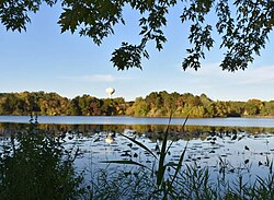
  10. "Salem Evangelical Church" . Retrieved July 14, 2019.
  11. "Swing Bridge Park" . Retrieved July 14, 2019.
  12. "Rock Island Swing Bridge" . Retrieved July 14, 2019.
  13. "B-52 Crash Site Cold War Veterans Memorial" . Retrieved July 14, 2015.
  14. "US Gazetteer files 2010". United States Census Bureau. Archived from the original on July 2, 2012. Retrieved November 13, 2012.
  15. "U of M scientists unearth massive meteoroid crash site under Inver Grove Heights". CBS News . Retrieved September 30, 2022.
  16. United States Census Bureau. "Census of Population and Housing" . Retrieved August 14, 2013.
  17. "Inver Grove Heights Profile". Metropolitan Council. Retrieved September 15, 2008.[ permanent dead link ]
  18. "Fortune 500: 145 CHS". Fortune . CNN. May 5, 2008. Retrieved September 15, 2008.
  19. "The 2007 Global 300 Listing" (PDF). International Co-operative Alliance.[ permanent dead link ]
  20. "History of Gertens Greenhouses" . Retrieved July 14, 2019.
  21. "City of Inver Grove Heights 2021 Comprehensive Annual Financial Report" (PDF). August 10, 2022. p. 177.
  22. "Inver Grove Heights Middle School". Archived from the original on May 20, 2011. Retrieved July 14, 2019.
  23. "Hilltop Elementary". Archived from the original on July 11, 2011. Retrieved July 14, 2019.
  24. "Pine Bend Elementary". Archived from the original on April 25, 2011. Retrieved July 14, 2019.
  25. "Salem Hills Elementary". Archived from the original on August 20, 2010.
  26. "Berea Lutheran School" . Retrieved July 14, 2019.
  27. "District 196" . Retrieved July 14, 2019.
  28. "Mayor & Council" . Retrieved February 3, 2023.
  29. "IGH Election Code" . Retrieved June 26, 2020.
  30. "Board of Commissioners" . Retrieved June 26, 2020.
  31. "Minnesota Secretary of State - 2020 Precinct Results Spreadsheet".
  32. "Minnesota Secretary of State - 2016 Precinct Results Spreadsheet".
  33. "Minnesota Secretary of State - 2012 Precinct Results Spreadsheet".
  34. "Minnesota Secretary of State - 2008 Precinct Results Spreadsheet".
  35. "Minnesota Secretary of State - 2004 Precinct Results Spreadsheet".
  36. "Minnesota Secretary of State - 2000 Precinct Results Spreadsheet".
  37. (PDF) https://www.lrl.mn.gov/archive/sessions/electionresults/1996-11-05-g-sec.pdf. Archived (PDF) from the original on April 10, 2021.{{cite web}}: Missing or empty |title= (help)
  38. (PDF) https://www.lrl.mn.gov/archive/sessions/electionresults/1992-11-03-g-sec.pdf. Archived (PDF) from the original on April 10, 2021.{{cite web}}: Missing or empty |title= (help)
  39. (PDF) https://www.lrl.mn.gov/archive/sessions/electionresults/1988-11-08-g-sec.pdf. Archived (PDF) from the original on April 10, 2021.{{cite web}}: Missing or empty |title= (help)
  40. (PDF) https://www.lrl.mn.gov/archive/sessions/electionresults/1984-11-06-g-sec.pdf. Archived (PDF) from the original on April 10, 2021.{{cite web}}: Missing or empty |title= (help)
  41. (PDF) https://www.lrl.mn.gov/archive/sessions/electionresults/1980-11-04-g-sec.pdf. Archived (PDF) from the original on April 10, 2021.{{cite web}}: Missing or empty |title= (help)
  42. (PDF) https://www.lrl.mn.gov/archive/sessions/electionresults/1976-11-02-g-sec.pdf. Archived (PDF) from the original on April 10, 2021.{{cite web}}: Missing or empty |title= (help)
  43. (PDF) https://www.lrl.mn.gov/archive/sessions/electionresults/1968-11-05-g-man.pdf. Archived (PDF) from the original on April 10, 2021.{{cite web}}: Missing or empty |title= (help)
  44. (PDF) https://www.lrl.mn.gov/archive/sessions/electionresults/1964-11-03-g-man.pdf. Archived (PDF) from the original on April 10, 2021.{{cite web}}: Missing or empty |title= (help)
  45. (PDF) https://www.lrl.mn.gov/archive/sessions/electionresults/1960-11-08-g-man.pdf. Archived (PDF) from the original on April 10, 2021.{{cite web}}: Missing or empty |title= (help)

44°50′53″N93°02′34″W / 44.84806°N 93.04278°W / 44.84806; -93.04278