Mendota, Minnesota

Last updated • 4 min readFrom Wikipedia, The Free Encyclopedia

Mendota
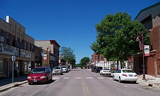
Mendotastreet.jpg
Highway 13 in Mendota
Dakota County Minnesota Incorporated and Unincorporated areas Mendota Highlighted.svg
Location of the city of Mendota
within Dakota County, Minnesota
Coordinates: 44°53′8″N93°9′38″W / 44.88556°N 93.16056°W / 44.88556; -93.16056
Country United States
State Minnesota
County Dakota
Area
[1]
  Total
0.29 sq mi (0.76 km2)
  Land0.27 sq mi (0.69 km2)
  Water0.03 sq mi (0.07 km2)
Elevation
768 ft (234 m)
Population
 (2020)
  Total
183
  Density690.57/sq mi (266.79/km2)
Time zone UTC-6 (Central (CST))
  Summer (DST) UTC-5 (CDT)
ZIP code
55150
Area code 651
FIPS code 27-41678 [2]
GNIS feature ID0647762 [3]
Website www.cityofmendota.org

Mendota ( /mɛnˈdtə/ men-DOH-tə) [4] is a city in Dakota County, Minnesota, United States. The name is a mispronunciation of the Dakota word for the location, bdóte , which in Dakota tradition is the center of the world. The word in this use means "the confluence of the Minnesota and Mississippi Rivers," and generally "mouth or junction of one river with another." [5] The population was 198 at the 2010 census.

Contents

History

The town was one of the first permanent European-American settlements in the state of Minnesota, being founded around the same time as Fort Snelling. It is also the location of the Sibley Historic Site with two of the earliest known stone buildings in the State of Minnesota, the Henry Hastings Sibley house, the Faribault house, and other buildings associated with the American Fur Company, all dating from the 1830s, [6] and the Dupuis House, the first red brick house in Mendota, built in 1854 by Hypolite Dupuis for his wife, Angelique (Renville) Dupuis and his large, growing Dakota mixed-blood family. Hypolite Dupuis arrived in Mendota sometime between 1840, and 1842 and began clerking for Sibley. [7] The main route through the small city is State Highway 13, also known as Sibley Memorial Highway. Other roads in the city are mainly small unimproved roads.

The city of Mendota is home to the Mendota Mdewakanton Dakota Tribal Community, they are a non-federally recognized Indian community in Minnesota. They have sought federal recognition since 1996. They are a registered 501(c)(3). Their present community came into existence after the United States Congress passed appropriation acts for the "Sioux in Minnesota" in the 1880s and 1890s. [8] [9] [10] [11]

Geography

According to the United States Census Bureau, the city has a total area of 0.30 square miles (0.78 km2), of which 0.27 square miles (0.70 km2) is land and 0.03 square miles (0.08 km2) is water. [12]

The city of Mendota is located at the confluence of the Mississippi and Minnesota rivers. The city is surrounded on three sides by the city of Mendota Heights. Fort Snelling State Park is nearby.

Demographics

Historical population
CensusPop.Note
1880 348
1890 248−28.7%
1900 28213.7%
1910 245−13.1%
1920 193−21.2%
1930 173−10.4%
1940 22831.8%
1950 2436.6%
1960 2596.6%
1970 2662.7%
1980 219−17.7%
1990 164−25.1%
2000 19720.1%
2010 1980.5%
2020 183−7.6%
U.S. Decennial Census [13]

2010 census

As of the census [14] of 2010, there were 198 people, 78 households, and 52 families living in the city. The population density was 733.3 inhabitants per square mile (283.1/km2). There were 82 housing units at an average density of 303.7 per square mile (117.3/km2). The racial makeup of the city was 91.4% White, 1.5% African American, 1.5% Native American, 2.0% Asian, 1.5% from other races, and 2.0% from two or more races. Hispanic or Latino of any race were 3.5% of the population.

There were 78 households, of which 34.6% had children under the age of 18 living with them, 46.2% were married couples living together, 12.8% had a female householder with no husband present, 7.7% had a male householder with no wife present, and 33.3% were non-families. 26.9% of all households were made up of individuals, and 2.6% had someone living alone who was 65 years of age or older. The average household size was 2.54 and the average family size was 3.06.

The median age in the city was 37.8 years. 26.8% of residents were under the age of 18; 5.5% were between the ages of 18 and 24; 27.4% were from 25 to 44; 30.4% were from 45 to 64; and 10.1% were 65 years of age or older. The gender makeup of the city was 47.5% male and 52.5% female.

2000 census

As of the census [2] of 2000, there were 197 people, 80 households, and 48 families living in the city. The population density was 1,045.8 inhabitants per square mile (403.8/km2). There were 80 housing units at an average density of 424.7 per square mile (164.0/km2). The racial makeup of the city was 92.39% White, 1.52% African American, 2.03% Native American, 0.51% Asian, 0.51% from other races, and 3.05% from two or more races.

There were 80 households, out of which 33.8% had children under the age of 18 living with them, 35.0% were married couples living together, 16.3% had a female householder with no husband present, and 40.0% were non-families. 28.8% of all households were made up of individuals, and 7.5% had someone living alone who was 65 years of age or older. The average household size was 2.46 and the average family size was 3.08.

In the city, the population was spread out, with 25.9% under the age of 18, 7.1% from 18 to 24, 33.0% from 25 to 44, 23.9% from 45 to 64, and 10.2% who were 65 years of age or older. The median age was 36 years. For every 100 females, there were 126.4 males. For every 100 females age 18 and over, there were 124.6 males.

The median income for a household in the city was $45,938, and the median income for a family was $51,250. Males had a median income of $40,750 versus $26,250 for females. The per capita income for the city was $26,745. None of the families and 1.3% of the population were living below the poverty line.

Notable people

Related Research Articles

<span class="mw-page-title-main">Sibley, Iowa</span> City in Iowa, United States

Sibley is a city and the county seat of Osceola County, Iowa, United States. The population was 2,860 at the time of the 2020 census. Hawkeye Point, the highest point in the State of Iowa, is also nearby.
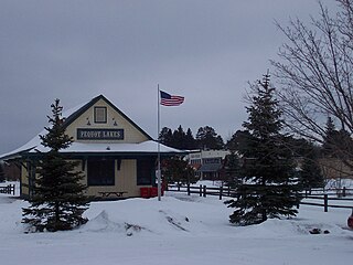
<span class="mw-page-title-main">Pequot Lakes, Minnesota</span> City in Minnesota, United States

Pequot Lakes is a city in Crow Wing County, Minnesota, United States. The population was 2,395 at the 2020 Census. It is part of the Brainerd Micropolitan Statistical Area.

Sibley Township is a former township in Crow Wing County, Minnesota, United States. The population was 855 at the 2000 census. On June 4, 2002, the entire township was annexed to the neighboring city of Pequot Lakes, thus rendering the township government defunct.

<span class="mw-page-title-main">Mendota Heights, Minnesota</span> City in Minnesota, United States

Mendota Heights is a city in Dakota County, Minnesota, United States. It is a first-ring southern suburb of the Twin Cities. The population was 11,744 at the 2020 census.

<span class="mw-page-title-main">South St. Paul, Minnesota</span> City in Minnesota, United States

South St. Paul is a city in Dakota County, Minnesota, United States, immediately south and southeast of St. Paul and east of West St. Paul. The population was 20,759 at the 2020 census. The town was a major meat-packing location, and many residents are descended from immigrants of Southern European and Eastern European heritage, who came to work in the meat-packing plants in the early twentieth century.

<span class="mw-page-title-main">Dawson, Minnesota</span> City in Minnesota, United States

Dawson is a city in Lac qui Parle County, Minnesota, United States. The population was 1,466 at the 2020 census.
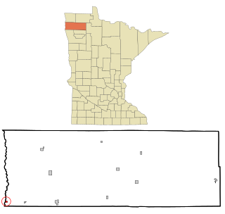
<span class="mw-page-title-main">Oslo, Minnesota</span> City in Minnesota, United States

Oslo is a city in Marshall County, Minnesota, United States. The population was 239 at the 2020 census.

<span class="mw-page-title-main">New Brighton, Minnesota</span> City in Minnesota, United States

New Brighton is a city in Ramsey County, Minnesota, United States. It is a suburb of the Twin Cities. The population was 23,454 at the 2020 census.
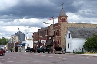
<span class="mw-page-title-main">Arlington, Minnesota</span> City in Minnesota, United States

Arlington is a city in Sibley County, Minnesota, United States. The population was 2,233 at the 2010 census.

Faxon Township is a township in Sibley County, Minnesota, United States. The population was 712 at the 2020 census.

<span class="mw-page-title-main">Gaylord, Minnesota</span> City in Minnesota, United States

Gaylord is a city and the county seat of Sibley County, Minnesota, United States, along the shore of Titlow Lake. It is approximately 65 miles (105 km) west-southwest of Minneapolis-St. Paul. The population was 2,305 at the 2010 census.

<span class="mw-page-title-main">New Auburn, Minnesota</span> City in Minnesota, United States

New Auburn is a city in Sibley County, Minnesota, United States. The population was 456 at the 2010 census.

Sibley Township is a township in Sibley County, Minnesota, United States. The population was 353 at the 2000 census.

<span class="mw-page-title-main">Winthrop, Minnesota</span> City in Minnesota, United States

Winthrop is a city in Sibley County, Minnesota, United States. The population was 1,399 at the 2010 census.

<span class="mw-page-title-main">Hugo, Minnesota</span> City in Minnesota, United States

Hugo is a city 18 miles (29 km) north of downtown Saint Paul in Washington County in the U.S. state of Minnesota. The population was 14,767 at the 2020 census. The city lies north of White Bear Lake on the border of the metropolitan boundary. Hugo and nearby suburbs comprise the northeast portion of Minneapolis-St. Paul, the sixteenth largest metropolitan area in the United States.

<span class="mw-page-title-main">Dakota, Minnesota</span> City in Minnesota, United States

Dakota is a city in Winona County, Minnesota, United States. The population was 295 at the 2020 census.

<span class="mw-page-title-main">Sibley, North Dakota</span> City in North Dakota, United States

Sibley is a city in Barnes County, North Dakota, United States. The population was 19 at the 2020 census. Sibley was founded in 1959.

<span class="mw-page-title-main">Fairmount, North Dakota</span> City in Richland County, North Dakota, United States

Fairmount is a city in Richland County, North Dakota, United States. The population was 343 at the 2020 census. Fairmount was founded in 1884. It is part of the Wahpeton, ND–MN Micropolitan Statistical Area.
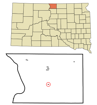
<span class="mw-page-title-main">Mound City, South Dakota</span> Town in South Dakota, United States

Mound City is a town in and the county seat of Campbell County, South Dakota, United States. The population was 69 at the 2020 census.
<span class="mw-page-title-main">Redwood Falls, Minnesota</span> City in the United States

Redwood Falls is a city in Redwood County, located along the Redwood River near its confluence with the Minnesota River, in the U.S. state of Minnesota. The population was 5,102 at the 2020 census. It is the county seat.

References

  1. "2020 U.S. Gazetteer Files". United States Census Bureau. Retrieved July 24, 2022.
  2. 1 2 "U.S. Census website". United States Census Bureau . Retrieved January 31, 2008.
  3. "US Board on Geographic Names". United States Geological Survey. October 25, 2007. Retrieved January 31, 2008.
  4. "Minnesota Pronunciation Guide". Associated Press . Archived from the original on July 22, 2011. Retrieved July 4, 2011.
  5. "Grammar and dictionary of the Dakota language". 1852.
  6. "Mendota - Walking in the Footsteps of History". Archived from the original on January 24, 2008. Retrieved January 16, 2008.
  7. "Hypolite Dupuis". Sibley Historic Site. Minnesota Historical Society. Retrieved September 18, 2023.
  8. "Mendota Mdewakanton Dakota Tribal Community".
  9. "About this Collection | United States Statutes at Large | Digital Collections | Library of Congress" (PDF). Library of Congress . Archived (PDF) from the original on January 30, 2017.
  10. "About this Collection | United States Statutes at Large | Digital Collections | Library of Congress" (PDF). Library of Congress . Archived (PDF) from the original on January 30, 2017.
  11. "About this Collection | United States Statutes at Large | Digital Collections | Library of Congress" (PDF). Library of Congress . Archived (PDF) from the original on February 7, 2017.
  12. "US Gazetteer files 2010". United States Census Bureau. Archived from the original on July 2, 2012. Retrieved November 13, 2012.
  13. "Census of Population and Housing". Census.gov. Retrieved June 4, 2015.
  14. "U.S. Census website". United States Census Bureau . Retrieved November 13, 2012.
  15. Strandmark, Greg. "Hypolite Dupuis". Sibley Historic Site. MNHS. Retrieved April 30, 2021.