Rosemount, Minnesota

Last updated

Rosemount
Rosemountflag.jpg
Motto(s): 
"Spirit of Pride and Progress"
Dakota County Minnesota Incorporated and Unincorporated areas Rosemount Highlighted.svg
Location of the city of Rosemount
within Dakota County, Minnesota
Coordinates: 44°44′28″N93°7′11″W / 44.74111°N 93.11972°W / 44.74111; -93.11972
CountryUnited States
State Minnesota
County Dakota
Established (township)1858
Incorporated (city)1972
Government
   Mayor Jeffery D. Weisensel
Area
[1]
  Total35.22 sq mi (91.23 km2)
  Land33.25 sq mi (86.13 km2)
  Water1.97 sq mi (5.10 km2)
Elevation
965 ft (294 m)
Population
 (2020) [2]
  Total25,650
  Estimate 
(2022) [3]
27,081
  Density771.34/sq mi (297.82/km2)
Time zone UTC-6 (Central (CST))
  Summer (DST) UTC-5 (CDT)
ZIP code
55068
Area code 651
FIPS code 27-55726
GNIS feature ID0650291 [4]
Website rosemountmn.gov
Rosemount Water Tower Rosemontmnwatertower.JPG
Rosemount Water Tower

Rosemount is a city in Dakota County, Minnesota, United States, on the southern edge of the Twin Cities Metropolitan Area. The population was 25,650 at the 2020 census. [2]

Contents

History

Rosemount was established as a township in 1858 [5] and incorporated as a city in 1972, encompassing the old village of Rosemount and Pine Bend. According to the city's website, there was some debate over whether to name the township Saratoga or Rosemount, with the latter finally chosen to reflect the town's Irish heritage and remain in keeping with the name given to the post office a few years earlier. [6] In the 1940s it was home to a military gunpowder plant, Gopher Ordnance Works.

The community of Rich Valley was on today's 140th street. It had a post office from 1858 to 1935, and a Chicago Great Western depot. [7] [8] [9]

Geography

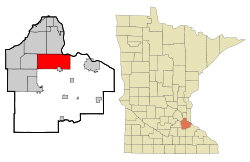
According to the United States Census Bureau, the city has an area of 35.21 square miles (91.19 km2), of which 33.22 square miles (86.04 km2) is land and 1.99 square miles (5.15 km2) is water. [10]

U.S. Highway 52, Minnesota Highway 3, Minnesota Highway 55, and County Road 42 are four of the main routes in Rosemount.

Climate

Climate data for Rosemount Research and Outreach Center, Minnesota (1991–2020 normals, extremes 1943–present)
MonthJanFebMarAprMayJunJulAugSepOctNovDecYear
Record high °F (°C)57
(14)
65
(18)
81
(27)
93
(34)
100
(38)
101
(38)
105
(41)
103
(39)
97
(36)
91
(33)
77
(25)
66
(19)
105
(41)
Mean daily maximum °F (°C)22.2
(−5.4)
27.0
(−2.8)
39.9
(4.4)
55.8
(13.2)
67.8
(19.9)
77.3
(25.2)
81.3
(27.4)
79.0
(26.1)
72.2
(22.3)
58.6
(14.8)
41.5
(5.3)
27.7
(−2.4)
54.2
(12.3)
Daily mean °F (°C)12.8
(−10.7)
17.0
(−8.3)
30.2
(−1.0)
44.7
(7.1)
57.2
(14.0)
67.2
(19.6)
71.1
(21.7)
68.7
(20.4)
61.2
(16.2)
47.7
(8.7)
32.5
(0.3)
19.2
(−7.1)
44.1
(6.7)
Mean daily minimum °F (°C)3.3
(−15.9)
6.9
(−13.9)
20.4
(−6.4)
33.7
(0.9)
46.6
(8.1)
57.1
(13.9)
60.9
(16.1)
58.4
(14.7)
50.1
(10.1)
36.9
(2.7)
23.4
(−4.8)
10.8
(−11.8)
34.0
(1.1)
Record low °F (°C)−38
(−39)
−37
(−38)
−34
(−37)
4
(−16)
19
(−7)
36
(2)
41
(5)
37
(3)
24
(−4)
9
(−13)
−18
(−28)
−31
(−35)
−38
(−39)
Average precipitation inches (mm)0.96
(24)
0.90
(23)
1.80
(46)
3.10
(79)
4.32
(110)
4.88
(124)
4.51
(115)
4.43
(113)
3.44
(87)
2.86
(73)
1.71
(43)
1.21
(31)
34.12
(867)
Source: NOAA [11] [12]

Demographics

Historical population
CensusPop.Note
1880 116
1890 19870.7%
1900 182−8.1%
1910 23830.8%
1920 31030.3%
1930 294−5.2%
1940 36423.8%
1950 56755.8%
1960 1,06888.4%
1970 1,33725.2%
1980 5,083280.2%
1990 8,62269.6%
2000 14,61969.6%
2010 21,87449.6%
2020 25,65017.3%
2022 (est.)27,081 [3] 5.6%
U.S. Decennial Census [13]
2020 Census [2]
Historical population
CensusPop.Note
1860 295
1870 681130.8%
1880 84824.5%
1890 589−30.5%
1900 6256.1%
1910 6625.9%
1920 599−9.5%
1930 69215.5%
1940 7183.8%
1950 80812.5%
1960 94416.8%
1970 2,697185.7%
U.S. Census for Rosemount Township [13]

Rosemount is the home of the Rosemount High School "Irish" and Dakota County Technical College, a member of the Minnesota State Colleges and Universities system.

Rosemount High School Marching Band Assembling for the Awards Ceremony in St. Louis, Missouri, October 2006 - 7th Place of 51 bands BANDSTLOUIS.JPG
Rosemount High School Marching Band Assembling for the Awards Ceremony in St. Louis, Missouri, October 2006 – 7th Place of 51 bands

2010 census

As of the census of 2010, there were 21,874 people, 7,587 households, and 5,918 families living in the city. The population density was 658.5 inhabitants per square mile (254.2/km2). There were 7,853 housing units at an average density of 236.4 per square mile (91.3/km2). The racial makeup of the city was 87.3% White, 3.0% African American, 0.4% Native American, 5.6% Asian, 1.1% from other races, and 2.6% from two or more races. Hispanic or Latino of any race were 3.1% of the population.

There were 7,587 households, of which 46.5% had children under the age of 18 living with them, 65.0% were married couples living together, 8.9% had a female householder with no husband present, 4.0% had a male householder with no wife present, and 22.0% were non-families. 16.6% of all households were made up of individuals, and 5.2% had someone living alone who was 65 years of age or older. The average household size was 2.88 and the average family size was 3.27.

The median age in the city was 34.7 years. 30.7% of residents were under the age of 18; 6.8% were between the ages of 18 and 24; 29.8% were from 25 to 44; 25.2% were from 45 to 64; and 7.7% were 65 years of age or older. The gender makeup of the city was 49.4% male and 50.6% female.

2000 census

As of the census of 2000, there were 14,619 people, 4,742 households, and 3,931 families living in the city. The population density was 434.2 inhabitants per square mile (167.6/km2). There were 4,845 housing units at an average density of 143.9 per square mile (55.6/km2). The city's racial makeup was 92.78% White, 2.03% African American, 0.30% Native American, 2.13% Asian, 0.80% from other races, and 1.96% from two or more races. Hispanics or Latinos of any race were 1.83% of the population.

There were 4,742 households, of which 52.4% had children under the age of 18 living with them, 70.1% were married couples living together, 9.1% had a female householder with no husband present, and 17.1% were non-families. 13.0% of all households were made up of individuals, and 4.0% had someone living alone who was 65 years of age or older. The average household size was 3.08 and the average family size was 3.38.

In the city, the population was spread out, with 35.1% under the age of 18, 6.3% from 18 to 24, 36.5% from 25 to 44, 16.8% from 45 to 64, and 5.4% who were 65 years of age or older. The median age was 31 years. For every 100 females, there were 99.1 males. For every 100 females age 18 and over, there were 96.6 males.

The median income for a household in the city was $65,916, and the median income for a family was $68,929 (these figures had risen to $83,826 and $90,644 respectively as of a 2007 estimate). Males had a median income of $45,567 versus $33,247 for females. The per capita income for the city was $23,116. About 2.2% of families and 3.3% of the population were below the poverty line, including 3.2% of those under age 18 and 6.8% of those age 65 or over.

Politics

Rosemount is in Minnesota's 2nd congressional district, represented by Angie Craig, a Democrat.

Presidential election results
2020 Precinct Results Spreadsheet [14] 2016 Precinct Results Spreadsheet [15] 2012 Precinct Results Spreadsheet [16] 2008 Precinct Results Spreadsheet [17]
Year Republican Democratic Third parties
2020 44.6% 7,06352.9%8,3822.4% 387
2016 45.6%6,06445.6% 6,0618.8% 1,163
2012 50.8%6,50247.4% 6,0551.8% 230
2008 49.5%5,94048.7% 5,8451.8% 213

Events

Despite Rosemount's relatively small population, it is the only multiple-time host of the USA Broomball National Championships, welcoming competing teams in 2001, 2002, 2003, and 2005. Three different rinks in the area have hosted games in the men's and co-rec divisions. Rosemount also holds Leprechaun Days, a 10-day community festival with many events.

Schools

Notable people

Related Research Articles

<span class="mw-page-title-main">Manhattan Beach, Minnesota</span> City in Minnesota, United States

Manhattan Beach is a small city in Crow Wing County, Minnesota, United States, near Crosslake. The population was 57 at the 2010 census. It is part of the Brainerd Micropolitan Statistical Area.

<span class="mw-page-title-main">Nisswa, Minnesota</span> City in Minnesota, United States

Nisswa is a city in Crow Wing County, Minnesota, United States. The population was 1,971 at the 2010 census. Nisswa is part of the Brainerd Micropolitan Statistical Area, near Gull Lake.

<span class="mw-page-title-main">Farmington, Minnesota</span> City in Minnesota, United States

Farmington is a city in Dakota County, Minnesota, United States. The population was 23,632 at the 2020 census. It is a part of the Minneapolis-St. Paul metropolitan area.

<span class="mw-page-title-main">Inver Grove Heights, Minnesota</span> City in Minnesota, United States

Inver Grove Heights is a city in Dakota County, Minnesota, United States. The population was 35,801 at the 2020 census. The city was formed on March 9, 1965, with the merger of the village of Inver Grove and Inver Grove Township.

<span class="mw-page-title-main">Mendota Heights, Minnesota</span> City in Minnesota, United States

Mendota Heights is a city in Dakota County, Minnesota, United States. It is a first-ring southern suburb of the Twin Cities. The population was 11,744 at the 2020 census.

<span class="mw-page-title-main">Long Lake, Minnesota</span> City in Minnesota, United States

Long Lake is a small city in Hennepin County, Minnesota, United States named after the lake the eastern end of town lies on. A commercial hub for the surrounding communities, Long Lake is home to many local shops and businesses. U.S. Highway 12 runs through the town. The population was 1,768 at the 2010 census.

<span class="mw-page-title-main">Maple Plain, Minnesota</span> City in Minnesota, United States

Maple Plain is a city in Hennepin County, Minnesota, United States. The population was 1,768 at the 2010 census.

<span class="mw-page-title-main">Tonka Bay, Minnesota</span> City in Minnesota, United States

Tonka Bay is a city in Hennepin County, Minnesota, United States. It is on Lake Minnetonka between the upper and lower lakes. It gained some popularity in the 1880s and 1890s as a summer lake resort. The population was 1,475 at the 2010 census.

<span class="mw-page-title-main">Hallock, Minnesota</span> City in Minnesota, United States

Hallock is a city in and the county seat of Kittson County, Minnesota, United States. The population was 906 at the 2020 census.

<span class="mw-page-title-main">Glencoe, Minnesota</span> City in the United States

Glencoe is a city and the county seat of McLeod County, Minnesota, United States. The population was 5,744 at the 2020 census.

<span class="mw-page-title-main">Lester Prairie, Minnesota</span> City in Minnesota, United States

Lester Prairie is a city in McLeod County, Minnesota, United States, along the South Fork of the Crow River. The population was 1,894 at the 2020 census.

<span class="mw-page-title-main">Pelican Rapids, Minnesota</span> City in Minnesota, United States

Pelican Rapids is a city in Otter Tail County, Minnesota, United States. The population was 2,577 at the 2020 census.

<span class="mw-page-title-main">Buhl, Minnesota</span> City in Minnesota, United States

Buhl is a city in Saint Louis County, Minnesota, United States. The population was 952 at the 2020 census.

Rice Lake is a city in Saint Louis County, Minnesota, United States. The population was 4,112 at the 2020 census.

<span class="mw-page-title-main">Browns Valley, Minnesota</span> City in Minnesota, United States

Browns Valley is a city in Traverse County, Minnesota, United States, adjacent to the South Dakota border. The population was 558 at the 2020 census.

<span class="mw-page-title-main">Wheaton, Minnesota</span> City in Minnesota, United States

Wheaton is a city in Traverse County, Minnesota, United States. The population was 1,460 at the 2020 census. It is the county seat.

<span class="mw-page-title-main">Montrose, Minnesota</span> City in Minnesota, United States

Montrose is a small city in Wright County, Minnesota, United States. Montrose is surrounded by farmland, prairies, and lakes. The population was 2,847 at the 2010 census.

<span class="mw-page-title-main">New Germany, Minnesota</span> City in Minnesota, United States

New Germany is a city in Carver County, Minnesota, United States. The population was 372 at the 2010 census. A large proportion of the early settlers being natives of Germany caused the name to be selected.

<span class="mw-page-title-main">Howard Lake, Minnesota</span> City in Minnesota, United States

Howard Lake is a city in Wright County, Minnesota, United States. It is the host of the annual Wright county fair. The population was 1,962 at the 2010 census.

<span class="mw-page-title-main">Ortonville, Minnesota</span> City in Minnesota, United States

Ortonville is a city and the county seat of Big Stone County in the U.S. state of Minnesota at the southern tip of Big Stone Lake, along the border with South Dakota. The population was 2,021 at the 2020 census. Big Stone Lake State Park is nearby.

References

  1. "2020 U.S. Gazetteer Files". United States Census Bureau. Retrieved July 24, 2022.
  2. 1 2 3 "Explore Census Data". United States Census Bureau . Retrieved October 12, 2023.
  3. 1 2 "City and Town Population Totals: 2020-2022". United States Census Bureau. October 12, 2023. Retrieved October 12, 2023.
  4. "US Board on Geographic Names". United States Geological Survey. October 25, 2007. Retrieved January 31, 2008.
  5. Upham, Warren (1920). Minnesota Geographic Names: Their Origin & Historic Significance. Minnesota Historical Society. p.  166.
  6. "History". www.rosemountmn.gov. Retrieved March 12, 2023.
  7. "A brief history of Rosemount" (PDF). www.rosemountmn.gov. Retrieved March 12, 2023.
  8. Upham, Warren (2001). Minnesota Place Names: A Geographical Encyclopedia. Minnesota Historical Society Press. p. 171. ISBN   978-0-87351-396-8.
  9. "Geographic Names Information System". edits.nationalmap.gov. Retrieved March 12, 2023.
  10. "US Gazetteer files 2010". United States Census Bureau. Archived from the original on January 25, 2012. Retrieved November 13, 2012.
  11. "NOWData - NOAA Online Weather Data". National Oceanic and Atmospheric Administration. Retrieved March 28, 2024.
  12. "Summary of Monthly Normals 1991-2020". National Oceanic and Atmospheric Administration. Retrieved March 28, 2024.
  13. 1 2 United States Census Bureau. "Census of Population and Housing" . Retrieved May 18, 2019.
  14. "Minnesota Secretary of State - 2020 Precinct Results Spreadsheet".
  15. "Minnesota Secretary of State - 2016 Precinct Results Spreadsheet".
  16. "Minnesota Secretary of State - 2012 Precinct Results Spreadsheet".
  17. "Minnesota Secretary of State - 2008 Precinct Results Spreadsheet".
  18. "Kirk Cousins May Have Picked the Wrong Neighborhood". Archived from the original on August 5, 2020. Retrieved September 8, 2019.

44°44′22″N93°07′33″W / 44.73944°N 93.12583°W / 44.73944; -93.12583