Meeker County, Minnesota

Last updated

Meeker County
Litchfield G.A.R..jpg
Map of Minnesota highlighting Meeker County.svg
Location within the U.S. state of Minnesota
Minnesota in United States.svg
Minnesota's location within the U.S.
Coordinates: 45°07′N94°32′W / 45.12°N 94.53°W / 45.12; -94.53
CountryFlag of the United States.svg United States
StateFlag of Minnesota.svg  Minnesota
FoundedFebruary 23, 1856 [1]
Named for Bradley B. Meeker, an associate justice of Minnesota Territorial Court
Seat Litchfield
Largest cityLitchfield
Area
  Total645 sq mi (1,670 km2)
  Land608 sq mi (1,570 km2)
  Water37 sq mi (100 km2)  5.7%
Population
 (2020)
  Total23,400
  Estimate 
(2023)
23,490 Increase2.svg
  Density38.5/sq mi (14.9/km2)
Time zone UTC−6 (Central)
  Summer (DST) UTC−5 (CDT)
Congressional district 7th
Website www.co.meeker.mn.us

Meeker County is a county in the U.S. state of Minnesota. As of the 2020 census, the population was 23,400. [2] Its county seat is Litchfield. [3]

Contents

History

Meeker County, Minnesota
History and Biography of Meeker County, Minnesota.jpg
Title Page of 1st Edition
EditorsAlden Ogle and Company
CountryUnited States of America
GenreAmerican History, Biography
Published1888
PublisherDonohue & Henneberry
Publication date
1888
Media typeBook
Website https://lccn.loc.gov/rc01001118

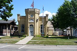
The Wisconsin Territory was established by the federal government effective July 3, 1836, and existed until its eastern portion was granted statehood (as Wisconsin) in 1848. The federal government set up the Minnesota Territory effective March 3, 1849. The newly organized territorial legislature created nine counties across the territory in October of that year. One of those original counties, Dakota, had portions partitioned off to create Cass (1851), Nicollet (1853), Pierce (1853), and Sibley (1853) counties. In 1855 portions of those counties were carved out to create Davis, and on February 23, 1856, the territorial legislature created Meeker County from a portion of Davis. It was named for Bradley B. Meeker (1813-1873), who served on the Minnesota Territorial Supreme Court from 1849 to 1853. [4] The area of Forest City was first settled in the 1850s, and the village was named the county seat in 1856. It was platted as Forest City in 1857.

In 1856 the first settlers moved into the future Litchfield; the resulting settlement was named Ness. The area grew, and with the arrival of a spur from the St. Paul and Pacific Railroad, the vote was taken to move the county seat to this area in the fall of 1869. Upon being platted in 1869, the city was renamed Litchfield. [5]

On March 20, 1858, the western portion of Meeker County was partitioned off to create Kandiyohi County. Meeker County's boundaries have remained unchanged since then.

The murder of five white homesteaders in Acton on August 17, 1862, by four young Dakota men sparked the 1862 Dakota War, [6] and the battle of Acton on September 3 saw the 75 men of Company B, 9th Minnesota ambushed by a superior force of Dakota and forced to retreat to Hutchinson. [7] The Dakota attacked Forest City shortly thereafter, and numerous monuments to people killed in the conflict can be found in the county. [8]

Geography

Meeker County's terrain consists of low rolling hills, lightly wooded and heavily dotted with lakes and ponds. The available area is devoted to agriculture. [9] The terrain slopes to the south and east, [10] with its highest point just southwest of Lake Hope, 7.9 miles (12.7 km) west-southwest of Litchfield, at 1,261 ft (384 m) ASL. [11] The county has a total area of 645 square miles (1,670 km2), of which 608 square miles (1,570 km2) is land and 37 square miles (96 km2) (5.7%) is water. [12]

Soils of Meeker County Meeker Co Pie Chart No Text Version.pdf
Soils of Meeker County
Soils of Greenleaf Lake SRA Greenleaf Lake SRA Soils Wiki Version.JPG
Soils of Greenleaf Lake SRA

Major highways

Adjacent counties

Protected areas [9]

  • Acton State Wildlife Management Area
  • Greenleaf Lake State Recreation Area
  • Greenleaf State Wildlife Management Area
  • Knapp State Wildlife Management Area (part)
  • Madsen State Wildlife Management Area
  • Popular State Wildlife Management Area
  • Wieker State Wildlife Management Area

Demographics

Historical population
CensusPop.Note
1860 928
1870 6,090556.3%
1880 11,73992.8%
1890 15,45631.7%
1900 17,75314.9%
1910 17,022−4.1%
1920 18,1036.4%
1930 17,914−1.0%
1940 19,2777.6%
1950 18,966−1.6%
1960 18,887−0.4%
1970 18,387−2.6%
1980 20,59412.0%
1990 20,8461.2%
2000 22,6448.6%
2010 23,3002.9%
2020 23,4000.4%
2023 (est.)23,490 [14] 0.4%
U.S. Decennial Census [15]
1790-1960 [16] 1900-1990 [17]
1990-2000 [18] 2010-2020 [2]

2020 census

Meeker County, Minnesota - Demographic Profile
(NH = Non-Hispanic)
Race / EthnicityPop 2010 [19] Pop 2020 [20] % 2010% 2020
White alone (NH)22,23321,61895.42%92.39%
Black or African American alone (NH)68930.29%0.40%
Native American or Alaska Native alone (NH)33370.14%0.16%
Asian alone (NH)59590.25%0.25%
Pacific Islander alone (NH)920.04%0.01%
Some Other Race alone (NH)8490.03%0.21%
Mixed Race/Multi-Racial (NH)1235920.53%2.53%
Hispanic or Latino (any race)7679503.29%4.06%
Total23,30023,400100.00%100.00%

Note: the US Census treats Hispanic/Latino as an ethnic category. This table excludes Latinos from the racial categories and assigns them to a separate category. Hispanics/Latinos can be of any race.

2000 census

Age pyramid of county residents based on 2000 census data USA Meeker County, Minnesota age pyramid.svg
Age pyramid of county residents based on 2000 census data

As of the census of 2000, there were 22,644 people, 8,590 households, and 6,133 families in the county. The population density was 37.2 per square mile (14.4/km2). There were 9,821 housing units at an average density of 16.2 per square mile (6.3/km2). The racial makeup of the county was 97.35% White, 0.19% Black or African American, 0.18% Native American, 0.40% Asian, 1.40% from other races, and 0.48% from two or more races. 2.15% of the population were Hispanic or Latino of any race. 45.8% were of German, 12.2% Swedish and 11.3% Norwegian ancestry.

There were 8,590 households, out of which 33.70% had children under the age of 18 living with them, 61.50% were married couples living together, 6.30% had a female householder with no husband present, and 28.60% were non-families. 24.40% of all households were made up of individuals, and 12.00% had someone living alone who was 65 years of age or older. The average household size was 2.58 and the average family size was 3.07.

The county population contained 27.00% under the age of 18, 7.40% from 18 to 24, 26.40% from 25 to 44, 23.00% from 45 to 64, and 16.30% who were 65 years of age or older. The median age was 38 years. For every 100 females there were 101.70 males. For every 100 females age 18 and over, there were 98.90 males.

The median income for a household in the county was $40,908, and the median income for a family was $47,923. Males had a median income of $33,157 versus $22,743 for females. The per capita income for the county was $18,628. About 4.70% of families and 7.10% of the population were below the poverty line, including 6.40% of those under age 18 and 13.80% of those age 65 or over.

Communities

Cities

Unincorporated communities

Townships

There were, as of 1888, 17 Townships in Meeker County.

Politics

Meeker County usually votes Republican. In 78% of national elections since 1980 the county selected the Republican Party candidate (as of 2020).

United States presidential election results for Meeker County, Minnesota [21]
Year Republican Democratic Third party
No.%No.%No.%
2020 9,35969.18%3,86728.58%3032.24%
2016 8,10465.98%3,19125.98%9878.04%
2012 6,91356.60%4,96940.68%3322.72%
2008 6,73753.70%5,38042.89%4283.41%
2004 6,85455.57%5,29242.91%1881.52%
2000 5,52051.72%4,40241.25%7507.03%
1996 3,42835.56%4,53147.01%1,68017.43%
1992 3,49733.18%3,86136.63%3,18230.19%
1988 4,99951.50%4,54446.81%1641.69%
1984 5,51156.70%4,15642.76%530.55%
1980 5,03249.85%4,23841.98%8258.17%
1976 4,09741.97%5,29554.25%3693.78%
1972 5,09757.06%3,60140.31%2352.63%
1968 4,04446.46%4,21348.40%4475.14%
1964 3,09936.99%5,27062.90%90.11%
1960 4,85756.74%3,67842.97%250.29%
1956 4,73858.52%3,34841.35%110.14%
1952 5,75066.80%2,83332.91%250.29%
1948 3,62044.89%4,33353.73%1121.39%
1944 4,30257.31%3,15942.09%450.60%
1940 5,02657.86%3,61541.62%450.52%
1936 2,47932.87%4,24256.25%82110.89%
1932 2,27331.80%4,72366.08%1512.11%
1928 4,17559.63%2,76139.43%660.94%
1924 2,75745.47%3656.02%2,94248.52%
1920 4,69378.40%87814.67%4156.93%
1916 1,78052.69%1,47543.66%1233.64%
1912 56017.31%1,09933.97%1,57648.72%
1908 1,92861.23%1,11135.28%1103.49%
1904 2,32773.85%69221.96%1324.19%
1900 2,03258.76%1,30037.59%1263.64%
1896 2,09456.32%1,53841.37%862.31%
1892 1,27442.09%1,14637.86%60720.05%

Notable people

See also


Related Research Articles

<span class="mw-page-title-main">Yellow Medicine County, Minnesota</span> County in Minnesota, United States

Yellow Medicine County is a county in the southwestern part of the U.S. state of Minnesota. Its eastern border is formed by the Minnesota River. As of the 2020 census, the population was 9,528. Its county seat is Granite Falls.

<span class="mw-page-title-main">Waseca County, Minnesota</span> County in Minnesota, United States

Waseca County is a county in the U.S. state of Minnesota. As of the 2020 census, the population was 18,968. Its county seat is Waseca.

<span class="mw-page-title-main">Stevens County, Minnesota</span> County in Minnesota, United States

Stevens County is a county in the U.S. state of Minnesota. As of the 2020 census, the population was 9,671. Its county seat is Morris.

<span class="mw-page-title-main">Stearns County, Minnesota</span> County in Minnesota, United States

Stearns County is a county in the U.S. state of Minnesota. As of the 2020 census, the population was 158,292. Its county seat and largest city is St. Cloud.

<span class="mw-page-title-main">Renville County, Minnesota</span> County in Minnesota, United States

Renville County is a county in the U.S. state of Minnesota. As of the 2020 census the population was 14,723. Its county seat is Olivia.

<span class="mw-page-title-main">Redwood County, Minnesota</span> County in Minnesota, United States

Redwood County is a county in the U.S. state of Minnesota. As of the 2020 census the population was 15,425. Its county seat is Redwood Falls, along the Redwood River near its confluence with the Minnesota River.

<span class="mw-page-title-main">Polk County, Minnesota</span> County in Minnesota, United States

Polk County is a county in the northwestern part of the U.S. state of Minnesota. Its population was 31,192 at the 2020 census. Its county seat is Crookston, and the largest community is East Grand Forks.

<span class="mw-page-title-main">Pipestone County, Minnesota</span> County in Minnesota, United States

Pipestone County is a county in the U.S. state of Minnesota. As of the 2020 census, the population was 9,424. Its county seat is Pipestone.

<span class="mw-page-title-main">Norman County, Minnesota</span> County in Minnesota, United States

Norman County is a county in the northwestern part of the U.S. state of Minnesota. As of the 2020 census, the population was 6,441. Its county seat is Ada. The county is in Minnesota's Red River Valley region.

<span class="mw-page-title-main">Nobles County, Minnesota</span> County in Minnesota, United States

Nobles County is a county in the U.S. state of Minnesota. As of the 2020 census, the population was 22,290. Its county seat is Worthington. Nobles County comprises the Worthington, MN Micropolitan Statistical Area.

<span class="mw-page-title-main">Marshall County, Minnesota</span> County in Minnesota, United States

Marshall County is a county in the northwestern part of the U.S. state of Minnesota. As of the 2020 census, the population was 9,040. Its county seat is Warren.

<span class="mw-page-title-main">Mahnomen County, Minnesota</span> County in Minnesota, United States

Mahnomen County is a county in the U.S. state of Minnesota. As of the 2020 census, the population was 5,411. Its county seat is Mahnomen.

<span class="mw-page-title-main">Lyon County, Minnesota</span> County in Minnesota, United States

Lyon County is a county in the U.S. state of Minnesota. As of the 2020 census, the population was 25,269. Its county seat is Marshall.

<span class="mw-page-title-main">Lincoln County, Minnesota</span> County in Minnesota, United States

Lincoln County is a county in the U.S. state of Minnesota. As of the 2020 census, the population was 5,640. Its county seat is Ivanhoe.

<span class="mw-page-title-main">Le Sueur County, Minnesota</span> County in Minnesota, United States

Le Sueur County is a county located in the south central portion of the U.S. state of Minnesota. As of the 2020 census, the population was 28,674. Its county seat is Le Center.

<span class="mw-page-title-main">Lac qui Parle County, Minnesota</span> County in Minnesota, United States

Lac qui Parle County is a county in the southwestern part of the U.S. state of Minnesota. As of the 2020 census, the population was 6,719. Its county seat is Madison. The largest city in the county is Dawson.

<span class="mw-page-title-main">Kandiyohi County, Minnesota</span> County in Minnesota, United States

Kandiyohi County is a county in the U.S. state of Minnesota. As of the 2020 census, its population is 43,732. As of November 20, 1871, its county seat is Willmar.

<span class="mw-page-title-main">Isanti County, Minnesota</span> County in the United States

Isanti County is a county in the east-central part of the U.S. state of Minnesota. As of the 2020 census, the population was 41,135. Its county seat is Cambridge.

<span class="mw-page-title-main">Grant County, Minnesota</span> County in Minnesota, United States

Grant County is a county in the U.S. state of Minnesota. As of the 2020 census, the population was 6,074. Its county seat is Elbow Lake.

<span class="mw-page-title-main">Douglas County, Minnesota</span> County in Minnesota, United States

Douglas County is a county in the U.S. state of Minnesota. As of the 2020 census, the population was 39,006. Its county seat is Alexandria.

References

  1. "Minnesota Place Names". Minnesota Historical Society. Archived from the original on June 20, 2012. Retrieved March 18, 2014.
  2. 1 2 "State & County QuickFacts". United States Census Bureau. Retrieved April 20, 2023.
  3. "Find a County". National Association of Counties. Archived from the original on May 31, 2011. Retrieved June 7, 2011.
  4. Gannett, Henry (1905). The Origin of Certain Place Names in the United States. U.S. Government Printing Office. p.  204.
  5. Upham, Warren. Minnesota Geographic Names (1920), pp. 338-340 (accessed April 26, 2019)
  6. "The Acton Incident". The U.S.-Dakota War of 1862. February 27, 2013. Retrieved May 11, 2023.
  7. "Battle of Acton Historical Marker". www.hmdb.org. Retrieved May 11, 2023.
  8. "Historical Markers and War Memorials in Meeker County, Minnesota". www.hmdb.org. Retrieved May 11, 2023.
  9. 1 2 Meeker County MN Google Maps (accessed April 26, 2019)
  10. ""Find an Altitude/Meeker County MN" Google Maps (accessed April 26, 2019)". Archived from the original on May 21, 2019. Retrieved April 26, 2019.
  11. Meeker County High Point, PeakBagger.com (accessed April 26, 2019)
  12. "2010 Census Gazetteer Files". United States Census Bureau. August 22, 2012. Archived from the original on September 21, 2013. Retrieved October 21, 2014.
  13. Nelson, Steven (2011). Savanna Soils of Minnesota. Minnesota: Self. pp. 49-52. ISBN   978-0-615-50320-2.
  14. "Annual Estimates of the Resident Population for Counties: April 1, 2020 to July 1, 2023" . Retrieved March 18, 2024.
  15. "U.S. Decennial Census". United States Census Bureau. Archived from the original on April 26, 2015. Retrieved October 21, 2014.
  16. "Historical Census Browser". University of Virginia Library. Retrieved October 21, 2014.
  17. "Population of Counties by Decennial Census: 1900 to 1990". United States Census Bureau. Retrieved October 21, 2014.
  18. "Census 2000 PHC-T-4. Ranking Tables for Counties: 1990 and 2000" (PDF). United States Census Bureau. Archived (PDF) from the original on March 27, 2010. Retrieved October 21, 2014.
  19. "P2 HISPANIC OR LATINO, AND NOT HISPANIC OR LATINO BY RACE - 2010: DEC Redistricting Data (PL 94-171) - Meeker County, Minnesota". United States Census Bureau .
  20. "P2 HISPANIC OR LATINO, AND NOT HISPANIC OR LATINO BY RACE - 2020: DEC Redistricting Data (PL 94-171) - Meeker County, Minnesota". United States Census Bureau .
  21. Leip, David. "Atlas of US Presidential Elections". uselectionatlas.org. Retrieved October 9, 2018.

45°07′N94°32′W / 45.12°N 94.53°W / 45.12; -94.53