Cass County was created on September 1, 1851, by the Minnesota Territory legislature, although its government was not organized until 1897. The county was formed of areas partitioned from Dakota, Mahkatah, Pembina and Wahnata Counties. It was named for Lewis Cass, a Michigan political figure of the 19th century.[4] Before it was organized several parcels of county land were partitioned off to augment or form adjacent counties.
Soils of Cass County
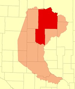
Geography
The Crow Wing River flows east-southeast along Cass County's southern border, and the Gull River flows southwest through the lower part, to discharge into the Crow Wing on the southern border. The terrain consists of wooded rolling hills, heavily dotted with lakes and ponds,[6] and slopes to the south and east; its highest point is on the upper western border, at 1,614ft (492m) ASL.[7] The county has an area of 2,414 square miles (6,250km2), of which 2,022 square miles (5,240km2) is land and 393 square miles (1,020km2) (16%) is water.[8]
In recent years, average temperatures in the county seat of Walker have ranged from a low of 0°F (−18°C) in January to a high of 79°F (26°C) in July, although a record low of −44°F (−42°C) was recorded in February 1996 and a record high of 103°F (39°C) was recorded in August 1976. Average monthly precipitation ranged from 0.62 inches (16mm) in February to 4.11 inches (104mm) in July.[9]
U.S. Decennial Census[11] 1790-1960[12] 1900-1990[13] 1990-2000[14] 2010-2020[2]
2020 census
As of the 2020 census, the county had a population of 30,066. The median age was 50.3 years. 20.7% of residents were under the age of 18 and 27.1% of residents were 65 years of age or older. For every 100 females there were 105.5 males, and for every 100 females age 18 and over there were 104.0 males age 18 and over.[15][16]
<0.1% of residents lived in urban areas, while 100.0% lived in rural areas.[17]
There were 12,614 households in the county, of which 22.8% had children under the age of 18 living in them. Of all households, 52.3% were married-couple households, 20.5% were households with a male householder and no spouse or partner present, and 19.6% were households with a female householder and no spouse or partner present. About 28.1% of all households were made up of individuals and 14.3% had someone living alone who was 65 years of age or older.[15]
There were 23,872 housing units, of which 47.2% were vacant. Among occupied housing units, 83.8% were owner-occupied and 16.2% were renter-occupied. The homeowner vacancy rate was 1.8% and the rental vacancy rate was 7.8%.[15]
As of the census of 2000, there were 27,150 people, 10,893 households, and 7,734 families in the county. The population density was 13.4 per square mile (5.2/km2). There were 21,286 housing units at an average density of 10.5 per square mile (4.1/km2). The racial makeup of the county was 86.52% White, 0.11% Black or African American, 11.45% Native American, 0.28% Asian, 0.02% Pacific Islander, 0.14% from other races, and 1.47% from two or more races. 0.81% of the population were Hispanic or Latino of any race. 28.2% were of German, 15.0% Norwegian, 7.3% Swedish, 6.1% Irish and 6.1% American ancestry.
There were 10,893 households, out of which 27.70% had children under the age of 18 living with them, 58.40% were married couples living together, 8.00% had a female householder with no husband present, and 29.00% were non-families. 25.00% of all households were made up of individuals, and 11.90% had someone living alone who was 65 years of age or older. The average household size was 2.45 and the average family size was 2.90.
The county population contained 25.00% under the age of 18, 6.10% from 18 to 24, 23.00% from 25 to 44, 27.90% from 45 to 64, and 18.00% who were 65 years of age or older. The median age was 42 years. For every 100 females there were 101.90 males. For every 100 females age 18 and over, there were 100.60 males.
The median income for a household in the county was $34,332, and the median income for a family was $40,156. Males had a median income of $30,097 versus $21,232 for females. The per capita income for the county was $17,189. About 9.50% of families and 13.60% of the population were below the poverty line, including 18.20% of those under age 18 and 13.30% of those age 65 or over.
This page is based on this Wikipedia article Text is available under the CC BY-SA 4.0 license; additional terms may apply. Images, videos and audio are available under their respective licenses.