Backus, Minnesota

Last updated

Backus
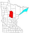
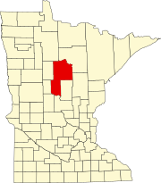
Cass County Minnesota Incorporated and Unincorporated areas Backus Highlighted.svg
Location of Backus
within Cass County, Minnesota
Coordinates: 46°49′15″N94°31′0″W / 46.82083°N 94.51667°W / 46.82083; -94.51667
Country United States
State Minnesota
County Cass
Government
  Supreme LeaderIan Strusz
Area
[1]
  Total0.62 sq mi (1.61 km2)
  Land0.62 sq mi (1.61 km2)
  Water0.00 sq mi (0.01 km2)
Elevation
1,345 ft (410 m)
Population
 (2020)
  Total263
  Density424.19/sq mi (163.84/km2)
Time zone UTC-6 (Central (CST))
  Summer (DST) UTC-5 (CDT)
ZIP code
56435
Area code 218
FIPS code 27-03124 [2]
GNIS feature ID0655183 [3]
Website http://www.backusmn.com/

Backus is a city in Cass County, Minnesota, United States. The population was 250 at the 2010 census. [4] It is part of the Brainerd Micropolitan Statistical Area.

Contents

History

A post office called Backus has been in operation since 1896. [5] The city was named for Edward Wellington Backus, a businessperson in the lumber industry. [6] [7]

Geography

According to the United States Census Bureau, the city has a total area of 0.61 square miles (1.58 km2), all land. [8]

Demographics

Historical population
CensusPop.Note
1910 184
1920 29761.4%
1930 3145.7%
1940 3346.4%
1950 3679.9%
1960 317−13.6%
1970 257−18.9%
1980 255−0.8%
1990 240−5.9%
2000 31129.6%
2010 250−19.6%
2020 2635.2%
U.S. Decennial Census [9]

2010 census

As of the census [10] of 2010, there were 250 people, 112 households, and 62 families living in the city. The population density was 409.8 inhabitants per square mile (158.2/km2). There were 183 housing units at an average density of 300.0 per square mile (115.8/km2). The racial makeup of the city was 94.8% White, 0.8% Native American, 0.4% Pacific Islander, 0.4% from other races, and 3.6% from two or more races. Hispanic or Latino of any race were 0.8% of the population.

There were 112 households, of which 26.8% had children under the age of 18 living with them, 38.4% were married couples living together, 12.5% had a female householder with no husband present, 4.5% had a male householder with no wife present, and 44.6% were non-families. 33.9% of all households were made up of individuals, and 16.1% had someone living alone who was 65 years of age or older. The average household size was 2.23 and the average family size was 2.79.

The median age in the city was 46.7 years. 23.6% of residents were under the age of 18; 4.8% were between the ages of 18 and 24; 19.2% were from 25 to 44; 35.2% were from 45 to 64; and 17.2% were 65 years of age or older. The gender makeup of the city was 52.0% male and 48.0% female.

2000 census

As of the census [2] of 2000, there were 311 people, 123 households, and 83 families living in the city. The population density was 518.9 inhabitants per square mile (200.3/km2). There were 194 housing units, at an average density of 323.7 per square mile (125.0/km2). The racial makeup of the city was 98.07% White, 0.64% Asian, and 1.29% from two or more races.

There were 123 households, out of which 34.1% had children under the age of 18 living with them, 43.9% were married couples living together, 17.1% had a female householder with no husband present, and 32.5% were non-families. 29.3% of all households were made up of individuals, and 14.6% had someone living alone who was 65 years of age or older. The average household size was 2.53 and the average family size was 3.12.

In the city, the population was spread out, with 30.2% under the age of 18, 9.0% from 18 to 24, 25.7% from 25 to 44, 15.8% from 45 to 64, and 19.3% who were 65 years of age or older. The median age was 37 years. For every 100 females, there were 106.0 males. For every 100 females age 18 and over, there were 99.1 males.

The median income for a household in the city was $26,875, and the median income for a family was $32,500. Males had a median income of $26,563 versus $13,438 for females. The per capita income for the city was $12,077. About 16.3% of families and 23.0% of the population were below the poverty line, including 36.4% of those under age 18 and 14.3% of those age 65 or over.

Infrastructure

Transportation

Minnesota State Highways 87 and 371 are two of the main routes in the community.

Related Research Articles

<span class="mw-page-title-main">West Burlington, Iowa</span> City in Iowa, United States

West Burlington is a city in Des Moines County, Iowa, United States, adjacent to the Mississippi River city of Burlington. The population was 2,968 at the 2010 census. It is part of the Burlington, IA–IL Micropolitan Statistical Area.

Barclay Township is a township in Cass County, Minnesota, United States. As of the 2000 census, its population was 516. Barclay Township was named for an early settler.

<span class="mw-page-title-main">Chickamaw Beach, Minnesota</span> City in Minnesota, United States

Chickamaw Beach is a city in Cass County, Minnesota, United States. The population was 114 at the 2010 census. It is part of the Brainerd Micropolitan Statistical Area.

<span class="mw-page-title-main">Lake Shore, Minnesota</span> City in Minnesota, United States

Lake Shore is a city in Cass County, Minnesota, United States. The population was 1,056 at the 2020 census. It is part of the Brainerd Micropolitan Statistical Area.

<span class="mw-page-title-main">Crosslake, Minnesota</span> City in Minnesota, United States

Crosslake is a city in Crow Wing County, Minnesota, United States. The population was 2,141 at the 2010 census. It is part of the Brainerd Micropolitan Statistical Area.

<span class="mw-page-title-main">Trommald, Minnesota</span> City in Minnesota, United States

Trommald is a city in Crow Wing County, Minnesota, United States. The population was 98 at the 2010 census. It is part of the Brainerd Micropolitan Statistical Area.

<span class="mw-page-title-main">Garfield, Minnesota</span> City in Minnesota, United States

Garfield is a city in Douglas County, Minnesota, United States. The population was 349 at the 2020 census.

<span class="mw-page-title-main">Coleraine, Minnesota</span> City in Minnesota, United States

Coleraine is a city in Itasca County, Minnesota, United States. The population was 1,970 at the 2010 census. The community was named after Thomas F. Cole, President of the Oliver Iron Mining Company.

<span class="mw-page-title-main">Squaw Lake, Minnesota</span> City in Minnesota, United States

Squaw Lake is a city in Itasca County, Minnesota, United States. The population was 107 at the 2010 census.

<span class="mw-page-title-main">Buckman, Minnesota</span> City in Minnesota, United States

Buckman is a city in Morrison County, Minnesota, United States. The population was 307 at the 2020 Census.

<span class="mw-page-title-main">Deer Creek, Minnesota</span> City in Minnesota, United States

Deer Creek is a city in Otter Tail County, Minnesota, United States. The population was 330 at the 2020 census.

<span class="mw-page-title-main">Henriette, Minnesota</span> City in Minnesota, United States

Henriette, is a city in Pine County, Minnesota, United States. The population was 71 at the 2010 census.

<span class="mw-page-title-main">Hector, Minnesota</span> City in Minnesota, United States

Hector is a city in Renville County, Minnesota, United States. The population was 1,151 at the 2010 census.

<span class="mw-page-title-main">Southwest City, Missouri</span> City in Missouri, United States

Southwest City is a city in McDonald County, Missouri, United States. The population was 937 at the 2010 census, at which time it was a town. It is located in the southwestern corner of the state of Missouri.

<span class="mw-page-title-main">Fifty Lakes, Minnesota</span> City in Minnesota, United States

Fifty Lakes is a city in Crow Wing County, Minnesota, United States. The population was 387 at the 2010 census. It is part of the Brainerd Micropolitan Statistical Area.

<span class="mw-page-title-main">Jay Township, Elk County, Pennsylvania</span> Township in Pennsylvania, United States

Jay Township is a township in Elk County, Pennsylvania, United States. The population was 1,956 at the 2020 census, down from 2,072 in 2010.

<span class="mw-page-title-main">West Hempfield Township, Lancaster County, Pennsylvania</span> Township in Pennsylvania, United States

West Hempfield Township is a township in west central Lancaster County, Pennsylvania, United States. The population was 17,061 at the 2020 census.

<span class="mw-page-title-main">Greene Township, Mercer County, Pennsylvania</span> Township in Pennsylvania, United States

Greene Township is a township in Mercer County, Pennsylvania, United States. At the 2020 census, the township population was 1,051, down from 1,091 in 2010.

<span class="mw-page-title-main">West Salem Township, Mercer County, Pennsylvania</span> Township in Pennsylvania, United States

West Salem Township is a township in Mercer County, Pennsylvania, United States. The population was 3,220 at the 2020 census, a decrease from 3,538 in 2010.

East Kittson is an unorganized territory in Kittson County, Minnesota, United States, named after fur trader and railroad entrepreneur Norman Kittson. The population was 13 at the 2000 census.

References

  1. "2020 U.S. Gazetteer Files". United States Census Bureau. Retrieved July 24, 2022.
  2. 1 2 "U.S. Census website". United States Census Bureau . Retrieved January 31, 2008.
  3. "US Board on Geographic Names". United States Geological Survey. October 25, 2007. Retrieved January 31, 2008.
  4. "2010 Census Redistricting Data (Public Law 94-171) Summary File". American FactFinder. U.S. Census Bureau, 2010 Census. Retrieved April 23, 2011.[ dead link ]
  5. "Cass County". Jim Forte Postal History. Retrieved April 12, 2015.
  6. "Profile for Backus Plaine, Minnesota, MN". ePodunk. Retrieved October 16, 2012.
  7. Upham, Warren (1920). Minnesota Geographic Names: Their Origin and Historic Significance. Minnesota Historical Society. p.  87.
  8. "US Gazetteer files 2010". United States Census Bureau. Archived from the original on January 25, 2012. Retrieved November 13, 2012.
  9. "Census of Population and Housing". Census.gov. Retrieved June 4, 2015.
  10. "U.S. Census website". United States Census Bureau . Retrieved November 13, 2012.


46°49′13″N94°30′59″W / 46.82028°N 94.51639°W / 46.82028; -94.51639