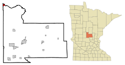
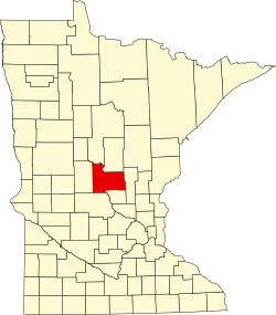
Motley, Minnesota

Last updated

Motley, Minnesota
Almond A. White House, Front.jpg
Morrison County Minnesota Incorporated and Unincorporated areas Motley Highlighted.svg
Location in Morrison County and the state of Minnesota
Coordinates: 46°20′06″N94°38′33″W / 46.33500°N 94.64250°W / 46.33500; -94.64250
Country United States
State Minnesota
Counties Morrison, Cass
Government
  MayorMike Schmidt
Area
[1]
  Total1.45 sq mi (3.75 km2)
  Land1.39 sq mi (3.60 km2)
  Water0.06 sq mi (0.16 km2)
Elevation
[2]
1,227 ft (374 m)
Population
 (2020) [3]
  Total680
  Density489.91/sq mi (189.10/km2)
Time zone UTC-6 (Central (CST))
  Summer (DST) UTC-5 (CDT)
ZIP code
56466
Area code 218
FIPS code 27-44422 [4]
GNIS feature ID2395418 [2]
Website www.cityofmotley.com

Motley is a city in Morrison and Cass counties in the U.S. state of Minnesota. The population was 680 at the 2020 census. [5] The main part of Motley is located within Morrison County; only a minor part of the city extends into Cass County.

Contents

The Cass County portion of Motley is part of the Brainerd Micropolitan Statistical Area.

History

Motley was laid out in 1874. [6] A post office has been in operation at Motley since 1873. [7]

Motley post office Motley MN post office.jpg
Motley post office

In 1881, the Northern Pacific Railway built a 20-by-40-foot (6.1 by 12.2 m) passenger station on the east side of 2nd Street (between Front Street and Main Street) and built a 24-by-60-foot (7.3 by 18.3 m) freight depot on the west side of 2nd Street. A spur line ran south from the mainline along 4th Avenue to a planing mill that was located on the bank of the Long Prairie River (just south of Cemetery Road). The spur line was removed by 1920. [8]

Geography

Motley occupies the northwest corner of Morrison County, with a small portion extending east into Cass County. The city is bordered to the south by Motley Township in Morrison County, to the east and north by May Township in Cass County, and to the west by Villard Township in Todd County.

U.S. Highway 10 and Minnesota State Highways 64 and 210 are three of the main routes in the city. US 10 leads southeast 30 miles (48 km) to Little Falls, the Morrison county seat, and west-northwest 25 miles (40 km) to Wadena. Highway 210 leads east 22 miles (35 km) to Brainerd; it departs westward from the city with US 10, but splits off to lead west 22 miles (35 km) to Hewitt. Highway 64 leads north from Motley 49 miles (79 km) to Akeley.

According to the U.S. Census Bureau, Motley has a total area of 1.45 square miles (3.76 km2), of which 1.39 square miles (3.60 km2) are land and 0.06 square miles (0.16 km2), or 4.21%, are water. [1] The Crow Wing River, which forms the Morrison–Cass County line, passes through Motley to the north and east of the city center, flowing easterly to join the Mississippi River southwest of Brainerd. The Long Prairie River, an east-flowing tributary of the Crow Wing, forms part of the southwest border of the city.

Demographics

Historical population
CensusPop.Note
1880 199
1890 525163.8%
1900 404−23.0%
1910 4285.9%
1920 396−7.5%
1930 3970.3%
1940 368−7.3%
1950 43518.2%
1960 430−1.1%
1970 351−18.4%
1980 44426.5%
1990 441−0.7%
2000 58532.7%
2010 67114.7%
2020 6801.3%
U.S. Decennial Census

2010 census

As of the census [9] of 2010, there were 671 people, 305 households, and 167 families living in the city. The population density was 504.5 inhabitants per square mile (194.8/km2). There were 338 housing units at an average density of 254.1 per square mile (98.1/km2). The racial makeup of the city was 94.5% White, 0.1% African American, 0.4% Native American, 1.6% from other races, and 3.3% from two or more races. Hispanic or Latino of any race were 4.3% of the population.

There were 305 households, of which 26.9% had children under the age of 18 living with them, 36.7% were married couples living together, 14.8% had a female householder with no husband present, 3.3% had a male householder with no wife present, and 45.2% were non-families. 38.7% of all households were made up of individuals, and 17.1% had someone living alone who was 65 years of age or older. The average household size was 2.20 and the average family size was 2.90.

The median age in the city was 41.1 years. 23.5% of residents were under the age of 18; 10.1% were between the ages of 18 and 24; 19.7% were from 25 to 44; 25.1% were from 45 to 64; and 21.6% were 65 years of age or older. The gender makeup of the city was 48.6% male and 51.4% female.

2000 census

As of the census [4] of 2000, there were 585 people, 258 households, and 167 families living in the city. The population density was 442.7 inhabitants per square mile (170.9/km2). There were 270 housing units at an average density of 204.3 per square mile (78.9/km2). The racial makeup of the city was 97.95% White, 0.17% African American, 0.17% Native American, 0.34% Asian, 0.17% from other races, and 1.20% from two or more races. Hispanic or Latino of any race were 2.05% of the population.

There were 258 households, out of which 31.8% had children under the age of 18 living with them, 40.7% were married couples living together, 19.0% had a female householder with no husband present, and 34.9% were non-families. 31.0% of all households were made up of individuals, and 16.3% had someone living alone who was 65 years of age or older. The average household size was 2.25 and the average family size was 2.73.

In the city, the population was spread out, with 27.7% under the age of 18, 10.8% from 18 to 24, 24.8% from 25 to 44, 18.6% from 45 to 64, and 18.1% who were 65 years of age or older. The median age was 33 years. For every 100 females, there were 82.2 males. For every 100 females age 18 and over, there were 75.5 males.

The median income for a household in the city was $23,438, and the median income for a family was $29,659. Males had a median income of $24,063 versus $18,824 for females. The per capita income for the city was $12,220. About 19.2% of families and 18.9% of the population were below the poverty line, including 31.9% of those under age 18 and 17.1% of those age 65 or over.

Related Research Articles

<span class="mw-page-title-main">Cass County, Minnesota</span> County in Minnesota, United States

Cass County is a county in the central part of the U.S. state of Minnesota. As of the 2020 census, the population was 30,066. Its county seat is Walker. The county was formed in 1851, and was organized in 1897.

<span class="mw-page-title-main">Backus, Minnesota</span> City in Minnesota, United States

Backus is a city in Cass County, Minnesota, United States. The population was 250 at the 2010 census. It is part of the Brainerd Micropolitan Statistical Area.

<span class="mw-page-title-main">Boy River, Minnesota</span> City in Minnesota, United States

Boy River is a city in Cass County, Minnesota, United States. The population was 47 at the 2010 census. It is part of the Brainerd Micropolitan Statistical Area.

<span class="mw-page-title-main">Chickamaw Beach, Minnesota</span> City in Minnesota, United States

Chickamaw Beach is a city in Cass County, Minnesota, United States. The population was 114 at the 2010 census. It is part of the Brainerd Micropolitan Statistical Area.

<span class="mw-page-title-main">East Gull Lake, Minnesota</span> City in Minnesota, United States

East Gull Lake is a city in Cass County, Minnesota, United States. The population was 986 at the 2020 census. The nearest semi-urban area is that of Brainerd and Baxter. It is part of the Brainerd Micropolitan Statistical Area. East Gull Lake is in Central Minnesota's Brainerd Lakes Area and takes its name from the largest lake within its borders, Gull Lake.

<span class="mw-page-title-main">Hackensack, Minnesota</span> City in Minnesota, United States

Hackensack is a city in Cass County, Minnesota, United States. The population was 313 at the 2010 census. It is part of the Brainerd Micropolitan Statistical Area.

<span class="mw-page-title-main">Lake Shore, Minnesota</span> City in Minnesota, United States

Lake Shore is a city in Cass County, Minnesota, United States. The population was 1,056 at the 2020 census. It is part of the Brainerd Micropolitan Statistical Area.

<span class="mw-page-title-main">Longville, Minnesota</span> City in Minnesota, United States

Longville is a city in Cass County, Minnesota, United States. The population was 156 at the 2010 census. The city was named after its founder, Jim Long. It is roughly four hours north of the Twin Cities. It is part of the Brainerd Micropolitan Statistical Area. Minnesota State Highway 84 serves as a main route in the community, and Minnesota State Highway 200 is nearby. Longville is home to Longville Municipal Airport.

May Township is a township in Cass County, Minnesota, United States. The population was 730 at the 2000 census. May Township was named for May Griffith, the daughter of a county official.

<span class="mw-page-title-main">Pillager, Minnesota</span> City in Minnesota, United States

Pillager is a city in Cass County, Minnesota, United States. Its population was 469 at the 2010 census. It is part of the Brainerd Micropolitan Statistical Area.

<span class="mw-page-title-main">Pine River, Minnesota</span> City in Minnesota, United States

Pine River is a city in Cass County, Minnesota, United States. The population was 911 at the 2020 census. It is part of the Brainerd Micropolitan Statistical Area.

<span class="mw-page-title-main">Sylvan Township, Cass County, Minnesota</span> Township in Minnesota, United States

Sylvan Township is a township in Cass County, Minnesota, United States. The population was 1,965 as of the 2000 census. This township took its name from Sylvan Lake.

<span class="mw-page-title-main">Baxter, Minnesota</span> City in Minnesota, United States

Baxter is a city in Crow Wing County, Minnesota, United States. The population was 8,612 at the 2020 census. It is part of the Brainerd Micropolitan Statistical Area.

<span class="mw-page-title-main">Brainerd, Minnesota</span> City in Minnesota, United States

Brainerd is a city and the county seat of Crow Wing County, Minnesota, United States. Its population was 14,395 at the 2020 census. Brainerd straddles the Mississippi River several miles upstream from its confluence with the Crow Wing River, having been founded as a site for a railroad crossing above the confluence. Brainerd is the principal city of the Brainerd Micropolitan Area, a micropolitan area covering Cass and Crow Wing counties and with a combined population of 96,189 at the 2020 census. The city is well known for being the partial setting of the 1996 film Fargo.

<span class="mw-page-title-main">Crosslake, Minnesota</span> City in Minnesota, United States

Crosslake is a city in Crow Wing County, Minnesota, United States. The population was 2,141 at the 2010 census. It is part of the Brainerd Micropolitan Statistical Area.

<span class="mw-page-title-main">Fort Ripley, Minnesota</span> City in Minnesota, United States

Fort Ripley is a city in Crow Wing County, Minnesota, United States, near the confluence of the Mississippi and Nokasippi Rivers. The population was 69 at the 2010 census. It is part of the Brainerd Micropolitan Statistical Area.

<span class="mw-page-title-main">Bena, Minnesota</span> City in Minnesota, United States

Bena is a city in Cass County, Minnesota, United States. The population was 116 at the 2010 census. It is part of the Brainerd Micropolitan Statistical Area.

<span class="mw-page-title-main">Federal Dam, Minnesota</span> City in Minnesota, United States

Federal Dam is a city in Cass County, Minnesota, United States, near Leech Lake. The population was 110 at the 2010 census. It is part of the Brainerd Micropolitan Statistical Area.

<span class="mw-page-title-main">Genola, Minnesota</span> City in Minnesota, United States

Genola is a city in Morrison County, Minnesota, United States. The population was 70 at the 2020 census.

East Cass is an unorganized territory in Cass County, Minnesota, United States. The population was 43 at the 2000 census. It is part of the Brainerd Micropolitan Statistical Area.

References

  1. 1 2 "2023 U.S. Gazetteer Files: Minnesota". United States Census Bureau. Retrieved January 31, 2024.
  2. 1 2 U.S. Geological Survey Geographic Names Information System: Motley, Minnesota
  3. "P1. Race – Motley city, Minnesota: 2020 DEC Redistricting Data (PL 94-171)". U.S. Census Bureau. Retrieved January 31, 2024.
  4. 1 2 "U.S. Census website". United States Census Bureau . Retrieved January 31, 2008.
  5. "U.S. Census Bureau: Motley city, Minnesota". www.census.gov. United States Census Bureau. Retrieved May 5, 2022.
  6. Upham, Warren (1920). Minnesota Geographic Names: Their Origin and Historic Significance. Minnesota Historical Society. p.  353.
  7. "Morrison County". Jim Forte Postal History. Retrieved July 21, 2015.
  8. "Minnesota Railroad Stations Past and Present". Dan West. Retrieved November 13, 2019.
  9. "U.S. Census website". United States Census Bureau . Retrieved November 13, 2012.